|
National Park Service History Electronic Library & Archive
The NPS History Electronic
Library & Archive is a portal to electronic publications covering the history of
the National Park Service (NPS) and the cultural and natural history of the national
parks, monuments, and historic sites of the (U.S.) National Park System. Also included
are documents for national monuments managed by other federal agencies, along with a
collection of U.S. Forest Service publications.
The information contained in this Website is historical in scope and is
not meant as an aid for travel planning; please refer to the official
NATIONAL
PARK SERVICE Website for current/additional information. While we
are an independent endeavor and not affiliated with the National Park
Service, we gratefully acknowledge the contributions by park employees
and advocates, which has enabled us to create this free digital
repository.
New eLibrary Additions
Featured Publications
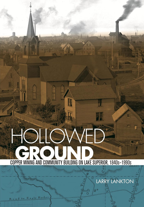 cover only Hollowed GroundCopper Mining and Community Building on Lake Superior, 1840s-1990s(Larry Lankton, 2010) |
|
Partners With Purpose: An Administrative History of Boston African American National Historic Site, 1980-2015 (Teresa Dujnic Bulger and Nedra Lee, December 2023)
Exile in Paradise: The Isolation of Hawaii's Leprosy Victims and the Development of Kalaupapa Settlement, 1865 to the Present, Historic Resource Study (Linda W. Greene, September 1985)
Condition Assessment and Treatment Report: Burdick House (Raths, Raths & Johnson, Inc., June 2026)
Cultural Landscape Report: Camp Round Meadow (Urban Heritage Project, November 2025)
Historic Structure Report: Buckstaff Bathhouse, Hot Springs National Park, Arkansas (Seven Generations AE, June 30, 2026)
Historic Structure Report: Ebenezer Baptist Church (2001)
Historic Structure Report: Crater Lake Lodge, Crater Lake National Park, Oregon (David Arbogast, Linda W. Greene, Catherine H. Blee and James M. Ellis, April 1984)
Cultural Landscape Report for Roebling's Delaware Aqueduct Site and the Zane Grey Property (Jeffrey Killion, Maryrose Kulick and Eliot Foulds, 2023)
Historic Structure Report and Historic Resource Study: Fort Barrancas Gulf Islands National Seashore (Edwin C. Bearss, September 1983)
Historic Structure Report/Historical Data Section: Wesleyan Chapel (Sharon A. Brown, April 1987)
Excavations at the Pharr Mounds and the Bear Creek Site, Natchez Trace Parkway (Charles F. Bohannon, July 1972)
Blue Ridge Parkway Viewshed Assessments: Summary Report (Kathryn Wrigley, Rachel Baer, Keerthi Krishna Devulapally, Payton Egan, Marie Haidara, Carly Knudson, Faranak Parkami, Isabelle Staph, Robert Powell, Ryan Sharp and Lauren Stephens, 2026)
George Rogers Clark: Vincennes Sites Study and Evaluation, George Rogers Clark National Historical Park, Vincennes, Indiana (Edwin C. Bearss, December 31, 1967)
Ebey's Landing National Historical Reserve: An Ethnohistory of Traditionally Associated Contemporary Populations (Douglas Deur, 2009)
Determination of NRHP Eligibility for Flagpole on Parade Grounds (Mallory Hawk, Angela Sirna and Jeremy Moss, August 10, 2026)
Historic Resources Study, Glacier National Park and Historic Structures Survey (Alan S. Newell, David Walter and James R. McDonald, August 1980)
Cultural Landscape Report: Going-to-the-Sun Road, Glacier National Park, Montana — Volume 1: Narrative (Mark Hufstetler, Kathryn L. McKay and Janet Cornish, Renewable Technologies, Inc., June 2002)
Historic Structure Report: Historic Cemetery Comfort Station (Building #313) (Kevin Wohlgemuth, Dorothy Krotzer, Michele Boyd and Kate Whitney-Schubb, 2026)
Condition Assessment and Treatment Plan: Montgomery Co. Jail & Sheriff's Residence (Seven Generations AE, July 31, 2026)
Federal Indian Boarding Schools Nationwide Historic Context Study (Draft) (Marie Archambeault, Nesta Anderson and Sammye Meadows, June 2026)
A Brief History of Cultural Resource Management in Alaska (Howard L. Smith, extract from Alaska Journal of Anthropology, Vol. 5 No. 2, 2007)
Budget Overview: National Park Service — Fiscal Year 2027
Camp Nelson, Kentucky, During the Civil War: Cradle of Liberty or Refuge Death Camp? (Marion B. Lucas, extract from The Filson Club History Quarterly, Vol. 63 No. 4, October 1989)
Cumberland Gap, Gateway of Empire (Robert L. Kincaid, extract from The Filson Club History Quarterly, Vol. 15 No. 1, January 1941)
Prehistoric Trails in the Upper Cumberland River Basin (Charles Mayer Dupier, Jr., extract from The Filson Club History Quarterly, Vol. 74 No. 4, Fall 2000)
Zollicoffer and the Battle of Mill Springs (R. Gerald McMurtry, extract from The Filson Club History Quarterly, Vol. 29 No. 4, October 1955)
Postscript to the Battle of Mill Springs (Cassius M. Clay, extract from The Filson Club History Quarterly, Vol. 30 No. 2, April 1956)
Zollicoffer, Crittenden, and the Mill Springs Campaign: Some Persistent Questions (C. David Dalton, extract from The Filson Club History Quarterly, Vol. 60 No. 4, October 1986)
Groping for Health in the Mammoth Cave (A.H.P. Anderson, extract from The Filson Club History Quarterly, Vol. 20 No. 4, October 1946)
George Brewer's Moving Panoramas of the Mammoth Cave and Other Natural Wonders of America: Part I (Joseph Earl Arrington, extract from The Filson Club History Quarterly, Vol. 39 No. 1, January 1965)
George Brewer's Moving Panoramas of the Mammoth Cave and Other Natural Wonders of America: Part II (Joseph Earl Arrington, extract from The Filson Club History Quarterly, Vol. 39 No. 2, April 1965)
The History of Saltpetre Mining in Mammoth Cave, Kentucky (Burton Faust, extract from The Filson Club History Quarterly, Vol. 41 No. 1, January 1967)
The History of Saltpetre Mining in Mammoth Cave, Kentucky: Parts II and III (Burton Faust, extract from The Filson Club History Quarterly, Vol. 41 No. 2, April 1967)
The History of Saltpetre Mining in Mammoth Cave, Kentucky: Part IV (Burton Faust, extract from The Filson Club History Quarterly, Vol. 41 No. 3, July 1967)
The History of Saltpetre Mining in Mammoth Cave, Kentucky: Parts V, VI, and VII (Burton Faust, extract from The Filson Club History Quarterly, Vol. 41 No. 4, October 1967)
The Saltpeter Works at Mammoth Cave and the New Madrid Earthquake (Angelo I. George and Gary A. O'Dell, extract from The Filson Club History Quarterly, Vol. 66 No. 1, January 1992)
The Sable Guides of Mammoth Cave (Jeanne C. Schmitzer, extract from The Filson Club History Quarterly, Vol. 67 No. 2, April 1993)
The Mammoth Cave Stagecoach Robbery and the Effectiveness of the Kentucky Judicial System in the 1880s (C. Walker Gollar, extract from The Filson Club History Quarterly, Vol. 69 No. 4, October 1995)
The Arctic Lowland Region: Potential Landform and Lifeform Natural Landmarks (November 1974)
Freshwater Tidal Marsh Elevation Monitoring at Kenilworth Park & Aquatic Garden: 2022-2025 (August 24, 2026)
A Guide to Craters of the Moon National Monument, Idaho (Dr. Harold T. Stearns, 1930, reprint 1959)
Glacier Recession Studies in Mount Rainier National Park (Howard R. Stagner, 1944)
Refoundation (Rolf Diamant, extract from Park Stewardship Forum, Vol. 41 No. 2, May 2025)
Refoundation: Does Place-Based Conservation in America Need to Start Over? (Rebecca Conard, Rolf Diamant, David Harmon and John Reynolds, theme eds., extract from Park Stewardship Forum, Vol. 42 No. 3, 2026)
Refoundation Resolve (Rolf Diamant)
Refoundation: What It Means, Why It Is Needed, Where It Is Going (Rebecca Conard, John Reynolds, Rolf Diamant, and David Harmon)
Mystic Chords of Memory (Brent A. Mitchell)
Advocates for Public Lands and Waters Must Help Shore Up Democracy’s Foundation (David Harmon)
Managing Parks and Protected Resources with Resilient Diversity in an Era of Changing Government (Michael T. Reynolds)
Dear Tracy, Dear Tim: Transatlantic Reflections on Refounding Conservation (Tim Badman and Tracy Farrell)
Beyond Whiplash: Advancing Durable, Place-Based Ocean Conservation in the United States (Lauren Wenzel)
Refounding National Public Lands: The Future of Place-Based Conservation of National Forests (Edgar Brannon)
Toward a Landscape-Scale Conservation Network (Robert B. Keiter)
A Better Path to Tribal Stewardship of Public Lands (Carla Chung Mattix)
Re-examining Place Based Conservation: Co-Governance and Co-Management as the Foundation for, and Future of, Parks and Protected Areas (Lydia A. Kiewra)
Reimagining America’s “Best Idea”: Indigenous Stewardship and the Next Era of Conservation (Katie Shea)
Renewing the Promise: The Humanities, Higher Education, and the National Park Service (Anne Mitchell Whisnant)
If the Humanities Are Any Guide: How the Methods and Insights of the Humanities Can Shape the Future of Public Lands (Eleanor Mahoney and Roneva Keel)
Revisiting DO-100: Supporting Interdisciplinary Stewardship in Rebuilding the National Park Service (Stephanie Toothman)
Renewing the US National Park Service’s International Mission (Jonathan Putnam)
Reclaiming the National Park Service Mission (Fred Herling)
Tilting at the “Best Idea” Windmill (Alan Spears)
Refoundation: Opportunity Out of Chaos (John Reynolds)
Final General Management Plan and Environmental Impact Statement: Volume 1, Gettysburg National Military Park (June 1999)
Draft General Management Plan/Environmental Impact Statement, Fort Vancouver National Historic Site (October 2002)
Final General Management Plan/Environmental Impact Statement, Glacier National Park: Volume II (April 1999)
Old San Francisco Mint 1869-74 (June 1969)
The Old Mint: A Feasibility Study (Walter M. Sontheimer, Sexton, Fitzgerald & Kaplan and O'Kelly & Schoenlank, September 29, 1971)
Historically Famous Lighthouses U.S. Coast Guard CG-232 (1997)
Administering the National Forests of Colorado: An Assessment of the Architectural and Cultural Significance of Historical Administrative Properties (Ralph Hartley and James Schneck, 1996)
NPS Reflections
|
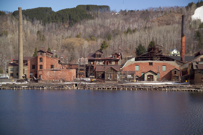
Historic Quincy Smelter Site. (NPS photo)
KEWEENAW COPPER
As the American economy industrialized in the nineteenth century, the
new manufacturers often had the luxury of choosing their locations.
They could locate near their major markets, or where they could tap into
an adequate labor pool. Many were sited along railroads, rivers,
canals, or other transportation routes; other firms went to cities that
offered access to money and capitalists. The mining industry, of
course, did not have such freedom of choice. To exploit natural
resources, mining firms had to go out to wherever those resources were
found.
In the 1840s, a new copper mining district opened up on the Keweenaw
Peninsula, found on the western end of Upper Michigan and on the south
shore of Lake Superior. This region was remote, isolated, and distant
from markets. No capitalists lived here — only a few hundred Native
Americans. No railroads or overland roads reached up to this place.
Only water routes connected it to the lower Great Lakes, and they were
closed, due to winter, for nearly half of each year. No indigenous
labor force lived in the region that could be put to work in mines —
only a handful of voyageurs, trappers, and Methodist and Catholic
missionaries. But the Keweenaw did hold copper — people were sure of
that. They didn’t yet understand the geology. They didn’t know exactly
where the copper was, or what forms might support a successful mining
industry. But they migrated to the Keweenaw any way, full of hope and
enthusiasm and with the desire to profit from the taking of the red
metal.
The copper mining industry that started in the 1840s in a remote Lake
Superior wilderness lasted for about one and a quarter centuries, and
when it died in the late 1960s it left behind the cities and villages
that had been built up to serve it. It left behind a population rich in
ethnic heritage, because the industry had drawn workers from dozens of
countries. It left behind mine sites marked by all kinds of structures:
rockhouses, hoist houses, machine shops, drill shops and dry houses. It
left behind thousands of dwellings built by companies to house their
workers. It left behind, besides the mines, remnants of the stamp mills
that had separated the copper from its host rock, and the smelters,
which had melted and refined the copper mineral. On the landscape,
companies left behind piles of poor rock at their mines; stamp sand
beaches at their waterfront mills; and hillocks of slag beside their
smelters.
The copper industry made intensive use of the Keweenaw and in doing so,
resculpted much of the landscape. But just as the industry changed the
place, the place had shaped the industry. The cultural geography of the
peninsula was tied to its natural resources, especially water and
copper. The industry’s mills and smelters went mostly to the Keweenaw’s
margins, its shorelines, because they needed water for industrial
processes or transportation. Of supreme import, the mines located in the
peninsula’s hinterland, because that’s where the mining companies
discovered the most promising copper-bearing lodes. Along this finger of
land jutting out into Lake Superior, the fortunes of mines and their
surrounding communities were directly tied to geology — to the formation
and distribution of rock and copper, to ancient changes in the earth
going back about 1.1 billion years.
The rock underlying the Keweenaw Peninsula is some of the oldest in
North America. About a billion years ago, the earth’s crust in this
region was thinning and trying to split. From deep in the interior of
the earth, molten rock rose up, followed lines of least resistance,
erupted onto the surface, spread out, cooled and then solidified. Some
two to four hundred magma eruptions occurred in this region over a span
of about twenty-five million years. Each eruption deposited dark
basalts (also called “trap” or “trap rock”) on the surface; each layer
of basalt overtopped the one that had come before. Some of these
eruptions were spectacularly large. One, called the Greenstone Lava
Flow, is thought to be the largest anywhere on earth. It ranges across
fifty miles and in places is more than one thousand feet thick.
Collectively, these successive lava flows are known as the Portage Lake
Volcanics.
Between magma eruptions widely spaced in time, a second type of rock
strata was laid down. Ancient streams and precipitation washed sand,
rocks, and pebbles down on top of the basalts, forming a “conglomerate”
layer, so-called because it contained a conglomeration of materials. A
later lava flow would overtop the conglomerate, compress it, and bind it
up into the Portage Lake Volcanics, which were being built up, ever so
slowly, layer by layer. When the volcanic activity finally stopped,
approximately twenty discernable conglomerate layers were interbedded
with the several hundred lava flows.
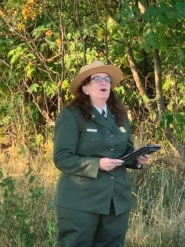
Park Superintendent Wyndeth V. Davis. (NPS photo)
After all this rock was put down, geological change continued. The
earth’s surface in this region came under compression and was squeezed.
The rock faulted, and along the faults some rock slid under adjacent
rock, lifting it and bending it into a bowl shape. The hollow, interior
part of the bowl became part of the Lake Superior basin. Along the
bowl’s raised rim, the edges of rock strata that had long been
underground now outcropped on the surface, both on the Keweenaw
Peninsula and on Isle Royale. Rock strata that had once been beneath
the surface and horizontal were now visible on the surface where they
outcropped, and they dipped into the ground on steep angles. The
exposed, upturned edges of many of these rock strata contained native
copper — copper that existed naturally in its metallic form, unalloyed
with other elements.
This copper had not been molten, and it had not been present in the
basalts or the conglomerates when first formed. Instead, it had been
carried in a hot solution that had leached the copper from lower in the
earth and then, under pressure, had flowed upward into the Portage Lake
Volcanics. There, the solution settled in fractures, fissures and
porous rock, and the copper precipitated out of the solution in its
metallic form.
Because the rock was not uniformly dense and compacted, the
copper-bearing solution could flow into and through parts of it. The
solution entered into conglomerate rock, due to the interstices that
existed among the pebbles, stones and sands that made up the rock. It
entered the basalts or lava flows because that rock contained many voids
or vesicles.
The lava, as it spread out, contained hot gases that migrated upward
toward the atmosphere. As the lava cooled, became thicker and then
solidified, it trapped the gases, and these gas bubbles became voids in
the rock, especially near the top of the flow, which could have a frothy
appearance. Also, after initial formation, many thick and heavy lava
flows had slumped, had dropped down, creating fractures or fissures in
the rock that later served as conduits for the copper-bearing solution.
Three types of underground cavities gave rise to three types of native,
metallic copper. The copper that filled spaces in the sedimentary rock
strata came to be called “conglomerate” copper, named after its host
rock. The copper that filled the vesicles in the porous basalts was
called “amygdaloid” copper. Geologists took this term from the Greek
word meaning “almond,” because it described the shape of the cavities
left behind by the gas bubbles. The copper found in larger fissures and
fractures came to be called “mass” copper, and indeed many mass copper
finds were impressive in size.
The copper did not disseminate evenly or equally across the host rock.
Some very dense and impervious rock deflected the copper bearing
solution, keeping much or all of it out. Other rock was so porous that
the solution passed right through it, meaning that the rock was not
well-charged with copper. As a consequence, the interbedded amygdaloid
and conglomerate lodes running the length of the Keweenaw Peninsula
differed considerably in the amount of copper they contained. One lode
might be rich, while all adjacent rock strata could be poor. This
variation ultimately made mining here difficult, made mining a
“subterranean lottery.” When the mining firms arrived in the
mid-nineteenth century, there was no telling if a given piece of ground
would “pay” — yield commercial quantities of copper — except by opening
it up at considerable expense. The fact that a neighboring property
proved either rich or poor was not a good predictor of an adjacent
property’s future.
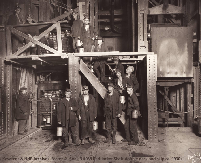
Red Jacket shaft workers, Keweenaw National Historical Park, 1930. (NPS photo)
Long after the Portage Lake Volcanics had been formed, charged with
copper, and bent into a bowl shape, a long period of glaciation took
place, lasting from 1.8 million years ago until about ten thousand years
ago. As heavy glaciers, as much as nine to ten thousand feet thick,
moved across the region, they scoured the tops of outcropping copper
lodes. Glaciers sometimes snagged pieces of copper, separated them
from their host rock, moved them, and eventually put them back down.
This action left some impressive pieces of “float” copper, as it came to
be called, sitting loose, right on the surface of the ground. This float
copper was first discovered and used by humans about seven thousand
years ago.
Relatively little is known about the native peoples who made their way
to the Keweenaw, discovered the copper, and began fashioning it into
artifacts. They left little behind, in terms of settlement remains.
However, before modern mining and mining communities arrived to
obliterate much of it, evidence once abounded on the surface that showed
where much earlier peoples had dug for copper. This evidence consisted
largely of pits, often called “ancient Indian diggings,” with stone
tools found nearby. These diggings — along the Keweenaw, along the
Ontonagon River drainage, and on Isle Royale — helped direct modern
miners to finds of copper in these places in the mid-nineteenth century.
Native peoples collected float copper and dug pits to liberate
additional copper from the south shore of Lake Superior from 7000 years
ago (as determined by radiocarbon dating) until the seventeenth
century. Over this long span of time, settlements and native copper
works on the Keweenaw were not continuous, but intermittent, and the
first technologies for taking and working the copper seemed to change
but little.
The aboriginal peoples picked up small pieces of float copper from the
surface. If they found a large mass of float copper above ground, it
typically had jagged, thin appendages that they could bash or twist off,
leaving them with pieces of workable size. If they encountered an
upturned edge of an amygdaloid or conglomerate lode, one having visible
copper bound up in a rock matrix, they hammered at the rock to free the
copper. They used hard, rounded hammerstones weighing ten to fifteen
pounds to strike and break the rock. These were often wielded by hand,
but some were hafted, probably with flexible thongs, so the hammerstone
could be swung with greater force against the rock. The native peoples
also pried pieces of copper loose from the host rock, using wood, stone,
or copper wedges. Many of the pits sunk into the rock by these methods
were small and shallow, but they made deeper where the rock was both
relatively easy to break and well charged with copper. The first miners
took at least one pit down to a depth of twenty-six feet. When this pit
was discovered in the mid-nineteenth century on the property of the
Minesota Mining Company, a large mass of copper sat in its bottom. The
ancient miners had been able to find it, but then had no means of
cutting it up or lifting it out.
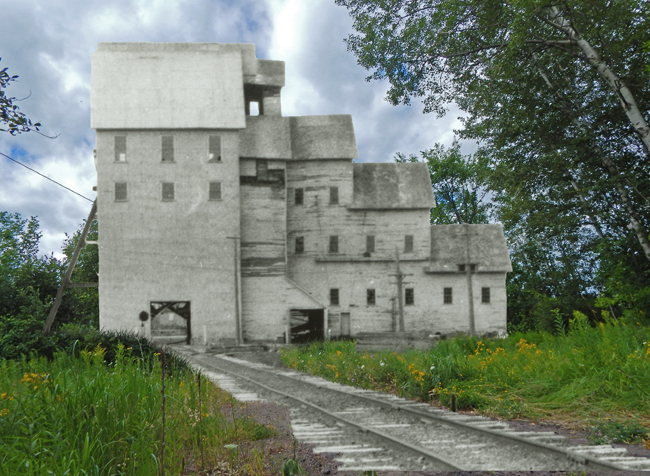
Quincy Number 8 Shaft-Rockhouse. (NPS photo)
The first people on the Keweenaw and on Isle Royale had no means of
smelting or casting copper. They took advantage of some of copper’s
properties — it was relatively soft and ductile — and hammered it into
different shapes for different purposes. They used stone tools to
hammer it, draw it out, and form it. These cold-working processes made
the copper, over time, brittle. While the early peoples had no means of
smelting copper, they did know how to use fire to anneal it . they
subjected it to heat that recrystallized the copper, making it ductile
once more, meaning that more work could be performed on it.
Besides hammering the copper flat, ancient artisans sometimes hammered
it around or inside forms to give it shape; they also rolled it. They
used sandstone, sand, and wood ashes or other natural abrasives to grind
down the metal, or to polish it to a desired luster. Using these
techniques, the first peoples fashioned their copper into hooks, knives,
chisels, awls, axes, scrapers, beads, and other decorative items and
useful tools. Then they traded these artifacts with other
groups; eventually this trade led to Keweenaw copper being diffused
across much of eastern North America.
In the seventeenth century European metals arrived on the North American
continent, and cultural contact and trade with the Europeans seemingly
made the continued taking of Keweenaw copper unnecessary. But while this
contact and trade lessened the native people’s interest in the copper,
it captured the interest of the newcomers to the continent.
The British and French who came to the New World quickly encountered
Native Americans who showed them tools and ornaments made of Keweenaw
copper, and who communicated, at first in broad, general terms, the
location of the deposits. Samuel de Champlain seems to have been one of
the first Europeans to learn of the copper. In 1610 he encountered two
Indians on the St. Lawrence River:
After conversing with them a short time about a number of things
touching their wars, the Algonquin Indian, who was one of their chiefs,
drew out of a sack a piece of copper a foot long, which he presented to
me. It was very fine and pure. He gave me to understand that the metal
was abundant where he had obtained it, which was on the bank of a river
near a large lake.
About a half century after Champlain first heard of the copper, French
explorers conducted expeditions to Lake Superior in search of it. These
early searches netted no significant finds. The French returned in the
eighteenth century, and conducted some experimental mining along the
Ontonagon River in 1737-38. The British, after gaining control over
French Canada in 1763, started their own searches for Lake Superior
copper. Alexander Henry led an expedition to the Ontonagon Boulder in
1766. This “boulder” was in reality a large piece of float copper that
had been snagged by a glacier, ripped from its rock matrix, carried some
distance, and then dropped off — alongside the west branch of the
Ontonagon River. This was the most famous piece of mass copper in the
region. This single specimen confirmed all the tales of native, metallic
copper sitting right on the ground, and it fired the enthusiasm of those
who one day hoped to mine it. Many European and early American explorers
for copper, usually with the aide of Ojibwe guides, made a difficult,
yet almost obligatory pilgrimage up the Ontonagon valley to see the
Ontonagon Boulder. After first visiting the boulder in 1766, Henry led a
small party of miners into the Ontonagon River valley in 1771-72.
The French and British explorers and miners arrived at the site of
Keweenaw copper too early to be successful. In the seventeenth and
eighteenth centuries, they arrived with too few men, inadequate
knowledge of the geology, and inadequate technologies and
transportation. After the failure of Alexander Henry’s expedition in the
early 1770s, further attempts at wresting copper from the Keweenaw were
delayed by the American Revolution, by disputes between the fledgling
United States and Britain over the Great Lakes, and by the War of 1812.
By 1820, however, a chain of events began that led directly to the
opening up of a real mining industry on the Keweenaw in the early 1840s.
Principally, a procession of explorations made their way to the
Keweenaw, and each one resulted in more news regarding its copper, which
in turn generated more enthusiasm for yet another expedition and,
eventually, a rush of miners.
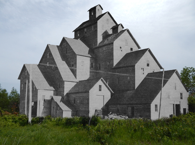
Quincy Number 6 Shaft-Rockhouse. (NPS photo)
In 1820, Lewis Cass, governor of the Michigan Territory, worked with
John C. Calhoun, the U. S. Secretary of War, to get an expedition
mounted to Lake Superior. They undertook this effort in part in the
name of military security, and in part to discover what was up on Lake
Superior that would help open up the west and make it more productive
and appealing to future settlement. They specifically aimed at
exploring the copper district and examining the legendary Ontonagon
Boulder. Lewis Cass himself led the 40.man expedition party that left
Detroit in May in three large canoes. Chief among his companions was
Henry Rowe Schoolcraft, recruited for the journey because of his
expertise in mineralogy and his interest in mining.
Just over a month after leaving Detroit, the party arrived at the mouth
of the Ontonagon River. Most stayed in camp near the Lake Superior
shore; only a portion of the crew made the arduous trip by canoe and
foot more than twenty miles up the Ontonagon’s valley to see the copper
boulder. Upon their arrival, after all their effort, most of the men
were disappointed. Expecting a magnificent specimen, truly a wonder of
the natural world, they discovered a boulder only four feet wide,
weighing between three and four thousand pounds. David Bates Douglass, a
West Point engineer on the expedition, called the Ontonagon Boulder “a
mere stone, a large pebble.” Yet the party’s immediate disappointment
did not result, later, in any dampening of public interest in the future
of Lake Superior copper. In a lengthy letter to Secretary of War
Calhoun, which later was published several times as his official report
on the expedition, Schoolcraft admitted that the boulder was smaller
than legend had made it out to be. Still, he called it “one of the
largest and most remarkable bodies of native copper upon the globe.”
Furthermore, his published illustration of the boulder greatly
exaggerated its real size; Schoolcraft made it appear to be several
times larger than the six-man canoes shown drawing up to it.
In 1830, Schoolcraft served as the Indian Agent for the upper Great
Lakes and worked out of Sault Ste. Marie, about 250 miles east of the
Keweenaw Peninsula. West of the Great Lakes, the Sioux and Chippewa
Indians were engaged in conflict, and the War Department and Lewis Cass
asked Schoolcraft to go west to try to broker a peace. Not uncommonly,
this federally funded project was made to serve several purposes.
Besides pacifying Indians, Schoolcraft used it as an excuse to try to
find the true headwaters of the Mississippi, and as an opportunity to
revisit Keweenaw copper.
Schoolcraft commanded two westward expeditions, one in 1831 and another
in 1832. Most importantly, he chose twenty-one year old Douglass
Houghton to accompany him. Like Schoolcraft, Houghton was a New Yorker
who had gone west to seek his fame and fortune. Also like Schoolcraft,
Houghton was a man of many interests and talents. Professional science
was just in its infancy at this time, and few careers had yet been built
around the notion of focus and specialization. Houghton was a
well-educated generalist, who a bit later in his life would be known as
Michigan’s foremost geologist, as a medical doctor, and as mayor of
Detroit. But in 1831-32, he was just a young man getting started, who
had a great opportunity to travel to a remote region rumored to be rich
in copper. And while mineralogy was becoming less important in
Schoolcraft’s life, it would later become, thanks to Keweenaw copper,
much more important in Houghton’s.
In 1831, the expedition coasted down the northwestern shoreline of the
Keweenaw, occasionally landing to explore the rocks and veins of green
and black copper ores, sometimes blasting free specimens to take back
home. While Schoolcraft eschewed another difficult passage up the
Ontonagon to see the boulder, Houghton made the pilgrimage this time.
As soon as Houghton returned to Detroit in the fall, local papers
pressed him for encouraging words about the copper finds and ran
articles on the discoveries. A bit later, in November, Houghton wrote a
letter to Lewis Cass, entitled, “A Report on the Existence of Copper in
the Geological Basin of Lake Superior.” In the letter, later published
(including as a congressional document) and widely read, Houghton wrote
of the existence of native copper and of several other ores of copper,
such as copper oxide and copper carbonate. His study was the best yet of
Keweenaw copper and marked him as a leading expert of its
characteristics and potential.
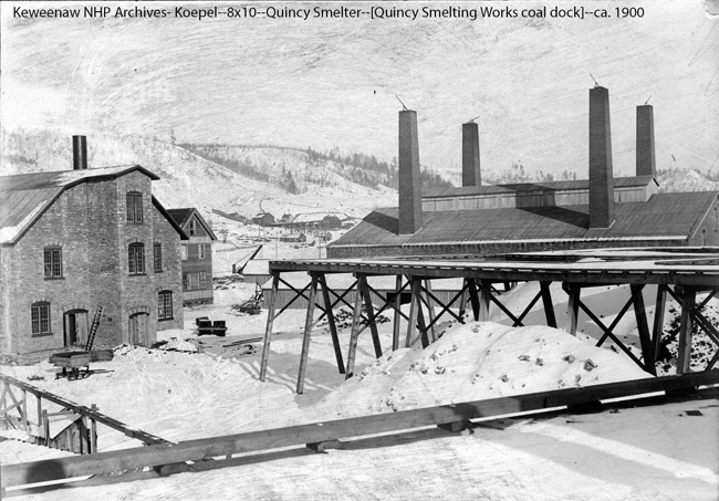
Quincy Smelter in winter. (NPS photo)
In 1832, Schoolcraft mounted another expedition, one he hoped would
travel further afield, including to the Mississippi’s headwaters.
Houghton went along again, this time as surgeon, to be in charge of
vaccinating Indians against smallpox. He did many vaccinations, carried
out some actual surgery, and explored the botany of the upper Great
Lakes region and collected plants. After the headwaters had been found
and the expedition’s official missions accomplished, Houghton managed to
revisit the Keweenaw on the way back east towards Sault Ste. Marie. He
again traveled to the Ontonagon Boulder, and hacked off some of its
corners to take as specimens. Coasting up the west shore of the
Keweenaw towards its point, he took more specimens of native copper and
green and black copper ores. Again, the overall expedition gained
considerable notoriety. Schoolcraft was hailed as the discoverer of the
real source of the Mississippi, and still more geological information
ended up in congressional reports and in newspapers, which published
letters from Houghton regarding copper discoveries. A Detroit paper,
always happy to boost the prospects of the region, noted that up north,
copper ore could no doubt be found in abundance, and that eventually it
would "reward future exertions [explorations and mining]. It may have a
mark’d influence on the coming prosperity of Lake Superior.”
After the 1831 and 1832 expeditions and trips to the Keweenaw, for a
time Douglass Houghton turned away from the Keweenaw’s geology and
potential as a mineral range and followed other pursuits. He had
considerable success as a doctor and investor. Then, in 1837, Michigan
became a state, and with statehood came the Upper Peninsula. Michigan
and Ohio had disputed over which state possessed Toledo on Lake Erie and
a strip of land running west from that port city. The federal
government gave the disputed territory to Ohio, and in return made the
Upper Peninsula a part of the new state of Michigan. Michigan’s new
governor, Stevens T. Mason, then made Douglass Houghton Michigan’s first
state geologist.
Functioning in this new role, Houghton used his scientific knowledge for
practical ends. As he started exploring the geology of the state, he
did not pursue additional geological knowledge just for the sake of
learning it — but for the sake of using it. Using it to help develop his
new state. Using it to discover what this state held in terms of mineral
resources that could be exploited to produce jobs, products, and new
wealth.
Houghton spent his first few years as state geologist working mostly in
Michigan’s Lower Peninsula and in the eastern portion of the Upper.
Then, in 1840, he returned to conduct an extensive field survey of the
Keweenaw and its copper deposits. The following year he reported on its
minerals and economic potential to the state legislature. At this time,
Houghton did not have a full understanding of the Keweenaw’s geology.
Houghton was not certain of what sorts of copper ores might support a
mining industry, or of the extent of the mass copper deposits and their
economic potential. He knew that no successful mining industry had even
been based on the exploitation of native copper. So, while his report
again reconfirmed and publicized the breadth of Keweenaw copper, it was
at best only guardedly optimistic:
While I am fully satisfied that the mineral district of our state will
prove a source of eventual and steadily increasing wealth to our people,
I cannot fail to have before me the fear that it may prove the ruin of
hundreds of adventurers, who will visit it with expectations never to be
realized. . . . I would by no means desire to throw obstacles in the way
of those who might wish to engage in the business of mining this ore. .
. , but I would simply caution those persons who would engage in the
business in the hope of accumulating wealth suddenly and with patient
industry and capital, to look closely before the step is taken, which
will most certainly end in disappointment and ruin.
Despite the cautionary tone of Houghton’s 1841 copper report, it helped
accelerate the development of a mine rush up to the Keweenaw. But three
other events, all in 1843, also served as catalysts: in that year, the
Treaty of LaPointe went into effect; the federal government opened a
mineral land agency at Copper Harbor on Keweenaw Point; and the
Ontonagon Boulder, finally snatched from the Keweenaw, made a
well-publicized trip to the east coast.
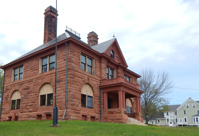
Old Quincy Mine Office. (NPS photo)
When it came to encouraging the start of a copper mining industry in
Michigan’s Upper Peninsula, the federal government did not adopt a
laissez-faire attitude. Instead, it took several positive steps to aid
and abet this development. For starters, it funded the Cass/Schoolcraft
expedition in 1826. Following up on that, the government signed the
Treaty of Fond du Lac with the Chippewa in 1826. In this treaty the
Chippewa granted the United States “the right to search for, and carry
away, any metals or minerals from any part of their country.” In short,
the government received mineral rights, but not property rights, to a
portion of the Chippewa’s land, including the Keweenaw. In 1831-32, the
federal government supported additional explorations of the copper
region. Then the Treaty of LaPointe — negotiated with the Chippewa in
1842 and made effective in 1843 — ceded to the United States government
all their land in Upper Michigan west of the Chocolay River.
The U.S. government now had mineral rights and property rights to the
copper lands, and in 1843 it opened up a mineral land agency in Copper
Harbor. This cleared the way for speculation in copper lands to begin.
Investors or prospectors in Copper Harbor and Washington, D. C. could
now begin leasing the Keweenaw’s mineral lands. In the same year, the
Ontonagon Boulder engendered much additional enthusiasm for Lake
Superior copper as it slowly made its way from the Keweenaw to the east.
Many early visitors to the Ontonagon Boulder had wanted to claim it as a
prize, but moving the copper specimen had proved a daunting proposition.
It sat more than twenty miles up from the mouth of the Ontonagon River,
above three rapids totaling over seventy feet of fall, and in a steep
valley surrounded by rugged, wooded terrain. In 1826, Lewis Cass, the
territorial governor, sent a twenty man crew well-supplied with tools
(or so they thought) to go get the boulder so it could be removed to the
nation’s capitol. The work party rather quickly learned the travail of
moving a copper boulder weighing over three thousand pounds from its
wilderness setting, and they abandoned the effort.
In 1843, a Detroit hardware store merchant by the name of Julius Eldred
finally succeeded in removing the boulder. A work crew used a capstan
or whim to lift the boulder fifty feet up to the top of the adjacent
bluff. They then loaded it on a small rail car, and for a distance of
four miles — from the bluff to just below the rapids — they inched their
prize along. They cut a swath through the woods, laid a short stretch of
rail, pushed the car to the end of the short line, picked up the rail
behind the car, and laid it out front again. Once below the rapids, the
boulder went on a raft; at the mouth of the Ontonagon, it went on a
schooner.
Still, even once on Lake Superior, Eldred’s expedition found no smooth
sailing. Eldred had, he thought, after about three tries, finally
managed to obtain legal ownership of the boulder. But when the schooner
landed at Copper Harbor, he was informed that the U. S. Secretary of the
Treasury had instructed the Secretary of War to claim federal ownership
of the copper boulder, to seize it from Eldred, and to ship it to
Washington. Eventually, Eldred did surrender the specimen, and the
federal government awarded him $5,665 for his efforts. On the way to
Washington, via Detroit, Lake Erie, the Erie Canal and New York City,
the Ontonagon Boulder received much public attention, and the publicity
generated by the boulder’s journey was another key spark in setting off
the rush to the Keweenaw in the mid-1840s.
Text from Historic Resource Study: Keweenaw National Historical Pak, Larry Lankton, 2005.
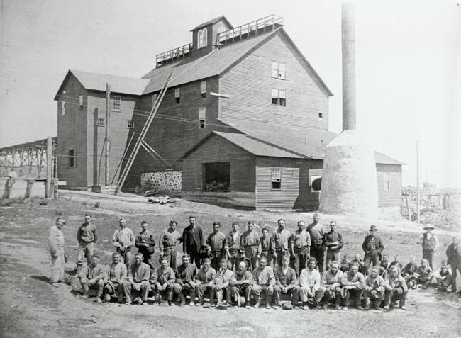
Miners pose at Quincy Mine around 1870. (NPS photo)
|
National Park Friends
|
Please Note: NPSHistory.com is an independent effort; we are not an
official partner of the National Park Service (NPS), though a
huge debt of gratitude is extended to all NPS employees (current
and former) and other park supporters who have graciously contributed
their personal collections, thus enabling us to present these rather
scarce documents for free public use. Due diligence has been employed in
scanning these documents in an attempt to ensure the accuracy of the
materials presented, however, we make no representations or warranties
of any kind about these digital documents. While most of the content
contained herein is in the public domain, the Website also contains
copyrighted works (permission to host this content is on file); please
respect the reserved rights of these copyright-holders. Use of this
Website is done so at your own risk; we are not responsible for
any loss or damage arising from information or links contained within
this site. Enjoy!
|
|