|
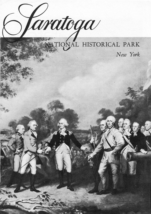
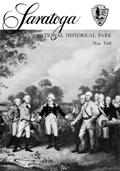
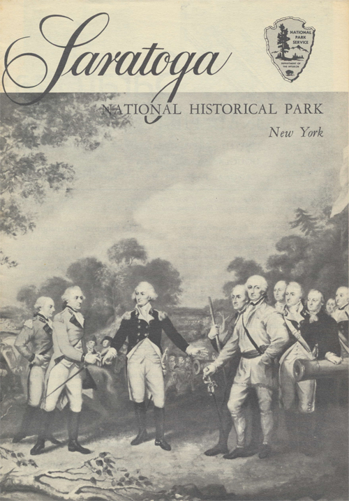
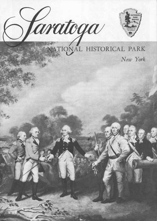
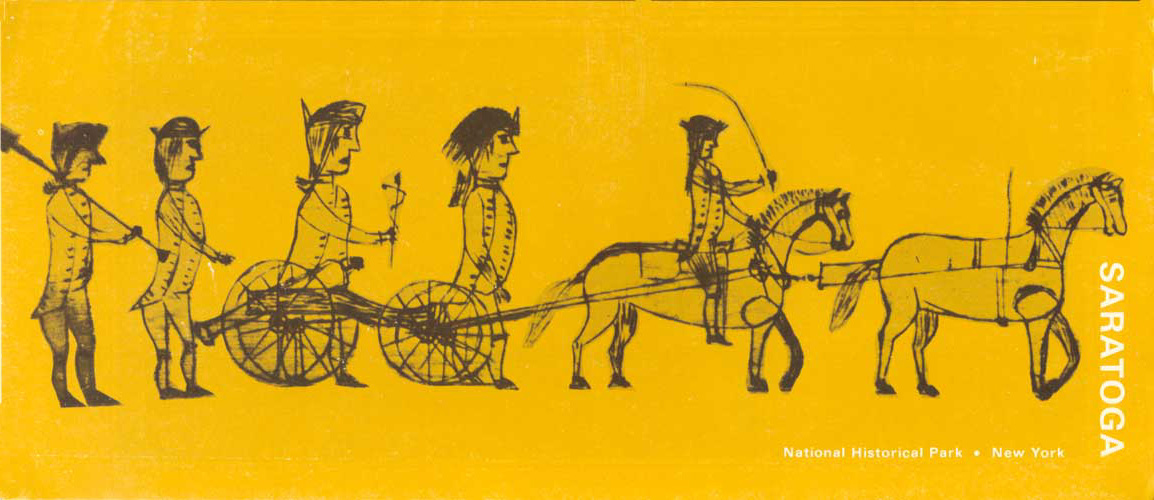
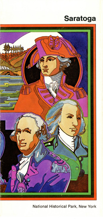
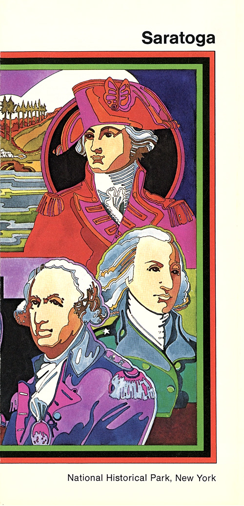
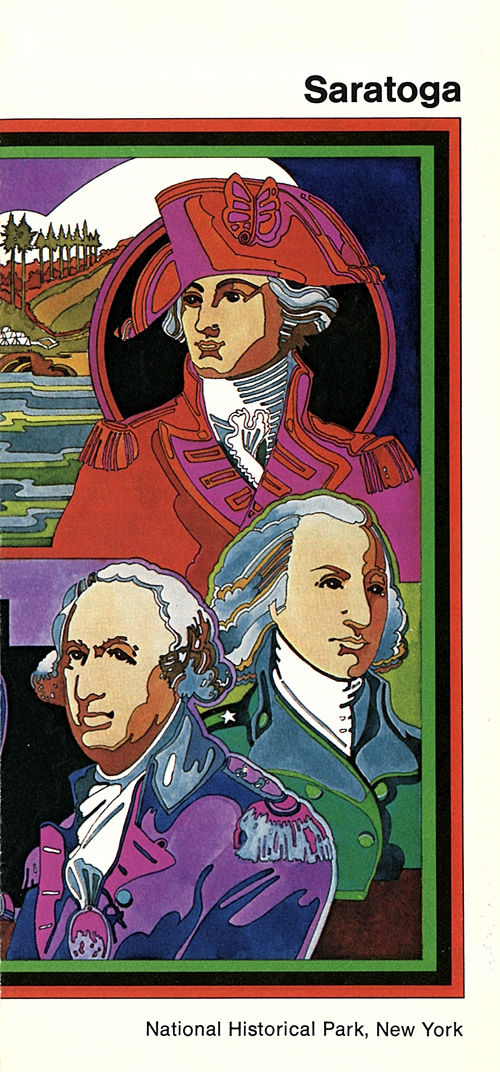
Saratoga National Historical Park New York |
|
 NPS photo | |
"I have always thought Hudson's River the most proper part of the whole continent for opening vigorous operations. Because the course of the river, so beneficial for conveying all the bulky necessaries of an army, is precisely the route that an army ought to take for the great purposes of cutting the communications between the Southern and Northern Provinces, giving confidence to the Indians, and securing a junction with the Canadian forces."
—Gen. John Burgoyne, 1775
The Campaign of 1777
Gen. John Burgoyne's belief in the importance of the Hudson River as a strategic highway through the northeast never wavered from the moment he arrived in America in 1775. It became the centerpiece of his plan for the British northern campaign of 1777, which called for his army to move south from Canada along the Lake Champlain-Hudson River route to Albany. A smaller force under Col. Barry St. Leger was expected to support this movement by marching east from Lake Ontario into the upper Mohawk Valley. Burgoyne and St. Leger would meet at Albany and join forces with Sir William Howe, who headquartered in New York City with a sizable army of his own. Together they would make a concerted effort to quell the rebellion.
But Howe had other ideas. Leaving only a small force under Sir Henry Clinton in New York, he planned to move the rest of his army against Philadelphia, the patriot capital, by way of Chesapeake Bay. Colonial Secretary George Germain approved the movement in the belief that Sir William would return to New York in time to cooperate with Burgoyne. Howe was already at sea and deeply committed to the Philadelphia campaign when he received Germain's endorsement, thus making the troops best positioned to help Burgoyne unavailable in the required numbers. Without a strong supporting force, Burgoyne's army could become an isolated column in a vast and hostile wilderness.
Burgoyne embarked from St. Johns (now St. Jean), Canada, on June 17, 1777, with a total force of some 9,000 men, including about 4,200 British regulars, 4,000 German troops, and nearly 1,000 loyalists, Indians, Canadians, and camp followers. His first major objective, Fort Ticonderoga on Lake Champlain, fell on July 6, after a four-day siege. Moving on south through Skenesboro and Fort Edward, the British were impeded by rough terrain and the delaying tactics of Gen. Philip Schuyler, then commanding American troops in the Northern Department charged with halting Burgoyne's advance.
Time and the tide of events now began to run against Burgoyne. St. Leger halted his advance down the Mohawk Valley to besiege Fort Stanwix. In the Battle of Oriskany on August 6 he stopped an American column marching to aid the fort. But learning that a strong force under Gen. Benedict Arnold was on its way, he raised the siege and retreated toward Canada. Even more serious was the fate of a detachment of men Burgoyne sent to Bennington. On August 16 John Stark's and Seth Warner's New England militia shattered this force, inflicting about 900 casualties.
Despite these setbacks, Burgoyne decided to sever his communications with Canada and risk everything on a push to Albany. On September 13, he crossed to the west bank of the Hudson at Saratoga (now Schuylerville) and began marching southward. Four miles north of the village of Stillwater, the British force came upon the Americans, 9,000 strong. In command now was Gen. Horatio Gates, who had replaced Schuyler. The Americans were entrenched on Bemis Heights, a strong position where the road to Albany squeezed through a defile between the hills and the river, as does today's U.S. 4.
American artillery on the heights and in redoubts along the Hudson commanded the river and the road. Col. Thaddeus Kosciuszko, a Polish military engineer serving with the Americans, had chosen and fortified the site. Burgoyne's heavily burdened army had either to run the gauntlet between the hills and the river, thus risking destruction, or drive the Americans out of their fortifications on the heights. The British general chose to fight.
The Battles of Saratoga
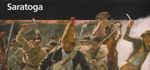
On September 19 the Royal army advanced upon the American camp in three separate columns. Two headed through the heavy forests covering the region; the third, composed of German troops, marched down the river road. American scouts detected Burgoyne's army in motion and notified Gates, who ordered Col. Daniel Morgan's corps of Virginia and Pennsylvania riflemen to track the British march. About 12:30 p.m., some of Morgan's men brushed with the advance guard of Burgoyne's center column in a clearing known as the Freeman Farm, about a mile north of the American camp.
The battle that followed swayed back and forth over the farm for more than three hours. Then, as the British lines began to waver in the face of the deadly fire of the numerically superior Americans, German reinforcements arrived from the river road. Hurling them against the American right, Burgoyne steadied the wavering British line and gradually forced the Americans to withdraw. Except for this timely arrival and the near exhaustion of the Americans' ammunition, Burgoyne might have been defeated that day.
Though he held the immediate field of battle, Burgoyne had been stopped about a mile north of the American line and his army roughly treated. Shaken by his victory, the British commander ordered his troops to entrench in the vicinity of the Freeman Farm and await support from Clinton, who was supposedly preparing to move north toward Albany from New York City. For nearly three weeks he waited, but Clinton did not come.
By now Burgoyne's situation was critical. Faced by a growing American army without hope of help from the south, and with supplies rapidly diminishing, the British army became weaker with each passing day. Burgoyne had to choose between advancing or retreating. He decided to risk a second engagement, and on October 7 ordered a reconnaissance-in-force to test the American left flank. Ably led and supported by eight cannon, a force of 1,500 men moved out of the British camp.
After marching southwesterly about three-quarters of a mile, the troops deployed in a clearing on the Barber Farm. While most of the British front was posted in an open field, the area's topography made both flanks vulnerable to surprise attack. By now the Americans knew that Burgoyne's army was again on the move and at about 3 p.m. attacked in three columns under Colonel Morgan, Gen. Ebenezer Learned, and Gen. Enoch Poor. Repeatedly the British line was broken, then rallied, and both flanks were severely punished and driven back. Gen. Simon Fraser, who commanded the British right, was mortally wounded as he rode among his men to encourage them to make a stand and cover the developing withdrawal.
Before the enemy's flanks could be rallied, Gen. Benedict Arnold—who had been effectively relieved of command after a quarrel with Gates—rode onto the field and led Learned's brigade against the German troops holding the British center. Under tremendous pressure from all sides, the Germans joined a general withdrawal into the fortifications on the Freeman Farm. Within an hour after the opening clash, Burgoyne lost eight cannon and more than 400 officers and men.
Flushed with success, the Americans believed that victory was near. Arnold led one column in a series of savage attacks on the Balcarres Redoubt, a powerful British fieldwork on the Freeman Farm. After failing repeatedly to carry this position, Arnold wheeled his horse and, dashing through the crossfire of both armies, spurred northwest to the Breymann Redoubt. Arriving just as American troops began to assault the fortification, he joined in the final surge that overwhelmed the German soldiers defending the work. Upon entering the redoubt, he was wounded in the leg. Had he died there, posterity would have known few names brighter than that of Benedict Arnold.
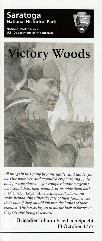
Darkness ended the day's fighting and saved Burgoyne's army from immediate disaster. That night the British commander left his campfires burning and withdrew his troops behind the Great Redoubt, which protected the high ground and river flats at the northeast corner of the battlefield. The next night, October 8, after burying General Fraser in the redoubt, the British began their retreat north. They had suffered 1,000 casualties in the past three weeks; American losses were fewer than 500.
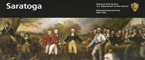
After a miserable march in mud and rain, Burgoyne's troops took refuge in a fortified camp on the heights of Saratoga. There an American force that had grown to nearly 17,000 men surrounded the exhausted British army. Faced with such overwhelming numbers, Burgoyne surrendered on October 17, 1777. By the terms of the Convention of Saratoga, Burgoyne's depleted army, some 6,000 men, marched out of its camp "with the Honors of War" and grounded its muskets along the west bank of the Hudson River. Thus was gained one of the most decisive victories in American and world history.
Touring Saratoga Battlefield
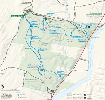
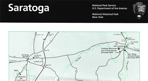
This guide, used along with the maps and exhibits in the visitor center and the interpretive markers on the battlefield itself, will help you understand the battles of Saratoga. The complete auto tour, which begins near the visitor center at the south end of the parking area, covers nine miles and contains 10 tour stops. If your time is limited, be sure to see the Neilson Farm, the Barber Wheatfield, the Balcarres Redoubt, and the Schuyler House.
Freeman Farm Overlook In 1777 the ground to the east of this open field was leased and farmed by John Freeman, a loyalist who went north and joined the British invasion force. The major fighting of September 19 took place on that open field. It was there that Morgan's riflemen opened the battle at about noon by firing on the advance guard of Burgoyne's center column from their posts near the Freeman House.
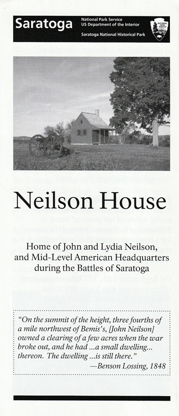
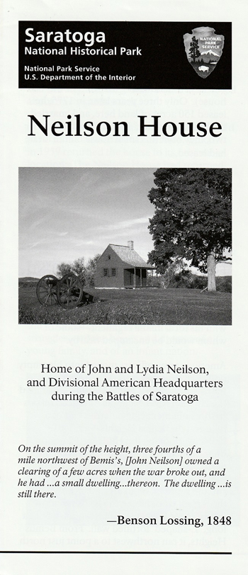
Neilson Farm (Bemis Heights) Before and after the battles, these heights were farmed by John Neilson, who joined the American troops opposing Burgoyne's advance. Today his restored home looks much as it did when American staff officers used it for quarters in September 1777. The heights are named for Jotham Bemis, who kept a tavern at the foot of the heights. Posts outline the fortified American line. The sites of General Gates's headquarters and the American field hospital are about A mile to the south.
American River Fortifications This powerful position was established under the direction of Col. Thaddeus Kosciuszko, a Polish military engineer and volunteer in the patriot cause. It proved to be the key to American strategy against Burgoyne in 1777. Patriot infantry and cannon posted here, supported by batteries along the near riverbank, closed off the Hudson Valley route to Albany and forced the British to attempt an attack upon the main American line on Bemis Heights on September 19.
Chatfield Farm An American outpost on this ridge, the site of Asa Chatfield's farm in 1777, spotted the British movement toward the Barber Farm on October 7. Beyond the ridge before you is Middle Ravine, across which American and British pickets exchanged musket and rifle shots just before the second battle began.
  (click for larger maps) |
Barber Wheatfield Here and in the field farther west (beyond the first row of trees) the Americans on October 7 intercepted the 1,500 British and German soldiers advancing southwest in an attempt to reconnoiter the American left. After an hour of fierce fighting, Burgoyne's troops were forced to withdraw to fortifications on the Freeman Farm. British Gen. Simon Fraser was mortally wounded northwest of here while trying to rally his men.
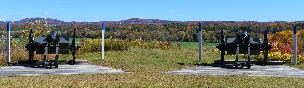
Balcarres Redoubt (Freeman Farm) was a log-and-earthen work about 375 yards long and 12 to 14 feet high. Named for Lord Balcarres, who commanded the British light infantry, it formed the strongest part of the fortified line constructed between the Hudson River and the Breymann Redoubt by Burgoyne's troops after the battle of September 19. On October 7 the British flanking column withdrew here after being driven from the Barber Farm. The redoubt is outlined by posts.
Breymann Redoubt, also outlined by posts, was a single line of breastworks about 100 yards long and seven to eight feet high. It guarded the British right flank and the road to Quaker Springs. It was named for Lt. Col. Heinrich Breymann, whose German troops were stationed here. Benedict Arnold's leg wound, which he received here just as Americans captured the position, is commemorated by the nearby "Boot Monument."
Burgoyne's Headquarters The path here leads to the site of Burgoyne's headquarters, which at the time of the battles consisted of large marquees or tents. It was established after the action of September 19 and was the center of British command and camp life between the two battles. Burgoyne chose the location because of a nearby spring.
The Great Redoubt was a system of fortifications built by the British on this hill and two others to the north. It was designed to guard their hospital, artillery park, Indian camp, and supplies on the river flat, and the boat bridge across the Hudson. Burgoyne withdrew his army to this vicinity during the night of October 7.
Fraser Burial Site and Trail A one-mile loop trail passes the traditional gravesite of General Fraser, mortally wounded during the second battle of Saratoga. Beyond the gravesite, the trail continues to the sites of the British hospital, artillery park, baggage area, and the Taylor House, where Fraser died. (Portions of the Old Champlain Canal may also be seen along the trail.) Note: The loop trail is fairly steep. Persons with physical limitations should take this into consideration before using it.
This ends the tour of the main park area. To reach the Schuyler House and the Saratoga Monument, located eight miles north in Schuylerville (historic Saratoga), return to U.S. 4 and turn left.
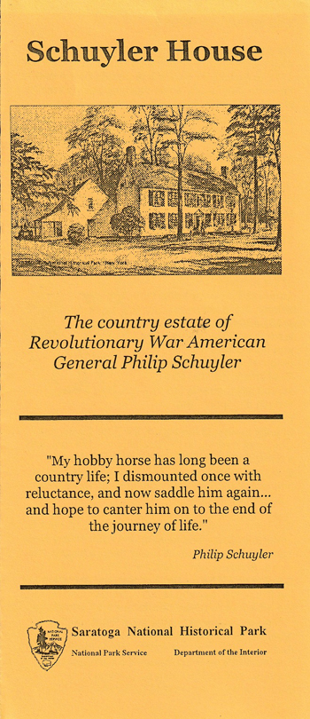
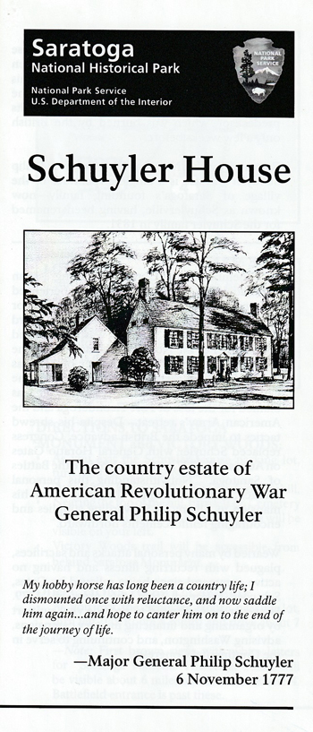
The Schuyler House This estate was the country home of Gen. Philip Schuyler both before and after the battles. The British burned the original house and its outbuildings to keep Americans from using them for cover during an attack. The present house, erected in 1777 shortly after Burgoyne's surrender, was the center of Schuyler's extensive farming and milling operations.
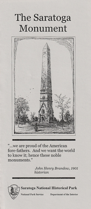
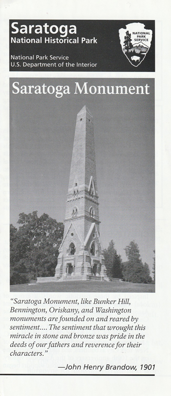
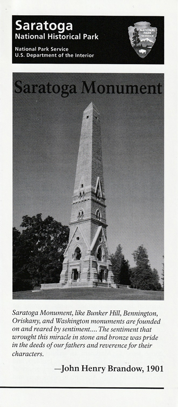
The Saratoga Monument commemorates Burgoyne's surrender to Gates on October 17, 1777. The 155-foot memorial was completed in 1883 and stands within what was Burgoyne's entrenched camp during the final days of the campaign.
About Your Visit
The park entrances are 30 miles north of Albany, N.Y., on U.S. 4 and N.Y. 32. The visitor center is open daily except Thanksgiving, December 25, and January 1. The Schuyler House, Saratoga Monument, and the Neilson House are open seasonally. Please call the visitor center for times of operation. The park tour road is open from early April to November 30, weather permitting.
For Your Safety Please be careful as you tour the park. Watch out for stinging insects, especially near the exhibits. Unpaved trails are rough, and poison ivy is common. Winter visitors should be aware of occasional severe weather conditions.
Source: NPS Brochure (2003)
|
Establishment
Saratoga National Historical Park — June 1, 1938 |
For More Information Please Visit The  OFFICIAL NPS WEBSITE |
Brochures ◆ Site Bulletins ◆ Trading Cards


Documents
18th Century Deer Populations: A Historical Study (W. Glen Gray, September 1984)
A Grounds Report of the General Philip Schuyler Property (Linda M. White, Summer 1982)
A Preliminary Analysis of the Gerlach "Plan" of Saratoga (Schuylerville), New York 1777 (Stephen G. Strach, 1982)
A Preliminary Report on the Schuyler House Research (Herbert Olsen, September 12, 1955)
A Report on Proposed Boundaries for Saratoga Battlefield Park, New York (Joseph Mills Hanson, August 31, 1938)
A Report on the Balcarras and Breymann Redoubts, Saratoga National Historical Park (Charles W. Snell, February 2, 1949)
A Report on the Construction of Cannon Carriages for Guns at Saratoga National Historical Park (Charles E. Shedd, Jr., June 5, 1953)
A Report on the Ground Cover at Saratoga National Historical Park, October 8, 1777 (Charles W. Snell, July 25, 1949)
A Report on the History, Construction and Social Use of the General Philip Schuyler Summer House at Schuylerville (Old Saratoga), N.Y. (Charles W. Snell, April 16, 1951)
A Report on the Left Wing of the British Fortified Camp at Freeman's Farm, September 20 to October 8, 1777 (Charles W. Snell, February 28, 1950)
A Report on the Organization and Numbers of Gates' Army, September 19, October 7, and October 17, 1777, Including an Appendix with Regimental Data and Notes (Charles W. Snell, February 1, 1951)
A Report on the Strength of the British Army Under Lieutenant-General John Burgoyne, July 1 to October 17, 1777 and on the Organization of the British Army on September 19 and October 7, 1777 (Charles W. Sell, February 28, 1951)
A Well Cultivated Domain: A Documentary Study of Farming on the Schuyler Estates (Stuart W. Lehman, February 1986)
Analysis of Saratoga National Historical Park Base Map (Susan R. Schrepfer, August 19, 1989)
Archeological Impact Assessment: Saratoga Monument, Schyulerville, New York, Saratoga National Historical Park (Thomas E. Mahlstedt, September 1980)
Archeological Overview and Assessment of the Saratoga National Historical Park, New York Draft (Eric S. Johnson, 1997)
Baldwin's Floating Bridge: A Report on the Identity of the Type and Composition of the American Structure Built Across the Hudson River, September and October 1777 (©Stephen G. Strach, 1980)
Baron Riedesel's Letter to Duke of Brunswick, October 21, 1777 (1935)
British - German - American Units in Saratoga Campaign (Charles W. Snell, August 2, 1949)
Burgoyne's Objective in the Second Battle of Saratoga, October 7, 1777 (Charles E. Shedd, Jr., December 15, 1952)
Catherine Schuyler: The Study of an Individual for the Understanding of an Era (Susan L. May, April 1983)
Colonial Saratoga: War and Peace on the Borderlands of Early America, Historic Resource Study, Saratoga National Historical Park (David L. Preston, 2018)
Cultural Landscape History: Saratoga National Historical Park (Emily W.B. Russell, December 30, 1991)
Cultural Landscape Report and Archeological Sensitivity Assessment for Victory Woods, Saratoga National Historical Park Olmsted Cetner for Landscape Preservation (Christopher Stevens, Linda White, William Griswold and Margie Coffin Brown, 2007)
Cultural Landscape Report: Saratoga Battlefield, Saratoga National Historical Park — Volume 1: Site History, Existing Conditions, and Analysis (September 2002)
Cultural Landscape Report for Saratoga Battlefield, Saratoga National Historical Park, Stillwater, New York — Volume II: Treatment (Michael Commisso and H. Eliot Foulds, 2011)
Cultural Landscapes Inventory: Fish Creek American Positions, Town of Saratoga, Saratoga County, New York Final Draft (Philip E. Pendleton, December 2010)
Cultural Landscapes Inventory: Saratoga Monument, Saratoga National Historical Park (1999)
Cultural Landscapes Inventory: Saratoga Surrender Site, Saratoga National Historical Park (2022)
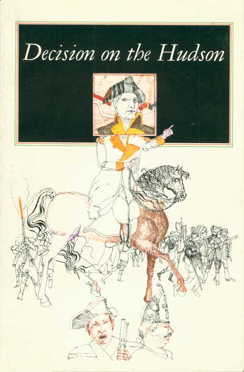
Decision on the Hudson: The Saratoga Campaign of 1777 (John Luzader, 1975)
Documentary Research Report, Neilson Farm Outbuildings, Saratoga National Historical Park (John F. Luzader, November 17, 1958)
Documentary Research Report on The Freeman Farm (John F. Luzader, June 1959)
Documentary Research Report on The Saratoga Campaign to September 19, 1777 (John F. Luzader, January 8, 1960)
Documentary Study of the Death and Burial of General Simon Fraser (John F. Luzader, May 1, 1958)
Documentary Study of the Location of American Fortifications Effected by the Construction of the Proposed Tour Route for Saratoga National Historical Park (John F. Luzader, October 10, 1957)
Documented Legislative History of Saratoga National Historical Park (Micheal M. Phillips, January 16, 1973)
Early History of Saratoga (Charles W. Snell, January 1949)
Historic Building Report: General Philip Schuyler House, Schuylerville, N.Y. (John F. Luzader, April 25, 1957)
Historic Building Report: Schuyler "Tenant House", Saratoga National Historical Park, Part I (John F. Luzader and Henry A. Jude, September 29, 1958)
Historic Documentation Report: Inventory King William's and King George's Wars Battlefields: 1689-1697 and 1744 to 1748 (Hartgen Archeological Associates, Inc., June 2015)
Historic Furnishings Report: Philp Schulyer House — Volume 1: Historical Data with Implementation Options, Saratoga National Historical Park, Town of Saratoga, New York (Laura M. DeNormndie, February 2004)
Historic Furnishings Study: John Neilson House, Saratoga National Historical Park, New York (James D. Mote, December 1976)
Historic Housekeeping Plan for the Neilson House, Saratoga National Historical Park (Richard E. Beresford, April 1989, revised May 1991 and February 1992)
Historic Housekeeping Plan for the Schuyler House, Saratoga National Historical Park (Richard E. Beresford, January 1989, revised April 1989, May 1990, June 1991 and February 1992)
Historic Resource Study: Barber Wheat Field, October 7, 1777, Saratoga National Historical Park, New York (Louis Torres, December 1974)
Historic Structure Report: General Philip Schuyler House, Saratoga National Historical Park, Volume 1 (Maureen K. Phillips, 2003)
Historic Structure Report: General Philip Schuyler House, Saratoga National Historical Park, Volume 2 (Maureen K. Phillips, 2003)
Historic Structures Report: Neilson House, Saratoga National Historical Park (Part I) Revision No. 1 (John F. Luzader, F. October 1959)
Historical Outline for Revision of Historic Base Map (John F. Luzader, March 1, 1960)
Housekeeping Plan for the Visitor Center, Saratoga National Historical Park (Richard E. Beresford, December 1991)
Interactions of White-tailed Deer and Vegetation at Saratoga National Historical Park NPS Technical Report NPS/NAROSS/NRTR/95-28 (H. Brian Underwood, Kelly A. Austin, William F. Porter, Robert L. Burgess and Richard W. Sage, Jr., December 1994)
Interior Paint Analysis, General Philip Schuyler House, Saratoga National Historical Park, Schuylerville, New York (Maureen K. Phillips, January 1998)
Interpretive Prospectus, Saratoga National Historical Park, New York (August 1970)
Long-Range Interpretive Plan, Saratoga National Historical Park (November 2007)
Master Plan, Saratoga National Historical Park, New York (1969)
Narrative Report for April, May, June, 1940 (F.F. Wilshin, August 6, 1940)
Narrative Report for March, April, May, 1941 (F.F. Wilshin, June 10, 1941)
Natural Resource Condition Assessment, Saratoga National Historical Park NPS Natural Resource Report NPS/NETN/NRR-2014/751 (Rebecca Wagner, Charles Andrew Cole, Larry Gorenflo, Biran Orland, Ken Tamminga, Margaret C. Brittingham, C. Paola Ferreri and Margot Kaye, January 2014)
Preliminary Documentary Report on Benedict Arnold at Saratoga (John F. Luzader, October 27, 1958)
Preliminary Report on the Source Material of the Burgoyne Campaign of 1777 (Francis F. Wilshin, April 29, 1940)
Proposed Historic Site: Genl. Schuyler Property, Schuylerville, New York (1943-1947)
Report on Investigations of the Burdyl Farmhouse, Saratoga National Historical Park, Stillwater, New York (Peggy A. Albee, December 1, 1992)
Report on Samuel McBrides Farm in the Township of Stillwater, New York (Gerald Lowell Christiansen, January 1965)
Report on the Location and Identity of the Burgoyne Cannon Surrendered at the Convention of Saratoga, October 17, 1777 (Francis F. Wilshin, January 7, 1942)
Saratoga Battlefield in 1777 (Frances F. Wilshin, 1941)
Saratoga National Historical Park, New York: Historic Handbook No. 4 (Charles W. Snell and Francis F. Wilshin, 1950)
Saratoga National Historical Park, New York: Historic Handbook No. 4 (HTML edition) (Charles W. Snell and Francis F. Wilshin, 1950, revised 1959)
Schuyler House Furnishing Plan (1777-1795), Saratoga National Historical Park (Vera B. Craig, Worth Bailey and John F. Luzader, 1960)
Selections from The Gates Papers (1950)
Supplement to A Report on Proposed Boundaries for Saratoga Battlefield Park, New York (Joseph Mills Hanson, September 24, 1938)
Supplement to Documentary Study of the Death and Burial of General Simon Fraser (John F. Luzader, May 1, 1958)
The Burgoyne Campaign from October 8 - October 16, 1777 (John F. Luzader, 1960)
The Field of Grounded Arms at Schuylerville (Old Saratoga), New York (Richard J. Koke, May 2, 1947)
The John Neilson House, Stillwater, New York: Furnishing Plan/Historical Research (Parts I & II) (Agnes M. Downey and John Luzader, 1960)
The John Neilson House: A Guide to the Furnishings (1994)
The Right Wing of the British Fortified Camp at Saratoga: HSR Balcarres and Breymann Redoubts (John Luzader, c1974)
The Saratoga Battlefield: A Vegetative History (Nancy M. Gordon, March 15, 1987)
The Schuyler House of 1777: A Guide to the Furnishings (Richard E. Beresford, January 1993)
The Schuyler House of 1777: A Guide to the Furnishings (Richard E. Beresford, revised April 1994)
The Site of the Sword Surrender Ceremony at Schuylerville (Old Saratoga), New York (Charles W. Snell, October 5, 1949)
Wallpaper Analysis: General Philip Schuyler House, Saratoga National Historical Park (Maureen K. Phillips, March 1998)
Water Quality Monitoring at Saratoga National Historical Park: Northeast Temperate Network 2011 Summary Report NPS Natural Resource Data Series NPS/NETN/NRDS—2012/348 (William G. Gawley, August 2012)
Water Quality Monitoring at Saratoga National Historical Park: Northeast Temperate Network 2012 Summary Report NPS Natural Resource Data Series NPS/NETN/NRDS—2013/544 (William G. Gawley, August 2013)
Water Quality Monitoring at Saratoga National Historical Park: Northeast Temperate Network 2013 Summary Report NPS Natural Resource Data Series NPS/NETN/NRDS—2014/658 (William G. Gawley and A. Hali Roy, May 2014)
Water Quality Monitoring at Saratoga National Historical Park: Northeast Temperate Network 2014 Summary Report NPS Natural Resource Data Series NPS/NETN/NRDS—2016/1028 (William G. Gawley and Fred W. Dieffenbach, June 2016)
White Tail Deer at Saratoga, Some Historical Perspectives (Stuart W. Lehman, April 7, 1987)
Exploring Saratoga National Historic Park
Books
sara/index.htm
Last Updated: 13-Nov-2023