|
Timucuan Ecological and Historic Preserve Fort Caroline National Memorial Florida |
|
 NPS photo | |
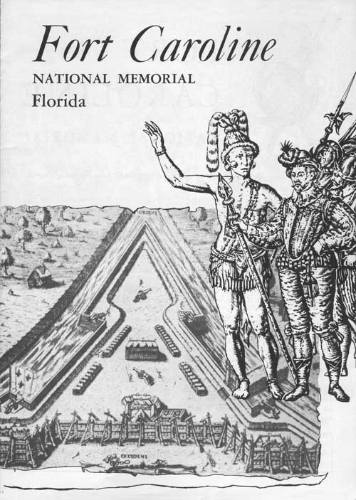
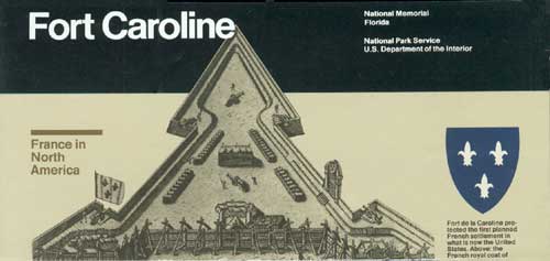
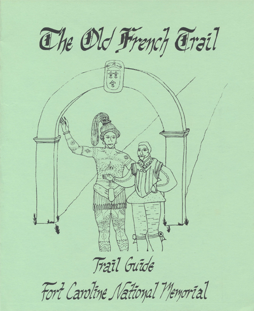
FORT CAROLIINE
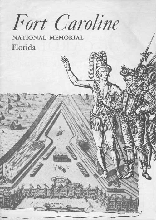
In the mid-1500s a vigorous, expansionist France was emerging from feudalism and dreaming of empire. Spain, the world's leading power, already had a foothold in the Americas, and France wanted to share Spain's riches gained by trade and plunder. France's first attempt at a permanent claim in North America was La Caroline, a settlement near the mouth of the St. Johns River in Florida.
The settlement was a commercial venture at first, but religious conflict in France enlarged its goals. Growing persecution of French Protestants (Huguenots) led their most powerful member, Admiral Gaspard de Coligny, to propose to the crown that the colony also be a refuge for Huguenots. An exploratory expedition commanded by Jean Ribault left France in February 1562. After erecting a monument at the River of May (now St. Johns River), Ribault went northward, left a small garrison at Charlesfort near Port Royal Sound, and sailed home. Within months his men's situation became desperate and they returned to France.
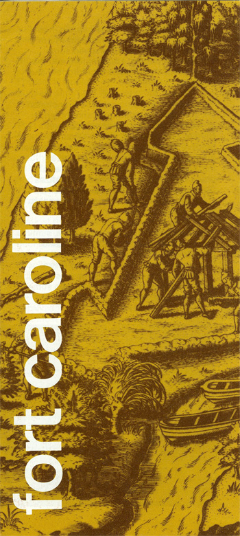
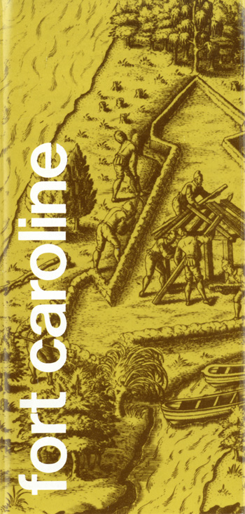
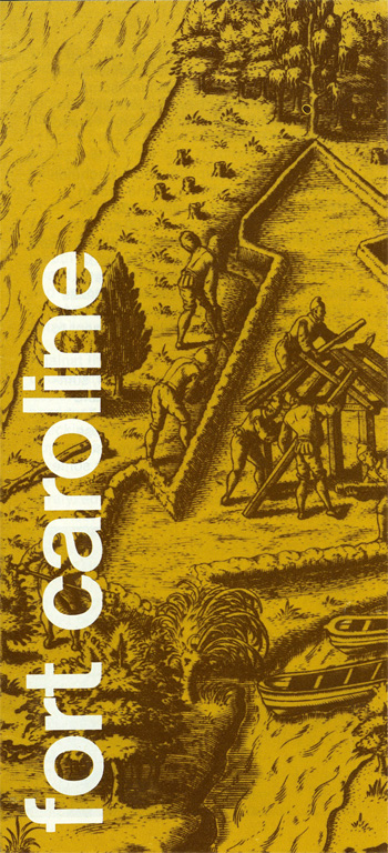
Coligny urged another attempt in April 1564, planning a permanent settlement of 200 soldiers and artisans, and a few women. Led by René de Goulaine de Laudonnière, who was with Ribault on his previous expedition, the colonists first touched at the River of May on June 22. Helped by Indians, they began building a village and fort on the river's south bank, naming the area La Caroline (land of Charles) after their king, Charles IX. Relations with the Indians soon soured and by spring 1565 the colonists faced starvation. Mutinous parties sailed off to seek their fortune—some to be captured by the Spanish, revealing the French colony's presence. Remaining colonists, discovering no silver or gold, were set to quit Florida in August 1565, when Ribault arrived with a relief expedition of supplies and 600 soldiers and settlers, including more women and some children.
Learning that Ribault had left for Florida, Philip II of Spain sent Admiral Pedro Menéndez to dislodge the French. Initially rebuffed off the coast, Meneédez set up a base to the south at San Augustin. Ribault sailed down the coast to attack the Spanish, but a hurricane scattered his ships and he beached far to the south. Seizing the opportunity, Meneédez marched north with 500 soldiers to attack the weakly guarded colony. In early morning, September 20, his troops massacred 140 settlers, sparing only about 60 women and children. Forty to 50 others, including Laudonnière, escaped and sailed for France. Menéndez next marched south and found the shipwrecked Frenchmen, Ribault among them. They threw themselves on his mercy, but to Menéndez they were heretics and enemies of his king. At a place later to be named Matanzas (slaughter) he killed about 350 men—all but those professing to be Catholics and a few musicians.
The French exacted their revenge in April 1568, when Dominique de Gourgues attacked and burned the fort, killing all who did not escape, and then sailed home. Spain rebuilt the fort, only to abandon it in 1569. France, however, never again would strongly challenge Spanish claims in North America.
Sea Lanes of Settlement and Conflict
In Florida both France and Spain hoped to claim their piece of the "new world." By the time the French planted a settlement at La Caroline, Spain was entrenched in South and Central America and its sea routes through the Caribbean were well established. Spanish ships bearing gold and silver from mines in Mexico and Peru stopped at Havana before sailing for Spain. They rode the Gulf Stream through the Bahama Channel (now the Straits of Florida) and up North America's southeast coast. Spain feared a French settlement because its treasure ships, although following Florida's coast, could be easy prey for French raiders in their nearby haven at La Caroline.
Charles IX (1550-74) became king of France at age 10. His mother Catherine de Medici and Admiral Coligny counseled the king to license Ribault's North American voyage.
Gaspard de Coligny (1516-72), Admiral of France and prominent Huguenot, was supported by Catherine de Medici in his plan to colonize New France with Huguenots.
Jean Ribault (ca. 1520-65), chosen by Admiral Coligny to explore Florida, brought reinforcements to Fort de la Caroline in 1565 and died in its defense.
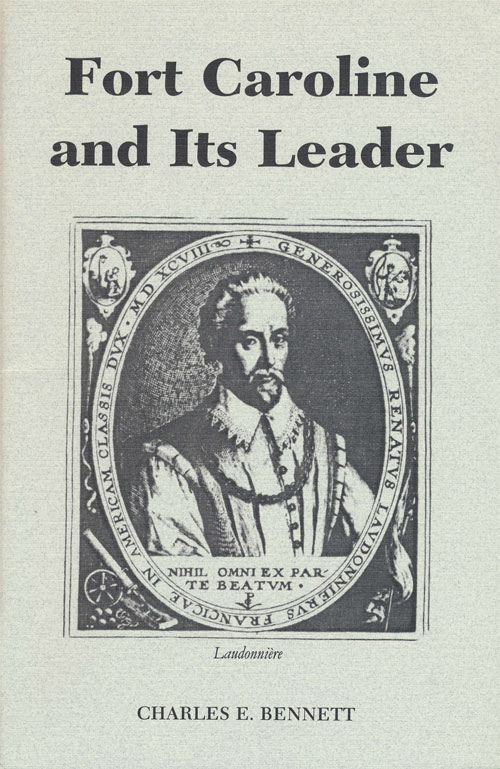
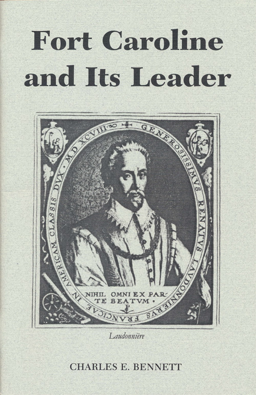
Renè de Laudonnière (ca. 1529-74) commanded Fort de la Caroline. He survived the Spanish massacre of the French, and later wrote his L'Histoire notable de la Floride.
"They be all naked and of goodly stature, mighty, faire and as well shapen . . . as any people in all the worlde, very gentill, curtious and of a good nature . . . the men be of tawny collour, hawke nosed and of a pleasant countenance . . . the wemen be well favored and modest..."
—Jean Ribault
The Native Floridians
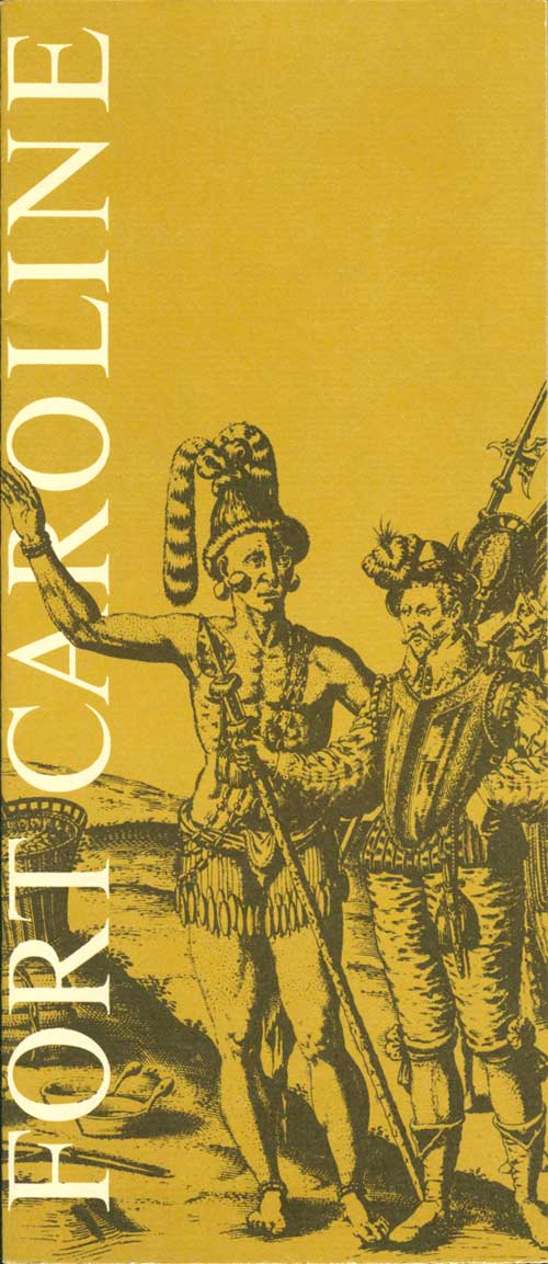
French explorer Jean Ribault was impressed by the first native peoples he met in Florida. The Timucuans under Chief Saturiwa who met the French at the mouth of the River of May in 1562 were one of several Timucua-speaking tribes who lived in central and north Florida and southeastern Georgia. Their culture and way of life had been essentially unchanged for over 1,000 years.
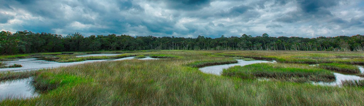
The Timucuans looked to the water to sustain them, settling along rivers or near the coast. (Their prehistoric ancestors are called "People of the Shell Mounds.") Besides collecting shellfish and fishing, they hunted and gathered in the forests and swamps and planted maize, squash, and beans. In their often palisaded villages, they lived in circular dwellings with conical, palm-thatched roofs and walls of woven vines caulked with clay. Ceremonial squares in larger villages were the scenes of festivals, dances, and religious ceremonies.
Related villages formed a loose political confederation under a head chief. In this caste society commoners deferred to a hereditary elite whose chief sat at the pinnacle. Within the clan, wealth and title were inherited through the mother's brother.
The Timucuans helped their new neighbors adapt to the area—sharing food and even helping them build a village and fort. Well aware of their minority status, the French at first made every effort to avoid alienating local tribes. Only when starvation threatened did this policy unravel. Mistrust turned to armed conflict, ending the brief period of harmony between French and Indian. Yet the Timucuans apparently remained neutral during the Spanish attack in 1565, and they helped French forces under de Gourgues recapture the fort in 1568.
Florida tribes could not long survive contact with Europeans. After driving out the French, Spain imposed tribute on the Timucuans and forced them into missions. Devastated by European disease and attacks by other Indians, the Timucuan culture rapidly disintegrated. From a population possibly numbering tens of thousands at the time of contact, there were only an estimated 550 Timucuans still alive in 1698. No known Native Americans today call themselves Timucuan.
Timucuans hold an early place in European consciousness of the native peoples of the Americas. French colonist Jacques le Moyne's sketches of Timucuan ceremonies and customs gave many Europeans their first views of American Indians. Francisco Pareja, a Franciscan priest, translated a set of catechisms and confessionals from Spanish into the Timucuan language in 1612, the first known translation of an American Indian language into a European language.
Visiting Fort Caroline
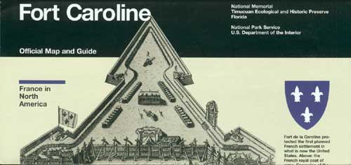
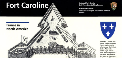
Fort Caroline National Memorial, a unit of Timucuan Ecological and Historic Preserve, is 13 miles east of Jacksonville. Take the Arlington Expressway (Fla. 115/Alt. U.S. 1/90) to Atlantic Boulevard (Fla. 10). Turn north on Monument Road and then travel east on Fort Caroline Rd. The original site of La Caroline no longer exists, possibly washed away after the river channel was altered in the 1880s. The fort exhibit is based on a 1500s sketch by Jacques le Moyne, colony artist and mapmaker.
Protect Yourself and the Park Use caution when walking along bluff trails and near the river. Insect repellent is advised. Picnicking is permitted, but no fires or grills are allowed. Use litter containers. It is illegal to disturb, move, or remove any historical or natural feature. Timucuan Preserve Visitor Center is accessible and service animals welcome.
Source: NPS Brochure (2017)
TIMUCUAN
Where the Waters Meet
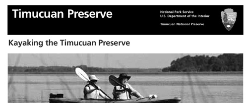
In and around one of the Atlantic Coast's largest urban areas, Timucuan Ecological and Historic Preserve offers glimpses of Old Florida in some unexpected places. Explore a fort exhibit that recalls the lives and deaths of French colonists in the 1500s. Walk among live oaks and thickets of palmettos where pre-Columbian and Timucua Indians once lived. Climb a wildlife observation platform overlooking salt marsh habitat. Visit a plantation where enslaved men, women, and children of African descent labored, raised families, worshipped, celebrated, and mourned. Find tranquility in a day at the beach or winding your way by kayak through the marshy expanse.
Established in 1988, this 46,000-acre preserve includes Fort Caroline National Memorial, the Theodore Roosevelt Area, Kingsley Plantation, Cedar Point, and thousands of acres of woods, water, and salt marsh. These diverse natural and human stories come alive where the Nassau and St. Johns rivers flow into the Atlantic Ocean—where the waters meet.
Who Were the Timucua?
For thousands of years, native people depended on the rich natural resources of the St. Johns estuary. These pre-Columbian people have left clues to their existence; the most easily recognized are the mounds of shells found throughout the preserve. The Indians who made contact with the first European arrivals to the area in the mid-1500s are today known as the Timucua. The term Timucua actually represents a number of cultural traditions that have become defined by a shared language.
The Timucua who settled along the rivers and islands near the Atlantic Ocean took advantage of the waterways for transportation. Using tools made from the storehouse of natural materials, they felled, burned, and scraped tree trunks to make dugout canoes. They hunted and gathered in the forests and marshes, fished, and collected oysters and clams. Discarded shells were piled atop the mounds accumulating from successive generations. It is these ever-present shell mounds that testify to the importance of the water for survival.
The Timucua of this area first encountered Europeans in 1562 when French settlers arrived at the St. Johns River. The Timucua offered food and even helped the strange newcomers build a fort. As with other Florida native peoples, though, they did not long survive contact with Europeans.
Spanish rulers, who had driven out the French, imposed their own culture, including spiritual beliefs through the Spanish mission system. European diseases, to which the Timucua had no immunity, devastated the population. Only 550 Timucua were recorded in 1698, from a population once in the tens of thousands. Today, no known indigenous people call themselves Timucua.
Fort de la Caroline
On May 1, 1562, a French voyage of discovery led by Jean Ribault arrived at the mouth of the St. Johns River. After exploring the area the corps erected a stone marker and sailed north. Two years later an expeditionary force led by René de Laudonnière established the first French colony in what is now the United States. They chose a site along the south bank of the river a few miles inland from the mouth. The colonists, mostly Huguenots, named their colony "la Caroline" in honor of King Charles IX. The Timucua helped them build a triangular fort.
Good relations between natives and newcomers were difficult to maintain. Moreover, problems with leadership, homesickness, hunger, and disappointment at not finding material wealth led to discontent among the colonists. In August 1565, just as they were about to abandon their colony, reinforcements led by Jean Ribault came from France.
King Phillip II of Spain, a Catholic, viewed the French as "heretics" and trespassers on Spanish-claimed lands. In September 1565, a force led by Pedro Menéndez de Aviles captured la Caroline and massacred most of its defenders. Though the French recaptured the fort in April 1568, they never again attempted colonization in the area. "La Florida" would remain Spanish for another 200 years. The climactic battles here between the French and the Spanish marked the first time that European nations fought for control of lands in what is now the United States. It would not be the last time.
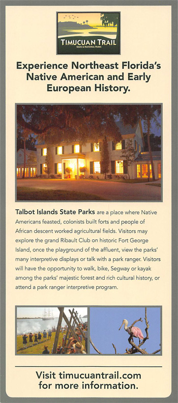
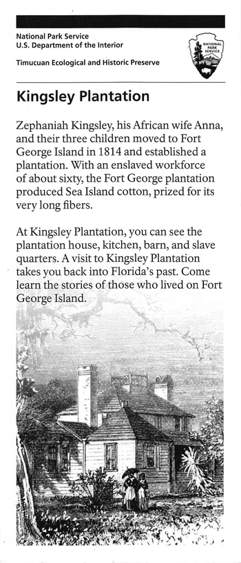
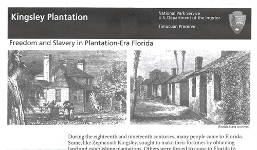
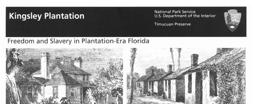
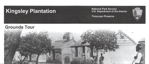
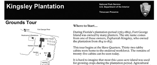
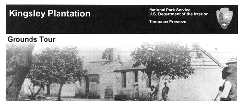
Kingsley Plantation
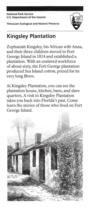
Fort George Island was isolated and reachable only by boat when Zephaniah Kingsley settled here in 1814. The island already had a well established plantation. Its cash crop was Sea Island cotton, a prized variety with very long fibers suitable for spinning into a fine, strong thread.
Kingsley brought his wife and three children; a fourth child was born here. His wife Anna was from Senegal in West Africa and was purchased as a slave by Kingsley in Havana, Cuba. When she and her children were freed in 1811, she acquired land and slaves.
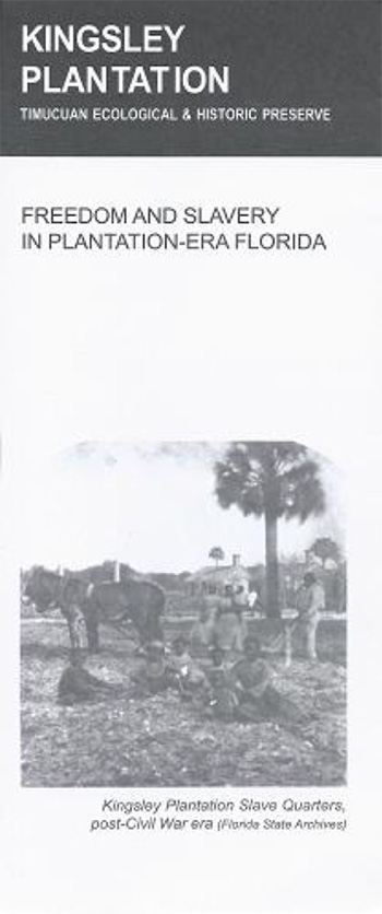
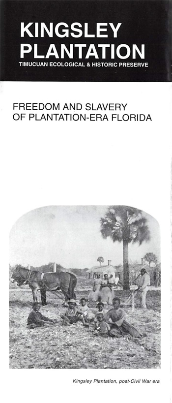
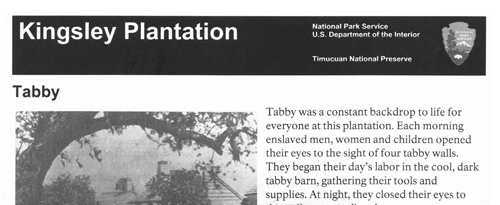
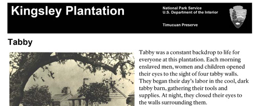
The plantation house was built by slaves and completed in 1798. Nearby in a semicircular arrangement were the cabins of enslaved men, women, and children who labored on the plantation. These thick-walled structures were made of tabby, a mixture of oyster shells, sand, and water. As with other coastal plantations, slave labor was done according to the "task system." Working without supervision, each slave was assigned a specific amount of work for the day, such as picking one-quarter acre of cotton. Once the task was complete, slaves were expected to use the balance of the day tending to their own family needs.
Under Spanish control, Florida had relatively liberal racial policies. In 1821 Florida became a United States territory and things changed dramatically. To escape the oppressive laws, Anna, her two sons, and some former slaves moved to Haiti in 1837, where Kingsley had established a free colony. In 1839 he sold Fort George Island to his nephew. Zephaniah Kingsley died in New York City in 1843. Anna returned to Jacksonville, where she lived with her two daughters until her death in 1870.
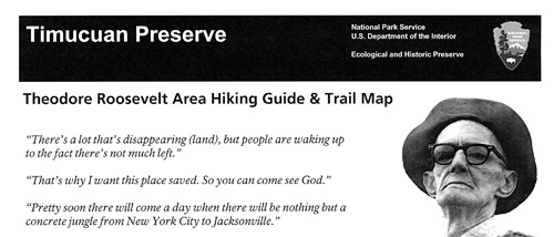
People have to work in the cities, they can't live in the woods anymore. But they ought to have a place in the woods they can go to.
—Willie Browne, 1889-1970
Theodore Roosevelt Area: A Walk on the Wild Side
This 600-acre remnant of Old Florida was the only home Willie Browne ever knew. His parents, William Henry and Eliza Browne, moved to Jacksonville from New York City in 1882. Shortly after Willie was born in 1889, they moved to property east of downtown Jacksonville to escape a yellow fever epidemic.
Willie and his younger brother Saxon grew up in a two-story house that overlooked the salt marsh. The boys fished, roamed the vast shell mounds, and explored the ruins of old Confederate gun batteries on St. Johns Bluff. They also tended the family's cattle, chickens, citrus trees, and vegetable garden.
After their parents moved to another house in the early 1900s, the Browne boys remained on the property. They lived off the land and water—farming, commercial fishing, running a sawmill, and selling oyster shells taken from the ancient Indian shell mounds. Saxon died in 1953. Willie lived by himself in a cabin on the property for the rest of his life—without electricity, indoor plumbing, or many other conveniences.
A strong admirer of President Theodore Roosevelt and his conservation efforts, Browne encouraged the public to use his land as a refuge from the modern world. In 1969 he donated his land to The Nature Conservancy. The National Park Service acquired the land in 1990 as part of Timucuan Ecological and Historic Preserve. Willie Browne died in 1970. He is buried in a family cemetery on the property.
Theodore Roosevelt Area Today
The Willie Browne Trail winds through a variety of habitats, including maritime
hammocks, scrub vegetation, freshwater swamp, and salt marsh. Passing over a
small wooden bridge, the trail leads to the "shell peninsula," consisting of
mounds of oyster shells left over from 1,000 years of pre-Columbian and Timacua
Indian habitation.
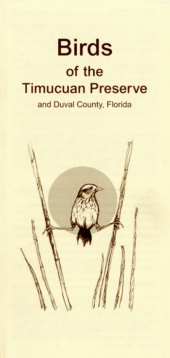
The salt marsh is a giant food-producer. As such, it attracts abundant wildlife. Birding opportunities abound, especially at the observation platform overlooking Round Marsh. Year-round residents include wood storks, ospreys, great blue herons, belted kingfishers, snowy egrets, and bald eagles. In winter look for kestrels, saltmarsh sharp-tailed sparrows, and green-winged teals. Summer brings roseate spoonbills and painted buntings. Get a full list at the visitor center.
You may also spot alligators, otters, dolphins, bobcats, gopher tortoises, marsh rabbits, and a variety of reptiles, including snakes. Along the trail lies the foundation of Willie Browne's cabin. Exhibit panels nearby tell about his life and legacy.
Planning Your Visit
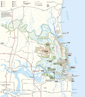 (click for larger map) |
Timucuan Preserve Visitor Center and Fort
Caroline
The visitor center Is located at Fort Caroline National Memorial: Follow the
Arlington Expy. (Fla. 115) to Atlantic Blvd. (Fla. 10). Turn north on Monument
Road, then east on Fort Caroline Road The visitor center has a sales and
information area and exhibits. A riverside trail leads to the fort exhibit. Open
daily 9 am to 5 pm. Preserve sites are closed on Thanksgiving, December 25, and
January 1.
Theodore Roosevelt Area
This area is accessible via a boardwalk trail from Fort Caroline or from the
parking lot just off Mount Pleasant Road near the preserve headquarters. Open
daily 8 am to dusk. There is a picnic table at the parking area. Bicycles are
allowed on the Willie Browne Trail only.
Klngsley Plantation
Located on Fort George Island, just off Fla. A1A/105 north of the ferry landing,
the site has an information and sales center, and interpretive exhibits are
located on the grounds. A trail connects the house complex to the slave
quarters. Open daily 9 am to 5 pm.
Ribault Club
This former 1920s-era golf club is open to the public, with exhibits on the
natural and cultural history of Fort George Island. Open Wednesday through
Sunday 9 am to 5 pm. Facilities are available for special events for a fee.
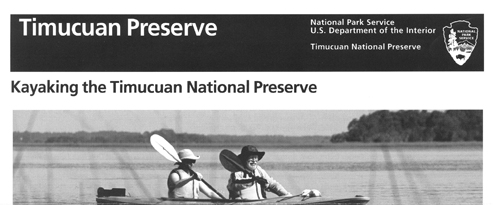
Boating
There are public docks and boat ramps in the preserve. Observe speed limits.
Manatees, a protected species, are slow moving and vulnerable to injury and death
by encounters with motorboats.
Fishing
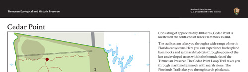
Good fishing spots are Cedar Point, Little Talbot Island State Park, and
throughout the Preserve from small craft. All federal and state licensing and
regulations apply.
Regulations
All plants, animals, cultural artifacts, and historic structures are protected
by federal law; there are serious penalties for violations. • Much land in
the Preserve is privately owned; obey posted signs.
Source: NPS Brochure (2017)
|
Establishment
Timucuan Ecological and Historic Preserve — February 16, 1988 |
For More Information Please Visit The  OFFICIAL NPS WEBSITE |
Brochures ◆ Site Bulletins ◆ Trading Cards

Documents
Assessment of Estuarine Water and Sediment Quality at Timucuan Ecological and Historic Preserve, 2008 NPS Natural Resource Data Series NPS/SECN/NRDS-2011/134 (M. Brian Gregory, Joe DeVivo, Phillip H. Flournoy and Kay Austin Smith, January 2011)
Assessment of Estuarine Water and Sediment Quality at Timucuan Ecological and Historic Preserve: 2008 Data Summary NPS Natural Resource Data Series NPS/SECN/NRDS-2019/1236 (Eric N. Starkey, Wendy Wright and Christopher S. Cooper, October 2019)
Assessment of Estuarine Water at Timucuan Ecological and Historic Preserve, 2013 NPS Natural Resource Data Series NPS/SECN/NRDS-2013/598 (Wendy Wright, M. Brian Gregory and Jennifer Asper, December 2013)
Climate Change Trends for Planning at Timucuan Ecological and Historic Preserve and Fort Caroline National Memorial, Florida (Patrick Gonzalez, August 8, 2012)
Coastal Hazards & Sea-Level Rise Asset Vulnerability Assessment for Timucuan Ecological & Historic Preserve and Fort Caroline National Memorial: Summary of Results NPS 006/186750, NPS 396/186750 (K.M. Peek, H.L. Thompson, B.R. Tormey and R.S. Young, November 2022)
Cultural Landscape Report: Spanish-American War Battery, Timucuan Ecological and Historic Preserve 95% Draft (Panamerican Consultants, Inc., Wiss, Janney, Elstner Associates, Inc. and Liz Sargent, December 2020)
Cultural Landscape Report: Spanish-American War Battery, Timucuan Ecological and Historic Preserve, Volume II: Environmental Assessment (Panamerican Consultants, Inc., Wiss, Janney, Elstner Associates, Inc., Jane Jacobs and Liz Sargent, March 2022)
Cultural Landscapes Inventory: Kingsley Plantation, Timucuan Ecological and Historic Preserve (2007)
Ethnohistorical Study of Kingsley Plantation, Timucuan Ecological and Historic Preserve (Antoinette T. Jackson and Allan F. Burns, August 2004/January 2006)
Fixed-Station Water Quality Monitoring at Timucuan Ecological and Historic Preserve: Data Summary 2010 NPS Natural Resource Data Series NPS/SECN/NRDS—2011/180 (M. Brian Gregory, Julie Dingle, Christina Wright, Emma Thompson and Amy Kalmbacher, July 2011)
Fixed-Station Water Quality Monitoring at Timucuan Ecological and Historic Preserve: 2011 Data Summary NPS Natural Resource Data Series NPS/SECN/NRDS—2012/393 (Wendy Wright, M. Brian Gregory and Aaron Rinehart, October 2012)
Fixed-Station Water-Quality Monitoring at Timucuan Ecological and Historic Preserve: 2012 Data Summary NPS Natural Resource Data Series NPS/SECN/NRDS—2013/494 (Aaron Rinehart, M. Brian Gregory and Wendy Wright, May 2013)
Fixed-Station Water-Quality Monitoring at Timucuan Ecological and Historic Preserve:: 2013-2014 Data Summary NPS Natural Resource Data Series NPS/SECN/NRDS—2015/978 (Wendy Wright and Peter Mockus, September 2015)
Foundation Document, Timucuan Ecological and Historic Preserve, Florida (December 2012)
Foundation Document Overview, Timucuan Ecological and Historic Preserve, Florida (December 2012)
Foundation Document Overview, Timucuan Ecological and Historic Preserve, Florida (January 2017)
General Management Plan/Development Concept Plans, Timucuan Ecological and Historical Preserve, Florida (March 1996)
Historic Resource Study: Timucuan Ecological and Historic Preserve (Daniel W. Stowell, October 1976)
Historic Structure Report: Kingsley Plantation Kitchen House, Timucuan Ecological and Historic Preserve (Hartrampf, Inc., January 31, 2005)
Historic Structure Report: Napoleon Bonaparte Broward House, Timucuan Ecological and Historic Preserve (Joseph K. Oppermann, March 2010)
History of Kingsley Plantation (2013)
Junior Ranger Program (Ages 7 and under), Timucuan Ecological and Historic Preserve/Fort Caroline National Memorial (Date Unknown; for reference purposes only)
Junior Ranger Program (Ages 8 and up), Timucuan Ecological and Historic Preserve/Fort Caroline National Memorial (Date Unknown; for reference purposes only)
Junior Ranger Program (Ages 7 and under), Timucuan Ecological and Historic Preserve — Kingsley Plantation (2014; for reference purposes only)
Junior Ranger Program (Ages 8 and up), Timucuan Ecological and Historic Preserve — Kingsley Plantation (2014; for reference purposes only)
Landbird Community Monitoring at Timucuan Ecological and Historic Preserve and Fort Caroline National Memorial, 2010 NPS Natural Resource Data Series NPS/SECN/NRDS-2011/296 (Michael W. Byrne, Joe C. DeVivo and Brent A. Blankley, September 2011)
National Register of Historic Places Nomination Form
Fort Caroline National Memorial (Kathleen L. Dilonardo, November 1975)
Kingsley Plantation Historic District Additional Documentation (Deborah Slaton, Liz Sargent and Tim Penich, July 11, 2016)
Natural Resource Condition Assessment, Timucuan Ecological and Historic Preserve NPS Natural Resource Report NPS/TIMU/NRR-2022/2394 (Kathy Allen, Andy J. Nadeau and Andy Robertson, June 2022)
Sea Level Trends for Planning at Timucuan Ecological and Historic Preserve (Maria Caffrey, May 8, 2012)
Spanish-American War Battery 95% Draft Environmental Assessment, Timucuan Ecological and Historic Preserve, Florida (October 2021)
State of the Park Report, Timucuan Ecological and Historic Preserve and Fort Caroline National Memorial, Florida State of the Park Series No. 39 (2016)
Summary of Amphibian Community Monitoring at Timucuan Ecological and Historic Preserve and Fort Caroline National Memorial, 2009 NPS Natural Resource Data Series NPS/SECN/NRDS-2010/095 (Michael W. Byrne, Laura M. Elston, Briana D. Smrekar, Marylou N. Moore and Piper A. Basemore, October 2010)
The Archaeological History of the Sixteenth-Century French Fort Caroline in Northeast Florida (Michael P. Fleck, March 2017)
The Enslaved Communities on Fort George Island: A Special History Study for Timucuan Ecological & Historic Preserve (Amani T. Marshall, March 2022)
Vegetation Community Monitoring at Timucuan Ecological and Historic Preserve and Fort Caroline National Memorial, 2009 NPS Natural Resource Data Series NPS/SECN/NRDS-2012/249 (Michael W. Byrne, Sarah L. Corbett and Joseph C. DeVivo, February 2012)
William Bartram's eyewitness account leads to likely location of Fort Caroline: It's on the south chanel of the Altamaha River in Glynn County, Georgia (People of One Fire, January 11, 2014)
Fort Caroline National Memorial
Timucuan Ecological and Historic Preserve Visitor Center
Books
timu/index.htm
Last Updated: 20-Nov-2023