|
National Park Service
A Survey of the Recreational Resources of the Colorado River Basin |

|
Chapter VIII:
CANYON LANDS OF SOUTHEASTERN UTAH
LOCATION
Broadly speaking, the region considered is the portion of the Colorado River Basin between Lees Ferry, Ariz., the Dewey Dam site on the Colorado, and the town of Green River, Utah, on the Green River, excluding the San Juan River Basin above Bluff, Utah, and the high plateaus along the west side of the basin.
The region is roughly bounded on the east by State Highway 47 and United States Highway 160; on the north by United States Highway 50; on the west by State Highways 10, 72, 24, the road through the Dixie National Forest from Torrey to Boulder, the county road from Boulder to Escalante, Utah, State Highways 23, 22, and 12, and United States Highway 89; and on the south by United States Highway 89, and the road through the Indian reservations from Tuba City, Ariz., to the Utah State line where it connects with Utah State Highway 47.
This report is especially concerned with the vast, colorful land of deserts, mountains, canyons, plateaus, and buttes that lie within the fringe of settlements and the connecting roads more than 20,000 square miles, in which probably less than 200 people have their permanent residence, exclusive of the Indians on the Navajo Reservation. Men running cattle and sheep in the area live in the bordering settlements and go out to their stock occasionally by truck and horseback. The sheepherders camp here during the winter and move to higher mountain pastures for the summer. (Plate 9 in pocket.)
PRESENT ROADS AND TRAILS
This region is part of the largest section in the United States in which there are no improved roads. Within the belt there are no improved roads except the short spur to Henrieville, the road in Bryce Canyon National Park, and in the settled section around Price. Two hundred and ninety miles of the 800 miles of roads forming the belt are unimproved.
State Highway 24 crossing the northwest portion of the area from Green River to Fruita in Capitol Reef National Monument is only a fair-weather trail, as is State Highway 95 from Blanding to Natural Bridges National Monument. The remaining roads in the area are truck trails constructed by the Grazing Service (now the Bureau of Land Management) or the local people to give access to cattle and sheep camps, mines, and oil prospects. Between Lees Ferry and Moab on the Colorado and the mouth of the San Rafael River on the Green River there is only one place where it is possible to drive to the rivers without extreme difficulty. The old trail down North Wash Canyon and up White Canyon to Blanding has been improved. The lower end of the trail from Escalante to Hole in Rock, a distance of about 6 miles, has not been used since the Hole in Rock pilgrimage in 1939, except by men on horseback. There has been a trail from Notom on State Highway 24, down Halls Creek to within a few miles of the river, but this was not passable in 1943 beyond a point 18 miles from the river. In the spring of 1943, trucks were driven from Kanab to the site of the old town of Paria, thence southeast to Lone Rock on Wahweap Creek, about 8 miles west of the point where the Colorado River crosses the Utah-Arizona State line.
On the east side of the Colorado it is reported that an automobile has been driven to a point west of the Clay Hills on the old Mormon Trail which runs from near Natural Bridges National Monument southwest toward Hole in Rock.
Fourteen miles north of Monticello there is an unimproved road leaving United States Highway 160 which gives access to the north side of the Abajo Mountains and Indian Creek Valley. Following this road down Indian Creek and around the north side of North Six-Shooter Peak, it is possible to drive, under favorable conditions, to the northeast edge of the spectacular Needles area, about 7 miles air line southeast of the junction of the Colorado and Green Rivers.
Half way between Moab and United States Highway 50 there is a truck trail leading to the west which gives access to the high plateau between the Green and Colorado Rivers. It is possible to drive to within 1 mile of the southern tip of the plateau. This point is about 3 miles from both rivers, approximately 2,400 feet above them, and 8 miles almost due north of their junction. Branch trails lead to Upheaval Dome on the west side of the plateau overlooking the Green River Canyon, and Dead Horse Point on the east side. Dead Horse Point is within a mile horizontally of the Colorado River and approximately 2,000 feet above it. Unquestionably the most spectacular and far-reaching views of the Colorado and Green River Canyons obtainable by automobile at the present time are from these trails on the plateau between the rivers. The only other point, now accessible by automobile, which rivals these, is Lands End at the southeast edge of the plateau between the Green and Dirty Devil Rivers. Excellent views of the canyon country are obtained along the last few miles of the trail from Hanksville to Lands End and it is about a mile walk from the end of the trail to Lands End, a high point on the rim of the plateau, only 5 miles from the Colorado River and more than 3,000 feet above it.
RECREATIONAL AND RELATED VALUES OF THE
REGION
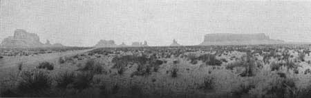
Monument Valley has been referred to as "The land of room enough and time enough." To this could be added beauty and thrills, and mystery enough, all of which are applicable to the Colorado River country of southeastern Utah. It is stark realism and mystical surrealism. Trying to make a living raising cattle on the Green River Desert or driving an automobile across its deep sandy wastes on a hot afternoon, one suffers the torments of hell, and curses the country and the reasons that brought him there. However, as the purple shadows begin to lengthen across the gold and red sands, as the towering buttes take on a rosy hue, and distant purple mountains are silhouetted against a royal blue sky, it becomes a dream world of marvelous beauty. Searching across barren rocks for a water hole in summer, or climbing a steep, rocky, snow-covered trail up a canyon wall in winter, you realize why no humans and few animals make their homes there; and yet, standing on Horse Mountain, or Dead Horse Point, or Lands End, or camping near a spring on the Kaiparowits Bench with the canyon of the Colorado below, and Navajo Mountain rising from its fluffy sandstone base across the way, you wonder why so few people have made their way to these places. You are exalted spiritually, but dwarfed by the scale of the scene. Your eye is attracted quickly from the nearby rocks to the mountaintops 40 to 70 miles away; across miles of bare, pink, red, buff, and white sandstone; down canyons 2,000 feet deep; and up buttes 1,000 feet high. All is yours—20,000 square miles or more and yet, to approach on foot or horseback even one of the nearby canyons is a giant's task.
|
| Figure 77.—Monument Valley. |
It is a land of the unusual in color and form, of great natural bridges, monuments, spires, intricately twisting canyons, mammoth terraces with sheer walls a thousand or more feet high, and rock forms that resemble castles and cathedrals. But the most impressive feature is that of space. Not the monotonous space of the Great Plains, but dramatic, colorful space accentuated by these varied land forms and the high mountains to the east and west and the broad sweeps of unfenced range.
From high points the region appears as a great, deeply eroded plain from which rise three beautiful mountain masses. The LaSals to the northeast rise to 13,089 feet above sea level; the Abajos in the east central part rise to 11,445 feet; and the Henrys in the west central part rise to 11,485 feet. To the southwest, the Kaiparowits Plateau stretches southeast from the high plateaus for 50 miles, at the 7,000-foot level, as far as Navajo Mountain (elevation 10,416 feet) which stands alone on the south side of the Colorado River. East of Navajo Mountain, the monuments of Monument Valley standing against the sky may be seen from great distances. To the north the Book Cliffs, with the Roan Cliffs above, form the skyline. To the northwest the San Rafael Swell, and beyond and above it the Wasatch and Fish Lake Plateaus, end the view. West of the Henrys, Boulder Mountain and the Aquarius Plateau, elevations 10,000 to 12,250 feet, respectively, blend into the western end of the Kaiparowits Plateau to form the distant skyline. To the south and southeast is a horizon less definite and broken by great mesas and mountain peaks. From the south end of Elk Ridge, which lies to the west of the Abajo Mountains, may be seen the Carrizo Mountains, Pastora and Zilbetod Peaks just south of the four corners, and Ute Peak southwest of Cortez, Colo. East of the Abajo Mountains, the great sage plain stretches on and on to the snow-covered peaks of the La Plata and San Miguel Mountains in Colorado. East of the La Sal Mountains is a jumble of canyons and mesas terminated by the Uncompahgre Plateau.
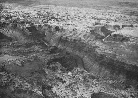
Down through the center of all this, majestically flows the Colorado River in its great canyon that starts just below the mouth of the Dolores River and continues almost unbroken to the Grand Wash Cliffs, a distance of 590 miles, the first 285 miles of which are in Utah. From Moab to the junction with Green River, the Colorado flows along a fairly smooth bed, easily navigable by small boats. From the junction to Mille Crag Bend are 40 miles of some of the roughest water of the entire canyon section of the river, hence, Powell's name for this section Cataract Canyon. From Mille Crag Bend to Lees Ferry the river flows quietly between monumental walls. The beauty of the scenery and quiet waters suggested to Powell the name Glen Canyon. Because of the depth of the canyon, little is seen from the river, except the immediate canyon walls. Powell and other river adventurers had to be continually scaling the canyon walls in order to get an idea of the country they were passing through. From the tops of the river canyon walls the scene is quite different from that obtained from the higher observation points on the plateau. For example, standing on the rim of the river canyon 1,200 feet directly above the junction of the Green and the Colorado, the great mountain masses and the plains are not visible; instead, there are the thousands of little mountains, buttes, spires, domes, and walls formed by the erosion of the great plain that forms the skyline. You are down in another world surrounded by a complicated jumble of pink, buff, and red sandstone formations, fantastic and beautiful. To the west, north, and east above the general level of this land of standing rocks, two great irregularly shaped terraces rise about 2,000 feet. Here and there, rising from the dark red lower terrace, are huge buttes and smaller walls and spires of the same color. The face of the upper terrace is sheer and of an orange-brown tone, which has given it the name, Orange Cliffs. To the south, on the east side of the river, an intricate system of parallel faults and erosion have created the unique Needles area which blends into formations similar to the Standing Rocks. These in turn build up gradually to Elk Ridge which runs generally north and south at an average elevation of 8,600 feet. Horse Mountain, the high point at the north end of Elk Ridge, rises 5,587 feet above the Colorado River to an elevation of 9,202 feet above sea level.
|
| Figure 78.—Junction of Green and Colorado Rivers—the Colorado River flows from right to left. (Air photo) |
Below Cataract Canyon the scene changes; great side canyons run back into the mountains on the east and west. The terracing is more broken and disappears entirely in some sections. From the river at Hite can be seen Mount Holmes, 6.5 miles away rising 4,500 feet above the river to an elevation of 8,000 feet above sea level, and Mount Ellsworth, 9 miles away, rising 5,800 feet above the river to an elevation of 8,250 feet above sea level. From the Escalante River to below Hole in Rock the Navajo sandstone forms a ridge along the west side of the river canyon. Climbing up from the river to this ridge one finds remarkable views in all directions. The Red Rock Plateau of apparently limitless barren sandstone obscures the view of the Abajo Mountains and the country to the east. But to the north, over the deeply carved back of the Waterpocket Fold, loom the peaks of the Henry Mountains and the rim of the plateau between the Colorado and Dirty Devil Rivers almost 70 miles away. To the northwest for 50 miles stretches the Escalante Valley, walled on the southwest side by the Straight Cliffs of the Kaiparowits Plateau. From the base of the Straight Cliffs the desert rises gradually to the northeast to the Waterpocket Fold and the Circle Cliffs. In the long twisting gash in the bare sandstone along the southwest side of the Waterpocket Fold is the Escalante River. Beyond the upper end of the desert can be seen the highland of the Aquarius Plateau, 70 miles away. To the south the lone peak, Navajo Mountain, dominates the view.
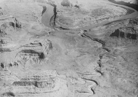
After the river winds down between the Kaiparowits Plateau and Navajo Mountain it comes out into more open country. The immediate canyon walls are lower and the land steps up gradually in great wide benches. This continues until the river reaches the Paria Plateau and swings around the east end of the plateau in a deep narrow canyon. It is in this more open stretch of the river that Escalante [1] found the Old Indian Crossing. If the Glen Canyon Dam raised the water to the elevation suggested by the Bureau of Reclamation, the widest expanses of water would be in the vicinity of the Crossing of the Fathers. Barry Goldwater of Phoenix, Ariz., stated in an article which appeared in Desert Magazine describing a trip down the river from Green River, Utah, to Hoover Dam: "Glen Canyon has always been synonymous in my mind with the unusual, the beautiful and the historic."
OUTSTANDING AND UNIQUE SCENIC
SECTIONS
Within the area there are certain sections where the various types of scenery and other recreational interests reach a climax; where, after traveling for miles through this fascinating country, you come to a section that startles you by its grandeur or unusual character.
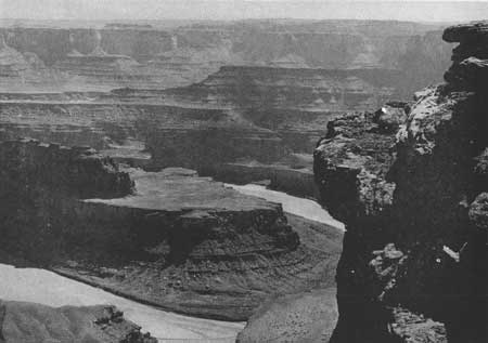
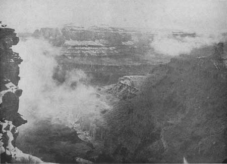
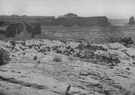
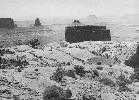
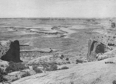
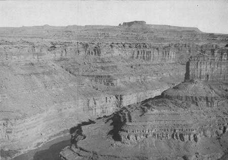
Grays Pasture-Junction Butte area.—Grays Pasture is such an area. It includes all of the plateau between the Colorado and the Green Rivers, south of the Neck, a 50-foot-wide isthmus connecting Grays Pasture and the highland to the north. At the present time this is one of the most accessible sections from which to view the great panorama of the area and the canyons of the Green and Colorado Rivers above their junction. Dead Horse Point on the east rim is the best known and probably one of the finest points from which to view the Colorado River winding through its amazing canyon 2,200 feet below. Upheaval Dome, on the west rim of the plateau, is the most unusual and dramatic geologic feature in southern Utah. It resembles a multicolored crater 2 miles in diameter, encircled by a ridge of red sandstone. From the southwest rim of the dome one obtains impressive views of the Green River Canyon and all of the highland in every direction—the Roan Cliffs to the north, La Sal Mountains to the east, Abajo Mountains to the south, and Henry Mountains to the southwest.
|
| Figure 79.—Colorado River from Deadhorse Point—the highland forming the skyline is Grays Pasture. |
|
| Figure 80.—Shafer Canyon from Deadhorse Point during a January storm. |
|
| Figure 81.—View southeast from Upheaval Dome. |
|
| Figure 82.—View south from Upheaval Dome. |
|
| Figure 83.—View southwest from Upheaval Dome—white rim sandstone edges the wide red Moenkopi bench. The slopes between the bench and the orange-brown Wingate sandstone cliffs are gray Shinarump and various colored Chinle formations. Above the cliffs is light buff Navajo sandstone. |
|
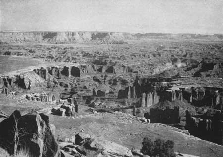
| Figure 84.—Monument Canyon and Indian Creek country east of Colorado River from Junction Butte point. |
|
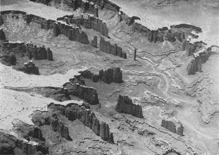
| Figure 85.—White rim sandstone caps the dark red towers of Monument Canyon. (Air photo) |
|
| Figure 86.—Junction Butte from the rim of Green River Canyon near the junction of the Green and Colorado Rivers. |
|
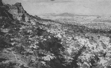
| Figure 87.—Junction Butte and Grays Pasture Plateau from south of the Needles. |
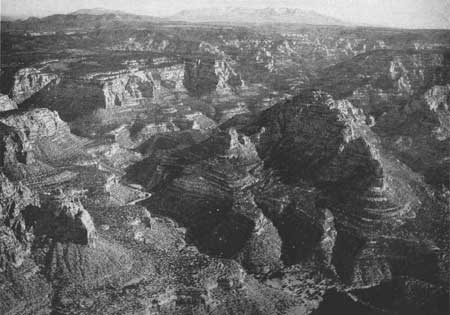
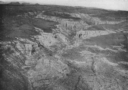
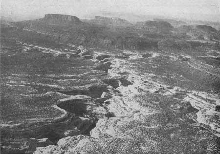
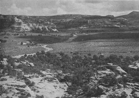
Elk Ridge.—On the east side of the Colorado, in the La Sal National Forest between Indian Creek on the north, and White Canyon on the south, and west of the Abajo Mountains, is a section which is certain to become nationally famous for its great variety of unusual scenic interests. Elk Ridge, running generally north and south at an average elevation of 8,500 feet, with high points at the north and south ends reaching over 9,000 feet, is the dominant topographic feature. From Elk Ridge great canyons start down toward the Colorado—White Canyon, Woodenshoe Canyon, Peavine Canyon, Dark Canyon, Fable Valley, and Gypsum Canyon. Near their junction, Dark and Woodenshoe Canyons are 2,000 feet deep, while the lower end of Gypsum Canyon is more than 2,300 feet deep, and at least one high point on the rim of Gypsum Canyon within a mile of the Colorado River is 3,527 feet above it. From the pine and aspen forested Elk Ridge there are grand views down into the canyons on all sides and out over Beef Basin and the Needles to Junction Butte to the northwest; over the Grand Gulch Plateau, Natural Bridges National Monument in White Canyon, the Tables of the Sun, and Red Rock Plateau to Navajo Mountain in the southwest; down 2,200 feet into Cottonwood Canyon which separates Elk Ridge from the Abajo Mountains and up 2,600 feet to Abajo Peak, elevation 11,357 feet. Elk Ridge is a delightfully cool forest island in a rough iridescent sea of deserts and canyons.
|
| Figure 88.—Dark Canyon—looking east over Elk Ridge to the Abajo Mountains. (Air photo) |
|
| Figure 89.—Arch Canyon—looking northwest over Elk Ridge. (Air photo) |
|
| Figure 90.—White Canyon, Tables of the Sun, and Navajo Mountain from vicinity of Natural Bridge National Monument. (Air photo) |
|
| Figure 91.—Beef Basin. Horse Mountain, the north end of Elk Ridge, is at upper right corner. |
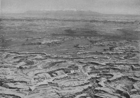
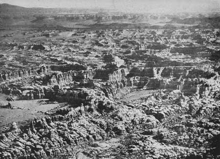
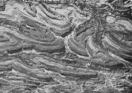
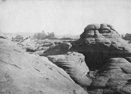
Needles area.—North of Elk Ridge lies the Indian Creek country which revolves around North Six Shooter, a great monolithic guide post. West of North Six Shooter and southeast of the junction of the Colorado and the Green Rivers is a fantastic section of curiously eroded and faulted red, buff, and white rocks called the Needles. On the ground it is a seemingly endless labyrinth of little valleys above which tower great sandstone domes and pinnacles. From the air it is an amazingly intricate pattern of green, yellow, buff, pink, and red.
On August 23, 1859, Dr. J. S. Newberry, geologist to the MacComb Expedition, wrote the following description of this area as seen from the top of a butte located about a mile south of the mouth of Indian Creek:
The great canon (Grand Canyon) of the lower Colorado, with its cliffs a mile in height, affords grander and more impressive scenes, but those having far less variety and beauty of detail than this. From the pinnacle on which we stood the eye swept over an area some fifty miles in diameter, everywhere marked by features of more than ordinary interest; lofty lines of massive mesas rising in successive steps to form the frame of the picture; the interval between them more than 2,000 feet below their summits. A great basin of sunken plain lay stretched out before us as on a map. Not a particle of vegetation was anywhere discernible; nothing but bare and barren rocks of rich and varied colors shimmering in the sunlight. Scattered over the plain were thousands of the fantastically formed buttes to which I have so often referred in my notes; pyramids, domes, towers, columns, spires, of every conceivable form and size. Among these by far the most remarkable was the forest of Gothic spires, first and imperfectly seen as we issued from the mouth of the Canon Colorado. Nothing I can say will give an adequate idea of the singular and surprising appearance which they presented from this new and advantageous point of view. Singly, or in groups, they extend like a belt of timber for a distance of several miles. Nothing in nature or in art offers a parallel to these singular objects, but some idea of their appearance may be gained by imagining the island of New York thickly set with spires like that of Trinity Church, but many of them full twice in height. Scarcely less striking features in the landscape were the innumerable canons by which the plain is cut. In every direction they ran ramified deep, dark, and rugged, impassable to everything but the winged bird. Of these the most stupendous was that of Grand River, which washes two sides of the base of the pinnacle on which we stood, a narrow chasm, as we estimated, full 1,500 feet in depth, into which the sun scarcely seemed to penetrate. At the bottom the whole breadth of this canon is occupied by the turbid waters of Grand River, here a sluggish stream, at least with no current visible to us who were more than 2,000 feet above it. In this great artery a thousand lateral tributaries terminate, flowing through channels precisely like that of Labyrinth Creek; underground passes by which intermittent floods from the distant highlands are conducted through this country, producing upon it no other effect than constantly to deepen their own beds.
|
| Figure 92.—The approach to the Needles labyrinth is from Indian Creek. La Sal Mountains are in the distance. (Air photo) |
|
| Figure 93.—The Needles area—looking northeast over Indian Creek Valley. (Air photo) |
|
| Figure 94.—The Needles area from the air is an intricate pattern of green, yellow, buff, pink, and red. |
|
| Figure 95.—The Needles area is carved out of Cutler sandstone. |
Lands End area.—West of the junction of the Green and Colorado Rivers is Lands End, appropriate name for a low knob at the south end of a finger of the high plateau standing between the Dirty Devil River and the Colorado. The name might well apply to the entire 9.5-mile remnant of plateau land between the knob and Observation Rock. Driving south from Green River, Utah, through seemingly endless stretches of sand and rock in places covered with blackbrush or grasses in places barren, you note that the ground is gradually rising. Occasionally there is a view of the La Sals to the east or the Henry Mountains to the west, or a glimpse of the heads of canyons leading down to the Green River. There are 60 miles of this to Robbers Roost, a large shallow open bowl, which is said to have provided the perfect secluded range for cattle stolen from the early Mormon settlers. It was reputedly the hang-out of Butch Cassidy and his gang of outlaws. Southeast of the Roost, the land continues to rise, piñon and juniper appear, and canyons heading near the road lead off to the right and the left. Fourteen more miles and you are at French Seep. Observation Rock stands directly ahead on the rim of a world of great terraces, canyons, and strangely carved rocks that surrounds the junction of the rivers.
North of Observation Rock is Cleopatras Chair, a high block of Navajo sandstone sitting on the edge of the upper terrace, commanding a view of the Stillwater Canyon of the Green, Junction Butte, Upheaval Dome, and the La Sal Mountains far beyond.
|
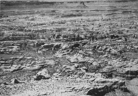
| Figure 96.—Land of Standing Rocks—looking northwest toward Elaterite Butte and Lands End Plateau (upper left) from the junction of the Green and Colorado Rivers. (Air photo) |
At French Seep the trail turns south and winds its way along the top of the piñon and juniper-covered remnant of plateau. The winding of the trail provides alternate views into the many fingers of Happy Canyon and out over the great canyon of the Colorado. Although lower than Elk Ridge, this too is an island of green forest surrounded by a fantastically shaped and colored sea of desert; an excellent place from which to view the canyons of the Colorado and the Green Rivers or for a base camp for exploring expeditions down into that beautifully weird "Land of Standing Rocks" or down to the edge of the sheer-walled Cataract Canyon 2,000 feet deep. Lands End is one of those satisfying far-off places you want to visit again.
Hite area.—The Dandy Crossing or ford of the Colorado River, later replaced by Hites Ferry, greatly facilitated the extension of early Mormon colonization of the San Juan country of southeastern Utah. The great early activity in placering Colorado River gravel bars for gold occurred in the vicinity and down river from Dandy Crossing and Hites Ferry.
Present access to Hite is by pioneer road down North Wash through impressive red sandstone cliffs and monuments to the Colorado, then for 6 miles along the narrow sandstone ledge on the west side of the river to Hite. Here one finds in a severe, rugged country the Chaffins living in a place of beauty and tranquility. Above the Orange Cliffs to the northwest the high and formidable Henry Mountains dominate the scene.
Glen Canyon Reservoir will inundate the area, but there is a proposal to preserve this natural Colorado River scene of Mormon pioneering as a scenic and historic area.
The Utah State Highway Commission and the Public Roads Administration have proposed a road joining Capitol Reef and Natural Bridges National Monuments, Arch Canyon and Blanding, and crossing the Colorado River by suspension bridge near the mouth of the Dirty Devil River. This crossing is 7 miles above Hite and 112 miles from Moab Bridge. It is 174 miles above Navajo Bridge at Marble Gorge. This will be the only through road in the 20,000 square miles of Utah's Canyon Lands.
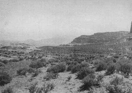
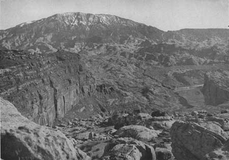
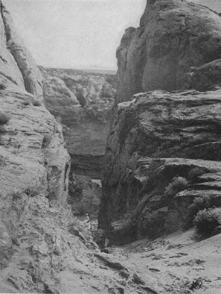
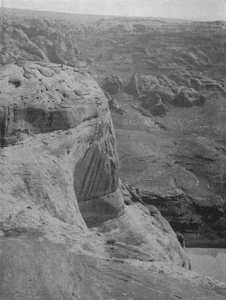
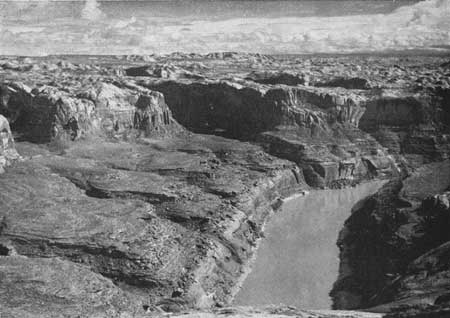
Hole in Rock area.—From the little town of Escalante, Utah, the Straight Cliffs of the Kaiparowits Plateau point the way and Navajo Mountain marks the center of interest in the Glen Canyon section of the Colorado River country. Here is scenery, bold, stark, gigantic. Natural bridges, 300 feet high, are lost in the canyons. Great domes of sandstone around Navajo Mountain appear as a downy cushion base for the mountain. The views from the plateau and from Navajo Mountain are breath taking. Navajo Point at the southeast end of Kaiparowits Plateau, elevation 7,500, is 5 miles horizontally from the Colorado River and 4,000 feet above it. The crest of Navajo Mountain, 8 miles east of the Colorado, is 7,015 feet above the river. A few miles to the southwest is the Crossing of the Fathers where Escalante made his arduous crossing in 1776. It is one of the few Indian crossings and the first crossing used by the Mormon missionary, Jacob Hamblin, on his early trips to the Zuni Pueblos. A few miles to the north is Hole in Rock where the Mormon settlers bound for the San Juan Valley made their heroic crossing of the 1,400-foot-deep canyon of the Colorado in the winter of 1890, a crossing so difficult it was only used once and abandoned for the easier Dandy Crossing at Hite.
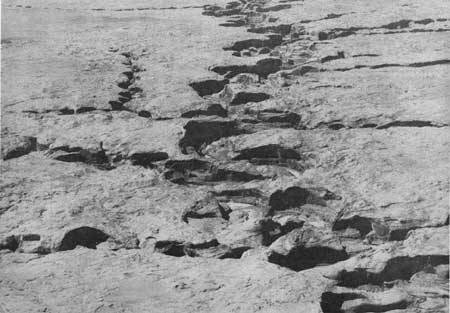
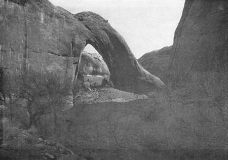
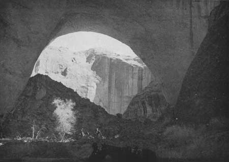
It is a land of natural bridges. Rainbow Bridge, the largest and most beautiful, and three others are found in the canyons around the base of Navajo Mountain. At least six fine bridges are known to exist in the twisting half-domed tributary canyons of the Escalante River. Two in Coyote Canyon, one in Willow Creek, and one in Davis Canyon have been visited by members of the survey staff. Another said to be about as large as Rainbow Bridge, was seen by the Nevills Expedition in 1940 and named by them "Gregory," in honor of Dr. Herbert Gregory, a noted American geologist.
Music Temple, famous resting point for all river expeditions since Powell's first party stopped there in 1869 for a night of singing and carved their names on the wall, is on the left side of the river between the mouth of the San Juan and Arch Canyon. North of the Escalante River Canyon is the Waterpocket Fold.
There are two unimproved roads leading to this section. From the Navajo country to the south and east there is a road to Rainbow Lodge located on the south slope of Navajo Mountain. From the lodge an 18-mile trail leads to Rainbow Bridge. From State Highway 23, the unusually scenic road between the towns of Escalante and Boulder, an automobile trail runs southeast along the base of the Straight Cliffs for 51.3 miles to Sody Tank, 6 miles west of Hole in Rock. There is a horse trail from Sody Tank up the face of the Straight Cliffs to the top of the Kaiparowits and to Hole in Rock.
|
| Figure 97.—Southeastern end of the Kaiparowits bench and Navajo Mountain from near Sody tank. |
|
| Figure 98.—Colorado River and Navajo Mountain from the southeastern end of the Kaiparowits bench. Navajo Mountain rises 7,100 feet above the river. |
|
| Figure 99.—Hole in Rock. |
|
| Figure 100.—View across Colorado River from left side of Hole in Rock. The point where the man is standing is about 1,400 feet above the river. |
|
| Figure 101.—The Colorado River Canyon at Hole in Rock. |
|
| Figure 102.—The Crossing of the Fathers. Escalante crossed the Colorado at this point in 1776. (Air photo) |
|
| Figure 103.—The Escalante River Canyon in Hole in Rock area. (Air photo) |
Wahweap area.—The old trail from Kanab to the Crossing of the Fathers crosses Wahweap Creek and Warm Creek almost on the Utah-Arizona State line and then swings northeast across Cottonwood Canyon to the crossing at Kane Creek. In this highly colored desert section of buttes, mesas, and canyons would be the only wide water of the lake formed by the potential Glen Canyon Damn. At spillway level, 3,528 feet, the lake would extend 7 miles up Wahweap Creek, spreading out north of the State line to form a body of water about a mile wide and 2 miles long. Two miles northeast of Wahweap Bay would be Warm Creek Bay 4 miles long and very irregularly shaped. Five miles northeast of Warm Creek would be the wide water at the Crossing of the Fathers averaging about 2 miles wide and 3 miles long. A long, narrow promontory and a bend in the Colorado River would separate this wide water from the Last Chance wide water which would be about 1.5 by 1.5 miles at the Colorado and extend 7 miles up Last Chance Creek. Opposite Last Chance is West Canyon. The water would back up this canyon more than 6 miles and be only 300 or 400 feet wide. The mouth of Navajo Creek is 2.5 miles south of Warm Creek. At high water it would be possible to boat up this deep narrow canyon for 14 miles. In the canyon of the Colorado River the lake will average between 1,000 and 1,500 feet wide from the dam to Last Chance wide water. The mouth of Wahweap Creek and the mouth of Warm Creek are about 12.5 and 23.5 miles, respectively, upstream from the dam site. The Crossing of the Fathers wide water would be between 34.5 and 38.5 miles above the site. Last Chance is between 45.5 and 47.5 miles above the site. West Canyon and Navajo Creek are 41.5 and 21 miles, respectively, above the site and Aztec Creek is 65 miles above it. The high water would extend up Aztec and Bridge Canyons about 3 miles to within 1 mile of Rainbow Bridge.
With a boat making about 20 miles per hour it would be possible to make a pleasant 1-day trip from the dam to Rainbow Bridge and return, spending about 3 hours in the vicinity of the bridge. This trip would be about the same length as the boat trip on Lake Mead from Boulder Beach up into Grand Canyon.
Wahweap and Warm Creeks provide the first two places above the dam where there will be a comparatively gradual slope to the shore of the reservoir. With the feasibility of constructing a road from Kanab to the shore on the reservoir and the variety and interest of this section it appears to be a logical and desirable place for recreational boating and housing facilities, and for headquarters for boating operations and parties wishing to explore this section of Glen Canyon by land or water.
Goosenecks of the San Juan River, located 9 miles from Mexican Hat, have impressed all who have seen them. They are possibly the finest example of entrenched meanders in the country, interesting to geologists and certainly spectacular to the layman.
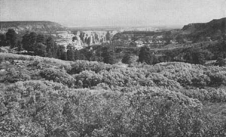
Arch Canyon.—This is a distinctive and outstanding feature to be seen by all visitors on their way to the Natural Bridges at the observation point on Elk Ridge not far from the Kigalia Ranger Station. Arch Canyon, approximately 15 miles west of Blanding at the head of Comb Wash and extending into La Sal National Forest, is a chasm of superb beauty with an unusual variety of color and a multitude of interesting towers and pinnacles. Because of its inaccessibility it is little known, but is one of the scenic jewels of the entire area. The upper and most scenic end of the canyon lies within the boundaries of La Sal National Forest. The Forest Service is cognizant of its recreational and scenic value and has planned for a camp and picnic area near the observation point and a trail leading into the canyon.
|
| Figure 104.—Arch in Willow Creek Canyon in Hole in Rock area. |
|
| Figure 105.—Arch in Coyote Canyon in Hole in Rock area. |
Fisher Towers are approximately 24 miles by the river road from the bridge crossing of the Colorado at Moab and directly north of the La Sal Mountains. From a distance, this detached and majestic group of pinnacles and spires rising 800 to 1,500 feet suggests a great architectural skyline of huge towers with elaborately sculptured facades. Some have dominant, unbroken vertical lines of the modern skyscraper, while others resemble great Gothic cathedrals with their wealth of delicate natural carvings. The towers of light red sandstone rise from a great base of elaborately sculptured, deep red or maroon mudstone. They are eminently different and distinct in a region where such erosional land forms are abundant.
LANDS, OWNERSHIP, LOCATION, AND
AMOUNTS
The major portion of the Canyon Lands of southeastern Utah is unsurveyed public domain, (Pl. 7 in pocket). Private lands are concentrated in the irrigated and coal mining districts around Price, Utah, along the highways in Castle Valley, and at Green River, Moab, Blanding and Monticello. The preponderance of private land, shown on Plate 7 (in pocket), is outside of the circumferential roads previously described. Sections 2, 16, 32, and 36 of the surveyed lands in each township are State school lands. The State has a definite program for the consolidation of State lands through exchange for public domain, but so far as is known there has been no consolidation in this section of the State.
There are four national monuments within the area: Navajo National Monument in the Navajo Indian Reservation, consisting of three detached units totaling 360 gross acres; Natural Bridges National Monument, containing 2,650 gross acres, located near the head of White Canyon about 30 miles west of Blanding, Utah; Capitol Reef National Monument, 36,393 gross acres of rugged colorful scenery located east of Torrey, Utah; and Rainbow Bridge National Monument, 160 gross acres, west of Navajo Mountain, set aside to preserve the famous bridge. Bryce Canyon National Park, with 36,010 gross acres, is within the circumferential roads but at the edge of the high plateaus which form the topographic boundary of the west side of the area. The 34,250 gross acres in Arches National Monument north of Moab are just outside of the road belt. The 109,823 acres in the national park and monuments represent less than 0.9 percent of the total acreage.
The Abajo Mountain-Elk Ridge section of the La Sal National Forest, containing more than two-thirds of the total 516,768 acres (gross) in the forest, lies within the area and the La Sal Mountains section adjoins the area just east of Moab. The Manti, Fish Lake, and Dixie National Forests lie along the west edge.
All of the area south of the San Juan River and east of the Colorado River, about one-fifth of the 20,000 square miles, is part of the western and northern Navajo Indian Reservations.
All of the public domain land is included in grazing districts administered by the Bureau of Land Management.
Certain lands along the Colorado, Green, and San Juan Rivers have been withdrawn for Bureau of Reclamation water control projects. Other small scattered withdrawals have been made in connection with irrigation projects, chiefly in the section around Price, Utah. The large withdrawal on the Colorado River north of the La Sal Mountains is for the proposed Dewey Reservoir which is outside of the area under consideration.
USE OF NATURAL RESOURCES
Water.—Of primary concern to the State and the Nation is the proper utilization of the natural resources of this vast area in southeastern Utah. The Colorado, Green, and San Juan Rivers offer opportunities for great power developments. In the comprehensive plan for the development of the water resources of the Colorado River Basin consideration is given by the Bureau of Reclamation to the possibility of constructing two large hydroelectric dams on the Colorado River; one, either at the Glen Canyon site 4 miles above Lees Ferry, Ariz., or at an alternate site 15 miles above Lees Ferry, and the other at the Dark Canyon site in Cataract Canyon, 3 miles above the mouth of Dark Canyon. These two dams would impound the Colorado River from just above Lees Ferry to Moab, Utah, a distance of 279 miles, and the lower 62 miles of the Green River. Tentative plans for the Glen Canyon site indicate that a dam 414 feet high would create a reservoir which at normal water surface elevation of 3,528 feet would have a surface area of 65,000 acres and a capacity of 8,600,000 acre-feet. The slack water would extend 186 miles up the Colorado to the Dark Canyon Dam site. There conditions are reported favorable for construction of a high dam which would back water to Moab and up the Green River.
The Glen Canyon site would be accessible from United States Highway 89, 131 miles by road north of Flagstaff, Ariz. The Dark Canyon site is at present inaccessible except by boat or horseback. The nearest automobile trail is at North Wash, 18 miles downstream.
There are three power site possibilities in the San Juan River Canyon below Mexican Hat—one in the Goosenecks of the San Juan, one near the mouth of Slickhorn Canyon, and the other in the Great Bend of the river.
The potential dams and reservoirs would eliminate the thrills of boating down the untamed rivers. The depths of the river canyons would be reduced. The deadly rapids of Cataract Canyon, responsible for the tragic ending of several canyon voyages, and the sand bars and the often shallow waters of Glen Canyon, would be gone. But the Glen Canyon Reservoir would provide access to the wonders of the canyons.
The three dams on the San Juan River would have little potential recreational value and, as previously stated, would eliminate the thrills of boating down the twisting canyoned river to the Colorado. This trip has been popular in recent years under the guidance of Norman D. Nevills of Mexican Hat.
If it is eventually determined to be in the best interest of the people of the Nation to construct these large dams, the present wilderness character of the side canyons and the adjoining country can still be preserved, though the mighty rivers responsible for this wilderness will have become mill-ponds. The dams would be lost in the canyons and have little or no effect on the surrounding scenery. On the other hand, the construction camps and roads, and the transmission lines could be objectionable features, destroying the present wilderness character of limited areas if not planned and constructed in the least conspicuous locations. For instance, transmission lines located where they are silhouetted against the sky are considerably more conspicuous than when they have a background.
Other resources.—The area is large enough and varied enough to permit the continued use and development of its resources. The unusual, colorful scenery and spectacular geological features, the canyoned rivers, the wealth of archeological material, and the great open, undeveloped spaces are considered by many people as recreational resources of the highest order which, under proper management, can become major economic assets to the State and Nation. The area is used extensively for grazing cattle and sheep and this use should continue under sustained-yield management. While no extensive mineral resources have yet been discovered and there is little indication that they will be, it remains a potentiality. Oil, magnesium salt, vanadium, soft coal, and some gold have been found. The limited forest areas are important for watershed protection, recreation, and grazing, but unimportant for timber production.
Except in certain limited sections where a single use is essential to obtain the greatest benefits, these resources can be developed and used simultaneously. The need is for each interest to understand, appreciate, and recognize the multiple values of the area. The vast unfenced range with its wandering herds and cowboys and sheepherder camps have a definite appeal to the recreational visitor. The old cow camp may be developed into a camp for vacationists wishing to ride the trails, see the canyons, and visit archeological features. A new development for the accommodation of tourists may double as a headquarters for cowboys and miners. The range will not give full recreational value or the best beef and wool without limiting grazing to a conservative sustained-yield basis, which assures a good ground cover and checks erosion. Roads can be constructed to serve recreational travel and provide access to the range and mines.
Elk Ridge in the La Sal National Forest has been an important summer grazing area but it is showing signs of overuse. As the area becomes better known it is certain to be one of the major recreation centers in the Canyon Lands. It is believed to be a suitable location for lodges, camps, and possibly a landing field serving people visiting Natural Bridges, Arch Canyon, Dark Canyon, Beef Basin, Fable Valley, Gypsum Canyon, and other places of interest in the surrounding canyon lands. Eventually the recreational use of Elk Ridge may be of primary consideration, with grazing a secondary use.
Grays Pasture and Lands End are other sections of major recreational value, where grazing and other uses should be subordinate to that major value. The other centers of recreational importance Navajo Mountain, Rainbow Bridge, Monument Valley, Hole in Rock, Escalante River Canyons, and The Needles—have little value except for recreation.
|
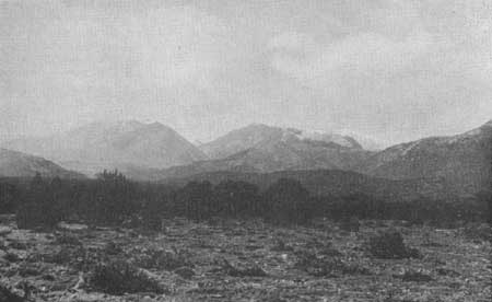
| Figure 106.—The Henry Mountains from the road between Hanksville and Hite, Utah. |
Administration.—In the administration of the national forests, the Forest Service recognizes recreation as one of the important uses of forests, along with timber production, grazing, watershed protection, and wildlife production. Areas where public recreation interests are concentrated are dedicated exclusively for recreational use to protect the area and the public.
A function of the Bureau of Land Management is to plan, manage, and execute a broad conservation program for the development, protection, and restoration of the soil, water, and forage resources on the Federal range, and to regulate the grazing therein, so that the dependent livestock industry may be stabilized around a profitable, orderly use of all the resources involved.
The administration of the Federal range involves many of the same problems as the administration of the national forests. For both there are economic and nonvendible values to be considered.
This is the case in the Canyon Lands of southeastern Utah. Much of the land is primarily useful for grazing, yet it has intrinsic recreational values which should be preserved under Bureau of Land Management and Forest Service administration.
In some sections the recreational values are of sufficient importance to equal or exceed the grazing or timber values.
The two areas in the Canyon Lands of Utah outlined on Plate 9 (in pocket) contain the most outstanding scenic and recreational features not included in the Indian reservations. In the administration of the lands within these two areas it is believed that recreation should be the major use, with grazing and other uses secondary. Certain sections of these areas which contain known scenic and scientific features of national significance should be given adequate protection. These sections are shown by cross hatching on the same map. The National Park Service recommends that full public notice be given before determinations are made regarding proposals for establishing any areas for park and recreational purposes so that all interests can be heard and considered.
PRESERVATION OF EXISTING FEATURES
The Canyon Lands of southeastern Utah have scenic, scientific, and wilderness features which are of significance to the State and Nation. The recreational and economic benefits to be gained by preserving these features may be facilitated by following the policies outlined below:
1. Roads should be constructed only when amply justified, based on positive need. Where such construction is justified, it should be performed in a manner which will render it as inconspicuous as possible.
2. Since the airplane is supplementing other major forms of transportation throughout the world, it is reasonable to assume that it eventually will be used as a means of access to the remote sections of the Canyon Lands, thereby greatly reducing the intrusion of surface transportation facilities into the scene.
3. Encourage business catering to recreational interests and tourist travel to locate in the vicinity of existing towns and certain recreational development centers, rather than at random throughout the area.
4. As the West develops, the roads which one may travel without having the feeling of being fenced in are gradually becoming fewer. Fences on both sides of the road and, to a lesser degree, pole lines, tend to separate the road from the adjoining country which creates the feeling that one is detached from it rather than being a part of it. This effect will be eliminated if only such fences are constructed as are absolutely necessary and if they are removed when their need no longer exists.
Roads.—The topography of the Canyon Lands has permitted limited travel east and west and has prohibited vehicular traffic north and south. The only east-west route which has been used to any extent in the past and has recently been improved, crosses the Colorado River at Hite. Surveys of the State Highway Department indicate that the only feasible route for an east-west highway across the Colorado River between Green River, Utah, and Lees Ferry, generally follows this old location. The route suggested by the highway survey is shown on Plate 9 (in pocket). To preserve the essential character of the area, it is questionable whether any other through highway should be constructed. Only spur roads providing access to the major centers of recreational interest are recommended. In all cases these proposed spur roads would generally follow existing truck trails and serve the grazing and mining interests as well as recreation. The spur roads should be of limited width and of a standard permitting year-round travel.
Fortunately, all of the major centers of recreational interest shown on Plate 9 (in pocket) are now accessible by automobile over trails which in most cases are very poor. It would be feasible to build good all-weather roads from the outer belt of highways to each of the suggested development sites. At these sites, or in the immediate vicinity, there is ground suitable for a landing field for small planes. While it is not absolutely essential to have a road to every landing field, such a road is considered desirable for use in hauling in equipment, building materials, and many supplies.
Air travel and landing fields.—It is believed that much of the tourist travel through the Canyon Lands will be by air because of the great distances and the necessarily circuitous routes that must be followed on land.
At the present time, one major commercial air line crosses the area on the route between Grand Junction, Colo., and Las Vegas, Nev. This line has an auxiliary landing field near Hanksville, Utah. A feeder line has been authorized to connect Grand Junction, Price, Provo, and Salt Lake City. To the south Winslow, Ariz., is the nearest point on a major air line. It appears that Grand Junction, Price, and Winslow would be the logical starting points for air tours over the Canyon Lands. At the present time there are landing fields in the area at Hanksville, at Goulding's Trading Post in Monument Valley, on the southeast side of Navajo Mountain, at Bryce Canyon, and at Fredonia, Ariz. For the safety and convenience of air travel, possible landing field locations convenient to all the major recreational centers and at certain intervening spots have been shown on Plate 9 (in pocket). If this plan were followed, at no time would a plane be more than 25 miles from a landing field.
|
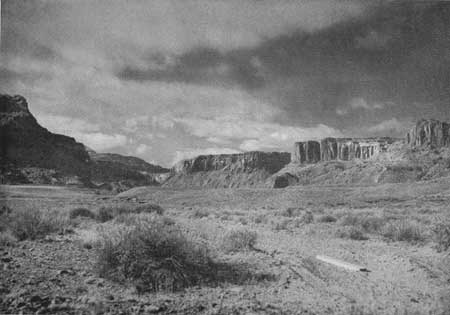
| Figure 107.—Mouth of Trachyte Canyon from site of former settlement of Hite. |
|
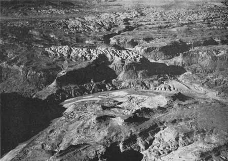
| Figure 108.—Trachyte Canyon joins the Colorado River at Hite. (Air photo) |
Recreational facilities.—As has been stated, practically all of the population of the region lives in towns and limited irrigated districts. There are only a few isolated ranches. Men running cattle on the range have their homes in the towns where schools, stores, churches, and social activities are available. This practical custom has resulted in the concentration of such developments at favorable points and a corresponding complete freedom of great areas of open country from any interruption by scattered reminders of town life. It is impossible to find such a set-up in most sections of the United States where the people live on the land they graze or farm. Future developments, including major facilities and businesses catering to the recreational interests and tourist travel, should follow this pattern of land use. However, the Canyon Lands are so extensive that it would be impracticable to confine all such facilities entirely within the bordering towns. Hence on Plate 9 (in pocket) the recreational centers have been shown located considerable distances from the towns at points where the cattlemen and the visitors would most likely wish to make their headquarters while working or exploring the various sections of the Canyon Lands.
The development of the recreational centers might well be in the ranch style, offering meals and lodging, camping supplies, pack and saddle animals, guides, gasoline and oil, and the like. The suggested landing fields indicated on the map are convenient to the development areas so that they might serve both airplane and automobile travel. From these centers horseback trails might lead to the various points of interest.
The Elk Ridge center at an elevation of 8,500 feet might be primarily a summer-use area because of the heavy winter snows; the Grays Pasture-Junction Butte and the Lands End centers would have longer periods of use and the facilities and services could be provided on a year-round basis. The Needles, Hite, Hole in Rock, and Wahweap centers appear to be suitable for year-round use. Hite, with an average annual temperature of 59.7 degrees, seems to be an ideal site for a winter resort on the river and might become one of the two main centers for boating and fishing on the Glen Canyon Reservoir the year around. The other center might be on the wide water somewhere between Wahweap Creek and Last Chance Creek.
Above Hite the recreational use of the Green and Colorado Rivers, or the reservoir to be formed by the proposed Dark Canyon Dam, would logically center at Moab and at or near Green River, Utah. Moab, with its scenic setting on the Colorado River and conveniently located to the many points of interest, seems destined to become an important recreational and tourist center.
Only the Hite and Wahweap centers would be largely controlled in their development by the potential Glen Canyon and Dark Canyon Reservoirs. The importance of Hite might be materially increased by the creation of the Glen Canyon Reservoir. The development at the Wahweap site would depend almost entirely on the creation of the reservoir. There is little need for a recreational center at that point if the reservoir is not created. However, there might be a small camp on Warm Spring or Wahweap Creeks to serve the cattlemen and the few who would wish to visit this remote section. If the Glen Canyon Reservoir is not created, the main boating and recreational center serving the lower end of Glen Canyon would probably be at Lees Ferry.
|
| Figure 109.—Arch Canyon from Elk Ridge. |
The Needles, Lands End, Elk Ridge, and Hole in Rock can be important centers for pack trips through the fascinating country surrounding them. Lands End sometimes has heavy snows in the winter, but pack trips can be made from there the year round as there is seldom snow in the Standing Rocks Basin around the junction of the Green and Colorado Rivers.
The Grays Pasture-Junction Butte area is certain to be visited by many tourists traveling by plane and automobile because of its convenient location in relation to main arteries of travel, the interesting features of the area, and the outstanding view of the Canyon Lands.
The big flat south of the Knoll appears to be suitable for the development of a landing field and there are many good sites for a lodge and other recreational facilities. A possible lodge site indicated on Plate 10 (in pocket) is the fairly level land lying west of Muffin Butte and south of Aztec Butte near the Y in the roads to Junction Butte and Upheaval Dome.
Consideration should be given to constructing a shorter road from Moab to the Knoll by way of Sevenmile Canyon. This route would be considerably more scenic than the present road and eliminate about 24 miles of unnecessary travel, making the distance from Moab to the Knoll only 20 miles.
Of special importance in the development of this area would be the construction of well-defined trails around and into Upheaval Dome so that people may see this fascinating and almost unknown geologic wonder.
P=ENDNOTES
1 Silvestre Velez de Escalante (1768-79), Spanish Franciscan, known chiefly as a missionary-explorer in New Mexico and adjoining regions about the beginning of the last quarter of the eighteenth century.
| <<< Previous | <<< Contents>>> | Next >>> |
colorado-river-basin/chap8.htm
Last Updated: 06-Sep-2004