|
National Park Service
A Survey of the Recreational Resources of the Colorado River Basin |

|
Chapter VII:
THE GRAND CANYON
From the mouth of the Nankoweap Canyon on the east to the Grand Wash Cliffs on the west—more than 200 miles by river the Grand Canyon maintains approximately the same 5,000-foot depth and a width between rims measured in terms of miles. All sections of the Grand Canyon are parts of one natural physiographic unit. Although the general character and form of the canyon change greatly from place to place, there is an imperceptible transition from one section to the next, and all are inseparable parts of the one great canyon.
Man-made boundaries in the Grand Canyon mean nothing as to the relative value of different portions. It is not possible to say that one part is either inferior or superior to another; each is different but each is great and part of the whole.
|
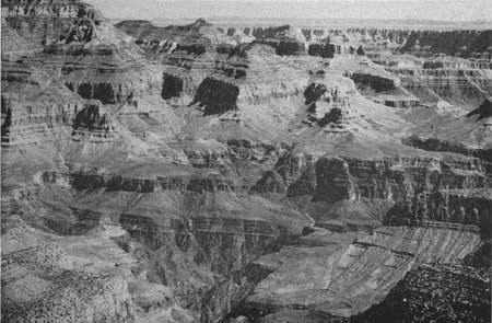
| Figure 66.—The Grand Canyon from Grandview Point. |
BRIDGE CANYON RESERVOIR SECTION
The inner part of the Grand Canyon which would be affected by the proposed Bridge Canyon Reservoir may be divided both scenically and geologically into four main divisions. The eastern division of the inner canyon, starting some miles above the mouth of Havasu Creek and extending almost to Toroweap Valley, is characterized by extreme narrowness of the gorge and by very high sheer walls of sedimentary rocks. Near the mouth of Havasu Creek, for instance, resistant beds of Muav limestone wall in the river and the soft shales that normally form the flat Tonto Platform below are not exposed, with the result that the inner canyon to a height of nearly 2,000 feet is extremely narrow, probably the narrowest within the entire canyon.
From Toroweap Valley to Whitmore Wash and beyond, the scenery has been changed by the introduction of vast quantities of volcanic materials and the cutting of the river progressively deeper into the sedimentary rocks, with consequent widening of the gorge. The Toroweap section is one of the most spectacular and remarkable parts of the Grand Canyon. At the foot of Toroweap Valley the nearly vertical walls of the inner gorge rise almost 3,000 feet above the river. Great lava flows have cascaded down into the gorge and cinder cones perch on slopes within the canyon. On the rim of the gorge at the foot of Toroweap Valley stands a large cinder cone known as Vulcans Throne.
Below Whitmore Wash the river turns south following the trend of several major fault lines—especially the Hurricane Fault to the north and the Peach Springs Fault to the south. The entire aspect of the canyon changes. It is considerably wider and cut into older rocks than those exposed in the Toroweap area. The most impressive part of this section is known as Granite Park.
From the great bend of the Colorado River at the mouth of Diamond Creek westward to and beyond the Bridge Canyon Dam site, the Colorado flows through the lower Granite Gorge, and the scenery near the river resembles that in the inner gorge of the Bright Angel section. Above the inner gorge the Tonto Platform also shows a resemblance to the corresponding feature in the eastern section of Grand Canyon.
On the south side of the canyon the great Cataract Plain extends west from the Williams-Grand Canyon Road to the Aubrey Cliffs—unbroken except for Cataract Canyon. West of the Aubrey Cliffs to the Grand Wash Cliffs are vast colorful canyons, plateaus, and mountains.
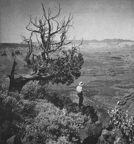
Prospect Canyon, which parallels the Aubrey Cliffs, provides a means of access to the high east rim of the canyon overlooking Granite Park. In this section, from Granite Park to Diamond Creek, the Grand Canyon reaches its greatest depth. The rim attains an elevation of 6,890 feet while the river at the mouth of Diamond Creek is an an elevation of 1,335 feet. From the piñon- and juniper-covered rim there are magnificent views of the brilliant canyon and the surrounding country. Hualpai Peak 72 miles to the southwest, the Music Mountains, and Peach Spring Wash are visible. To the northwest is the Shivwits Plateau. Below is Granite Park. Across the river to the north are the Pine Mountains, Parashont Canyon, and Whitmore Wash, and rising out of the red Tonto Platform like a huge ant hill is a volcanic cinder cone. The lava flow down from Mount Emma ending abruptly in Whitmore Wash and the gigantic row of red Supai windows projecting through the lava are also plainly visible. The scene is entirely different from that of the Bright Angel section but equally grand. There are fewer dramatic formations in the canyon but a greater variety of landforms and an endless horizon.
|
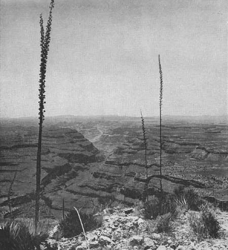
| Figure 67.—Burnt Springs Canyon from Twin Point—Grand Wash Cliffs form the skyline. |
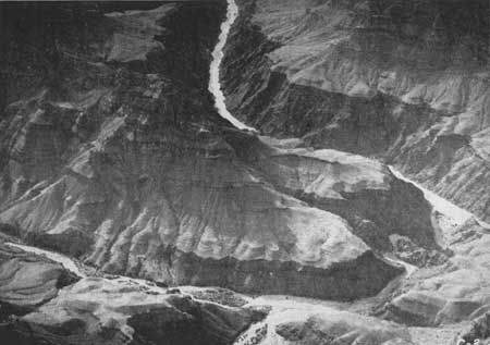
Peach Spring Draw, which joins Diamond Creek just before it enters the Colorado, provides the only natural grade suitable for a road to the bottom of Grand Canyon. Before the railroad was built to Grand Canyon Village, the old Diamond Creek Hotel near the mouth of the creek was the most popular place in the Grand Canyon. It may become popular again as an access point to the reservoir if Bridge Canyon Dam is constructed. Diamond Peak, near the junction of Peach Spring Draw and Diamond Creek, is one of the well-known geologic features of the canyon.
|
| Figure 68.—Looking toward Whitmore Wash and Pine Mountains from Shivwits Plateau. |
|
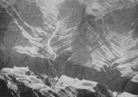
| Figure 69.—Bridge Canyon and Gneiss Canyon (right). The inner gorge of the Colorado River is about 800 feet deep. (Air photo) |
Spencer and Meriwitica Canyons, west of the Bridge Canyon Dam site, are fine examples of side canyons. Meriwitica Canyon is of special interest for, according to tradition, it is the original home of the Hualpai Indians. Between Spencer Canyon and the Grand Wash Cliffs the high points on the rim of the canyons offer views of canyon scenery as rugged, colorful, and interesting as any part of the Grand Canyon.
North of the river the region is divided into a series of canyons and plateaus. East of Kanab Canyon is the high, pine-covered Kaibab Plateau. Between Kanab Canyon and Toroweap Valley on the west is the comparatively uninteresting Kanab Plateau. However, from the rim of this plateau as at Boysag Point, Kanab Point, and Toroweap Point, there are marvelous views of the Grand Canyon. West of the gently sloping 3-mile-wide Toroweap Valley are the Pine Mountains, a series of forest-covered volcanic cones striped by large lava flows. West of the Pine Mountains are the spectacular Whitmore Wash and Parashont Canyons. Beyond them is the Shivwits Plateau, a green peninsula in the sky flanked by brilliantly colored deserts and canyons. The Toroweap-Whitmore Wash area, including the Pine Mountains and Parashont Canyon, is the most outstanding section west of Kanab Canyon. Here are the great faults, evidences of volcanic activity, pine forests and desert vegetation, springs, deep narrow canyons, and color.
The recreational value of the Shivwits Plateau is primarily in the fine views of the Grand Canyon from the rim and its remote wilderness character. However, the views are not unlike those obtained from the east rim of the Grand Canyon above Diamond Creek, and the high points along the latter rim are about 300 feet higher than Mount Dellenbaugh, the highest point on the Shivwits Plateau.
LANDS AND AGENCIES INVOLVED
All of the Grand Canyon is within areas now administered by the Federal Government through the Bureau of Indian Affairs, the National Park Service, the Fish and Wildlife Service, the Bureau of Reclamation, and the Bureau of Land Management, all of which are in the Department of the Interior, and the Forest Service of the Department of Agriculture.
The eastern side of the canyon between Lees Ferry and the Little Colorado River is part of the Western Navajo Indian Reservation. From Lees Ferry to Nankoweap Canyon, the west side of the canyon is partially in the Kaibab National Forest and partially public domain. Grand Canyon National Park includes all of the canyon from Nankoweap Canyon and the Little Colorado River to Tapeats Creek. From the west side of Tapeats Creek Canyon to the west rim of Kanab Canyon, the area north of the river is part of the Kaibab National Forest. On the south side, Grand Canyon National Park extends west to include Havasu Canyon. Grand Canyon National Monument lies between Grand Canyon National Park and Lake Mead Recreational Area, the greater portion being north of the river. Lake Mead Recreational Area adjoins the southern portion of the monument on the west. South of the river, the Hualpai Indian Reservation extends from National Canyon almost to the Grand Wash Cliffs. Lake Mead Recreational Area overlaps the Hualpai Indian Reservation to include most of the Grand Canyon south of the river which is within the reservation.
BUREAU OF RECLAMATION PROPOSALS
Bridge Canyon Dam and Reservoir.—Nineteen miles northwest of Peach Springs, Ariz., in the seldom-visited western half of the Grand Canyon, the Bridge Canyon Dam may some day rise to the towering height of 740 feet above bedrock if the present plans of the Bureau of Reclamation are carried through. Exceeding Hoover Dam in height, this dam would in turn be dwarfed by the canyon. Though the dam would raise the water 672 feet to a maximum elevation of 1,876 feet above sea level, the multicolored canyon walls would tower more than 4,000 feet above the fiord-like lake. The quiet water of the lake thus created would extend upstream 93 miles to within a tenth of a mile of the mouth of Kanab Creek. At normal water surface elevation 1,866 feet, it would extend to within four-tenths of a mile of Kanab Creek. The minimum surface elevation of the reservoir would be 1,645 feet.
Bridge Canyon Dam is proposed primarily for the generation of power. Coincidental with the construction of the Bridge Canyon Dam would be the construction of the Coconino Dam on the Little Colorado River 49 miles upstream from the Colorado River and the Bluff Dam on the San Juan River 132 miles upstream from its mouth. Both of these dams would serve as flood control and silt detention structures. The Bluff Reservoir also would regulate the flow of the San Juan as required by downstream power plants. These two dams are essential to the life of the Bridge Canyon Reservoir.
Marble Gorge Dam and Kanab Tunnel.—Following the Bridge Canyon, Coconino, and Bluff Projects in the Bureau's schedule of development would be the Glen Canyon Dam located 4.5 miles upstream from Lees Ferry. This dam would be for power development and river regulation. This project is discussed in Chapter VIII—Canyon Lands of Southeastern Utah. In the 150 miles between the Glen Canyon Dam site and the estimated headwaters of the potential Bridge Canyon Reservoir at normal water surface elevation, the Colorado River falls approximately 1,260 feet. About 100 miles and 950 feet of the drop are within the boundaries of Grand Canyon National Park. To take advantage of this drop and yet avoid the construction of dams or other works in the park, the Bureau of Reclamation suggests a plan for diverting the Colorado River waters "not needed to maintain a steady stream for scenic purposes in the park" through a 44.8 mile tunnel from just above the east end of the park to a power plant on the Colorado River near the mouth of Kanab Creek. The capacity of the Kanab Tunnel would be 13,000 second feet. A 298-foot dam at the Marble Gorge site 15.5 miles upstream from Nankoweap Canyon would divert water to the tunnel. Water released from the dam for scenic purposes in the park would pass through a power plant.
The maximum and normal water surface elevation of the Marble Gorge Reservoir would be 3,125 feet, the elevation of the Colorado River at the Glen Canyon Dam site, and the minimum water surface would be 3,115 feet above sea level.
Proposed operation of reservoirs.—According to present studies of the Bureau of Reclamation for reservoir operation in connection with the Parker diversion route of the proposed Central Arizona Project, Bluff and Coconino Reservoirs would be for the purpose of silt control. Glen Canyon and Marble Gorge would be future developments for river regulation, silt control, and power. Generally, the Marble Gorge Reservoir would be maintained at maximum content. However, during a critical year of operation the active content of Marble Gorge Reservoir would be withdrawn prior to utilizing the active content of Bridge Canyon Reservoir. Such withdrawal would be made only after the active storage contents of Bluff and Glen Canyon Reservoirs had been exhausted. Release through the Marble Gorge Power Plant would be at a uniform rate of approximately 1,000 second feet. Operation of the Kanab Power Plant would be closely coordinated with the operation of the Glen Canyon Power Plant.
Normally, after full river regulation is provided by upstream storage, Bridge Canyon Reservoir would be operated at maximum content with release of water for power corresponding to releases from Glen Canyon.
With this method of operation, the water surface elevation of Bridge Canyon Reservoir would normally be between 1,866 and 1,876 feet. Only in an extremely dry period would it be drawn down to a minimum elevation of 1,645 feet. The Marble Gorge Reservoir would have a maximum fluctuation of 10 feet between elevations 3,125 and 3,115.
EFFECT OF PROPOSED PROJECTS ON THE GRAND
CANYON
The projects proposed for the control and use of the Colorado River would completely change the natural conditions and character of the river through the Grand Canyon. In place of a thundering, heavily silt-laden river, it would be harnessed by dams into a series of quiet mill ponds, except through Grand Canyon National Park where it would be diverted under the plateau through which it has for millions of years been grinding its own way. The silt and debris would be dropped behind upstream dams. The river through the Grand Canyon without its grinding agents would no longer be the Colorado known to thousands of visitors who go to the bottom of the canyon each season. It would be a clear stream.
In place of great fluctuations in volume of flow between the spring months when the snow is melting on the Rockies, the Uintas, and the White Mountains and the winter months when the plateaus are dry and the mountains frozen, the flow would be regulated to meet the demands of the power plants. Between Marble Gorge Dam and Kanab Creek, roughly the area covered by Grand Canyon National Park, the flow would be regulated to a constant 1,000 second feet.
|
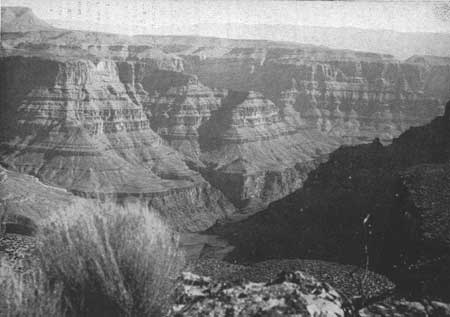
| Figure 70.—The Grande Canyon above Bridge Canyon—the high rim of Grand Canyon north of Diamond Creek forms the skyline. |
|
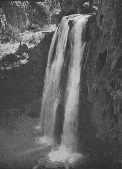
| Figure 71.—Havasu Falls—one of the four falls of Havasu Creek. |
With the series of dams proposed, silt and debris now carried by the Colorado River and deposited in Lake Mead would be drastically reduced. Navigation in the canyon section of Lake Mead, practically impossible at the present time because of silt conditions, would be stabilized, making it possible to travel with ordinary types of boats from Pierce Ferry to just below the Bridge Canyon Dam.
Bridge Canyon Dam and Reservoir.—The impounding of water behind Bridge Canyon Dam to an elevation of 1,876 feet probably would conceal few geological features that are unique or of special importance as documents of geological history. Any impoundment more than a few feet higher than that elevation, however, would back water beyond the upper reaches of the inner canyon to which it would otherwise largely be confined, and create a conspicuous, insistent intrusion into the broader part of the canyon visible from the rim. There would result an artificial reservoir replacing the natural river in some of the most spectacular and characteristic views of the canyon obtainable. The greatest losses, insofar as geological features are concerned, would be in the area of volcanic activity at and westward from Toroweap Valley. Several features illustrating the early stages of canyon cutting and of local volcanism would be inundated. Also covered would be the remnants of lavas that flowed down the river channel and, in two places, the sediments formed in ancient lakes or reservoirs behind natural lava dams. A detailed report on many of these features was made by Edwin D. McKee and Edward J. Schenk to the Director, National Park Service, in December 1941. The report is entitled "Lava Dams in Grand Canyon." The following statement appears in the report: "The spectacle of lavas that have cascaded down the steep canyon walls, and [of] cinder cones perched on the sides and brink of the chasm usually makes a profound impression on the layman, while to the geologist the problems presented are intriguing."
Toroweap Valley slopes gently toward the canyon rim and ends with a sheer cliff almost 3,000 feet above the river. The views down into the canyon, combined with the roar of the rapids, are spectacular and awe-inspiring. The increased width of the strip of water in the bottom of the canyon through submergence of the talus slopes would decrease the apparent depth and impressiveness of the chasm.
Havasu Creek, an unfailing spring-fed stream of crystal clear water, is a distinctive feature of the canyon. The notable and beautiful, though seldom seen, mingling of the blue waters of Havasu Creek with the brown waters of the Colorado would be radically altered for the worse. But the more frequently visited waterfalls and other features that have made Havasu Canyon famous would not be affected by the Bridge Canyon Reservoir.
Between Havasu Canyon and Kanab Creek the high, upper rim of the Grand Canyon is characterized by narrow, long projecting points, with deep bays between, and an abrupt descent from its edge to an exceptionally wide "bench" nearly 2,000 feet lower. The general appearance of the bench is extraordinarily flat, although it is dissected by minor canyons and has a number of isolated small buttes rising from it. This wide bench appears to be nearly bare of vegetation, has a peculiar and distinctive rock texture and color, and extends to a sharply defined edge much closer to the river and more nearly parallel with its course than is the case with this formation in the canyon farther east. The inner gorge lying between the two rims of this bench is correspondingly deeper and more closely shut in, making the river invisible from the upper rim except at a few projecting points, of which the most remarkable is Boysag Point. This point is much closer to the river than any point of the upper rim in Grand Canyon National Park. Views into the inner canyon from places on the inner rim would doubtless be impressive but that rim is at present extraordinarily difficult of access. Only a minute fraction of all the visitors to Grand Canyon National Park thus far have ever obtained a good view of the depths of the inner gorge between Tapeats Creek and Havasu Creek, and probably most of that relatively small number have seen it only from the mouth of Havasu Creek. These conditions, however, could be changed by later park developments.
For its entire length the Bridge Canyon Reservoir would be confined in the lower inner gorge and extend only short distances up side canyons. The largest arm would extend up Diamond Creek and Peach Spring Draw about 2.5 miles. The narrowest arm would extend more than 2.5 miles up the sheer-walled Parashont Canyon. The entire reservoir would be in colorful canyons of overwhelming grandeur, and the north-south section of this fiord-like lake between Diamond Creek, Granite Park, and Parashont Canyon, would be extraordinarily scenic.
The Act of February 26, 1919 (40 Stat. 1175) creating Grand Canyon National Park provides in Section 7
That, whenever consistent with the primary purposes of said park, the Secretary of the Interior is authorized to permit the utilization of areas therein which may be necessary for the development and maintenance of a Government reclamation project. (U.S.C., title 16, sec. 227.)
Various heights for Bridge Canyon Dam have been considered, but the one presently planned would have a maximum water surface elevation of 1,876 feet. This would raise the water 666 feet above the stream bed at the dam and place the head of the reservoir less than a mile downstream from the mouth of Kanab Creek. It would raise the water surface about 85 feet at the mouth of Havasu Creek, backing the water approximately one-half mile up Havasu Canyon in Grand Canyon National Park.
Frederick Law Olmsted, noted landscape architect, made a study of the probable effects of the proposed Bridge Canyon Dam upon the national park and monument. In his report Mr. Olmsted said:
This section of the Grand Canyon as a whole is notable for the distinctive character of its scenery, especially as seen from certain places on the upper rim on both sides of the canyon. It was completely included from rim to rim in the portion of the Grand Canyon originally set apart in 1908 as a national monument for preservation of the noneconomic values of its unique and inspiring scenery. It was, and is worthy of selection for such a purpose.
When the Grand Canyon National Park was established in 1919, its boundaries were so drawn as to leave the entire north side of the canyon between Tapeats Creek and Havasu Creek under the administration of the Forest Service, which had previously administered all parts of the Grand Canyon set apart for preservation of its natural scenery in 1908. The investigators have found no record indicating that the omission of that area from the park was due to a deliberate and reasoned decision to reverse the earlier intention of protecting the scenery of this entire unit of the canyon from rim to rim.
If that is to remain the policy of the Government concerning this entire unit of the Grand Canyon, in accordance with the decision made in 1908 and adhered to in essence ever since, then the limitation of Bridge Canyon Reservoir to an elevation that will not encroach on that protected area should be continued, for the following points are clear, viz: A higher elevation would substantially alter natural conditions and injuriously affect the natural scenery along the Colorado River as far as the backing up of the water extends, for the sake of an exclusively economic gain, in direct contradiction of that policy. The conclusion above stated is not invalidated by the fact (a) that the impairment of natural scenery within the supposedly protected area would be relatively limited in extent in comparison with the entire area of the Grand Canyon that is supposedly protected, and would probably be observed by no more than a small fraction of the people who visit various parts of that entire area in order to enjoy its scenery, and (b) that the economic gain would be relatively large.
If, on the other hand, it is decided that the justifying reason for existence of a national park extending into the canyon downstream from Tapeats Creek is not that of protecting, in conjunction with the Forest Service, natural conditions and scenery in the Grand Canyon from rim to rim, but merely to protect Havasu Canyon Unit and adjacent areas south of the river; then the logical procedure would be Congressional action making a marginal modification of the present boundary of the park west of the Tapeats Creek watershed, shifting it from the north bank of the river to a contour on the south bank that would keep it clear of the prospective reservoir.
Choice between those alternative policies depends not primarily upon technical details such as have been discussed in this report, but upon broad considerations of public purpose; in the last analysis upon how much the people of the United States care about preserving the natural conditions and scenery in the portion of the Grand Canyon selected for such preservation in 1908, and whether they are able and willing to pay the economic price of such preservation.
Marble Gorge Dam.—The Marble Gorge Dam site is 15 miles upstream from Nankoweap Canyon, the northeast corner of Grand Canyon National Park. Neither a low dam, as contemplated under the Bridge Canyon Route for diversion of water to central Arizona, nor a high dam, such as the one proposed under the Marble Gorge diversion route, would be particularly objectionable from the scenic and recreational viewpoint. In either case the part of the reservoir below Navajo Bridge would be confined in the deep narrow Marble Gorge. From Navajo Bridge to Lees Ferry the lake formed by the higher dam would cover the bottom lands between the Echo Cliffs on the east and the high, vermilion cliffs of the Paria Plateau on the west. This more open body of water would be very scenic and easily accessible from United States Highway 89 which crosses the Colorado River on Navajo Bridge.
Considering only the recreational use of the proposed Marble Gorge Reservoir and the Glen Canyon Reservoir, a high dam at the Marble Gorge site, which would eliminate a dam at the Glen Canyon site, might be more suitable for recreational development and use than a low dam at that site and a high dam at the Glen Canyon site. The Glen Canyon site is in a deep, sheer-walled canyon which extends upstream for a number of miles. Access to the reservoir from United States Highway 89 would be difficult, and there is little or no land suitable for development of recreational facilities adjacent to the water.
Kanab Tunnel and Power Plant.—The proposal to divert the main flow of the Colorado River from just above the Marble Gorge Dam to a power plant on the Colorado River near the mouth of Kanab Creek by means of a 44.8-mile tunnel under the Kaibab Plateau would be infinitely more serious in its effect upon Grand Canyon National Park than that resulting from the construction of Bridge Canyon Dam. According to the preliminary plans of the Bureau of Reclamation, the Kanab Power Plant would utilize for power generation most of the water available from the Colorado River in excess of the 1,000 second feet released through the Grand Canyon National Park, which is entirely inadequate for scenic purposes. The tunnel and power plant would be designed for a maximum discharge of 13,000 second feet.
The average discharge of the Colorado River at Bright Angel Creek was 17,720 second feet for a period of 19 years—1922-41. The maximum discharge during that period was 127,000 second feet and the minimum 700 second feet. The gage height at the maximum was 29.25 feet and at the minimum—0.70 feet. (Reference Geological Survey Water-Supply Paper 929.) The 1,000 second feet which would be permitted to flow through the national park section of the Grand Canyon under the plan proposed would be only slightly more than the minimum flow of the past 23 years, and less than one-seventeenth of the average flow. The minimum flow in 1941 was 4,300 second feet (gage height 2.61 feet), more than four times the amount proposed.
This stringent limitation on the volume of water permitted to flow through Grand Canyon between Marble Gorge Dam and Kanab Creek would greatly alter the character of the river and natural conditions in the bottom of the canyon through Grand Canyon National Park, that portion of the Grand Canyon which has been set apart since 1908 for preservation of the noneconomic values of its unique and inspiring scenery.
With the construction and operation of the Kanab Tunnel and Power Plant, the Colorado no longer would be a great river grinding the Grand Canyon ever deeper, but a man-controlled stream which could be turned on and off at will. In this section of the Grand Canyon, contrasting sharply with the section of the canyon which would be in undated by the Bridge Canyon Reservoir, the river is visible from numerous points on the upper rim and well-used trails provide access to and along it.
|
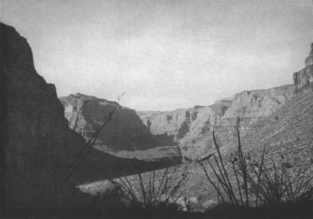
| Figure 72.—View across the inner gorge of the Colorado River from Bridge Canyon. |
|
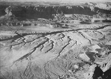
| Figure 73.—Where United States Highway 89 crosses Marble Gorge—Paria Plateau in the background. (Air photo) |
|
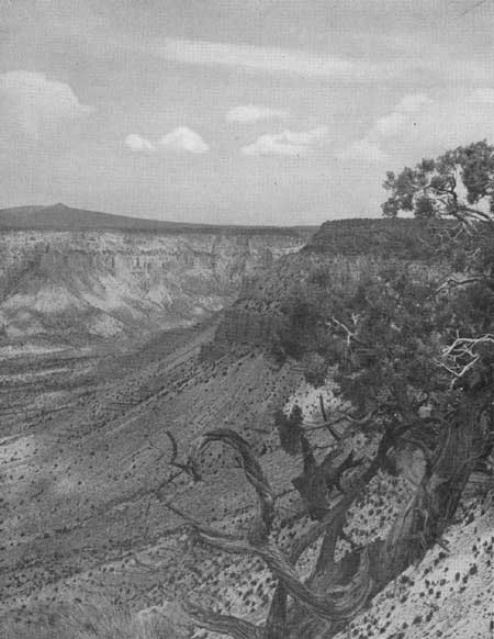
| Figure 74.—Mount Dellenbaugh from the rim of Green Springs Canyon, Shivwits Plateau. |
The Kanab Creek diversion proposal would, in effect, take away from the Grand Canyon the very agent that created it; the remaining trickle would be sham and mockery in comparison to the once great force that carved the canyon—the Colorado River. The natural river and its companion piece, the canyon, are vitally significant and interrelated elements of the whole which is Grand Canyon National Park. Without the normal flow of the river the significance and completeness of the park will be destroyed and the will of the people defeated in that the great spectacle of the Grand Canyon, as set aside by the Congress in the national park, to be preserved in its natural state for this and succeeding generations, will be seriously impaired.
SUGGESTIONS FOR DEVELOPMENT OF THE GRAND
CANYON AREA
Probably the best use that can be made of the Grand Canyon area from the standpoint of the American people as a whole is to reserve and develop the entire canyon and bordering plateaus as a place for recreation, primarily of the inspirational type. To those who contend that the present development in Grand Canyon National Park is sufficient to meet this need, it should be pointed out that already increased population and travel make the developed areas in the park so crowded and congested at certain seasons that chances for rest and contemplation are virtually nonexistent. The extension of opportunities to use Grand Canyon, especially the little-known western part, would greatly help in solving the future problem of adequate space for meeting the recreational needs of an increasingly large group.
Plate 5 (in pocket) presents a broad scheme for the general development of the Grand Canyon region, suggesting locations for roads and a limited number of new recreational centers which would be desirable in connection with the recreational use of the proposed Bridge Canyon Reservoir and the western part of Grand Canyon. The development plans for Lake Mead Recreational Area, Hualpai Indian Reservation, Grand Canyon National Monument, Kaibab National Forest, and Grand Canyon National Park should be coordinated on the basis of such an over-all plan to avoid conflicting developments. No one section of this area can be properly planned without due consideration being given to the possible and desirable development of the other sections.
Roads.—At the present time most of Grand Canyon is inaccessible except by arduous pack trips. The only improved roads to the canyon rim are the south and east entrance roads to Grand Canyon National Park and the road from Jacobs Lake to the north rim. On the south side of the canyon, east-west travel is practically limited to United States Highway 66, the heaviest traveled cross-continental highway west of the Mississippi River. On the north, the improved highways make such a big loop to the north that they do not provide for east-west travel through the area. There appears to be need for an improved through road for east-west travel on both the north and south sides of the canyon. At present, administration of the area is hindered by lack of such roads and the public is able to see only the eastern end of the canyon.
Consideration should be given to a road, generally paralleling Lake Mead and the Grand Canyon, that would provide a direct connection between Hoover Dam, Temple Bar, Pierce Ferry, Bridge Canyon Dam, Peach Springs, Frasiers Well, Hualpai Hilltop, and Grand Canyon Village. Such a road would enable persons to travel through the canyon country undisturbed by the nuisances of heavy trucks, fast through traffic, billboards, road side stands, pole lines, and fences. From such a through road, spur roads might be built to outstanding observation points and recreational centers, such as at Temple Bar, Pierce Ferry, Bridge Canyon, Diamond Creek, and Granite Park. These centers could offer overnight accommodations and operate as outfitting and informational centers from which the canyon country could be explored by foot, horseback, or by boat. They could also be sub-centers for the administration of this vast area.
The two existing main roads in the Hualpai Indian Reservation logically would be parts of this proposed road. The road from Peach Springs through the northwest section of the Indian reservation provides access to fine viewpoints. It could be continued down through the Grand Wash Cliffs to the Pierce Ferry Road and thence west around the White Hills to United States Highway 93. The road northeast from United States Highway 66 to Frasiers Well and Hualpai Hilltop connects with a road which continues to Anita and Arizona State Highway 64. The proposed development area above Granite Park, the high point between Prospect and Mohawk Canyons, and Yumtheska Point in Grand Canyon National Monument could be made accessible by spur roads from this section of the proposed through road.
The area north of the river west of Kanab Creek is quite remote and entirely off the beaten paths of tourist travel. Existing roads and trails, for the most part ungraded, are passable only in dry weather. Mount Trumbull, the only settlement in the area, is 49 miles from St. George, Utah, and 81 miles from Fredonia, Ariz., over very poor roads. The boundary of the Lake Mead Recreational Area on the Shivwits Plateau near Mount Dellenbaugh is 82 miles by road from St. George.
There is need for an improved road from Fredonia to Tuweap in Toroweap Valley, thence west over the Pine Mountains, through the settlement of Mount Trumbull, and around Poverty Knoll to the head of Hidden Canyon. From this point there are two possibilities. One would be to carry the road down Hidden Canyon through the Grand Wash Cliffs to Pocum Wash and then south down Grand Wash to Pierce Ferry where there would be a ferry connection with the Pierce Ferry Road south of the river. The other possibility would be to connect this east-west road at the west side of Poverty Knoll, with a north-south road running between Bridge Canyon Dam and St. George, Utah.
The Pierce Ferry-Hidden Canyon route was originally proposed, primarily for recreational travel between the north rim of Grand Canyon, Fredonia, Pierce Ferry, Kingman, and Hoover Dam, at a time when Pierce Ferry appeared to be the only place where it was physically possible to have a crossing of the Colorado River between Navajo Bridge and Hoover Dam. As it has been proposed to have a highway from United States Highway 66 to and across Bridge Canyon Dam, the continuance of that highway north to St. George is within the realm of possibility.
At the present time there are only two existing routes between the populated centers of Utah and Arizona, one by way of Las Vegas, Nev., and Hoover Dam, the other by way of Navajo Bridge. United States Highways 91 and 89 are the two major north-south highways in Utah. Near the Arizona line, United States Highway 91 becomes a southwest-northeast diagonal route to Las Vegas and Los Angeles, and United States Highway 89 swings east many miles to Navajo Bridge and then south to United States Highway 66 near Flagstaff. From United States Highway 66, United States Highway 89 and alternate Arizona State Highway 79 follow indirect courses to Phoenix.
The Arizona State Highway Department has plans for a direct diagonal highway from Phoenix to Kingman and Las Vegas. It will be an extension of United States Highway 93 southeast from Kingman through the Big Sandy Valley to Congress Junction. Should the Bridge Canyon Dam be constructed, it is logical that this road would have a branch to Hackberry on United States Highway 66. This would provide a direct route from Phoenix to the Bridge Canyon Dam.
The primary consideration in the construction of a road north from Bridge Canyon Dam would be the difficulty and expense of constructing a road from the dam to the rim of the Shivwits Plateau. It appears that it might be possible to follow along the bench of the inner gorge from the dam to Separation Canyon thence up the east side of Separation Canyon and Twin Canyon to the rim west of Mount Dellenbaugh. From there to the divide north of Wolf Hole construction would be comparatively simple. Between the divide and the Virgin River there would be a short stretch of heavy construction. The total length of the road from the dam to St. George would be approximately 105 miles.
Should Bridge Canyon Dam be constructed it is recommended that preliminary surveys be made to determine whether such a road connection between United States Highway 66 near Peach Springs, Ariz., and United States Highway 91 near St. George, Utah, is or is not practicable and ultimately desirable.
Development areas.—1. Bridge Canyon section. With the construction of Bridge Canyon Dam and a highway from United States Highway 66 to the dam, the Bridge Canyon area would become one of the major recreational centers of the region. On the basis of traffic counts on United States Highway 66 and the attendance at Hoover Dam and the south rim of the Grand Canyon in Grand Canyon National Park, it is estimated that there may be approximately 365,000 visitors annually to the Bridge Canyon area. These people would desire overlook or observation points from which they could see the dam and the canyon, a lodge and cabins, trailer space and tent camps, parking areas, sanitary facilities, docks and boats for sightseeing trips on the reservoir, a landing field for both private and commercial planes, and concession and information buildings. The spectacular canyon scenery, plus the attraction of the lake, may hold people here for extended visits. Foot and horse trails through Hindu Canyon to Meriwitica and Spencer Canyons and to Peach Spring Draw as well as to viewpoints along the rims of the canyons would probably be popular. Horses and guide service could be furnished by the Hualpai Indians.
The route selected by the Bureau of Reclamation for the highway from United States Highway 66 to the dam starts about 3.5 miles west of Peach Springs, Ariz., and runs generally north to Hindu Canyon. From the north side of Hindu Canyon a 4,000-foot tunnel would carry the road down through the divide between Hindu and Bridge Canyons. From the lower end of the tunnel the route continues down the west side of Bridge Canyon to the narrow bench above the inner gorge of the river and then winds along the bench to the dam site which is about 2.25 miles downstream from the mouth of Bridge Canyon. There would be a road across the dam to a parking area on the north side of the river.
This road down into Grand Canyon would be one of the dramatic features of the area. Turn-out parking areas should be provided wherever possible so that people may stop and enjoy the views. The turn-outs also would be useful for the heavy traffic of the construction period.
From near the upper end of the tunnel in Hindu Canyon a branch road would run west and north to the rim of the Grand Canyon directly above the dam where there is a quarry site for the crushed aggregate to be used in the construction of the dam. The construction camp site is located along this road on the high land between Bridge Canyon and Spencer Canyon.
Because of the difficulties of constructing roads to the rim of the Grand Canyon and of getting water to the rim, it is recommended that the lodge, cabins, and other recreational facilities be located on the rim southeast of the quarry site. In that location the road to the quarry and the water system serving the construction camp could also serve the recreational area. The recreational facilities should be constructed during the early stages of the project, so that they could be used both during and after the construction of the dam.
At a suitable point above the dam, provision should be made for a boat dock from which concessioners could operate sightseeing boat trips on the reservoir. Such trips would be popular because of the unusually spectacular canyon scenery.
2. Peach Springs Draw-Diamond Creek Area. At the present time Peach Springs Draw is the only place where it is possible to drive an automobile to the bottom of Grand Canyon. It would be a comparatively simple matter to construct a road down this draw from United States Highway 66 to the shore of the Bridge Canyon Reservoir where limited development of boat landings, parking areas, and other facilities for the recreational use of the reservoir could be provided. If this road were built, the Peach Spring-Diamond Creek arm of the reservoir would be the major center for boating activities on the reservoir. The precipitous banks of the reservoir in the vicinity of the dam would limit boating operations in that location. It would be possible to continue the road along the shore of the reservoir to a bench in the canyon overlooking Diamond Creek and the Colorado River. This would be an interesting location for a lodge in connection with the harbor development. Peach Spring Draw is dry except after a heavy rain in the immediate vicinity, but Diamond Creek has a continuous flow which could be used as a source of water for the development in this section.
3. Granite Park. This remote section of the Lake Mead Recreational Area and the Hualpai Indian Reservation, now practically unknown, offers canyon scenery of outstanding interest. At the present time there is an unimproved road from Frasiers Well north into Prospect Valley. The road ends about 16 miles north of Frasiers Well at a point about 17 miles south of the mouth of Prospect Canyon. The Aubrey Cliffs wall the east side of Prospect Valley while on the west side the land, thickly covered with large old piñons and junipers, slopes up to the rim of the Grand Canyon. This high rim, around 5,600 feet above the river, provides splendid views in all directions. The scene is entirely different from that of the Bright Angel section of the canyon but is considered to be equally grand. Halfway down to the river is the wide red Esplanade which could be made accessible by road and might be a suitable location for a lodge. From a well-chosen point on the Esplanade, the river gorge, the reservoir, and the towering cliffs of the outer rim would be visible so that the full scale of the canyon could be comprehended. It is difficult to appreciate the size of the canyon from the upper rim or from the bottom.
Granite Park is about 28 miles upstream from the Bridge Canyon Dam site and 17 miles above Diamond Creek. Boat trips on the reservoir and horseback trips along the Esplanade from this development center would be wonderful experiences.
|
| Figure 75.—Peach Springs Draw (left) joins Diamond Creek near the Colorado River. (Air photo) |
|
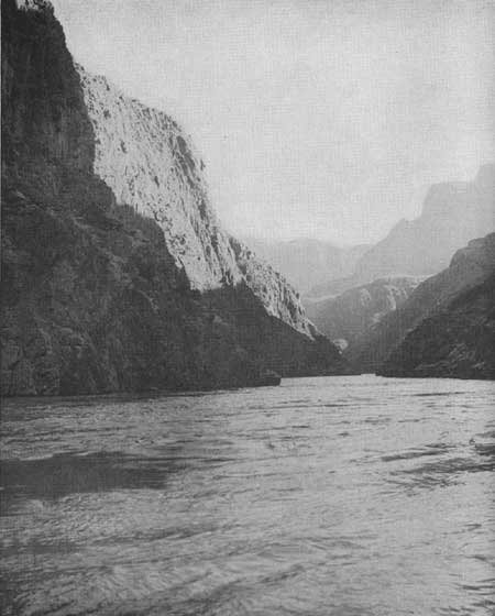
| Figure 76.—The Colorado River. |
4. Toroweap-Whitmore Wash area. The Toroweap-Whitmore Wash area should attract more visitors than any other section on the north side of the Colorado River west of the Kaibab Plateau because of the variety of spectacular scenic and geologic features and the fact that it can be made accessible both by road and by air.
It has been suggested that a loop road, connecting with the main east-west road previously suggested, extend down Toroweap Valley around the south end of the Pine Mountains into Whitmore Wash to the little settlement of Mount Trumbull. From near Mount Trumbull a spur road following an existing automobile trail could be built to the end of Whitmore Point, overlooking Whitmore Canyon, Parashont Canyon, and the inner gorge of the Colorado River.
Due to the scarcity of water in this country, the best location for a lodge would appear to be at the upper end of Whitmore Wash near Big Spring Wash. To the north, up Big Spring Wash, green forest-covered hills rise to Mount Logan. On the east Mount Emma and other volcanic cones form the skyline more than 3,000 feet above the valley. Great, black lava flows descend from the peaks down to the center of the valley around and over sheer cliffs of Coconino sandstone and Kaibab limestone. Farther down the wash, or canyon, are the cinder cones and other formations previously mentioned. In the canyon to the west are numerous evidences of early Pueblo Indian occupation. Most important, however, is the fact that a good flow of water is available at this point. Years ago it was piped here from Big Spring, located high on the slope of Mount Logan.
From the road in Whitmore Wash a spur road could be built on the Esplanade around the end of Whitmore Point to observation points on the inner rim of Parashont Canyon and the rim of the inner gorge of the Colorado River. Trails from the lodge and various points along the roads might lead to the many points of interest such as the Pine Mountains, the lava flows, and the canyons along the reservoir.
It is possible that a suitable handing place for boats can be found either in Whitmore Wash or Twin Canyon which joins Whitmore Wash about a half mile from the Colorado River. If Twin Canyon could be made easily accessible from the reservoir, it would be a delightful place for a camp. The bottom of the canyon presents the appearance of a peaceful, grassy meadow and there is water nearby.
Development on the north side of the Grand Canyon should, it is believed, include the improvement of a spur road from Fredonia-Tuweap Road to the vicinity of Boysag Point.
5. Shivwits Plateau area. The use and development of this area will depend to a large extent upon whether a road is built from Bridge Canyon Dam to St. George, Utah. The chief attractions of the area are the fine views of the Grand Canyon from such points as Price Butte, Sanup Point, Twin Point, and Horse Point. On an average of 5 miles from the Colorado River the plateau ends abruptly with almost sheer walls 1,000 to 1,300 feet high. Below the cliffs is a wide bench, the Esplanade, sloping down to the inner gorge of the Colorado which varies from 2,000 to 3,000 feet in depth. Sanup Point, the extreme south end of the plateau, rises about 4,800 feet above the river to an elevation of 6,000 feet. Deep side canyons cut back into the plateau, and four prominent knobs—Blue Mountain, Price Butte, Mount Dellenbaugh, and Poverty Knoll—rise above the general level of it.
A road northward from Bridge Canyon Dam might reach the rim of the plateau at the head of Twin Canyon, southwest of Mount Dellenbaugh. A short distance from the rim a cross road could head east and south to Price Butte and west and south to Twin Point and Horse Point. Recreational headquarters for the Shivwits Plateau area might logically be located near the crossroads on the rim of Twin Canyon. There is a nice growth of ponderosa pine in this section and water is available.
If a road from Bridge Canyon Dam to St. George is not built, no development for recreational use of the Shivwits Plateau area is recommended. The present trails will suffice for those who wish to explore this remote area.
| <<< Previous | <<< Contents>>> | Next >>> |
colorado-river-basin/chap7.htm
Last Updated: 06-Sep-2004