|
National Park Service
A Survey of the Recreational Resources of the Colorado River Basin |

|
Chapter II:
GEOLOGY
Provinces and subprovinces of the Colorado River drainage area, as recognized in this report, are based on physiographic character, on rock structure, and on the age of surface rocks. The value derived from using such subdivisions is chiefly that of ease in making descriptions of geologic features. Thus, elements of similar nature are considered together and contrasts are made apparent.
This portion of the report is prepared with a twofold objective: first, to present a general description of geology in the Colorado River drainage system and, second, to indicate specific features of unusual interest or unique character which should be permanently preserved and or made accessible because of their educational or inspirational values. The general description of the area is essential to an understanding of the individual features which are discussed in more detail later. An appreciation of these features is essential in evaluating the recreational possibilities of the region or in planning its development.
GENERAL FEATURES AND RELATIONS OF DRAINAGE
BASIN
In its continental relations, the area comprising the drainage basin of the Colorado is a feature of the great intermountain region outlined by the Rocky Mountains and the Sierra Nevada—an enormous expanse of relatively low land that might have been drained by a single river system. During Tertiary times this vast area was separated into two parts by the building of crinkled mountains in western Wyoming and uplifting masses of sedimentary rock to form the high plateaus of Utah. West of this common boundary is the Great Interior Basin, characterized by elaborately faulted and uptilted strata arranged as ridges between broad flats—a region of dwindling streams which never reach the sea. East of the division zone and extending to the crest of the Rocky Mountains lies the well-drained Colorado Basin, developed in dominantly flat-lying sedimentary rocks whose continuity has been interrupted by lava flows and igneous intrusions, and which in places have been bent upward into monoclinal folds or sliced into long earth blocks by faults. During a large part of Tertiary time the basin was the dumping ground for rock debris worn from its border lands. As a regional structural unit the Colorado drainage basin is a geosyncline—a downwarp formed at the time when its counterpart, the Rocky Mountains, was upraised.
An outstanding feature of the Colorado River Basin is the alinement and the peculiar local setting of the drainage channels. The original streams chose courses in accord with regional and local slopes and the relative hardness of the surface rocks. Some doubtless were through-flowing and others formed lakes, but nearly all of them eventually became parts of an integrated drainage system whose master stream, the Colorado, reached the sea. In the soft, uniformly textured Tertiary rocks that once covered most of the plateau country, the streams developed in the usual fashion, but as their channels were deepened, more resistant rocks in various attitudes were encountered. To escape these obstacles, some streams developed new round about courses, but many were so firmly established in deep trenches that readjustment was impossible, and as erosion of the adjacent lands proceeded their position became glaringly out of accord with the topography. Thus, with seeming disregard of regional features, the Green River crosses the Uinta Mountains, the Uinta Basin, and the Tavaputs Plateaus, and its tributaries pass through, instead of around, rock domes; the San Juan River meanders through Hogback Mountain and the Monument upwarp; the Paria River crosses the East Kaibab monocline; the Virgin River plunges through the Hurricane Cliffs, and farther on through the Beaverdam and Virgin Mountains; and the Colorado itself flows squarely across the Grand Hogback and the Waterpocket Fold and has cut a mile-deep trench across the Kaibab Plateau. Obviously, these streams, so strangely out of place in the present landscape, are superposed; they have inherited courses established on higher, less complex surfaces. They illustrate the superposed stream pattern characteristic of the entire Colorado drainage basin.
In developing their runways by down cutting, headward cutting, and the sluicing-out of rock waste, the Colorado and its scores of tributaries have removed from their drainage basin rocks with an average thickness of about 5,000 feet, and during this process have exposed all the major geologic formations. Along the Grand Canyon, where vigorous erosion has continued longest, rocks of Pre-Cambrian and Paleozoic age lie at the surface; northward across Utah, Mesozoic rocks predominate; and in southwestern Wyoming the floor of Tertiary limestones and shales is almost continuous.
In southern and western Arizona, below the great plateau region, the Colorado River and its tributaries drain an area totally different from that to the north. Rugged mountain ranges rise above broad, flat valleys like islands in the sea. The mountains contain rocks of many geologic ages and their structural histories are complex. Surrounding plains are in reality deep valleys that have been filled to thousands of feet with debris worn off the mountains within relatively recent geologic time. The present drainage follows the gentle surfaces of these valley floors between the ranges, flowing over sediments at low elevations.
The Colorado River drainage basin comprises areas of unlike physiographic and geologic history. For convenience of description they are listed as provinces, each of which is discussed as a separate unit. They are the Green River Basin, the Uinta Mountain Region, the Colorado Plateau (north and south portions), the eastern and western border lands, the Arizona mountain region, the Arizona volcanic areas, and the basin and range province. (Plate 3, in pocket.)
GREEN RIVER BASIN PROVINCE
In its broad relations, southwestern Wyoming and an adjacent narrow strip in northeastern Utah, together with an area of considerable size in northwestern Colorado, comprise a topographic depression of about 30,000 square miles, shown on modern maps as the Green River Basin or the western part of the Wyoming Basin. The basin is completely enclosed except for a deep trench in its south rim, through which the waters carried by the Green River and its large tributaries—Sandy Creek, Little Snake River, Yampa River, Vermillion Creek, La Barge Creek, and Blacks Fork—pass southward and finally reach the master stream the Colorado. (Plate 3, in pocket.)
The general floor of this regional basin consists of flat stretches and broad slopes of gentle gradient trenched by relatively broad valleys and shallow canyons, but is roughened by ridges and elongated domes sufficiently high and resistant to erosion to outline somewhat poorly defined subordinate units. The Rock Springs Dome and the White Mountains separate the Great Divide Basin—4,200 square miles in extent—from the Bridger Basin, the latter extending along both sides of the Green River, from the foothills of the Wind River and Gros Ventre Mountains southward for 150 miles to the base of the Uinta Mountains. The lofty cuestalike Lany Rim and Cathedral Bluffs mark the boundary between the Bridger and Great Divide Basins and the Washakie Basin, and farther south the anticlinal Cherokee Ridge separates this structural depression from the much larger Yampa Basin.
Though its average altitude exceeds 6,500 feet, the Green River Basin is surrounded by mountains 10,000 to 12,000 feet high. At its northeastern border stands the massive Wind River Range. On its southwest side, the broadly exposed granite core of the range rises abruptly from the flat lands of Bridger Basin along a fault, and northeastward is flanked by the truncated edges of steeply inclined strata. The Wind River Range originated as an uplift in late Cretaceous time, during which thick, horizontal Paleozoic and Mesozoic strata were bent upward in elongated anticline. Then during a long period of erosion the up-arched strata were worn down to Pre-Cambrian rocks and the mass uplifted again and reexposed to erosion by the present-day powerful streams.
The southeastern border of the Green River Basin is defined by the Park Range, which essentially is a mass of ancient granite; the basal rock of an anticlinal uplift that in Pre-Tertiary time was deeply mantled with sedimentary rocks. In consequence of erosion, a second uplift, and recent dissection by streams, the originally arched surface of the range has been worn down to a plateau of moderate relief, above which in places rise craggy, glaciated alpine ridges to heights exceeding 12,000 feet. The eastern border of the Green River Basin between the Park Range and the Wind River Mountains is poorly defined. For a distance of 125 miles the rocks characteristic of the crests of the high ranges along the Continental Divide occupy a huge structural sag, where they are covered by sediments of younger age. In the place of the usual topographic drainage divide, the margin of the basin is a sinuous line across featureless plains where the intermittent and ephemeral streams tributary to the Green River seem to be interlaced with those flowing eastward to join the Platte.
The western border of the Green River Basin is a belt of parallel mountain chains—the prominent Wyoming Range, Salt River Range, and Oyster Range—that rise 8,000 to 11,000 feet above the Intermontane valleys, and southward decrease in height to less than 1,000 feet. Their component strata, chiefly sedimentary, are closely folded—much like those of the Appalachian Mountains—and are broken by faults of enormous dimensions. In the Bannock fault, 150 miles long, the rocks have been overthrust toward the east, possibly as much as 35 miles. At Aspen Ridge (Aspen Station, Union Pacific Railroad), an anticline is crossed by three long faults, in one of which (the Absaroka) the strata were raised more than 15,000 feet, bringing Jurassic rocks to the level of the Tertiary. These border ranges are famous as illustrations of geologic structure, and if made more accessible, doubtless would be visited each year by many students. (Plate 13, Sections 1 and 2, in pocket.)
The drainage pattern of the Green River Basin is peculiar; to an extent not duplicated elsewhere in the United States, the alinement of rivers and creeks is out of accord with the topography. Bitter Creek goes through, instead of around, the Rock Springs Dome, crosses a valley, and then plunges directly into the face of White Mountain. In the present topography an unobstructed course lies 1,000 feet below. Equally remarkable is the drainage of the Great Divide Basin, particularly the Red Desert, where the streams have no outlet. On a surface of flat land, ridges, and remnant mountains they terminate in alkaline lakes or die out on mud flats in the midst of brightly colored sand dunes—the all-year home of antelope and a winter grazing ground for sheep.
The interpretation of the anomalous stream pattern its wholesale disregard of present day mountains—involves the assumption that the Pre-Tertiary rough floor of the Green River Basin—its highlands and lowlands alike was completely buried by younger sediments and that the courses of streams established on the new-made surface have been maintained regardless of the structure and composition of the exhumed mountains encountered in down cutting. In geologic terms, the entire drainage system is superposed.
Within the Green River Basin most of the exposed rocks are sedimentary in origin and geologically very young. Lavas cap a few mesas and, at Leucite Hills, lavas, volcanic tuffs, and ash occupy about 750 square miles; in a few places Upper (?) Jurassic rocks are in sight; and Upper Cretaceous beds crop out in some valleys and inter-stream areas and are uptilted along folds and faults. But the basin is almost completely filled with Tertiary strata in nearly horizontal position. (Pl. 13, Secs. 1 and 2, in pocket.) The hard Cretaceous rocks form hogback ridges, while the poorly consolidated Tertiary strata erode into banded cliffs and picturesque castles, towers, "pulpits," and "witch rocks," in places into extensive badlands. From them have been obtained the fossil mammals, fish, birds, and plants exhibited in American and foreign museums.
Yampa River Valley.—The salient Yampa River Valley topographic and geologic features of the Green River Basin in Wyoming extend southward into northwestern Colorado where an area of about 2,000 square miles drained by the Yampa River, particularly its chief tributary, the Little Snake River, is surfaced with rocks of Tertiary age. This plainlike expanse, most of it north of the Yampa, is trenched by shallow streams, and its easily eroded soft rocks have been carved into attractive small-scale badland forms. Locally, the Tertiary beds are overlain by lavas or so far stripped away as to expose Cretaceous sandstones, igneous dikes, and volcanic necks. At the Elkhead Mountains, a lone mass of metamorphic and igneous rock that culminates in Hahns Peak (altitude 10,824 feet) interrupts the continuity of the flat-lying Tertiary beds. Near its mouth the Yampa has cut deeply into the steeply tilted rocks of the eastern Uinta Mountains, exposing the edges of Paleozoic and Mesozoic strata. The Yampa also transects Cross Mountain and, farther east, Juniper Mountain, which are short domelike masses that rise abruptly from the regionally flat surface. Like Douglas Mountain and Spring Mountain north of the river, these conspicuous landmarks are anticlines once arched over by Cretaceous rock but now so deeply eroded that the Cambrian and Pre-Cambrian core rock is exposed, and against it the Paleozoic and Mesozoic formations lie in orderly sequence. In shape and structure these isolated masses are so like the Uinta Mountains that they have been dubbed "Little Uintas."
Also suggestive of the Uinta structures is the remarkable Axial Basin a valley formed by stripping away the crest of an anticline which crosses the Yampa River and farther southeast merges with folds of the White River Plateau. The sequence of strata shows that the anticline is post-Eocene in age; the date of the second up-arching of the Uintas. South of Juniper Mountain, beyond the Axial Basin, the land rises to the anticlinal Danforth Hills, which stand 2,000 feet above the bordering lowland and outline the drainage divide between the Yampa and White Rivers. Here in the Cretaceous rocks, Goodsprings, Wilson, and Morgan Creeks, and Maudlin and Temple Gulches have cut deep channels across hogback, ridges, and the Collom syncline. From Juniper Mountain to Steamboat Springs, Colo., except near the mouth of Elkhead Creek, where Tertiary rocks are exposed, the Yampa and its southern tributary flow on Cretaceous rocks, developing broad valleys and rounded hills in soft shales, and rugged landscapes of ridges, mesas, and "pagodas" in the most resistant sandstone. The many-branched Williams Creek, Trout Creek, and the Upper Yampa start abruptly at the Flat Tops extensive sheets of basalt and andesite.
East of the latitude of Steamboat Springs, characteristic landscapes of the Yampa Basin entirely disappear. In the topography the plainlike surfaces developed on approximately horizontal beds are replaced by rugged mountains trenched by steeply inclined streamways and, as stratigraphic units, the dominant Tertiary formations are replaced by schists, gneisses, and granites. In other words, the southeastern edge of the Green River Basin—the northeastern edge of the Colorado River drainage basin lies on the west slope of the Park Range and its features are those of the Rocky Mountains rather than of the plateau lands farther southwest.
If approach roads were available, the deep meandering canyon of the lower Yampa and a large part of the ruggedly carved landscape along its upper tributaries, now accessible only on foot or horseback, would add much to the recreational resources of northwestern Colorado (Plate 13, Section 5, in pocket.)
White River Valley.—In transporting White River Valley surface water and rock waste from northwestern Colorado to the Green River, the streams that drain the Yampa River Basin are assisted by those within the similar, but much smaller, White River Basin. Like the Yampa, the meandering White and its major tributaries have developed most of their channels in nearly horizontal Tertiary strata and have cut into Cretaceous and older rocks only where anticlines lie athwart their long-established route. In the soft Tertiary rocks, the streams have cut innumerable runways and thus have carved the surface into flat-topped ridges, mesas, and towers which are well displayed at Cathedral Bluffs, Gray Hills, Powell Park, and Douglas Peaks features of the "Goblin City" mentioned by diarists of the second Powell Expedition. (Plate 13, Section 6, in pocket.)
|
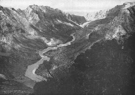
| Figure 19.—The Green River passed through Split Mountain, part of the Uinta upwarp. |
UINTA MOUNTAIN PROVINCE
Uinta Range.—As a highland belt 25 to 40 miles wide with an average elevation exceeding 11,000 feet—2,000 to 6,000 feet above the peripheral lowlands—the Uinta Mountains are the dominating topographic feature of northeastern Utah between the Wasatch Mountains and the Green River. In some respects the Uinta Mountain region—the lofty Uinta Range and the Uinta Basin along its southern base—is unique. In contrast with the general north-south alinement of similar topographic features elsewhere in the Colorado drainage basin, in fact, within the United States, the mountain mass, its bordering structural valleys and its principal fault lines trend east-west and, unlike that which characterizes the mountainous masses along the eastern edge of the Colorado Basin, the topography is in close accord with the structure. As a major feature of the regional landscape, the present Uinta Mountains differ little except in height from their ancestral forms; the crestline seems always to have been approximately the drainage divide and the bordering slopes to have retained their original position. The widely exposed core rock of the Uinta Mountains is the brick red, thickly bedded quartzite and sandstone of the Pre-Cambrian Uinta formation. On the flanks of this central mass, Paleozoic and Mesozoic formations in normal sequence are every where steeply tilted and, on the north and east sides of the mountain, broken by faults, some of great magnitude. (Plate 13, Sections 3 and 4, in pocket.)
The rocks of the Uintas contain a rich fossil fauna. The bones of dinosaurs are particularly abundant in the Jurassic Morrison formation at Dinosaur National Monument.
The major events in the geologic history of the Uintas include two periods of crustal movements, two of widespread denudation, and an epoch of glaciation. Soon after the close of the Cretaceous period the rocks of the region were pushed upward in the form of an elongated fold, thus bringing strata previously below sea level to altitudes exceeding 20,000 feet (Powell's estimate is 30,000 feet). This great up-arching was associated with down-warps paralleling its borders—on the north the Bridger Basin, on the south the Uinta Basin, and on the east the Yampa Basin. Then followed a period of erosion, an estimated 45,000,000 years, during which the range was greatly reduced in height. The bordering strata were truncated, and rock thousands of feet in thickness eroded from the highlands, the sediments being deposited in the adjacent basins, forming thick extensive deposits of sands and muds, now represented by the formations of early and middle Tertiary age. Before denudation ceased, the original lofty mountains had been worn down to a low-lying surface, probably of inconsiderable relief. In late Tertiary time, crustal upthrust was renewed, the remnant of the original arch was raised, and the edges of the flat-lying surrounding sediments were bent upward. There was thus introduced a second major cycle of erosion which has not yet come to an end. The new conditions have been favorable for roughening the surface of the mountain mass by cutting deep canyons and outlining peaks and ridges, especially along the borders. Twice during the glacial period the summit mountain surfaces were covered by ice. Thirty distinct glaciers, the smallest 1-1/2 miles long and the largest 27-1/2 miles long, extended down the highland valleys. Over an area exceeding 1,000 square miles only a few peaks and narrow divides escaped burial. The peculiar work done by these stationary ice caps and slowly moving ice streams is plainly recorded by striated rocks, cirques, U-shaped valleys, moraines, and glacial lakes—about 400 of them large enough to be shown on maps.
Most of the streams in the Uinta region are in accord with the topography, and also generally with the structure. They occupy synclinal troughs or descend the flanks of anticlines, and locally follow courses determined by the relative hardness and attitude of the rocks encountered. In other words, they are consequent or subsequent streams. A conspicuous exception to the normal arrangement is the Green which, after flowing southward for 150 miles over soft flat-lying rocks, abruptly turns east, crosses a great fault, meanders through the hard, steeply upturned rocks along the flanks of the Uintas, and passes entirely through the range in spectacular canyons. To account for this abnormal course involves the supposition, based on a study of the regional geology, that the ancestral Green River was established on a surface that lay far above its present canyon walls at a time when the eastern end of the Uintas was buried beneath strata of late Tertiary age. In consequence of readjusted alinement caused by the growth of its tributaries and by local tilting and faulting, the stream became so well established that it maintained its course, cutting through the soft rocks and on into the complex hard rocks its present floor. Like many rivers in surrounding regions, the Green through the Uintas is superposed; its course has been inherited.
Uinta Basin.—Among the physiographic features of outstanding interest in northeastern Utah and northwestern Colorado, the Uinta Mountains are matched by the Uinta Basin which covers an area of about 8,000 square miles in Utah and 7,000 square miles in Colorado drained by the Green River and its large tributaries, the Duchesne, Uinta, Yampa, and White Rivers. From the Wasatch Mountains the basin extends eastward for about 170 miles to the White River Plateau, as a border belt for the Uinta Range and the Axial Basin anticline. Southward from the base of Uinta uplift it extends to the crest of the Book and Roan Cliffs 40 to 120 miles distant. Within this large area a few remnants of an ancient erosion surface are exposed, but generally the older rocks lie beneath thick deposits of Tertiary age exposed to view only in the deep canyons. These Tertiary rocks, 500 to 12,000 feet thick, floor not only the Uinta Basin but also the lands east and north of the Uinta Mountains. (Plate 13, Section 3, in pocket.)
The Uinta Basin is both a topographic and structural depression. In generalized north-south profile across its central part, the surface descends from 7,000 feet at the base of the Uintas to about 5,000 feet (along Green River, 4,000 feet), then ascends to altitudes of 8,000 to 9,000 feet. This topographic expression is largely in accord with the attitude of the underlying sedimentary rocks. In structure the basin is a long syncline; from its axis northward, the strata bend upward to the base of the Uintas and southward up the back slopes of the Tavaputs Plateaus.
The Uinta Basin is a profitable agricultural section, a potential oil field, and the site of the largest and oldest Indian reservation in Utah. It is a famous source of fossils, and derives additional geologic interest from its scattered outcrop of solid hydrocarbons, which include rare types, some of them unique and little understood—uintaite, native asphalt, ozocerite (mineral wax), wurtzililze, tabbyite, and bituminous sandstone. Especially peculiar are the deposits of commercially valuable gilsonite, which on both sides of the Green River fill deep vertical cracks 1 to 8 feet wide and 3 to 8 miles long, and appear at the surfaces as conspicuous black streaks.
COLORADO PLATEAU PROVINCE
Outline of geologic history.—The geologic history of the Colorado Plateau Province, now in vigorous process of destruction, is recorded in the composition, the sequence of deposition, fossil content, and geographic position of its constituent rocks. In broad outline it is the story of enormous masses of sedimentary rock raised high above sea level and dissected by the Colorado River and its many tributaries. Thus, in strong contrast with adjacent regions, its history is fairly simple and easy to read. In it six major events are recorded.
1. During Paleozoic and Mesozoic times—periods aggregating as much as 490,000,000 years—sandstone, limestone, and shale were deposited alternately on the ocean bed and on land, and progressively sunk, thus leaving each set of beds periodically not far above sea level.
2. Near the close of the Cretaceous era, approximately 60,000,000 years ago, the entire plateau country was uplifted. For the region as a whole, the raising of this enormous mass was accomplished without greatly modifying the original, almost horizontal attitude of its constituent strata. In places, however, the beds were warped into broad synclines, anticlines, and domes, and locally were folded into long narrow monoclines, conspicuously represented by the San Rafael Swell, the Kaibab Plateau, the Waterpocket Fold, and the Comb monocline.
3. Following this general uplift both the flat-lying rocks and the folded rocks were so completely worn down by streams that the surface again became substantially level.
4. On the surface produced by post-Cretaceous erosion, great thicknesses of Tertiary rocks were deposited over most of the plateau province, and upon them a master stream and subordinate streams were developed the ancestral drainage system of the Colorado River.
5. After a large part of the Tertiary sediments and some of the lavas had been laid down the plateau country was again uplifted—substantially to its present height and in places broken by faults. In consequence of the uplift, the gradients of drainage channels were greatly steepened; the streams became powerful agents of erosion.
6. During the past 20,000,000 years, substantially the present plateau landscape of canyons, cliffs, plateaus, mesas, terraces, and the amazing variety of minor land forms has been modeled, chiefly by stream erosion.
|
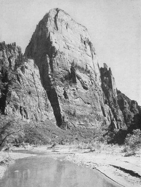
| Figure 20.—The Great White Throne. The Navajo sandstone in Zion National Park, Utah, is 2,280 feet thick. |
Regional features of northern portion.—The central part of the Colorado drainage basin is unique in geologic history, topographic form, and scenic grandeur. Within it are displayed the oldest and youngest rocks exposed on the North American Continent, and the major subdivisions of the geologic time scale are represented in orderly succession. It is a vast expanse of plateaus, terraces, mesas, and cliffs that seem to have an unlimited range in form, size, and color.
Over an area of about 130,000 square miles in Utah, southwestern Colorado, northwestern New Mexico, and northern Arizona, plateaus that rise 5,000 to more than 10,000 feet above sea level are so numerous and prominent that the region well merits the various applied names—the Colorado Plateau province, the plateau province, the Colorado plateaus, or, considered as an areal unit distinct from surrounding regions, the Colorado Plateau. Outstanding features are the widespread Triassic, Jurassic, and Cretaceous strata in approximately horizontal position, the gigantic cliffs and the multitude of canyons that carry the perennial, intermittent, and ephemeral run-off. The sedimentary strata that lie above the meagerly exposed Paleozoic rock extend hundreds of miles with little change in character. They include series of shales 1,400 to 2,200 feet thick, of limestones 1,000 to 1,500 feet thick, of volcanic tuff 6,000 feet thick, and many single beds of sandstone 200 to 1,500 feet thick. In the walls of Zion Canyon the remarkable Navajo sandstone measures 2,280 feet—the thickest unit sedimentary bed so far known. In succession above the strongly predominant sedimentary rock extensive sheets of lava characterize the landscape in widely scattered areas. The edges of both these sedimentary and igneous beds are fully exposed in vertical, unscalable cliffs of seemingly interminable length that advance in headlands and retreat in bays, tower above the adjacent lower lands, and from their crests extend backwards to the bases of similar escarpments. Substantially the rocks in each of the great cliffs are of different geological age and are marked by distinctive colors—Lower Triassic, brown and light red; Upper Triassic, vermilion or brilliantly variegated; Jurassic, uniformly white or red, or regularly banded; Cretaceous, gray; Tertiary, pink, extending up and into white; and, the Tertiary and Recent capping lavas, black.
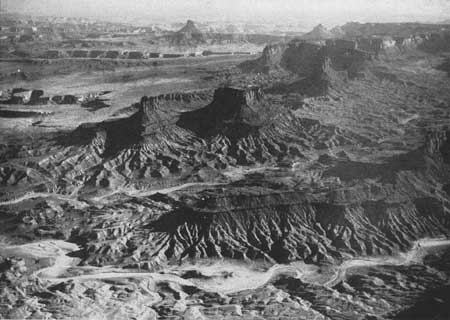
The major features of the plateau topography are so consistent that in distant views the long stretches of even skyline give an impression of extensive flat surfaces that terminate in lines of cliffs. The plateau country in reality is intricately dissected and closer inspection reveals a ruggedness possessed by few if any other regions. Over large areas the canyons are so narrow, so deep, and so thickly interlaced that the region seems made up of gorges, cliffs, and mesas and platforms, intimately associated with a marvelous variety of minor erosion forms. Some of the topographic features are developed on a scale that in other regions would justify the term "mountains." However, the plateau is essentially devoid of high peaks and narrow, serrate ridges. Like a deeply engraved intaglio, its departures from the regional surface are downward rather than upward.
For making a land of canyons, the physiographic conditions in the plateau province are especially favorable. The region lies at high altitudes; its climate is generally arid; its major rock strata are thick, resistant, and lie nearly flat; its longer streams receive abundant water from the adjacent humid Rocky Mountains and are at the stage in their life history where their ability to grind up rock and to transport the resulting debris is greatest. Consequently, innumerable deep, narrow trenches are cut into strata that otherwise remain intact, and the great beds of sandstone and limestone terminate in vertical walls. In striking contrast to the wide open valleys, the graceful slopes, and the rounded hills of most other regions, the topography of the plateau lands is abruptly angular, even in minor details.
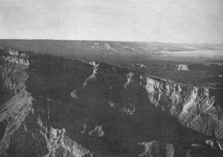
Though the Colorado Plateau is generally floored with horizontal or slightly inclined sedimentary strata, its surface has been roughened in places by folding, faulting, the building of volcanoes, and the intrusion of igneous rocks—geologic activities that have modified the otherwise normal drainage pattern and the orderly development of erosion features. Of the folds, many are merely "rock wrinkles" of slight importance, but the larger upwarps and downwarps have produced elongated domes 90 to 150 miles long and 40 to 75 miles wide that in the present topography stand 1,000 to more than 3,000 feet above the adjacent land. Particularly conspicuous are the mountainous upwarps that brought into existence the isolated Uncompahgre Plateau, the San Rafael Swell, the Kaibab Plateau, and the Waterpocket Fold, the Defiance upwarp, and the Escalante anticline. Most of these folds are steeper on their east sides where, in consequence of erosion, the strata that once overarched them are represented by remnant beds steeply inclined along their flanks. Few features in the plateau are more conspicuous than the upturned strata in the high, rugged hogbacks that characterize the Waterpocket, Comb, Echo, and East Kaibab monoclines. The larger folds, perhaps all the ridge-making folds, in the plateau country are the result of compressive forces directed horizontally from the east and confined to the sedimentary strata. Another type of upwarp in which the strata were raised by the intrusion of igneous rocks—laccoliths is also exceptionally well represented. The lofty Navajo, Henry, Abajo, La Sal, Ute, and Carrizo Mountains, and similar structures in the Rico and La Plata Mountains, are essentially igneous masses that once were completely overlain by sedimentary rocks. In all of them except Navajo Mountain, which retains its cover, erosion has exposed the igneous cores. Similar to the laccolithic mountains in manner of formation are the peculiar faulted domes in the vicinity of the La Sal Mountains, where the strata have been deformed by the intrusion and expansion of masses of salt and gypsum.
|
| Figure 21.—The Colorado Plateau. Like a deeply engraved intaglio, its departures from the regional surface are downward rather than upward. (Air photo) |
|
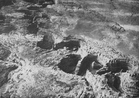
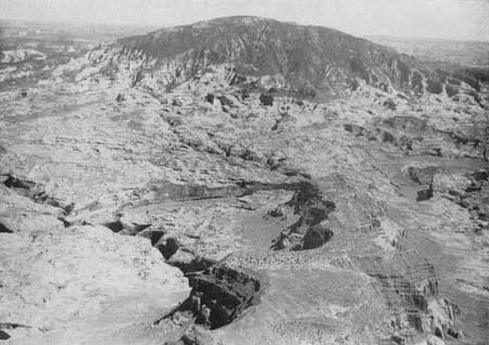
| Figure 22.—Grand Gulch in the Canyon Lands of southeastern Utah. (Air photo) |
|
| Figure 23.—East side of the Kaibab Plateau upwarp. (Air photo) |
|
| Figure 24.—Navajo Mountain. |
In the southwestern part of the plateau province, where conspicuous folds are rare, the strata have been deformed by faults so large in dimensions as to completely remodel the landscape. They have sliced the region into enormous earth blocks, realined streams, and formed cliffs comparable in height and length to the towering escarpments developed by erosion. In roughly parallel position the Paunsaugunt, Sevier, and Hurricane faults, each nearly 200 miles in length, and the shorter Grand Wash fault, extend from south central Utah into Arizona and southward across the Colorado River. Along the east side of these fractures the stratigraphic formations have been raised a few hundred to as much as 7,000 feet above their counterparts on the west. The effects of faulting are typically expressed in the Zion National Monument, where the sharply defined Hurricane Cliffs, produced by the Hurricane fault, separates the flat-lying cultivated plain about New Harmony and Kanarraville from the uninhabitable Kolob Plateau, which stands more than 3,000 feet higher.
The remarkable unevenness of the regional surface produced by great faults has been intensified by the building of volcanoes and the outpouring of lavas during Tertiary and Recent times. Above the general surface of the Uinkaret Plateau in the southern portion of the province more than 150 ash and cinder cones rise to heights of 50 to 500 feet, and the tabular masses of lava that cap Trumbull, Logan, and Emma Mountains rise to heights of 1,000 to 2,000 feet. Similar igneous prominences characterize the adjoining Shivwits Plateau, and cones with attendant lava flows are conspicuous features of the St. George Basin, the Little Creek and the Kolob Terraces, and the valleys of Kanab and Johnson Creeks. Many craters are of such recent origin as to have retained their original features; others are worn to stumps or volcanic necks that, particularly in the Navajo country, rise sheer from the surface as towers of black rock. Likewise, some of the lava fields have been little changed, but others have been cut into fragments and, in the existing topography, are represented by the basaltic cap rock of many mesas and ridges and the thick sheets of andesitic lavas that cover Pine Valley Mountain, the Aquarius Plateau, and Grand Mesa.
Considered as a whole, the land forms that characterize the Colorado Plateau comprise a single physiographic province readily distinguishable from other parts of the North American Continent. However, the component plateaus vary so much in origin, altitude, degree of isolation, and amount of dissection that in geological literature they are classified by groups or sections. Certain areas of special scenic interest have been further segregated as national parks and national monuments.
Plateaus adjoining the Colorado River.—On both sides of the Colorado River from Lake Mead to Grand Junction, Colo., and for many miles along the tributary Green, San Juan, and Little Colorado Rivers, plateau topography is dominant. In the Grand Canyon section the Shivwits, Uinkaret, Kanab, Kaibab, and Coconino Plateaus terminate at the rim of the world's most spectacular gorge. In corresponding positions along Glen Canyon lie the moderately elevated Glen Canyon platform, the Paria, Rainbow, and Grand Gulch Plateaus, and the Kaiparowits Plateau which stands nearly 4,000 feet above the river at its base. The trenchlike Cataract Canyon separates Dark Canyon Plateau from the equally lofty Standing Rock Plateau drained by the Dirty Devil and San Rafael Rivers. Farther upstream the Colorado River is bordered on the north by the Roan Plateau and on the south by the Uncompahgre Plateau and Grand Mesa. In valleys tributary to the Colorado River, plateau topography persists. In Green River Valley, East Tavaputs and West Tavaputs Plateaus, parts of an otherwise continuous highland, are separated only by the profound Gray Canyon; in the San Juan Valley, Grand Gulch and Chaco Plateaus, and the plateau-like Mesa Verde are prominent features; and above the floor of the Little Colorado River, continued as the Rio Puerco, stands the Moenkopi, Manuelito, and Dutton Plateaus. In topographic expression these extensive river-border platforms, which lie at relatively low altitudes, are similar and all are remnants of high-lying lands but, in consequence of crustal deformation and varying stages of erosion, they display rocks of different ages and in somewhat different attitudes. Thus the eastward tilted Shivwits, Uinkaret, and Kanab Plateaus are outlined by faults, and the Kaibab Plateau is a sequence of bowed strata bordered by monoclines. As these four plateaus occupy the area of greatest uplift, and consequently of unusually vigorous erosion, they have been worn down the most—to rocks of Permian age that farther north in the plateau country are exposed only in canyons. The adjacent East Kaibab monocline and, a short distance beyond, the Echo monocline, have so lowered the strata that along Glen Canyon, rocks younger than the Triassic are buried. In fact, throughout the Colorado drainage basin the rocks in most of the plateaus are of Triassic, Jurassic, Cretaceous, or Tertiary age.
The Uncompahgre Plateau, 20 to 30 miles wide and nearly 100 miles long, with summit altitude of 9,000 to 10,000 feet, is a flat-topped anticline in which the core of Pre-Cambrian granite is largely covered by Triassic and Jurassic rocks, which are magnificently displayed in Colorado National Monument. In forming the plateau, the strata of Paleozoic age were stripped away from a former highland mass before younger sediments were deposited. Throughout its life the Uncompahgre seems to have determined the local drainage pattern. On approaching it, streams from the Rocky Mountains and the northern San Juan Mountains are deflected; they follow the edge of the upwarped highland. Even the powerful Colorado, which once made its way through the barrier, has chosen an easier course—a great curve around its north end. Its abandoned runway through the deep, narrow Unaweap Canyon, 53 miles in length, is now an automobile highway. It seems strange that this outstanding illustration of stream adjustment has received so little attention.
Grand Mesa, "the world's largest flat-topped mountain," is an isolated outlier of the Roan Plateau, 50 miles distant across the Colorado. In it the Tertiary and older rocks are preserved by a thick cap of basalt. Its glaciated lake-dotted surface covers an area of 900 square miles at an altitude of 10,300 feet—5,000 feet above the surrounding lowlands. North of it stands the smaller Battlement Mesa—similar in form and geologic history.
Mesa Verde, 250 square miles in area, is a portion of a widespread highland, in essence a promontory extending from the San Juan Mountains, from which it is separated by the broad valleys of the Mancos and Upper Dolores Rivers. In distant view, its surface, at an altitude of 8,000 feet, appears to be smooth and continuous and, in conformity with the dip of the strata, to slope southwestward. In reality the mesa is ragged. Except along its northern edge, it is so elaborately dissected by scores of south-flowing, box-headed canyons and gulches that the interstream spaces are reduced to narrow strips. The whole frayed highland has been likened to a "worm-eaten log." The mesa is surfaced with resistant sandstone about 1,000 feet thick (the Mesa Verde group) and underlain by the easily eroded Mancos shale, 1,800 to 2,000 feet thick, thus providing conditions favorable for the rapid making of great cliffs at the edge of the strata while their surfaces were but slightly abraded. The northern face of the mesa is an escarpment 1,500 to 2,000 feet high. In sequence of geologic events, a regional uplift permitted vigorous erosion of the ancient highlands; the more exposed and the softer rocks were stripped down to the massive sandstones. In late Tertiary times the mean surface was doubtless coextensive with the peneplained surface of the southwestern San Juan and adjacent areas in the plateau province. Renewed uplift and erosion brought the structure to its present form.
The high plateaus of Utah.—Of the 10 great plateaus that dominate the topography of south central Utah, the Pavant, Tushar, and Sevier are drained by westward-flowing streams; the Kaiparowits is the source of streams that go directly to the Colorado River; and the Wasatch, Fish Lake, Awapa, Aquarius, Paunsaugunt, and Markagunt Plateaus, and Pine Valley Mountains contribute water to the Colorado River and at the same time to the Great Basin. The plateaus that face the Colorado River are huge rock masses; nearly level platforms 25 to more than 500 square miles in area and bordered by terraced escarpments 4,000 to 5,000 feet high. From heights of 10,000 to 11,000 feet they overlook the lower series of plateaus along the Colorado River. Though the plateaus are now individual topographic units, it is believed that they once formed a continuous surface and that their present detachment is the result of faulting that has broken their once continuous surface into longitudinal, tilted earth blocks. The Paunsaugunt fault separates the Aquarius from the Paunsaugunt Plateau; the Sevier fault, the Paunsaugunt from the Markagunt; and the Hurricane fault, the Markagunt from the plateau-like Pine Valley Mountains. These long faults deformed all the sedimentary rocks and also the sheets of lava that overlaid them, some of them nearly 3,000 feet thick. This large-scale faulting accompanied by regional uplift introduced the long cycle of erosion still in progress. The Triassic, Jurassic, Cretaceous, and Tertiary rocks that form the stream-scoured fronts of the plateaus are but remnants. Corresponding formations appear south and east of Glen Canyon and doubtless once extended to the foothills of the Rocky Mountains. North of Grand Canyon, Triassic strata have been stripped back 30 to 80 miles, and the rocks of younger age still farther. To an extent not equalled elsewhere, the major erosion has been accomplished by wearing back the faces of cliffs rather than by abrasion and dissection of the plateau tops; erosion is directed against, rather than upon, the exposed strata. Because the individual rock layers differ in thickness and hardness, the protruding edges retreat at different rates, thus developing a zigzag vertical profile in which the resistant rocks appear as escarpments and the softer rocks as flats or gentle slopes. In other words, the plateau fronts are neither continuous nor broken curves: they are successive terraces that follow the contour for nearly 200 miles, and in distant view suggest a stairway whose ascending risers are the Chocolate Cliffs, Vermilion Cliffs, White Cliffs, and Pink Cliffs.
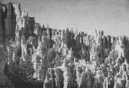
The high plateaus of Utah comprise a landscape famous alike for its esthetic appeal and its geological interest. Their crenelated skyline rims, their elaborately carved frontal escarpments, the canyon walls decorated with arches, bridges, and caves, and the picturesque towers and terraces in their foothill belts—all brightly colored—well merit the term "marvelous." Naturally, the unique landscape has attracted the attention of poets, prose writers, and artists, and its features have been reproduced in countless photographs in color. Each year thousands of persons go to Zion and Bryce Canyon National Parks and Cedar Breaks National Monument to view the spectacular scenery. To the scientist, the region is the most comprehensive text book on Mesozoic history and on processes involved in erosion. Fortunately, the significant features of structure, stratigraphy, and volcanism are fully exposed, and the fascinating story of geological events needs no profound study for interpretation. Few places in the world afford better opportunity to realize the power and persistence of the forces that have shaped the surface of the earth, for though displayed on an enormous scale the rock units show a certain simplicity of mass composition, form, and arrangement that makes their relations clear.
Navajo Country.—The Navajo country, about 25,000 square miles in area, extends from the Little Colorado River eastward across Arizona into New Mexico and from the Rio Puerco northward to the San Juan and Colorado Rivers. Within this large area the landscapes are notably diversified. At its center lies the extensive, little-dissected Black Mesa, from which most of the major drainage passes southward through canyons in the high bordering cliffs and continues across relatively flat lowlands as shallow washes 40 to 60 miles long. East of Black Mesa the dominant topographic features are the up-arched Defiance Plateau and the lofty, narrow, cliff-walled Chuska Mountains, and the isolated Carrizo Mountains, which rise abruptly above the surrounding lowlands. The western part of the Navajo country adjoining the famous Painted Desert is substantially the surface of a chain of low-lying plateaus deeply trenched by the Moenkopi and Navajo Creeks. At the north, overlooking the San Juan and Colorado Rivers, are the Tsegi Mesas—enormous blocks of red sandstone separated by profound canyons—and west of them is the conspicuous Navajo Mountain, whose dome-like summit (altitude 10,416 feet), 7,000 feet above the floor of Glen Canyon, is the highest land within an area of many thousand square miles.
There seems reason to believe that the prominent, detached high-lying sedimentary rocks in the Navajo country are remnants of once widely extensive formations that owe their positions to a regional uplift near the close of the Cretaceous period and that, during Tertiary and Recent times, the landscapes of pre-Tertiary times have been completely remodeled, chiefly by stream erosion. From a former general surface that stood perhaps 9,000 feet above sea level, the region has been worn down to an average altitude of about 5,000 feet, parts of it to less than 4,000 feet, and in consequence nearly all the Tertiary, most of the Cretaceous, large parts of the Jurassic, and some of the Triassic and Permian strata have been swept away. The volcanoes have been reduced to stumps, the lava flows to their feeding dikes, and deep-seated folds have been uncovered. Coincident with the removal of enormous masses of sedimentary and igneous rock, differential erosion has produced prominent topographic inequalities; flat surfaces that end abruptly at the base of terraced escarpments; mesas that rise at various stratigraphic levels above plateau surfaces, and streams that follow roundabout courses, in and out of canyons, across folds and hogbacks, with seeming disregard for rock composition, structure or regional slopes. Continuous vigorous erosion has exposed complete sections of the Permian, Triassic, Jurassic, and Cretaceous rocks and partial sections of the Tertiary and Carboniferous. In fact, the type sections for many Permian and Mesozoic formations are in the Navajo country.
Furthermore, in consequence of regional denudation, igneous rocks, particularly intrusives, are unusually well displayed seemingly extraneous features of a landscape modeled almost wholly in sandstone. Rising abruptly from brightly colored surfaces are countless black spires, serrate ridges, walls, and irregular masses of basaltic rock, agglomerate, and tuff. Within four volcanic fields, or widely dispersed, about 50 volcanic necks, 100 to 700 feet high, and 60 dikes, 10 to 900 feet long, have been mapped. In places, lavas cap mesas and protrude as palisade walls. Of the two huge laccoliths, Carrizo Mountain has been stripped down to its igneous core, but Navajo Mountain retains its original cover of sandstone. Thus the present topography of the Navajo country bears little resemblance to its earlier expression. The once fairly continuous surface is represented by a bewildering array of erosion forms among which the dwindling streams follow their tortuous courses. The outstanding elements of the landscape are mesa, butte, volcanic neck, canyon, and wash repeated indefinitely. Natural bridges, windows, arches, alcoves, cliff caves, and miniature erosion features of great variety and rare beauty stand as ornamental carvings on the larger architectural forms.
|
| Figure 25.—Elaborately carved frontal escarpment, Bryce Canyon National Park, Utah. |
|
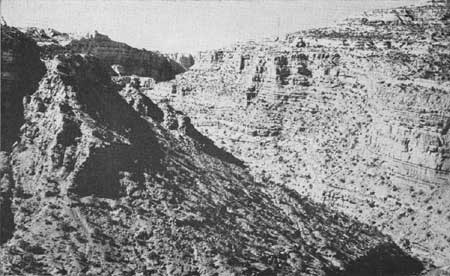
| Figure 26.—Gypsum Canyon at mouth of Fable Valley in the Canyon Lands of southeastern Utah. |
In its structural make-up the Navajo country is a region of rock flexures; the faults are few and of small dimensions. Characteristically northward-trending synclines and anticlines—both broad and narrow domical upwarps, and sharply delineated monoclines follow one another in succession and, in places, overlap or abut against each other. Ten major folds and eight minor folds, in addition to scores of local flexures, have been noted in the region between the Puerco and San Juan Rivers. In origin, most of these structural features are associated with the regional uplift from the Cretaceous sea. For a time they were concealed by the deposition of Tertiary sediments but since they have been exposed to erosion they have governed in various degrees the adjustment of streams and the development of the regional and the local topography. Some of the folds have been widely effective in preserving and obliterating the sedimentary rocks. Thus the central part of the broad de Chelly upwarp has been stripped down to Permian rock but at its eastern edge all of the Mesozoic formations are present in the steep Defiance monocline and extend long distances beyond. The Tusayan downwarp preserves Cretaceous strata that have been removed from surrounding areas. Likewise, the symmetrical Gallup syncline has prevented the destruction of a commercially valuable coal field.
The Navajo country, substantially the Navajo Indian Reservation, is the home of approximately 56,000 Navajo Indians, most of them nomadic sheepmen who follow their flocks from place to place in search of forage and water, and of 3,700 Hopis who occupy ancient villages on mesa tops and derive their support from cultivated crops, chiefly corn. A prehistoric pueblo population is represented by cliff houses, especially well preserved in Canyon de Chelly and Tsegi Valley. The region is known chiefly to professional geologists, archeologists, and graziers. The absence of paved automobile highways and the restrictions imposed by the Bureau of Indian Affairs are deterrents to general travel. Passable roads connect the administration centers but reach few places of special scenic interest. In fact, some areas of considerable size await exploration.
San Juan Basin.—At the eastern edge of the plateau province southward from the foothills of the San Juan Mountains at Durango, Colo., the land surface descends into the San Juan Basin—a topographic and structural depression that occupies about 12,000 square miles of northwestern New Mexico and adjacent parts of Colorado drained by the San Juan River system. The southern part of the basin is floored with nearly flat-lying Cretaceous sandstones, above which rise a few conspicuous mesas capped by rocks of Tertiary age; the northern part by southward and westward dipping Cretaceous sandstones overlain by Tertiary rocks that include shales, conglomerates, sandstones, and as much as 2,000 feet of volcanic debris. The strata in the basin have been deformed by several small folds and faults. The basin is conspicuously walled in on the west by the Hogback Ridge—a huge monocline, in which the Cretaceous beds are abruptly bent downward at angles exceeding 30 degrees. (Plate 13, Sec. 9, in pocket.)
Regional features of southern portion.—As defined in this report, the southern portion of the Colorado Plateau is that area, extending both north and south from the Grand Canyon and southeastward to the Arizona-New Mexico boundary, in which the rock sequence is chiefly of Paleozoic age. The plateau province to the north and east, including both the Navajo country and the canyon region of southern Utah differs from this southern portion chiefly in the character and sequence of the rocks. In both regions strata are flat-lying with the result that the processes of erosion have sculptured innumerable straight-walled canyons, mesas, and tablelands. In the southern area, however, the rocks are of an older group (Paleozoic) than those upstream (Mesozoic) and basic differences in these strata have profoundly affected various aspects of the landscape.
Contrast between physical features of the Grand Canyon district and those of the basin and range province to the south and west is great. The characteristically horizontal strata of the former are in marked contrast to the steeply tilted or much-folded layers of the other. Flat-topped hills and level skylines are replaced by jagged ranges and irregular peaks. Even where the same strata that form the walls of Grand Canyon are represented in mountains to the south and west, features of the landscape are totally different because of differences in rock structures.
The southern portion of the plateau province is divisible into 10 principal sections, separated one from the other by major lines of displacement such as faults or folds. Each section is in reality a block or segment of the earth's crust raised more or less vertically to its particular elevation high above sea level. North of the Colorado River at Grand Canyon are five of these segments or plateaus as shown on Plate 13, Section 10 (in pocket). Two others lie south of Grand Canyon, and an eighth extends southeastward forming the southern margin of the Colorado Plateau in this area. (Pl. 13, Sec. 12, in pocket.) Finally, near the New Mexico-Arizona boundary two additional sections are assigned to this province because of the similar rock types involved, even though the strata are more folded than elsewhere, making dome structures. (Plate 13, Sec. 11, in pocket.)
Within the plateau province and along its borders are areas of varying size, the surface features of which have been formed through the agencies of volcanism. Some of the features are spectacular; all of them have profoundly modified the general appearance and character of the landscape. Because they differ so from other features of the southern plateau district, a separate treatment will be given the volcanic areas.
Plateaus on the north side of Grand Canyon.—The general character and geologic structure of the plateau blocks that form the north wall of Grand Canyon have been well-known since the early surveys made by Powell, Dutton, and others 60 to 70 years ago. The remarkable manner in which great segments of the earth's crust have been elevated along faults or fractures to form a series of steplike platforms, rising from west to east (Pl. 13, Sec. 10, in pocket), has been the subject of much speculation and has greatly influenced the development of ideas concerning the causes of mountain uplift.
Approached from the west along the Colorado River, the plateau province begins in Arizona, not far from the Nevada line, where a great cliff has been formed as a result of vertical movement of the area to the east along the Grand Wash fault. This upraised block is known as the Shivwits Plateau and extends from west to east for 30 miles. Its flat surface terminates abruptly against the face of a cliff formed by the Hurricane fault, and east of this is the higher Uinkaret Plateau. Two other faults, the Toroweap and Kanab, mark the western boundaries of successively higher plateaus still farther to the east. These are the Kanab and Kaibab. Finally the eastern end of the Kaibab Plateau, which has elevations up to 9,000 feet, is reached where the normally flat-lying rock strata are bent steeply downward in a monocline to the low level of the Marble platform. These four great blocks or plateaus form the northern rim of Grand Canyon, which is more than 100 miles long in air-line distance.
The Kaibab Plateau is by far the best known of the areas bordering Grand Canyon on the north. This is partly because it is more accessible and therefore better known than the plateaus farther west, and partly because its higher altitude affords a more attractive summer climate. Significant, however, is the fact that while many of the finest views of Grand Canyon are to be had from points along the margin of the plateau, such views cover only one part of Grand Canyon, whereas many superlative views of other and different parts can be obtained only from the more western areas. Furthermore, though the climate of the Kaibab favors summer recreation, it prohibits any appreciable winter usage, whereas the lower areas to the west can be visited during almost any season.
Geologically each of the plateau blocks is a modified repetition of the next. It is composed of essentially flat-lying strata such as are seen in the walls of Grand Canyon, but varying in proportion and in detailed character so that over many miles the surface expression of the rocks is quite distinct. Thus, the wide, green bench of shale that forms the well-known Tonto platform of eastern Grand Canyon gradually disappears westward, whereas the broad, red esplanade of western Grand Canyon is a negligible feature in the east as a result of the thinness of the Hermit shale there. The significant point, therefore, concerning the Grand Canyon as a great spectacle with unusual inspirational value is that it is distinctly different in different parts, yet large and impressive throughout.
Notable exceptions to the general uniformity in geological features of the plateau are those developed by volcanic activity. In both the Uinkaret and Shivwits divisions, extensive flows of lava and numerous small craters and cinder cones blanket large parts of the surface, thus giving a new character and added interest to the region. In Toroweap Valley on the Uinkaret Plateau, this display of volcanism is especially fine and constitutes an exhibit of exceptional value which has as yet been but little appreciated. The freshness and recency of some flows, the symmetry of many craters, the spectacular manner in which lavas have cascaded over canyon walls, examples of lava dikes leading upward from the depths, and, above all, the complex interrelationship between erosion of the canyon on the one hand, and the piling up of volcanic matter on the other, make this area outstanding as a place for stimulating the mind and furnishing inspiration.
The Hualpai Plateau.—The southwesternmost section of the Colorado Plateau, bounded by the Colorado River on the north, the Grand Wash and Aubrey Cliffs on the west and east, respectively, and the Juniper Mountains on the south, is commonly termed the Hualpai Plateau. The Hualpai Indian Reservation occupies a large part of this area.
In geologic structure the Hualpai Plateau is similar to the adjoining plateaus. It is formed of essentially flat-lying strata of sedimentary rock that have been uplifted as a block or series of blocks along great fault lines that traverse the region with a general north-south trend. The largest of these faults are the Grand Wash and Aubrey, although others of considerable magnitude also cross the region.
The surface of the Hualpai Plateau, about 5,000 feet in elevation, is somewhat lower than that of neighboring plateaus because the several upper most formations in the others have here been stripped away by long erosion. On the other hand, the surface of the Hualpai is everywhere 2,000 to 3,000 feet higher than the desert valleys to the west and south, causing it to have a temperate climate and to be favorable for year-round recreational use.
The geological features of this region are primarily those of the Grand Canyon, which forms its northern boundary. Surface rock over most of the area is massive gray limestone of the uppermost Redwall (Mississippian), although locally beds of red Supai sandstone (Permian) remain above this, and elsewhere Devonian strata have been faulted up to the surface. Where the river has cut through these strata, forming Grand Canyon, there is a drop of about 3,000 feet and the canyon walls have the appearance of being nearly sheer. This accounts for many fine and spectacular views along the rim, as at Quartermaster Canyon and Bridge Canyon in the west and above Granite Park farther east.
Geology of the Hualpai Plateau is similar and related to that of eastern Grand Canyon, yet it is different enough to be worthy of special consideration. In addition to the broad aspects of stratigraphy and structure, there are such special features as Rampart Cave, where prehistoric animals, notably the extinct ground sloth, are buried in great numbers. The green and purple shales at Columbine Falls also contain quantities of well-preserved Cambrian trilobites.
Coconino Plateau.—The Coconino Plateau, extending from Grand Canyon south to the San Franciscan volcanic field (see Pl. 13, Sec. 12, in pocket) and from the Aubrey Cliffs east nearly to the Little Colorado, is the best known of the plateau blocks within the Grand Canyon province. It is composed of essentially flat-lying strata with resistant Kaibab limestone of Permian age forming the surface. Along the eastern margin the strata are folded into a monocline, causing them to dip under more recent rocks of the Painted Desert. Elsewhere in this plateau and along its western margin, strata have been broken by faults of varying magnitude. In general, however, the geologic structure is very simple.
Eastern Grand Canyon, of which the Coconino Plateau forms the southern rim, is the outstanding feature of this area. Included is the most frequently visited and best known portion of Grand Canyon. As part of a national park, its recreational aspects have been carefully studied and partly developed.
Throughout the Coconino Plateau are many minor features of geologic significance some of which, through proper development as places of interest to the visitor, would add to the recreational assets of the area. Included in this category are solution phenomena formed in the surface limestone by rain and snow waters. Examples are the Citidel fissure and Doney fissure northeast of the San Francisco Mountains, Bottomless Pits near Walnut Canyon, and the caverns south of Ashfork. Another type of feature is represented by Grand Falls of the Little Colorado. It is formed where an ancient lava flow blocked the stream course and caused the river to drop over a limestone cliff, making an inspiring sight, especially in flood season. Farther downstream is the canyon of the Little Colorado, remarkable for its proportions. It stands out in a region of canyons as one of the narrowest and most sheer-walled. Excellent views into its depths may be obtained at a few places along the Grand Canyon-Cameron highway, but much more might be done to take advantage of the canyon's inspirational and educational possibilities. Salt Springs near its mouth, where Hopi Indians obtained their main supply of salt for years, is a little-known place of considerable historic interest.
East of the San Francisco Mountains toward Winslow is Meteor Crater—one of the most remarkable features in the United States and one that is internationally known. Today, a preponderance of evidence seems to favor the theory that this pit is the result of impact and explosion of a meteorite from outer space, but whether this be true or, as some scientists have suggested, a volcanic steam explosion was responsible, the crater is unique in character.
The Mogollon Plateau.—The Mogollon Plateau is a southward and a southeastward extension of the Coconino Plateau. These two sub-provinces are similar in geologic structure and age, but are separated by the San Francisco volcanic field. (See Pl. 13, Sec. 12, in pocket.) In both, the surface is formed largely of resistant limestone of Permian age and the strata are essentially horizontal, being disturbed only by a few breaks or normal faults and by monoclinal folds. The Mogollon Plateau ends abruptly on the south and west where high escarpments form what is known as "the Rim." Beyond this, low valleys give a very different aspect to the country.
Most of the Mogollon Plateau is covered with forests which, together with the cool summer climate, make it favorable for recreational development. Springs are not abundant but are scattered throughout the area. Relatively small, but narrow and attractive little canyons such as Chevelon, Black, Clear Creek, and others, dissect its surface. Cutting back into it from the adjoining valleys to the south and especially to the west are some large and colorful canyons that are very scenic. One of these—Oak Creek Canyon—is readily accessible by a main road and is a very popular resort area offering fishing, swimming, and exceptional scenery. Some of the others, such as Beaver Creek and Fossil Creek, are attractive and interesting, but less known.
Of special geologic significance in the Mogollon Plateau area are coal deposits located in the eastern part of the area near to the rim, and "the Sinks" which are to the north of this area. "The Sinks" consist of 30 or 40 bowl-shaped depressions in limestone, ranging from a few yards to about one hundred yards in diameter, formed by the solution work of water. Lesser features of interest are the spectacular dikes of black lava that extend through red sandstone in the walls of Oak Creek Canyon and the examples of columnar jointing in lava at the head of this canyon.
Defiance Plateau.—Immediately west of the Arizona-New Mexico line from the vicinity of Houck on Highway 66 almost to the border of southern Utah is an upwarped area named the Defiance Plateau. Strata of Paleozoic and earlier age, comparable to those on the Mogollon and Coconino Plateaus to the south and west, appear here at the surface, folded into a large anticline along a north-south axis. (See Plate 13, Sec. 11, in pocket.) Near the center of the fold, in Quartzite Canyon, very ancient quartzites project through the red shales and sandstone, showing that for vast ages an old land mass remained in this area while seas came and went around its borders.
The magnitude of the uplift, together with the massive character of the sandstone involved, resulted in the erosion of numerous deep and spectacular canyons in the flanks of the anticline. Most notable are Canyons de Chelly and del Muerto, although lesser canyons such as Nazlini are also colorful. From a geological standpoint these and related features of erosion compete with the antiquity and history of the quartzite core for major interest.
Southwest of Fort Defiance is a natural bridge of spectacular character carved in the red de Chelly sandstone. It is one of many scenic features sculptured by erosion along the flanks of this plateau.
Zuni Mountains.—The Zuni Mountains of New Mexico are interesting geologically because they represent an uplifted area the surface features of which have been considerably modified through erosion. Structurally the area is similar to the Defiance Plateau to the northwest in Arizona in that there is a massive core of very ancient rock flanked by younger strata. In the Zunis, granite forms the core and red sandstone of Permian age has been deposited around the margins. This structure is significant from the standpoint of historical geology for it represents a positive area or region that stood above sea level during millions of years (Paleozoic) while marine waters from several directions periodically advanced toward and retreated from it.
EASTERN BORDER LANDS OF COLORADO
PLATEAU
The Green River Basin, the Uinta Mountain region, and the Colorado Plateau, which constitute by far the greatest and most characteristic part of the vast region drained by the Colorado River north of central Arizona, are relatively simple in topographic expression, physiographic expression, and physiographic history. Bordering this central region on the east and still within the Colorado drainage basin is a belt of unusual topography developed on rock complex in structure, composition, and relationship. Particularly noteworthy are the lands along the Upper Colorado, the Gunnison Valley, and the San Juan Mountains.
Upper Colorado River Valley.—In geologic make-up, scenery, and recreational resources, the valley of the Colorado River in north central Colorado is totally unlike its expression elsewhere. The landscape is that characteristic of the Rocky Mountains rather than of the plateau country. In the place of flat lands, vertically walled canyons, and cliff-bound mesas and plateaus, fairly simple and regular in topographic form and stratigraphic details, there is an aggregation of saw-toothed ridges, ragged peaks, abraded highlands, glacial cirques, and flat-floored "parks" whose origin and interrelations are difficult to interpret. The Upper Colorado and its tributaries flow in a succession of wide and narrow canyons and valleys with flaring sides, over plains, across anticlines, synclines, and faults, and from place to place trench schists, lavas, sedimentary rocks, and alluvium of varied composition and attitude. The larger tributaries have cut their way far into the granite core rocks along the Continental Divide—past the axis of the Rocky Mountain uplift—and thus bring into the Colorado drainage basin most of the water that falls on the lofty, glaciated Park Range, Gore Mountains, and the Sawatch Range, which culminate in the highest peaks of the Rockies. In the Sawatch Range about 25 peaks exceed 13,000 feet, and 10 exceed 15,000 feet. The Roaring Fork has cut from the granitic Sawatch mass the equally high Elk Mountains—a much deformed anticline of Carboniferous rocks—into which many dikes and sheets of igneous rock have been intruded. Because developed in rocks of different hardness, attitude, and stratigraphic sequence—flat lying and tilted sandstone, limestone, shale, and lavas—the remarkably sinuous streams flow swiftly between close-set vertical rock walls, between slopes gashed by ravines, or meander leisurely across wide alluvial flats. A traverse of Eagle River, the Roaring Fork, or the Colorado above the brightly colored canyon at Glenwood Springs reveals a succession of fascinating vistas, tumbling waters, quiet waters, pasture land, grain fields, farmhouses, and above the valley walls, snow capped mountains.
An outstanding feature of the Upper Colorado Valley is the White River Plateau, about 40 miles in diameter and 10,000 to 12,000 feet above sea level (Pl. 13, Sec. 6, in pocket) a flat-topped highland bordered by steep slopes and structurally an uplifted mass in which the deformation of its component strata is restricted to its rims. At its western edge the Grand Hogback, composed of thick Cretaceous and thinner Jurassic and Triassic strata with dips as great as 30 degrees, emerges from the adjacent Tertiary floor and stands as prominent ridges, 600 to 1,000 feet high. From the hogback across the plateau top, nearly horizontal Paleozoic rocks form the surface, and at their eastern limit are overlapped by steeply tilted Mesozoic beds, the remnants of strata that once overarched the plateau and joined those in the Grand Hogback. To attain their position and altitude, the sedimentary rocks inside the tilted borders of the plateau must have been uplifted en masse as much as 14,000 feet (early Tertiary time), then stripped down to a somewhat uneven surface over which lava in extensive sheets was poured out (Quaternary time). At the present time the plateau is a single topographic unit, the source of streams that flow to the Yampa, the White, and the Colorado, but as a regional structure once extended southwestward across the Colorado River, Eagle River, and Roaring Fork. Its major characteristic features in modified form are represented in Red Table Mountain and adjacent lava-capped mesas and its western terminus, the Grand Hogback, is traceable for 80 miles.
Gunnison Valley.—South of the Elk Mountains the landscape presents features not represented elsewhere along the eastern edge of the Colorado drainage basin. Above a general surface, developed on Cretaceous rocks at an average altitude of about 8,500 feet, rise low domes of metamorphic and igneous rocks—the uneroded remnants of a former peneplain. In the West Elk Mountains, masses of intrusive porphyry culminate in isolated peaks that rise as much as 1,500 feet above the upturned edges of the strata that once arched over them. The dominating surface features are thick, widespread accumulations of volcanic breccia and tuff—in one area continuously covering about 400 square miles—and extensive sheets of rhyolitic and andesitic lavas. Into the regional surface the Gunnison and its tributaries have sunk deep runways by cutting through sedimentary, igneous, and metamorphic rocks down to porphyritic granite.
The present scenic features of the Gunnison Valley record merely the last event in the long geologic history of the Rocky Mountains and the Colorado plateaus. In Cretaceous times the region was covered by the sea, in which sediments of great thickness accumulated, then near the beginning of Tertiary time was uplifted as a great arch the ancestral Rocky Mountains. During the long period of erosion that followed, the sedimentary rocks that once were continuous across its surface were stripped away, down to the core of the schist and granite, leaving an erosion surface of moderate relief; a broad belt that extends from the Sawatch Range westward about 70 miles, and southward merges with the foothill slopes of the San Juan Mountains. The latest major movement of the earth's crust was upward and brought the Sawatch Range and its bordering lands along the Gunnison to their present lofty position, and perhaps coincident with the uplift the newly exposed surface was flooded with lavas or buried beneath volcanic tuffs. Then followed a period of erosion whose length is the life span of the present-day streams. The progress of the streams in developing valleys and cutting channels in rocks of various types is faithfully recorded by the Gunnison River. For about 100 miles of its upper course (Tomichi Creek) the river occupies alternately shallow canyons in intrusive granite and open valleys in less-resistant Cretaceous and Jurassic rocks. Farther down it flows between vertical walls of dark-colored contorted schists and gneisses through the spectacular Black Canyon, 1,700 to 2,400 feet deep and in places not more than 50 feet wide at the bottom. The Pre-Cambrian rock in the canyon walls terminates abruptly at an eroded surface above which stratified rocks of Upper Cretaceous age form slopes. The division line between these unlike rock masses represents a hiatus in the geologic time scale of an estimated 400,000,000 years. That the Gunnison is a superposed stream that has persisted in the course established on a surface high above its present walls is shown by its entrenched meanders and its topographic position. It has continued to cut its path across highlands through hard Archean schists, seemingly ignoring the soft rocks in the adjacent, downfaulted lowlands.
San Juan Mountains.—The dominating topographic feature of southwestern Colorado is the San Juan Mountains, which lie athwart the Continental Divide and cover an area of about 6,500 square miles. (Pl. 13, Sec. 8, in pocket.) The western part of this lofty-peak-studded mass lies within the Colorado drainage basin and is the gathering ground for the waters carried northward directly to the Colorado by the Uncompahgre, San Miguel, and Dolores Rivers, and southward by the La Plata, Animas, Los Pinos, and Piedra Rivers which reach the Colorado River by way of the San Juan. Through the escarpment that walls in the mountains, these streams descend precipitously to the adjacent plateau lands. The average altitude of the main mountain mass including the western San Juan Mountains, the north-trending Cimarron and Mount Sneffels spurs, the Needles Mountains, and the somewhat isolated San Miguel Mountains is about 11,500 feet. Scores of peaks rise to heights of 13;000 feet, 13 exceed 14,000 feet, and the canyon floors lie 4,000 to 6,000 feet below the adjacent summits. The mountains consist almost entirely of Tertiary volcanic rocks; lavas, stratified tuffs, agglomerates, and breccias, 5,000 to 9,000 feet in thickness, with which are associated igneous intrusives. Mesozoic and Paleozoic formations are exposed in the deeper canyons, and along the edges of the mountain mass they appear in sequence beneath the volcanic cap, and dip north, west and south, and within short distances from the mountain center assume a horizontal position.
Compared with adjacent regions, the San Juan Mountains are a deeply, though not intricately, dissected rock-surfaced plateau in which the forms of many peaks, ridges, and canyons have been modified by glacial erosion. Their present features record merely the latest major event in a long, complex geological history. As revealed by the composition and arrangement of the exposed rocks, an enormous basal mass of Pre-Cambrian and Cambrian schists, porphyries, and quartzite was worn down, then overlaid by Paleozoic sediments 2,000 to 4,500 feet thick—most of them deposited in a sea. Near the close of Paleozoic time the strata were folded, broken, locally uplifted, and then eroded to a surface of small relief, upon which were accumulated sediments of Mesozoic age to an estimated thickness of about 6,000 feet. Near the close of the Cretaceous period, when much of the region was below sea level, areal disturbances in the earth's crust, accompanied by volcanic activity, pushed the strata upward as a broad dome—the ancestral San Juan—far higher than the existing mountains. The uplift continued into early Tertiary time, attaining altitudes that permitted glaciation—a very rare episode in Pre-Pleistocene geologic history. Erosion also continued until the highland mass was reduced to a roughly level surface. Then followed the deposition of great beds of tuff and lava, for which the region is famous. With the cessation of volcanic activity, stream erosion once more became the dominant geologic force. On the widely spread volcanic rocks, streams tributary to the Colorado established their courses and renewed uplifts so increased their power that by the end of the Tertiary era the irregular mountain mass had been reduced to the San Juan peneplain, a generally even, regional surface above which rose residual peaks. Later uplifts introduced the present cycle of erosion, during which the extensive peneplain has been trenched by great canyons and its summit and edges modified in form. Even during Quaternary time the San Juan region has been subjected to almost continuous crustal warping, and sculpturing by vigorous streams has been interrupted only when the region was mantled by ice. During the Pleistocene epoch, except for the high peaks which doubtless were covered by snow, the summit lands were buried by ice to depths of 500 to 1,000 feet, and more than 30 ice streams 5 to 50 miles long flowed down the valleys to the mountain base. The effects of glaciation, repeated three times, are everywhere plainly recorded in ice-scoured surfaces, cirques, widened valleys, moraines, outwash plains, and scores of lakes. Durango, La Plata, Silverton, Ouray, Ridgeway, and several other villages are situated on glacial debris. Furthermore, the steepening of valley walls by glacial scour in conjunction with heavy rainfall has provided conditions exceptionally favorable for the transport of material en masse. In the San Juan Mountains more than 300 landslides, 100 rock streams, and many mud flows and soil creeps have been mapped; masses of moving debris that cover 1/2 to 2 square miles, extend up canyon walls to heights of 1,000 to 2,600 feet above the stream beds and some distance down valley—the Slumgullion flow for 6 miles.
Though the picturesque erosion forms characteristic of the plateau province are lacking, the San Juan landscape is truly magnificent. The grandeur of the desolate summit lands—bare rock flats, huge domes, lofty pyramids and needles—is matched by the majesty of the gigantic canyons. For the scientist the region has special interest. It reveals chapters in geological history and displays physiographic features not duplicated elsewhere. Here the whole story of glaciation is easy to read, and such features as the great rock streams and mud flows are fully displayed.
WESTERN BORDER LANDS OF COLORADO
PLATEAU
In topographic expression, the western border of the Colorado drainage basin is radically unlike the eastern border. In contrast with large eastern tributaries to the Colorado River, which generally rise along mountain crests at the Continental Divide and flow across Pre-Cambrian granite and Paleozoic rock, most of the western tributaries are short, carry little water, and occupy channels cut in sedimentary rocks of Mesozoic and Tertiary age. Along the Wyoming-Idaho boundary and in the Uinta Mountains some streams rise in highland valleys, but in Utah most of them originate on plateau escarpments, and in Nevada on flat lands or the slopes of scattered mountains. Across the tops of the high plateaus the drainage divide between the Colorado Basin and the Great Interior Basin is difficult to trace, and even more difficult where it lies on the slopes of Pine Valley, Snake, and Sheep Mountains, and crosses Charleston and New York Mountains. Southeastern Nevada is part of the Colorado drainage system with topographic features characteristic of the basin and range province.
In the area drained by the Virgin River, some of the little-known faulted mountainous masses are composed of Paleozoic rock; some, like Beaverdam and Virgin Mountains, of Pre-Cambrian schists overlaid by Paleozoic strata; and others, like the Muddy and Spring Mountains, of thick Paleozoic and equally thick Mesozoic formations. The character of this region is described in the section of this report concerning the basin and range province.
ARIZONA MOUNTAIN PROVINCE
This province, as described in this report, refers to the area along the south margin of the Colorado Plateau occupied by certain outliers which structurally resemble the plateau but which appear very different because they are eroded into rugged mountains.
Like the Grand Canyon province, this province is formed of large upraised crustal blocks or segments. Here, however, the rocks forming the surface are not flat-lying sedimentary types of Paleozoic age as at Grand Canyon, but granite and metamorphic rocks of earlier age. The result is that erosion has sculptured them into forms very different from the characteristic mesas and buttes of the plateau. Outstanding examples of these outliers are the granite masses around Prescott, Ariz., the Mazatzal and the Sierra Ancha Mountains. Between these are some large valleys, including those of the Verde River and Tonto Creek, which have distinctive character and are of exceptional interest from a geologic standpoint.
Prescott Area.—The mountainous region about the town of Prescott, in central Arizona, is largely composed of granite. It weathers into rugged hills and irregular surfaces that are in marked contrast to topographic features of the plateau area farther north. This granitic area extends eastward to the Verde Valley, north to Chino Valley, west to the Aquarius Cliffs, and south as far as Yarnall Hill. Lavas cover and conceal the granite across some rather extensive portions of the region, locally modifying the general appearance of the area. For the most part, however, the vast granite mass dominates the landscape.
Along the eastern borders of the Prescott Mountain area, faulted blocks, formed of sedimentary strata resting on granite, are preserved, indicating that this entire region once was covered with strata such as now form the plateau province. An enormous amount of erosion, therefore, must have stripped away the overlying sediments here, leaving the great granite core to form the present land surface. Peculiar rock forms resulting from this erosion, as illustrated by the Granite Dells, are among the most interesting features of the area.
From a geologic standpoint, the most significant elements of the Prescott area are those that have to do with ore deposits. Great ore bodies have been brought up by faulting, especially along the border areas, and many mines have been developed in this region as a consequence.
Mazatzal and Sierra Ancha Mountains.—South of the Mogollon Plateau and east of the Verde Valley is a portion of central Arizona that differs geologically from other parts of the State. It consists of two great mountain blocks—the Sierra Anchas on the east and the Mazatzals on the west—separated by the Tonto Basin. The ranges which extend for many miles along north-south axes are eroded into jagged, irregular skylines, resembling the mountains of the basin and range province to the south. Structurally, however, they appear to be more closely related to the plateau, having been raised vertically as great blocks, the upper parts of which were long ago removed by erosion. Very ancient quartzites (Algonkian) form the present mountain summits, whereas in the plateau to the north, rocks of corresponding age, if they occur at all, lie buried at great depths.
The height of the mountains (Aztec Peak in the Sierra Anchas, 7,400 feet), the abrupt rise above the surrounding valley floors, and the ruggedness of the terrain combine to make the Sierra Ancha Mazatzal Mountain area one of the wildest, least accessible parts of Arizona. Vegetation is dense over wide areas and wildlife is abundant. In general, this area is one of the most favorable places for recreational development of the type that involves hunting, camping, and hiking.
Among features of outstanding geologic interest in this area are the asbestos deposits high in the Sierra Ancha Mountains. They appear as a conspicuous white line when seen from a distance. Similar asbestos deposits are found in other parts of this area, notably in Salt River Canyon.
Between the Sierra Ancha and Mazatzal Mountains, near the town of Payson, Ariz., is a natural bridge which has been developed in limestone through the work of solution. It is large enough to have a small orchard on top and should attract considerable interest.
Verde Valley.—The walled-in Verde Valley differs in physiographic character from other large valleys in Arizona, yet it is one of the most delightful because of the large permanent stream flowing down its length. On three sides the valley is enclosed by cliffs forming the margins of upraised blocks of the Colorado Plateau. Details of geologic structure have not yet been determined in this area, but a series of great vertical faults apparently controlled its early development. Erosion has since greatly modified the escarpments on each side and partly obliterated evidence of the crustal movements involved. Lavas formed a dam across the river in one place and extensive deposits of limestone are the result of deposition in a very large lake that once covered much of the valley. Because of this complex history, many geologic features of unusual interest are represented in the Verde Valley.
Unlike the dry plateau country of northern Arizona or the mountain ranges to the south, Verde Valley is destined, both because of its character and location, to be developed as an important source of water and of agricultural produce. Among the best known features of this area deserving consideration and more study are Verde Hot Springs, Soda Springs, fossil tracks of lions and other prehistoric mammals, salt deposits and prehistoric salt mines, and lake deposits with mollusks.
RECENT VOLCANIC AREAS
Within and along the borders of the Colorado Plateau are several areas of geologically recent volcanic activity which have so modified both the appearance and the character of the country as to merit special treatment in this report. Although underlain by normal strata of the plateau type, lavas, cinder cones, and strata volcanoes have covered and masked the sedimentary rocks, thus obscuring the original topographic forms. Outstanding examples of such areas are the San Francisco Mountains and the White Mountains. A lesser example is found in the Mount Trumbull region.
San Franciscan volcanic field.—One of the largest, most spectacular, and probably the most interesting geologically, of the volcanic fields within the Colorado River watershed is that developed about San Francisco Mountain in the central part of Northern Arizona (Pl. 3, in pocket). This lava field covers an area of approximately 3,000 square miles. In addition, several hundred small cinder cones are scattered over this surface, and a series of five large strato-volcanoes form a row from east to west, dominating the landscape. San Francisco Mountain, the largest of the volcanoes, reaches an elevation of 12,611 feet above sea level or about 5,000 feet above the plateau surface.
The age of the various volcanic features in this area varies considerably, for the results of three distinct periods of activity can be recognized. The oldest of these, which was a time when very extensive basic lava flows poured forth on the surface of the plateau, dates back at least a million years (Pliocene). During the middle period the high peaks were formed of more viscous lavas. The last period, like the first, was featured by vast sheets of basalt spreading over the surface and by the development of small cinder cones, but it is most notable because of its recency. One cone, Sunset Crater, is less than a thousand years old.
The diversity of features represented and the excellent state of their preservation due to recency of origin combine to make this an outstanding area for illustrating volcanic phenomena. Most of these features are well known to scientists through the works of Robinson and Colton; some of them are familiar to the general public through the educational programs of the National Park Service and U. S. Forest Service, the agencies which control a large part of the area. Still, much remains to be learned about the various features and only a beginning has been made in utilization of the recreational possibilities of this area.
Features of special geological interest in the San Franciscan volcanic field, having potential value from an educational and inspirational standpoint, range from entire mountains that illustrate the results of remarkable or unusual processes to small detailed structures or products incidental to the volcanism. In the former category are Slate Mountain and Marble Mountain, which are excellent examples of semi-laccoliths small hills due to the partial doming up of once flat-lying layers of sedimentary rocks through the force of molten material being introduced from below. The structure in these hills is easy to see and presents an impressive story when understood, especially in Slate Mountain, where a road affording spectacular views makes many of the features readily accessible.
Sunset Crater, a recent cinder cone preserved as a national monument, already has received recognition as an outstanding natural feature, though only a beginning has been made in presenting its story so that the layman can see and understand it. Another cinder cone of unusual interest, and one that is little-known, is Red Mountain. Erosion has cut away the north side of this cone, clearly exposing to view the sloping layers of bright red cinders, thus demonstrating the manner in which it has been built up.
Among features of special interest on San Francisco Mountain are evidences of glacial activity including moraines and outwash plains, areas of obsidian or volcanic glass, and plugs or necks showing where molten material came up through the interior at several different times. Features of the adjoining volcanic field that deserve mention because of their unusual character are the "squeeze ups" and ice cave near Sunset Crater, the large lava tube known as Government Cave, and the Grand Falls of the Little Colorado formed by a lava dam.
White Mountain volcanic field.—Along the southeastern margin of the Colorado Plateau in Arizona, east of longitude 110°, the plateau surface and much of the area to the south is thickly mantled with volcanic rocks of relatively late geologic age. The highest elevations are reached at such important centers of eruption as Ord Peak and Mount Baldy, around 11,000 feet. Southward from here, the volcanic field includes the Blue Range and extends to the vicinity of Clifton and Morenci. Eastward, it goes far into New Mexico, while in the west, many lava flows extend down into the Apache Indian Reservation, especially in the area east of Eagle Creek and north of the Gila River, on the Natanes Plateau south of the Salt River, and down Forestdale Creek farther north.
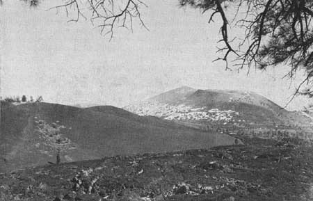
|
| Figure 27.—Sunset Crater in Arizona. |
The mantle of igneous rock forming this volcanic field varies greatly in thickness and in composition, and rests upon different types of surface from place to place throughout the region. Along the northern margin between Springerville and Snowflake, it consists of only a few relatively recent, flat-lying flows of basalt with small, partly-weathered cinder cones superimposed. Farther south toward Alpine, the volcanic series is much thicker and includes many deposits of soft tuff, but cinder cones are lacking. South of this area, where the scenic Coronado Trail reaches its highest elevations, deep canyons dissect the mountains and show that the landscape is formed of a great number of flat-lying basaltic flows with a total thickness of thousands of feet. Such vast outpourings of lava are unexcelled elsewhere in this region and represent a truly impressive volcanic history.
Along the Coronado Trail south of Rose Peak, the volcanic rocks exposed to view are largely silicic or intermediate in composition, in contrast to the basic types farther north, and they are much folded and faulted. Furthermore, these lavas probably are considerably older than the basalts and at one time were covered by a southward extension of the basic lavas. Westward from this area across the great valley of Eagle Creek, the products of volcanism cover the surface for many thousands of square miles. Flat-lying sheets of relatively recent basalt, locally with beds of tuff, cover all of the Natanes Plateau and the area northward.
Examination of the volcanic rocks along the western margin of the field, that is, in the San Carlos and Fort Apache Indian Reservations, shows that strata of sedimentary rocks upon which the lavas rest are progressively younger and higher in altitude from south to north. In all of this area the underlying formations remain in a nearly horizontal position, having been uplifted vertically as in the Grand Canyon area. Near San Carlos, however, the basalts rest on a surface of Mississippian limestone. Near Fort Apache and White River the black lavas are on red Supai sandstone, and far to the north they are underlain by Permian limestone and later formations typical of the Grand Canyon and Navajo countries.
Geologic features of this volcanic field that have outstanding scenic interest include the deep canyons eroded by the Black and the White Rivers, the narrow gorge of the Blue River, and the black volcanic necks or plugs that rise spectacularly above the red sandstone east of Fort Apache and once served as feeders to lava flows long since removed.
Uinkaret and Shivwits Plateau volcanic fields.—The two westernmost plateau blocks north of Grand Canyon, known as the Uinkaret and Shivwits, are centers of relatively recent volcanic activity. Although these volcanic fields are small beside the San Franciscan and White Mountain fields to the southeast, they contain many elements of interest, especially in areas where the lavas and craters are in proximity to the rim of Grand Canyon. The outstanding features of these areas are discussed in this report, in the section on "Plateaus on north side of Grand Canyon."
BASIN AND RANGE PROVINCE
The term "basin and range" is applied to a type of country formed of long, usually parallel, mountain ranges separated by flat alluvial plains which are the result of mud, sand, and gravel filling former intervening valleys of considerable depth. West and south of the great plateau is a vast, low desert region, traversed by the lower part of the Colorado River and drained by its tributaries such as the Gila and Salt Rivers. Geologically speaking, this is but a part of the entire area commonly designated as the basin and range province, which includes the interior drainage of the Great Basin and parts of certain other watersheds.
Mountain ranges within the basin and range province are of many types whether classed according to structure or rock character. Most of them trend from northwest to southeast, though there are notable exceptions. Some of them are composed largely of stratified sedimentary rocks, some are granitic or metamorphic masses, and still others are dominantly of recent volcanic rock. A majority contain combinations of these materials. Certain of the ranges owe their present positions to the simple tilting of strata along nearly vertical fault planes, whereas others are the result of folding, overthrusting, or complex combinations of these processes. Various parts of the province can be classified and grouped in a rough way according to these characteristics. The treatment in this report follows such natural groups.
The principal subdivisions of the basin and range province as recognized here are (1) the sedimentary ranges of the Arizona-Nevada corner; (2) the desert ranges south of Lake Mead; (3) the east-west trending ranges of middle western Arizona; (4) the southeastern Arizona ranges; (5) the southwestern Arizona ranges; and (6) the Colorado River delta, and Salton sink area.
Arizona-Nevada corner.—That portion of the basin and range province that includes the southern part of Nevada, northwestern Arizona, and southwestern Utah differs from neighboring parts of the province in the Colorado River drainage in that most of its ranges are formed largely of the same sedimentary strata found in the adjoining Colorado Plateau. These ranges, in general, have a north-south trend, but they differ considerably in structure. Some are relatively simple, being formed by the tilting of rock layers through movement along normal faults, but others are extremely complex and involve folding, thrust faulting, and several stages of normal faulting.
The Muddy Mountains and the Spring Mountains represent the more complex types. Over-thrusting of rock strata on a huge scale is especially well illustrated and easy to see in the Muddy Mountains and might well be featured as an educational exhibit. Folding, compound normal and reverse faults forming wedges of strata, and examples of rock replacement near faults can be well illustrated in both ranges.
Examples of mountains developed with simple structure are the ranges through which have been carved Iceberg and Grand Wash Canyons on Lake Mead. These are particularly good illustrations of the effects of crustal disturbances, both because of the spectacular character of the ranges and because of their easy accessibility by boat. They also offer unusually good opportunities for illustrating to the layman the basic geologic principles involved in contrasting types of deposition, cyclic sedimentation, and differential erosion, all of which are shown especially well by the colorful beds forming the walls of these canyons.
Other ranges in this area which are relatively simple in structure, and therefore easy to understand, are the Frenchman, the Virgin, and the Beaver Dam Mountains. Steeply tilted layers of rock are readily apparent in all of these and usually attract the attention of the visitor. The Frenchman Mountains as seen from the air near Las Vegas Airport are especially striking.
In addition to large-scale structural features of the mountain ranges, this portion of the basin and range province contains an abundance of other geological features having interest and significance, many of which should be considered in developing a recreational program. Among these are (1) Gypsum Cave, Nev., where traces of early man were found associated with remains of extinct animals; (2) extensive lake deposits resting high above Lake Mead and illustrating clearly the former presence of a large natural lake in this area; (3) dikes of volcanic rock intruded into other rocks as illustrated especially well by the black dike in gravels by the highway south of Hoover Dam; (4) excellent illustrations of angular unconformities to be found in several places along Lake Mead and elsewhere in the region; (5) erosional controls in forming spectacular mesas of gravel as shown by the Temple, Napoleon's Tomb, and other hills near Lake Mead; (6) the remarkable erosional features developed in red sandstone at the Valley of Fire; and (7) deposits containing mammoth remains east of Las Vegas.
Desert ranges south of Lake Mead.—A large section of the basin and range province in northwestern Arizona contains north-south trending mountains composed partly of very ancient crystalline rocks and partly of geologically young (Tertiary) volcanic rocks in varying proportions. Sedimentary strata are absent. This type of desert topography extends over a large area from Lake Mead on the north to the vicinity of Topock on the south; from the Grand Wash Cliffs on the east to and beyond the Colorado River on the west. It is a region of rugged mountain ranges with mining operations in many places.
The Black Mountains are the largest desert range in this area. They are 100 miles long and reach heights of more than 5,000 feet at Mount Perkins and Mount Wilson. At their northern end, where they are cut through by the Colorado River, Hoover Dam has been constructed. From this locality southward, the range is paralleled on the west by the Colorado. Perhaps the most unusual element of the entire range is Fortification Hill a lava-capped mesa of light-colored fanglomerate, near Hoover Damn.
East of Black Mountains, across Detrital Valley, are three other prominent ranges of somewhat similar character. From north to south, they are the White, Cerbat, and Hualpai Mountains. The last named is the largest and highest, reaching an altitude of about 7,500 feet, and has an abrupt western front caused by a large fault. Already, advantage has been taken of the summit's cool climate and good views with the development of a county recreational area.
The broad geologic features are simple in most parts of this area where many flows of black basalt may be seen, one upon another or resting on an old eroded surface of granite and schist. On the other hand, details of structure in the older rocks are difficult to work out for they are much altered by metamorphism and intrusion. The region as a whole is inhospitable both because of the very hot summer climate and because of the barrenness of most of the ranges. Some geological features, such as a prominent lava dike that cuts through gravels along the highway to Hoover Dam, might be made interesting to visitors, but opportunities are limited.
East-west trending ranges of middle western Arizona.—In contrast to the north-south trend of most mountains throughout the basin and range province, those ranges forming a belt across middle western Arizona are oriented in an east-west direction. These mountains are largely of very ancient crystalline rocks, although some also contain remnants of sedimentary strata of Paleozoic age. Furthermore, late basalts are common in places. Most of these ranges have complex structure, resulting from a long history of crustal disturbances. Extensive overthrusting of great mountain blocks has been recognized in various localities.
Prominent among the east-west trending ranges of western Arizona are the Buckskin, Harquahala, and Huarcuvar Mountains in Yuma County, and the Vulture Mountains in Maricopa County. All of these are typical desert ranges of considerable interest from the standpoint of geologic structure and mineral wealth. The structure is very complex but in other respects there is nothing outstanding about the mountains. In general, they are relatively low in altitude.
The Mohave Mountains in southern Mohave County probably also should be included in this group. The western part of these mountains is formed of volcanic rocks and in them the "Needles"—irregular pinnacles of erosion near the Colorado River have been carved.
Southeastern Arizona ranges.—Satisfactory generalizations concerning the many mountain ranges of central and southern Arizona are difficult to make. These mountains have in common a general north-south or north-west-southeast trend and most of them rise abruptly to considerable altitudes from the low, flat, alluvial plains of the desert. A majority are composed chiefly of sedimentary strata that are steeply tilted, but there are notable exceptions. The Santa Catalinas, as exposed today, are mostly metamorphic. The Galiuro and some others are largely volcanic.
Each separate mountain range has a distinct and, in most cases, complicated structural history. Some involve folding, and some have their fronts raised along huge normal faults. Cross faults may or may not be present, and overthrusts are responsible for some of the ranges. In brief, a description of these ranges, adequate to illustrate the origin of each, would require a series of individual treatments and, in many instances, sufficient information is not yet available.
The more prominent of the mountains in this region are the Pinal, Mescal, Dripping Springs, Apache, Santa Catalina, Santa Rita, Wetstone, and Huachuca. Mining operations are, or have been, active in a majority of these. Other types of development are negligible except in the foothills and most development is handicapped by the general lack of permanent water.
Of the more prominent scenic attractions are such high peaks as Mount Graham (10,100 feet), Mount Turnbull (7,800 feet), Mount Lemmon (9,500 feet), and Baboquivari (7,500 feet). Also of note are the great steepwalled canyon of the Gila River (2,200 feet) in the Mescal Mountains and the weird monuments of erosion at Chiricahua National Monument. Several caverns, including Colossal Cave and Onyx Cave, are known, but none of outstanding character.
Southwestern Arizona ranges.—In the southwestern portion of Arizona is found the driest, hottest part of the State. The nearly parallel desert ranges that slant diagonally across this area from the northwest to southeast differ from those to the north in their orientation and from those to the east in being smaller and less covered with vegetation. Furthermore, they are almost entirely lacking in sedimentary rocks such as occur in the adjoining regions.
Mountain ranges in this region are of two principal types those composed dominantly of ancient granites and schists, and those of relatively recent volcanics. Because these two varieties of rock weather very differently, mountains developed from each have distinctive shape and topographic expression. On the other hand, some ranges are combinations of both types of rock, with volcanic materials partially covering and concealing the older granites. In such cases, the resulting mountain types have mixed characteristics.
In the extreme southwestern part of this area the mountains are almost all of the granitic type. They include the Tinajas Altas, the Gila Mountains, the Cabeza Prieta, Mohawk, and Sierra Pintas. All are low and characteristically weather into blocks. In the northeastern part of the area other ranges, especially the Sierra Estrella and the Maricopa, are also of this type. Elsewhere volcanic rocks predominate and tend to make the ranges rougher and more impressive. Especially rugged and massive are the Kofa Mountains, northeast of Yuma, which rise with a sheer western front high above the alluvial plain at their base and which have several narrow, spectacular gorges cut into them, including Palm Canyon. Other smaller mountains of the group are the Castle Dome and Plomosa in the west and Growler and Sand Tank farther east.
The Whipple Mountains on the California side of Lake Havasu just to the northwest of Parker Dam are scenically spectacular because of their brilliant coloring, picturesque canyons and peaks of deeply eroded volcanic rocks, and the striking desert vegetation.
The Eagle Tail Mountains in the north central part of this area form a narrow, prominent ridge that is remarkable because of its picturesque peaks known as Eagle Tail and Court House Rock. These mountains are formed of a fine succession of early volcanic rocks.
One of the most interesting geologic features of this region is the Pinacate lava field at the international boundary southeast of Yuma. It is part of a very large area of volcanism extending southward into Mexico and is significant because of its recency. Lava is 50 to 100 feet thick with well-defined margins. Many small craters are present, all of them apparently very young. Through this rough but awe-inspiring terrain the famous Camino del Diablo passes.
Colorado Delta and Salton Sink.—The delta of the Colorado River is formed in, and controlled by, one of the most remarkable structural troughs on the earth's surface. It is a depression resulting from the subsidence of a long narrow crustal block between faults or breaks, comparable to the trough of the Dead Sea and Jordan Valley in Palestine. Extending for more than one hundred miles in a north-south direction, it is submerged at one end beneath the Gulf of California and is occupied at the other by the Salton Basin which is partly below sea level. In the central part, where the Colorado has for ages been piling up its load of sediment, the history has been that of the constructional activities of the river versus the downsinking of the trough.
Although much of the Colorado delta is in Mexico and therefore beyond the scope of this report. Its effect on that part of California within the Salton Basin has been profound. There is evidence to indicate that despite recent subsidence, concurrent building of the delta has successfully kept the upper end of the trough blocked off from the Gulf of California. As a result, the Salton Sea is about 250 feet below sea level and has a depth of 24 feet, yet the river delta is built up to slightly above sea level.
Numerous features of unusual geologic interest are found in this area, but there is some question as to what extent they may be developed for educational or other purposes because of the inhospitable character of much of the delta area. Mud volcanoes occur on the west side of Volcano Lake in Mexico, and hot springs issue forth along the San Jacinto fault. At Travertine Point, a spur from the Santa Rosa Mountains that projects toward the Salton Sink from the west shore, are seen evidences of former levels of the lake. North of the delta and west of Yuma is an extensive area of large, well-developed sand dunes.
PLAN RECOMMENDED FOR DEVELOPMENT OF CERTAIN
RECREATIONAL FEATURES IN THE PLATEAU PROVINCE
In writing of the remarkable scenic features of the Colorado Plateau, Capt. C. E. Dutton stated in 1884: "Great innovations, whether in art or literature, in science or in nature, seldom take the world by storm. They must be understood before they can be estimated, and must be cultivated before they can be understood." This penetrating analysis of the problem that is faced in obtaining maximum recreational value from a region of exceptional and unique scenic character is the basis of a plan that follows.
Information available to visitors in the plateau region should not be confined to unrelated ideas concerning the immensity, the beauty, or the marks of erosion presented by such spectacles as Zion, Bryce Canyon, Rainbow Bridge, or Grand Canyon. Such features are truly great and inspiring, and normally have a profound influence on the thinking of those who see them, but as a source of mental stimulation they are surpassed in greatness by the history of the earth which is illustrated through them. To one who has not studied the geological processes this history will not at once be apparent, but with a very little explanation it may become understandable to any person of normal intelligence and will thereafter remain a source of great pleasure and inspiration.
Earth history as represented in the Colorado Plateau is not significant merely because of the chronological record that it represents, but also because it serves as a means of conveying certain great concepts to the human mind. These include the magnitude of geologic time, the reality of crustal movements and mountain uplifts, the evolution of life, and the never-ending processes of deposition, erosion, and volcanism. Such concepts are responsible for great mental stimulation and lead, through thought, to attainment of one of the highest forms of recreational enjoyment.
Events representing the history of the earth undoubtedly are more closely and simply illustrated by the record of the rocks in the Colorado Plateau than anywhere else in the world. In order that this history be skillfully and artfully presented to visitors of this region, emphasis must be placed on original materials. Facts must be dealt with and presented in a way that will guide people's thoughts toward a realization of the principles. By way of illustration, consider the result of calling attention to sea shells and corals in rock layers now some thousands of feet above the sea. In most cases, a concept of crustal movement and uplift will come to the visitor, evolved through his own thinking and not because of a theory advanced to him by some scientist. The thrill and satisfaction of discovery will be his.
From the preceding analysis it appears that the task of the planner is, first, to lead people to the best possible illustrations through a skillful development of roads and trails and, second, to make available, without forcing upon them, data necessary to a correct interpretation and correlation of facts. In the Colorado Plateau the normal flat-lying attitude of the rock layers and the orderly succession of beds according to age greatly simplify this problem.
There are three principal routes used today by visitors crossing the plateau region and, fortunately, each of these routes offers opportunity for seeing evidence of the normal succession of events in geologic history. One of the routes is from Grand Canyon northward, through Zion and Bryce. Another (which probably will be much used in the future) is from Grand Canyon northeastward through Tuba City, Kayenta, and Monument Valley. The third is from Grand Canyon eastward by way of Petrified Forest and Gallup. Visitors traveling any of these routes from Grand Canyon will pass through rocks from oldest to youngest or, taking the routes in reverse order, will start with the youngest layers and end with the oldest. Thus a unified story may be obtained and the history made appealing if it is properly explained along the route by wayside observation stations, markers for exhibits-in-place, and literature covering the routes.
It is clear that at each place of interest and significance along any of the main routes of travel not only the local features of geology, such as fossils or rock structures, should be brought to notice as they appear in natural position, but also their place in the general scheme of things should be emphasized. This must be done primarily by means of charts and diagrams. Details of museum and exhibit development, of roadside signs, and of circulars needed to take people from one unit to another over these routes should be so planned as to have an orderly and appealing sequence.
| <<< Previous | <<< Contents>>> | Next >>> |
colorado-river-basin/chap2.htm
Last Updated: 06-Sep-2004