|
National Park Service
A Survey of the Recreational Resources of the Colorado River Basin |

|
Chapter I:
THE COLORADO RIVER BASIN
|
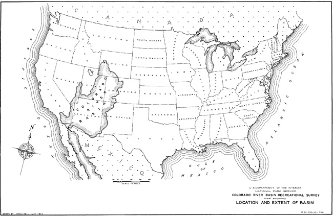
| Plate 1.—Map showing location and extent of Basin. (click on image for an enlargement) |
GENERAL DESCRIPTION
From Gannet Peak in the Wind River Mountains of Wyoming and the 14,000-foot mountain peaks in Colorado to the Salton Sea in southern California, 248 feet below sea level, stretches the vast region of forests, deserts, plains, mountains, canyons, and plateaus drained by the Colorado River.
The outline of the Colorado River Basin as it follows the crests of adjacent mountain masses is irregular, but its general shape may be compared with the ear of a horse. The lower end of the basin in southern California, Arizona, and New Mexico, corresponding to the base of the ear, is broad, being some 500 miles wide at one point, and is bounded for the most part by low, desert ranges. Northward, in Utah and Colorado, the basin becomes progressively narrower, edged by loftier mountain ranges, until at the extreme northern tip of the ear, 830 miles from the Mexican border, it is reduced to a width of 25 miles as it culminates in the magnificent Wind River Range of western Wyoming.
The Colorado River Basin not only is ringed with mountains but contains within its boundaries many extensive ranges and lofty plateaus. In the north, these interior ranges run in an east-west, or else a northwest-southeast direction, forming a series of more or less parallel mountain barriers and high plateaus across the basin. Between these barriers lie great valley systems, also running more or less east and west. Only the mighty Green and Colorado Rivers have cut deep gorges in a southerly direction through the barriers to unite all the streams into one drainage. Toward the south, the interior ranges pivot gradually from the northwest-southeast direction, until in southern Arizona, Nevada, and New Mexico they run nearly north and south. The physiography of the basin can be most readily described in terms of these various mountain barriers and their intervening valleys.
Farthest to the north lies the spacious but bleak valley of the southward-flowing Upper Green River in Wyoming, with the elevated and still more barren Red Desert to the east. These areas have long, cold winters and short, dry summers. They extend south into northern Utah and Colorado where they encounter the first of the mountain barriers. This barrier is formed by the Uinta Mountains and Yampa Plateau as they extend eastward toward, but do not quite meet, the Danforth Hills and White River Plateau—which in turn are westward extensions from the main Rocky Mountain Divide. Winters are still longer and colder than in the valleys, with a heavy snowfall. Summers are cool, with frequent afternoon thunderstorms.
Beyond this first barrier to the south lies the broad, east-west valley of the Duchesne River, elevated and bleak, but farmed, and its counterpart on the opposite side of the Green River, the wilder but similar valley of the White River. These valleys have long cold winters and short dry summers like the Upper Green River Valley. They are bounded on the south by the second mountain barrier, comprising the Tavaputs Plateaus which, with the Roan Plateau, form an 8,000- to 9,000-foot wall all the way across the basin from the Wasatch Mountains on the west to the White River Plateau of the Rockies on the east. Only the Green River has been able to cut a cleft through this wall to join with the stream systems still farther south. The climate of this mountain barrier resembles that of the first, being characterized by deep, long-lasting winter snows and cool summers with afternoon thunderstorms.
About 50 miles south of the Tavaputs—Roan Plateau barrier, the southward-flowing Green River joins the Colorado River which, with its great tributary, the Gunnison, flows southwest from the heart of the Rockies through broad sagebrush valleys to this junction point. The Colorado River beyond this junction plunges into a wild and fantastically eroded land of winding gorges and sandstone mesas whose vast expanses are punctuated at irregular intervals by the isolated, steeply upthrust masses of the Henry, Abajo, and Navajo Mountains. With the exception of the mountain summits, which are cool and moist, the greater portion of the area receives but little snowfall in winter and is characterized by a long, warm summer season. Average temperatures are higher than those of valleys to the north, in conformity with the decrease in latitude, but lower than those of deserts to the south. The annual precipitation ranges from about 6 to 14 inches, with the greatest amount coming from thunderstorms during July and August.
|
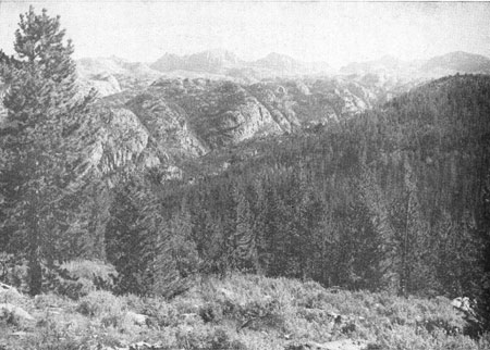
| Figure 2.—The Wind River Mountains of Wyoming. |
|
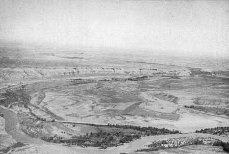
| Figure 3.—Looking down the Green River Valley from La Barge, Wyo. |
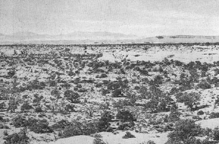
This desolate but spectacularly scenic sandstone area is referred to in this report as the Canyon Lands of southeastern Utah. Into it from the east, through a deep meandering gorge, flows the turbid San Juan River which, with its tributaries, drains a far-reaching area, including the La Plata Mountains, the San Juan Mountains and other lesser ranges on the Continental Divide, the Chuska Mountains, and enormous areas of mesa land in the interior of the basin. From the Wasatch and Aquarius Plateaus on the west come other, but lesser, silt-laden streams, all carving the deep, winding canyons which have given this country its name.
The Canyon Lands terminate, approximately, at a third, intermittent barrier formed by the Paria Plateau, Black Mesa, and the Chuska Mountain mass. Southwest of this third barrier lies the great valley of the Little Colorado River and the adjacent House Rock Valley a semidesert grassland, piñon pine, and juniper country which, in spite of its enormous area, contributes but a meager stream flow because of the sparse annual rainfall and snowfall. Winters are mild and summer temperatures about the same as in the Canyon Lands.
South and west of the Little Colorado River, the last great highland barrier extends in a vast curve across the Colorado River Basin from the southern boundary of Utah through Arizona to western New Mexico. This barrier is formed by the Grand Wash Cliffs, the Coconino and Kaibab Plateaus, the San Francisco group of volcanic peaks which rise above 12,000 feet, the long but narrow Mogollon Plateau averaging above 7,000 feet, and the 11,000-foot crests of the White Mountains. Heavy snowfall, long winters, and cool summers with afternoon thunderstorms characterize the climate of most of these highlands.
|
| Figure 4.—Canyon Lands of southeastern Utah—looking over the junction of the Green and Colorado Rivers to the Henry Mountains from Dark Canyon Plateau. |
West and south of this last barrier lies the great southern desert of Nevada, Arizona, California, and Mexico. Rainfall is scanty and the summer season long and intensely hot. Winters are mild. Many low mountains rise from this desert. The most important of these ranges are the Hualpai, Harquahala, Santa Maria, Bradshaw, Pinal, Santa Catalina, Rincon, Galiuro, Pinaleno, Santa Rita, and Chiricahua Mountains. They comprise a series of cool islands rising out of the surrounding desert heat rather than a climatic or physiographic barrier.
The life zone map (Pl. 12, in pocket) summarizes graphically the natural features of the Colorado River Basin. It indicates the climates of the basin and their characteristic plants and animals. In view of the close relation between temperatures and altitudes, to be described later, the map also shows enough of the topography to furnish a rough three-dimensional presentation of the basin, the extent of the many great plateaus, the island-like distribution of many of the southern mountain ranges, and the deep penetration of the Rocky Mountains by numerous long, winding valleys.
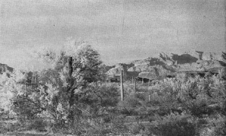
The life zone map indicates the nature and distribution of the basin's various recreational regions. The Lower Sonoran Zone is principally a winter recreation region, where the desert scenery and sunshine are ideal for photography, swimming, camping, hiking, horseback riding, and motoring, and where some hunting and fishing may be enjoyed. The Upper Sonoran Zone, in valley and plains lands, provides recreational opportunities similar to those of the Lower Sonoran Zone, but is usable in summer when the latter region is too hot for comfort. The northern limit of the Upper Sonoran Zone is generally open sagebrush country not suitable for winter recreation.
|
| Figure 5.—The great southern desert—Organ Pipe Cactus National Monument, Ariz. |
The Transition Zone of the foothills and lower mountains probably attracts more vacationists than any other because it is the principal retreat of those seeking to escape from the summer heat of the lowlands. The location of this zone at the lower mountain levels usually renders it easily accessible at all seasons, while the coolness which accompanies its ample precipitation makes it the principal zone of winter sports. In the Colorado River Basin, water is most plentiful in the Transition Zone, so that it includes most of the best natural fishing areas, and for similar reasons the finest forests. With this abundance of vegetation are associated most of the big game animals, affording maximum opportunities for hunting and wildlife photography. In fact, nearly every form of outdoor recreation may be found in the Transition Zone and many kinds reach their highest development there.
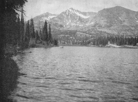
The Boreal Zone is the high mountain recreational region. In the northern half of the basin it is visited nearly as frequently as the Transition Zone because it extends to fairly low levels. However, in the southern half of the basin it is, as a rule, sufficiently difficult to reach that only those who can appreciate its wilderness character are likely to penetrate it very deeply or permanently. High mountain recreational developments usually are restricted to the general vicinity of the relatively few roads that penetrate Boreal regions, and such developments are further restricted in their operations by the extreme shortness of the summer season. Camping, hiking, fishing, horseback riding, winter sports, photography, and the enjoyment of wildlife and rare flowers reach their culmination for many persons in this remote, and, to many, most beautiful and inspiring of all recreation regions.
LIFE ZONES
Because the basin embraces latitudes from Mexico almost to Yellowstone National Park, and altitudes ranging from 248 feet below sea level to 14,431 feet above sea level, all of the life zones of the United States are present except the Tropical Life Zone of southern Florida. These life zones are as follows:
Boreal Zone.—In detailed studies of small areas this often is subdivided into three zones Alpine, Hudsonian, Canadian but these finer distinctions are needless here. This zone is characterized by the cool, moist climate of Canada and the northern coniferous forest belt of the United States. Winter snows are heavy and long-lasting. Total annual precipitation is from 23 to 60 inches or more. On the other hand, at the lower levels of the Boreal Zone in the arid Upper Green River Valley of Wyoming, annual precipitation may be as low as 15 inches in some localities. [1] The annual mean temperatures are in the neighborhood of 45° to 27°F. or less. Narrow tongues of the Boreal Zone extend far south of the main area along various high mountain crests such as the Rockies. With the increase in average temperature toward the Mexican border, the tongues give way to a series of scattered islands as the zone becomes restricted to the tops of the loftiest peaks.
In the Colorado River Basin, the most reliable and conspicuous plant indicators of the Boreal Zone are the lodgepole pine, limber pine, whitebark pine, white pine, foxtail pine, white fir, alpine fir, Engelmann spruce, blue spruce, dwarf juniper, aspen, red elderberry, dogwood, and the blueberries. Extensive timberline grasslands and scattered high mountain meadows also occur in this zone.
Some of the more interesting or conspicuous animals and birds that characterize the Boreal Zone are the pine squirrel, marmot, cony, snowshoe rabbit, lynx, red fox, marten, wolverine, goshawk, three-toed woodpecker, Rocky Mountain jay or camp robber, clark crow, and crossbill.
Transition Zone.—The zone was given this name because it was considered to be essentially an area where the ranges of many northern (Boreal) and southern (Sonoran) plants and animals overlapped. Although this is to some extent true, the Transition Zone possesses a quite distinctive climate and a number of prominent and characteristic species of its own.
In Wyoming, Colorado, and northern Utah, where the Boreal Zone covers all the major mountain masses, the Transition Zone occupies the foothills and higher valleys. Farther south, however, where the Boreal Zone is restricted to projecting tongues and isolated high peaks, the Transition Zone occupies most of the mountain masses, and is replaced in the valleys by a warmer climate. Winter snows are moderate. Total annual precipitation is from 17 to 26 inches, occasionally as much as 32 inches, and sometimes more. [2] Annual mean temperatures usually are between 40° and 50°F., except in a few Transition areas of extreme cold and aridity such as the Upper Green River Valley at Pinedale and Kendall, Wyo. [3]
Throughout a large part of the Colorado River Basin, this zone coincides very closely with the open, parklike ponderosa pine forests of the mountains and foothills, but north of the San Juan Mountains, Uncompahgre Plateau, and the Aquarius Plateau, the Transition Zone becomes a partially open region, characterized by sagebrush valleys and grassy slopes, often covered with Gambel oak and other chaparral shrubs. This reduction of forest growth may be due to the fact that precipitation in that region is relatively light even at the higher altitudes, while soil moisture and average relative humidity are further reduced by frequent high winds. [4] In this northern part of the basin the ponderosa pine gradually is replaced by Douglas-fir, but distribution of the latter within the zone often is restricted to steep slopes, shady areas, or the crests of plateaus above 7,000 feet, leaving the major part of the zone to the sagebrush and chaparral.
|
| Figure 6.—Boreal Zone—Lake Brennon, Colo. |
Other plant indicators are the narrow-leaved cottonwood, Utah oak, bur oak, bearberry, Rocky Mountain birch, Oregon or holly grape, elderberry, maple, locust, and alder. The sagebrush previously mentioned cannot be used as an exclusive indicator of the Transition Zone because it occurs even more extensively in the next warmer zone and sometimes enters the lower limits of the Boreal Zone. Since hardly any two kinds of plants, or animals, have precisely the same climatic requirements, the location of zone boundaries is based upon the presence of not one but a large number of the appropriate indicators. Obviously, therefore, the establishment of sharp lines of division between zones represents merely a compromise among various arbitrary decisions that it is necessary to make in order to draw up an intelligible small-scale map.
|
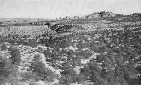
| Figure 7.—Upper Sonoran Zone—Canyon lands of southeastern Utah. |
Animal indicators confined to, or particularly characteristic of, the Transition Zone include the tuft-eared squirrels, certain local races of wood rats and pocket gophers, and other small rodents, wild turkey, and band-tailed pigeon.
Upper Sonoran Zone.—This and the next zone take their names from the Province of Sonora in Mexico, from which they derive some of their plants and animals. Climatically, the Upper Sonoran Zone is considerably cooler than much of Sonora. It comprises most of the broad lower valley lands of the basin except in southern and western Arizona, southern Nevada, and adjacent California, where it gives way to a still warmer climate and becomes the principal life zone of the foothills, extending even to the summits of the lower desert mountains. Snow is light or absent, and the summers are warm. Total annual rainfall usually is from 10 or 12 to 18 inches, occasionally more, and annual mean temperatures are between 50° and 65° F.

|
| Figure 8.—Transition Zone—Shivwits Plateau. |
The Upper Sonoran Zone is typified by the seemingly endless foothill and mesa regions, sparsely covered with junipers (3 species) and piñon pines, that comprise vast areas in the Colorado River Basin. The zone is practically coextensive with these trees wherever they occur but is by no means restricted to such areas. It includes also extensive regions formerly covered with nutritious grasses where soil and moisture are too meager for piñons and junipers; also the alkali plains, sagebrush flats, and parched wastelands of the Upper Green River Valley and Red Desert in Wyoming, the sandstone barrens in the Canyon Lands of Utah, and the shortgrass and alkali plains of the Little Colorado River.
Some parts of the Upper Sonoran Zone that have a slightly greater rainfall and higher mean temperature than the piñon-juniper region support an extensive belt of scrub oaks. [5] Growing conditions seldom are favorable enough to permit these scrub oaks, which comprise several species, to become full-sized trees. Usually they are low, spreading shrubs that form dense thickets covering thousands of acres of foothill country. The Upper Sonoran oak brush is prevalent in the disconnected chain of foothills and low mountains south of and paralleling the Mogollon Plateau in Arizona, and is well exemplified in Kirkland Valley and the hills south of the town of Prescott. It also occurs, though apparently less extensively, in some comparable foothill areas of southeastern Utah and southwestern Colorado, such as the Abajo Mountains. [6]
Additional plant indicators are the sycamore, boxelder, greasewood, hackberry, cliffrose, silk tassel, rabbitbrush, winterfat, and antelope brush. Mammal indicators include several species of small rodents, shrews, and bats which are not listed here because of the difficulty encountered by the average person in distinguishing these species from quite closely related animals inhabiting adjacent life zones. Such a list would be of practical use only to the technical worker, who can readily obtain such information elsewhere.
Bird indicators also are numerous, but, as in all of the life zones, only those are given this status that are known to nest in the zone in question. After nesting season, most of these birds spread into adjacent life zones, so that here again, a list of breeding birds would be of little help to any but the technical worker. The few birds that are listed as indicators elsewhere in this outline are believed to be year-round residents of the zone concerned. The piñon jay probably comes the closest of any bird to being a year-round resident of the Upper Sonoran Zone, but even this species wanders briefly into other regions.
Lower Sonoran Zone.—This, the last and lowest of the Colorado River Basin life zones, is the hot southern desert zone. It extends from Mexico northward into Arizona as far as the highland barrier formed by the Grand Wash Cliffs and the previously described chain of foothills and low mountains that parallel the Mogollon Plateau and White Mountains. It completely surrounds many of the southern desert mountains as an ocean surrounds an island, particularly in the southeastern part of the State, while other mountains of lesser height, including the many low ranges of southwestern Arizona, are completely submerged by it. This zone occupies the Salton Sea region (among other places) of California and extends long fingers into the lower valleys of southern New Mexico. It occupies the desert plains and valleys of southern Nevada and extends a dilute arm for a short distance into the adjacent Virgin River Valley of southwestern Utah. Another dilute extension of the zone threads its way up the Colorado River, deep beneath the surrounding land surface, between the sheer, heat-reflecting walls of the Grand Canyon. It extends briefly at the lower end of the Little Colorado River Valley in the vicinity of Cameron, and in the lower Paria and Wahweap Valleys above Lees Ferry.
Snow is practically absent, and annual precipitation averages from 1-1/2—2 to 12 or 15 inches. In some parts of the zone there may be no rain at all for 2 or 3 years, but irregularly occurring cloudbursts help to raise the average figure. The summers are long and in many areas intensely hot, and annual mean temperatures are between 51° and 74°F.
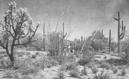
The Lower Sonoran Zone is the zone of mesquites, many kinds of cacti, and the creosotebush. The mesquites are too dependent upon subsoil moisture to occur throughout this zone, while some kinds, though not all, of the cacti are sufficiently tolerant of cold to occur well beyond its limits. The creosotebush is the most conspicuous, widespread, and characteristic single plant of the Lower Sonoran Zone, and is almost coextensive with it except that it does not occur in the poorly drained alkaline soils of the desert sinks.
Other Lower Sonoran Zone plant indicators are the screwbean, catsclaw and other acacias, ocotillo, desertthorn, allthorn, paloverde, smoketree, tesota, bluethorn, varnish bush, arrowwood, century plants, and sotol.
Mammals used as indicators by ecologists include the round-tailed ground squirrels and cotton rats, as well as various other rodents whose close relatives occur in adjacent zones. Among birds, the white winged dove, Arizona cardinal, and Arizona pyrrhuloxia are good indicators where they occur, but their range within the zone is not as wide as that of the mammals.
|
| Figure 9.—Lower Sonoran Zone. |
LIFE ZONES IN RELATION TO
ALTITUDE
In general, the higher the altitude the cooler the air; roughly, the temperature decreases 3-1/2° F. for each increase of 1,000 feet in elevation above sea level. Stated in another way, an increase of 1,000 feet in altitude is equivalent to a northward shift in latitude of approximately 200 miles. An easily remembered illustration is experienced by anyone who travels over the desert in summer by airplane. On taking off at approximately sea level from a desert airport that is sweltering under a temperature of, say, 110° F. in the shade, a few minutes' climb to 5,000 feet brings a reduction of temperature to 92° F., followed by a further drop to 74° F. if one continues through the upper layers of air to the 10,000-foot level. One can even fly over Death Valley during midsummer in complete comfort in a plane at 11,000 feet, and no doubt this new form of recreational travel will become increasingly important in desert regions and elsewhere.
The lowering of temperature with increasing altitude helps to explain the permanent coolness of mountaintops, and why they constitute islands with a northern climate rising above the surrounding ocean of warmer air. On these island summits cling assemblages of cold-climate plants and animals that have been stranded there since the last Ice Age, when more than one-half of the continent was buried under a vast, unmelting crust of ice and snow. In southern regions these mountaintops usually are choice recreation areas.
LIFE ZONES AS MODIFIED BY DIRECTION OF SLOPE
AND OTHER LOCAL INFLUENCES
Although latitude and altitude are the major factors influencing the climate of the Colorado River Basin, many interesting and striking modifications of climate by minor influences are visible even to the casual traveler and recreationist, and a knowledge of some of their causes heightens interest in the region.
Direction of slope.—South-facing mountainsides are exposed to the warming and drying effects of sunshine to a much greater degree than are north-facing slopes. On steep slopes, the difference often is so extreme that a given climate or life zone, say the Upper Sonoran oak brush, may extend on the south side all the way to the summit, at 7,500 feet, in spite of the low temperature of the surrounding air at this altitude. On the shady, moist, north side of this mountain, on the other hand, the Upper Sonoran Zone may give way near the base of the mountain, at 6,000 feet, to a cool forest of ponderosa pine. One may see just such a contrast on the opposite sides of innumerable hills, buttes, and low mountains throughout northern Arizona and New Mexico and southern Utah.
The warming effect on south-facing slopes is still further increased by the circumstance that an inclined surface facing the sun at a right angle may receive almost one and one-half times as much heat and light as a level surface. The inclined north-facing slopes on the other hand, receive less sunlight than a level surface.
Additional results of this difference are that snowbanks on north-facing slopes linger longer, and soils warm up and dry out more slowly or not at all. Spring flowers come later and birds may commence nesting 2 weeks later than their neighbors on the other side of the mountain. On many mountain peaks in the southern part of the basin, it is only on the shady north slopes that sufficient moisture remains throughout the dry season to permit the existence of a Boreal Zone fir forest. This situation occurs on Sitgreaves, Bill Williams, O'Leary, and the San Francisco Peaks, and in the Santa Catalina Mountains, as well as numerous other places in Arizona. [7] In general, mountain peaks intercept a greater precipitation than lowlands. The degree of interception is approximately proportional to the altitude of the peaks above the lowlands, the precipitation increasing about 1 inch per 160- to 200-foot rise. [8] [9] In some places, however, the atmospheric currents often have been so robbed of their moisture by the time they reach the lee side of the mountains that the latter have a dry climate that is out of proportion to their altitude. Blacks Fork in the lee of the Wasatch Range is an example of this. Though at an elevation of 9,500 feet, it has an annual average precipitation of only 21.6 inches. Similarly, in Utah, Monticello receives much more winter and spring precipitation than La Sal at the same altitude, because the former is on the windward side of high mountains, whereas La Sal is on the lee side. [10]
Moisture.—In general it has been established that for an area such as the Colorado River Basin, the northward distribution (or on a mountain, the upward distribution) of plants is determined by the lowering temperatures, while the southward (or downward) distribution is limited by the progressive decrease of moisture.
In many parts of the basin there are striking illustrations of the ability of northern zone plants of the higher mountain levels to survive in the lower zones, provided their moisture requirements are satisfied. Two or three miles southwest of Lyman's Reservoir, near St. Johns, Ariz., a small isolated cinder cone, grassy and otherwise devoid of trees, has on its shady north-facing slope a shallow steeply sloping ravine within the narrow confines of which there stands a slender file of ponderosa pine. Obviously a snowbank lingers in this shaded defile long after other snows are gone, thus providing moisture sufficient for the small colony, which is a mile or more from the main body of the forest and at a lower elevation. Similarly, countless mountain streams through the basin, long after descending from the cool highlands into the warm lowland valleys, are lined with pines and other mountain trees which, having been carried down as seeds, were able to establish themselves along the moist stream banks in the midst of an otherwise alien environment.
Spectacular examples of climate extensions downward into a lower zone may be seen in the Canyon Lands of Utah. There the streams, upon leaving the mountains, frequently vanish into narrow, shadowy gorges of great depth which wind erratically for miles below the rolling surface of the sandstone mesas, on their way to join the canyon of the Colorado. The Transition Zone pines, in following these streams down from the mountain slopes, likewise disappear beneath the surface of the desert, and may be glimpsed only from the brink of one of these gorges or from an airplane. This reversal of the usual altitude relationships is well illustrated in Indian Creek and Montezuma Creek Canyons at the base of the Abajo Mountains, and similar examples occur over great areas of the basin, as on the Black Mesa, and at the edge of the Defiance and Mogollon Plateaus in Arizona. Likewise, the outlet streams of Boulder, Fremont, and other large lakes at the foot of the Wind River Mountains, in the Upper Green River Valley of Wyoming, carry long tongues of Boreal Zone lodgepole pines and aspens down through the treeless, grassy Transition Zone.
Air currents.—Cold air tends to flow flown canyons from the high peaks, especially at night, thus further promoting the downward migration of northern plants and animals along the stream banks.
On the other hand, rising currents of warm air, especially those which sweep over mountain slopes from adjacent desert lands, have a reverse effect and carry the climate of the lower levels to a much higher elevation than usual. The Colorado River Basin contains countless examples of this upward shifting of the lower zones adjacent to desert areas.
The Gila Mountains in southeastern Arizona exceed 6,000 feet and under other circumstances would be expected to have a Transition Zone pine forest at the summit. The heat of the San Simon Valley, however, carries the Upper Sonoran Zone to the summit of the range. A similar condition occurs, in varying degrees, in the Little San Bernardino Mountains north of the Salton Sea in California; in the Virgin Mountains of southern Nevada and northeastern Arizona; the Kaiparowits Plateau and San Rafael Swell in Utah; and in extensive foothill regions of the Green River Valley north of the town of Green River, Wyo.
Mountain masses.—The larger the mountain mass, the greater the area of cool surface, and the less the likelihood of its being affected by the warming influences of surrounding lowlands. The great frigid mass of the Rocky Mountains, together with such lofty spurs as the San Miguel and Elk Mountains, and the White River Plateau, is able to maintain a Transition Zone climate at lower altitudes than can the isolated Henry and Abajo Mountains in southwestern Utah.
A result of the proximity of mountain masses that is particularly noticeable in desert regions is the greater soil moisture at their bases derived from run-off.
In the Colorado Desert, even in rainfall areas of 5 to 9 inches, many mountain barriers lifting up to 4,500 feet or more will knock out from 14 to 16 inches of rainfall per year . . . (In) the Kofas . . . while they form a mountain island only 4,200 feet high . . . there is an increased run-off deriving from about 14 inches of rainfall per year, and this moisture, and the consequent food and cover that it produces, supports (or did support before excessive hunting) a relatively abundant fauna of mule deer, sheep, quail and other forms of small bird and animal life which would be largely absent from the area were it not for this. [11]
FISH LIFE IN RELATION TO LIFE
ZONES
The distribution of fresh-water fish often is closely related to stream and lake temperatures, but because such temperatures may be greatly modified by local factors extraneous to the general climate, such as source and volume of stream flow, proportions of sunlight and shade, and the size and depth of lakes, fish have not been used as life-zone indicators. Nevertheless, in a broad study of an area as large and diversified as the Colorado River Basin, certain useful comparisons may be made between fish and other wildlife regarding the general effect of climate on distribution.
Boreal Zone.—The snow-fed, headwater streams and lakes of the high mountains are small, cold, and poorly supplied with fish food. The lack of food results from the prolonged low temperatures which permit a growing season of only a few weeks for aquatic plants and the various small organisms that feed on them and, in turn, are eaten by fish. The low temperatures retard the growth of fish directly by reducing the food supply, and indirectly by slowing up their metabolic rate. In addition to the adverse effects of low temperatures, there is a deficiency of organic matter and of plant nutrients in general in the higher parts of the Boreal Zone. Bare rocks and melting snows that produce water almost as pure as distilled water can provide only meager nourishment for the aquatic plants that comprise the basic link in the fish-food chain. Boreal Zone fish usually remain small no matter how long they live. Mortality during the long, rigorous winters runs as high as 60 percent. [12] Often, where artificially planted in high mountain lakes, they remain half-starved throughout the season and willingly take any lure, thereby affording some sport even though their size and the condition of their flesh may not always be up to par.
In addition to the native trout, various non-native trout have been planted in the basin, including the rainbow, brown, and eastern brook. For all of them the Boreal Zone comprises a submarginal habitat, and they do better in the warmer, more abundant waters of the Transition Zone.
Transition Zone.—The streams here are cold enough for trout requirements, but not so cold as to inhibit their growth. They traverse greater areas of fertile soil and pick up larger amounts of plant nutrients than Boreal Zone streams. Transition Zone streams, which drain extensive, moist mountain masses such as the Wind River, Uinta, and Rocky Mountains, may become large rivers occupying broad, fertile valleys and fringed by dense vegetation furnishing vital supplies of terrestrial insect food in addition to the abundant aquatic sources. The Transition Zone affords by far the finest natural trout fishing, and is exemplified by the Gunnison River in Colorado and its tributaries. Although trout are the most conspicuous and best-known fish of these mountain waters, a few minnows, suckers, and bullheads are present. [13]
Upper and Lower Sonoran Zones.—After the streams have traversed the long, sunny Transition Zone sagebrush valleys of Wyoming, Utah, and Colorado, or have dropped from the limited plateau and mountaintop Transition areas of the States to the south, the water has warmed up beyond the survival point for trout. This occurs at about 7,000 feet, [14] thereby coinciding approximately with the lower limit of the Transition Zone on land. Below this point the water not only becomes warmer, but also becomes more quiet and thereby loses the high oxygen content required by trout. It often picks up a yellow or chocolate-colored burden of silt which smothers food-producing aquatic plants, insects, and crustaceans, and buries spawning grounds. A few Upper Sonoran Zone streams which are fed by cold springs, such as Oak Creek and Bright Angel Creek in Arizona, are partial exceptions to this rule for a short distance, and provide fine trout fishing.
|
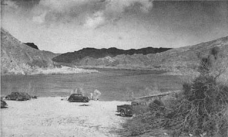
| Figure 10.—Trout fishing is excellent on the Colorado River below Hoover Dam. |
|
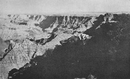
| Figure 11.—From Lipan Point on the South Rim of the Grand Canyon can be seen the Echo Cliffs and Navajo Mountain. |
|
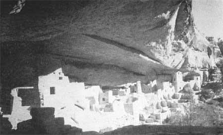
| Figure 12.—Cliff Palace in Mesa Verde National Park, Colo., dates from 1066 to 1273 A.D. |
|
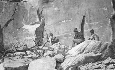
| Figure 13.—Petroglyphs in the Needles area southeast of the junction of the Green and Colorado Rivers. |
Trout soon disappear from the Upper Sonoran Zone, but a few more or less silt-tolerant species of warm-water fish are able to survive there. In the lower stretches of the Colorado and Green Rivers, the Colorado "white salmon" occurs in limited numbers. Actually it is an enormous minnow, occasionally attaining a length of 3 feet, and a weight of 30 pounds. Small streams may harbor suckers, top-minnows, and true minnows; the larger streams may contain, in addition, sunfishes, bonytails, perch, and catfishes, provided there is a zone of aquatic shore vegetation in which such fish spawn, and where their young can hide. Such plants also probably furnish some food. The turbid waters of the principal lowland rivers of the Colorado River Basin either fluctuate so greatly with the seasons, or have such a violent scouring action that such streamside and bottom vegetation is usually sparse or lacking.
Artificial reservoirs often completely reverse original stream conditions and may introduce the equivalent of an entirely different "life zone." This will be discussed more fully elsewhere and is mentioned here only to complete the zonal description of the basin. The construction of deep reservoirs like Lake Mead, which discharge large and fairly constant volumes of cold water from which the silt has settled out, has about the same effect as though a section of Transition Zone stream were substituted below the lake for a stretch of the previously barren, hot, and silt-laden river. In this cold stretch of water, trout have been introduced with great success, while in the clear waters of the lake itself, downstream from the silt deposition area, bass thrive, as well as such other introduced species as the bluegill and crappie, and the native warm-water fish previously mentioned. Carp also have been introduced into lower Colorado River waters but are considered undesirable.
|
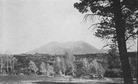
| Figure 14.—Bonita lava flow and Sunset Crater. |
|
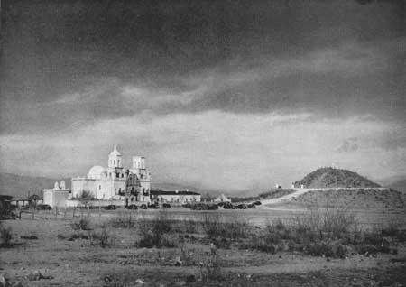
| Figure 15.—San Xavier Mission near Tucson, Ariz., was built about 1790. |
|
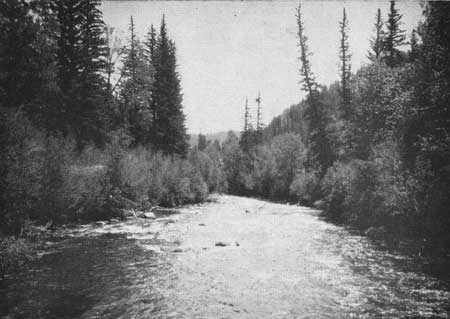
| Figure 16.—Gunnison River above Gunnison, Colo. |
RECREATIONAL RESOURCES
Recreational resources are all natural and cultural features which stimulate, encourage, or provide for the physical, mental, and cultural well-being of the individual. The mountains, with rushing sparkling streams shaded by tall pines in which birds sing; the call of a loon across a lonely lake; the overpowering spectacle of the Grand Canyon; Navajos and their sheep at a water hole in Monument Valley; cowboys riding fence or driving in cattle for the spring round-up; the cry of coyotes across the valley; trout and bass in Lake Mead luring the fishermen to the desert; Hoover Dam; the Arizona Biltmore; the log cabin on Grand Mesa; the old mining towns such as Ouray, Silverton, Aspen, and Tombstone; the abandoned mine dumps where you may find some silver; the long purple shadows on the desert pavement; brilliant sunny days and starlit nights; the great open spaces and views without end; silence so complete the hum of a bee sounds like a distant airplane; Meteor Crater, that forceful reminder of the cosmic spaces, and Sunset Crater, equally forceful evidence of the earth's inner heat; Cliff Palace at Mesa Verde; Betatakin; pieces of broken pottery made centuries ago to hold corn; dinosaur tracks in red sandstone; petrified tree trunks; sea shells on a mountaintop; a startled deer leaping across a fragrant sagebrush flat these and many more are the recreational resources of the Colorado River Basin. Nowhere else in the United States do the curious and fascinating land forms, evidences of the building up and wearing down of the earth's surface, stimulate more interest in geology. Nowhere else are the evidences of prehistoric peoples so obvious and numerous. Nowhere else is there scenery so colorful.
|
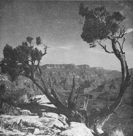
| Figure 17.—The Grand Canyon at the mouth of Whitmore Wash. |
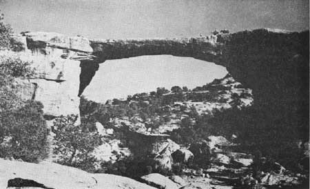
Here is the world's greatest canyon, the largest natural bridge, the largest man-made lake (in volume), and the highest dam. Here too, one may enjoy much sunshine and find perfect climates for outdoor recreation the year around. Hunting, fishing, photography, snow sports, boating, swimming, horseback riding, camping, mountain climbing, exploration the entire realm of outdoor recreational activities may be enjoyed. Five national parks and 33 national monuments have been established within the basin to preserve some of the most outstanding natural, scientific, and cultural features. Large sections have been included in national forests, wildlife refuges, and grazing districts, and vast areas have been set aside as Indian reservations. Much of the basin is in public ownership, but this is not surprising when one sees the country and knows that about half the basin has a population of less than 2 persons per square mile, and that the most densely populated county, Maricopa County, in which Phoenix, the largest city, is located, has a population of only 20.2 persons per square mile.
It is only natural in a region so endowed that recreation should become one of the major industries. Agriculture is restricted almost entirely to irrigated sections. Mining, lumbering, and the raising of cattle and sheep first attracted settlers to the basin, but the recreational features are now attracting many more, and as the various sections of the basin become better known and more accessible to the densely populated regions of the United States through improved highways and air transportation, catering to the recreationist should become a major industry. To foster this industry it must be recognized that recreational use of land may, in certain places, be the highest or best use of the land for the general welfare of the people in the basin and, in vast sections of the basin, should be on an equal basis with other uses, such as grazing or production of timber. The great stretches of open range, unobstructed by buildings, fences, transmission lines, and other signs of modern civilization, comprise one of the most important recreational features of the basin. As other sections of the United States become more and more highly developed, this one feature of the Colorado River country, if preserved, will have unusual appeal.
|
| Figure 18.—Owachomo Bridge in Natural Bridges National Monument, Utah. |
ENDNOTES
1 Dr. John W. Scott, letter, 1946.
2 37.5 on summit of Mount Lemmon, in Arizona (Schwalen, 1942, p. 442 and map).
3 Martin and Mattice, 1930, p. 12
6 Many ecologists separate the scrub oak belt from the piñon-juniper area, which more commonly denotes the Upper Sonoran zone. Such a subdivision is entirety justifiable for local studies, but the climatic differences are relatively minor, and a large number of animal life zone indicators are common to both, so that for broad descriptive treatments of climate in such large areas as the Colorado River Basin, the old system of combining them into one zone is retained here for simplicity's sake.
9 Precipitation does not increase with altitude at a regular rate in all regions. In southeastern Utah, for example, to take some extreme cases, it averages 1 inch for each 112 feet of rise between St. George and Andersons Ranch (near Leeds); 1 inch per 328 feet between Castle Dale and Hiawatha; 1 inch per 730 feet between Green River and Castle Dale; 1 inch per 403 feet between Green River and Watson; and 1 inch per 515 feet between Duchesne and Fruitland. Martin and Corbin, 1930, p. 3.
10 Martin and Corbin, 1930, p. 3.
11 Nichol, A. A., 1945, letter.
12 Needham, Moffett, and Slater, 1945, p. 19.
| <<< Previous | <<< Contents>>> | Next >>> |
colorado-river-basin/chap1.htm
Last Updated: 06-Sep-2004