|
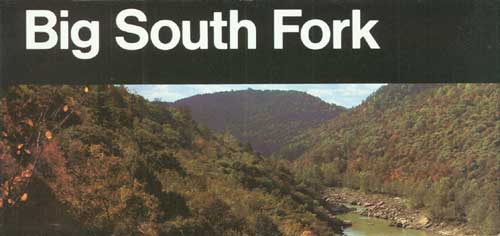
Big South Fork National River and Recreation Area Kentucky - Tennessee |
|
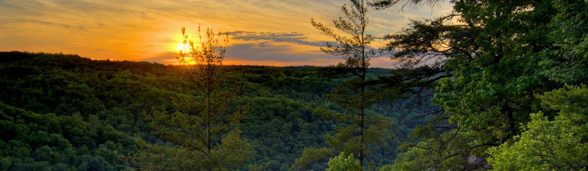 NPS photo | |
A Deeply Carved Plateau
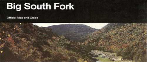
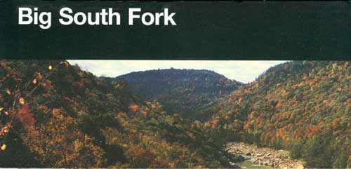
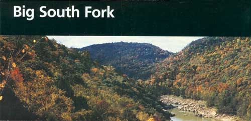
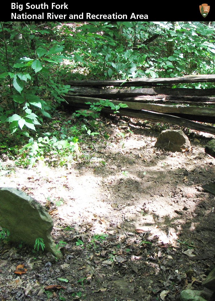
The Big South Fork River begins in Tennessee at the confluence of the Clear Fork and New rivers, flows north through a spectacular 600-foot-deep gorge, enters Kentucky, and empties into the Cumberland River. This land embraces the wildest and most rugged territory on the Cumberland Plateau. Carved over millennia by water flowing over sandstone and shale, the plateau today is a network of hills and hollows, rocky ridges, and river valleys. Rock shelters bear evidence of thousands of years of human habitation, and remnants of homesteads and cemeteries dot the landscape.
The gorge slowly widens northward, revealing river benches, floodplains, and bottomlands. Many streams drop suddenly from the plateau's surface into deeply entrenched valleys. The bottom of the gorge ranges from flat and sandy, almost like a beach, to huge boulders that force the river into violent stretches of white water.
Plateau rivers sustain some of the most varied fish and freshwater mussel species in the nation. Ravines and hollows are among the richest wildflower areas in the South.
Nationally significant for its free-flowing rivers, its deep gorge, and variety of plants and animals, the area captured the attention of the U.S. Congress in the 1970s. In 1974 Congress authorized Big South Fork National River and Recreation Area, the first to be designated as both a national river and a national recreation area. This insightful blend of park management—protecting an area with few roads and no development while providing visitors with recreational opportunities—preserves this park for you and future generations.
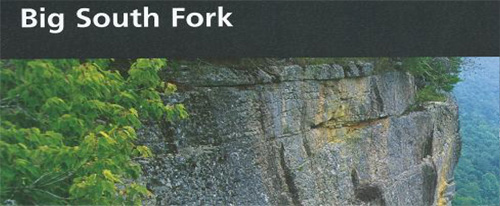
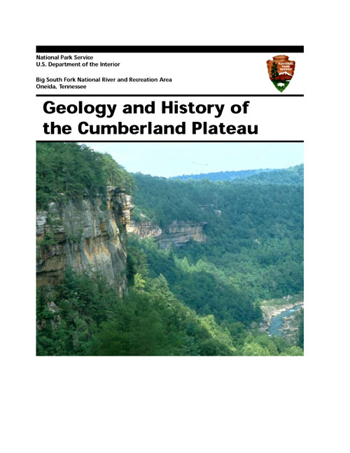
LAYERS UPON LAYERS Rocks on the Cumberland Plateau were born as sediments deposited by a shallow sea millions of years ago. The sediments built up gradually in horizontal layers thousands of fee thick and, crushed by their own weight, hardened into limestone, shale, coal, and sandstone, toppee by a rocky conglomerate—a natural concrete.
When the region uplifted, erosion began shaping a new landscape. Streams cutting into the sandstone and other layers formed gorges, arches, cliffs, and rock shelters. You can see layers of shale, coal, sandstone, and conglomerate at Leatherwood Ford.
Making The Mountains
The Appalachian Mountains are old, even in geologic terms. They formed over millions of years as continental and ocean plates collided, separated, and collided again. Extensive erosion followed each series of mountain building, scouring gigantic mountains into mere nubs. Each time the plates collided, masses of rock pushed up and moved westward.
Today the Appalachians—formed under relentless heat and pressure—are a mosaic of uplifted plateaus, parallel ridges and valleys, and layers of sedimentary and igneous (volcanic) rock.
THE CUMBERLAND PLATEAU lies in the western Appalachian Mountains. This large tableland, formed over time by continental collisions, rises over 1,000 feet above the surrounding region. Weather-resistant sandstone tops the plateau giving it a flat horizon, while layers of soft shale erode to form sheer cliffs and steep-walled gorges.
HILLS AND HOLLOWS The plateau's flat surface causes streams to spread out at any angle like tree roots. Water seeping through cracks scours out softer rock, leaving behind hills and carving out hollows.
RIDGES AND VALLEYS This region features long, even-crested mountain ridges alternating with long, continuous river valleys. Looking much like nature's corduroy, the ridges and valleys run northeast-to-southwest for hundreds of miles.
People Of The Cumberland Plateau
For centuries Indians traversed the plateau and plied its rivers, hunting, fishing, and gathering food. They camped in rock shelters, leaving their stories in the traces of bone tools and spear points that archeologists study today. From 1,000 to 3,000 years ago Woodland Indians lived longer in one place, allowing them to begin crafting pottery. By 1000 to 1600, Mississippian Indians built farming communities in river valleys, developed new strains of corn, squash, and beans, and supplemented their diet with deer, bear, and other animals from the plateau. In the 1700s Shawnee and Cherokee hunted here, and by 1805 the Cherokee ceded the land to the U.S. government.
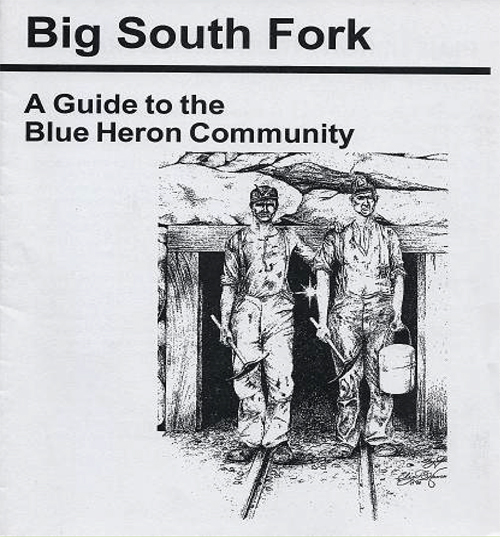
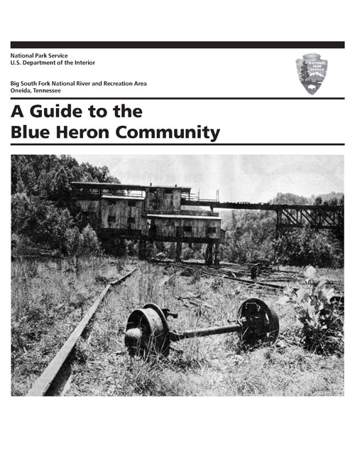
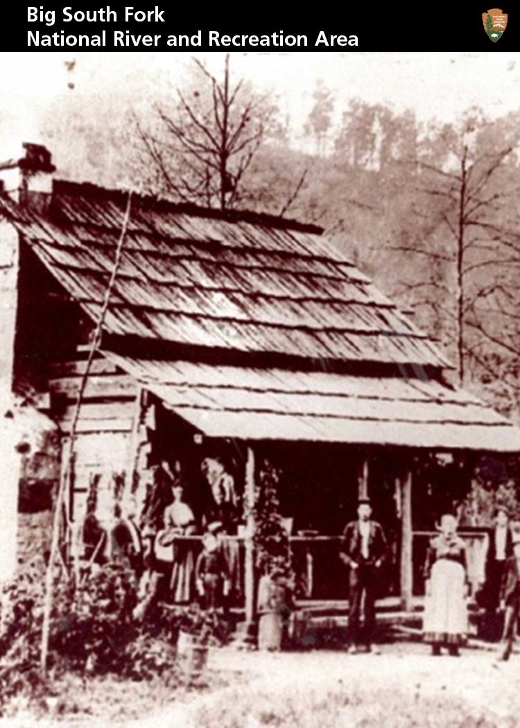
In the early 1800s American settlers of Scotch-Irish heritage worked subsistence farms. People gathered at stores, one-room schools, and churches to socialize and share ideas. But life was hard, as indicated by place names like No Business and Difficulty. In the 1900s the plateau witnessed coal mining, logging, and other exploitation, including drilling for gas and oil. Companies built railroads and mining towns like Blue Heron, and workers flooded in. By the 1960s, after extracting most of the local resources, the companies pulled out. Without work, many people moved away too. Fortunes changed in 1974 with the creation of the national river—recreational activities brought new life to the region.
Appreciating Local Plants and Animals
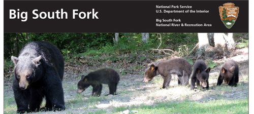
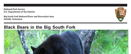
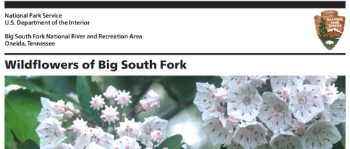
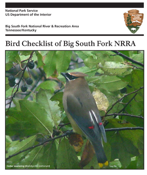
Are you curious? Do you have a notebook, a camera? Come to Big South Fork, and you'll discover an amazing diversity of plants and animals. In spring, yellow lady's slippers grow in the sandy soil on the floodplains of creeks. Virginia bluebells poke shoots through the earth along river banks, opening their blue flowers to the sun. Mountain laurel thrives in the acidic soil, producing clusters of pink and white blossoms. Not to be outdone by these colorful plants, animals in Big South Fork also put on a show. Wild turkeys peck in abandoned fields, and strutting toms establish domination over their territory. White-tailed deer give birth to spotted fawns. Shy American black bears, reintroduced in the mid-1990s, are increasing in number. Over 160 species of birds are recorded here, both year-round residents and migratory, including woodpeckers, chickadees, warblers, and owls.
RIVER PRAIRIES? Mention prairies and most people imagine landscapes with waving grasses, wildflowers, and a lone buffalo. But a rare prairie occurs at Big South Fork—the largest concentration of cobble bar plant communities in existence. In river prairies, plants cling to gravel (cobble) bars and expanses of bedrock. Western prairies are sustained by fire, but here in the river gorges of the Cumberland Plateau the driving force is water. Floods wash over these habitats, scouring out species not adapted to disturbance. Grasses, herbs, and some shrubs survive these punishing conditions, including the endangered Cumberland rosemary and Virginia spirea.
IS THERE A FUTURE FOR FRESHWATER MUSSELS? Big South Fork is one of the last refuges for freshwater mussels in this watershed. Twenty-six species live here; seven are endangered. These mussels are sedentary, long-lived, pearly mollusks that burrow into gravel bars, sucking in and filtering water for nutrients. Sensitive to water quality, they are bellwethers of aquatic ecosystem health.
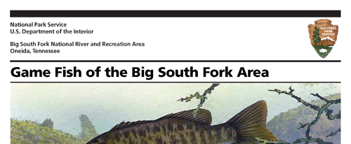
LIFE OF THE RIVER The aquatic systems of Big South Fork—nearly destroyed by pollution from unregulated mining and logging in the early to mid-1900s—are recovering under the park's protection. The park boasts over 138 miles of fishing streams and is home to over 60 species of fish, including largemouth bass. But is the river completely healthy? Freshwater mussels may tell us; they play an important role in the food chain for wildlife like the great blue heron and river otter. But many freshwater mussels are declining. National Park Service staff works hard to restore the river's health. With your help and public support this watershed can again achieve world-class status.
Enjoying Big South Fork
PLANNING YOUR VISIT Start at a visitor center for information, maps, exhibits, and a bookstore. The free park newspaper Big South Fork Visitor Guide has up-to-date details on activities, camping and horse facilities, safety, and regulations, plus articles of local interest. Contact the park about programs, fees, and permits, or visit www.nps.gov/biso.
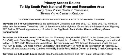
Bandy Creek Visitor Center, 15 miles west of Oneida, Tenn., is open daily except December 25; hours vary seasonally.
Stearns Depot Visitor Center, Stearns, Ky. is open daily May through October, seasonally the rest of the year; hours vary. Big South Fork Scenic Railway (operates seasonally) runs from Stearns Depot to the Blue Heron Mining Community.
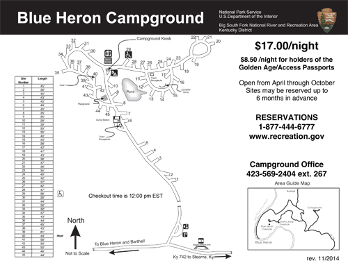
Blue Heron Mining Community, in Kentucky off KY 742, has an outdoor museum that tells the 25-year coal-mining story with exhibits, structures, and audio programs. It is open year-round; rangers are available April through October.
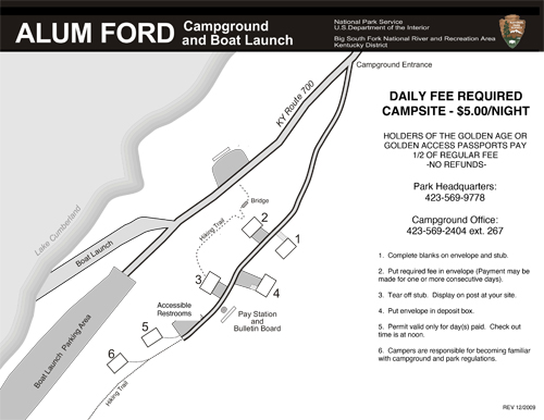
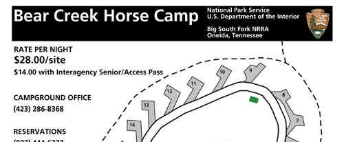
Camping, Lodging, Food, Services The park has developed campgrounds, horse campgrounds, backcountry lodging, and backcountry camping (permits required). Neighboring communities offer lodging, food, and services.
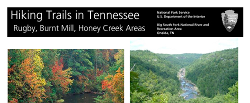
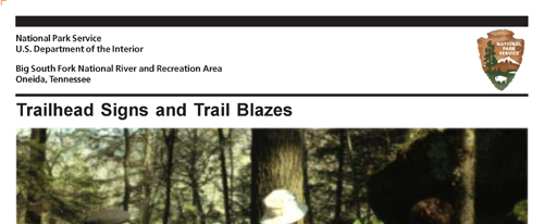
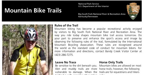
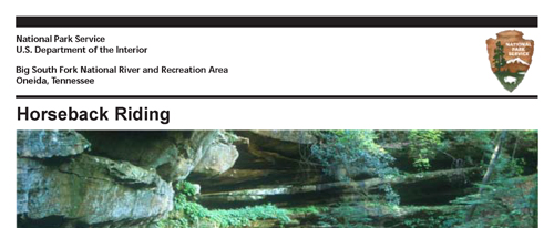
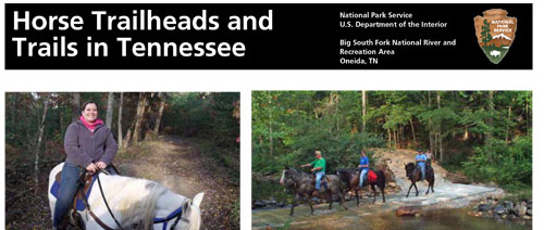
Hiking, Horses, Trail Blazes Big South Fork has hundreds of miles of trails. Colored blazes at trailheads indicate authorized use: red for horse and wagon, green for hiking, blue for mountain bikes, and orange for multi-use.
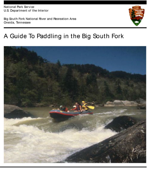
On the River The Big South Fork and its tributaries wind through 90 miles of scenic gorges, cliffs, and valleys, and pass by historic features. Contact the park or visit our website for details on river levels, descriptions, and access points.
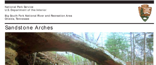
Arches, Waterfalls, Overlooks The region abounds in arches, waterfalls, rockshelters, and overlooks. You can drive to many sites, but some require hiking or riding. Yahoo Falls is Kentucky's tallest, spilling water 113 feet to a pool below. Twin Arches form the largest sandstone arch complex in the East.
STEWARDSHIP Big South Fork strives to protect the river, its watershed, and its cultural features. Everyone has a stake in this stewardship—please help us preserve the park for future generations. All plants, animals, rocks, and historic and archeological sites are protected by federal law. Report suspicious behavior (anonymously).
Exploring Big South Fork
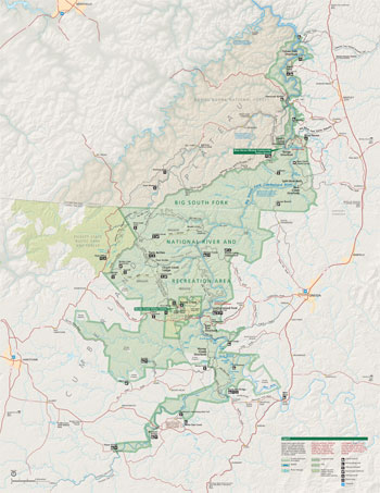 (click for larger map) |
SAFETY FIRST
Floating, hiking, riding, and exploring can be fun, but if you get hurt you may
be a long way from help. Cell phones may not work, and getting medical help to
you can be difficult. Ask rangers for safety tips, read bulletin boards, and
know the regulations. Remember, your safety is your responsibility.
SAFETY ON THE RIVER
• Swim at your own risk. Don't swim alone.
• Wear a life jacket (PFD) when boating. It won't do you any good at the
bottom of your boat. Children under 16 must wear a PFD.
• As you approach obstacles look for the long glassy "V" pointing
downstream. This is the chute—the safest route through.
• If you capsize, stay upstream from your boat. Currents pushing against a
canoe can trap and hold you underwater.
• If you capsize in rapids, swim hard to the bank or eddy. Otherwise, stay
on your back and keep your feet pointed downstream. Swim ashore after reaching
calmer water.
• Rapids and unmarked hazards can occur at any time. Scout ahead and know
river levels.
• Never tie a person in a watercraft. Do not lash tubes or canoes
together.
MORE SAFETY TIPS
• Stay back from cliffs; they may be undercut. Stay on trails to prevent
erosion. Watch your step. Rocks and logs can be unstable.
• Be alert for ticks, stinging insects, poison ivy, and venomous snakes
(copperhead and timber rattlers). Wear insect repellent, and watch where you
step, sit, or place your hands.
• All surface water is unfit for drinking.
• Thefts do occur at trailheads. Leave your valuables at home, secure them
out of sight in your vehicle, or take them with you. Ask about shuttle services
for floaters and hikers.
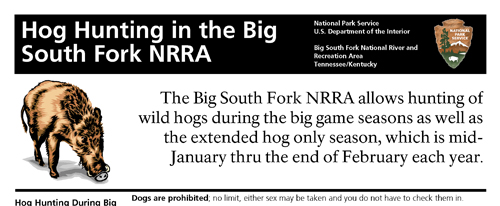
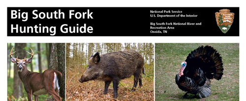
• Hunting and fishing are allowed here; state and federal regulations
apply. Ask staff about hunting seasons and hunt-free safety zones.
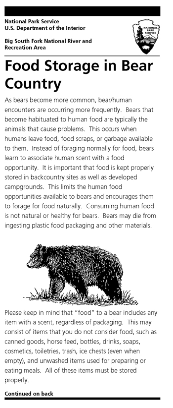
• Black bears live in the park. Practice proper food storage, and keep a
clean camp.
• Pets must be on a leash. Do not leave them unattended or in vehicles.
Emergencies Contact a ranger or call 911
ACCESSIBILITY We strive to make our facilities, services, and programs accessible to all. For information go to a visitor center, ask a ranger, call, or check our website.
Source: NPS Brochure (2017)
|
Establishment Big South Fork National River and Recreation Area — March 7, 1974 |
For More Information Please Visit The  OFFICIAL NPS WEBSITE |
Brochures ◆ Site Bulletins ◆ Trading Cards


Documents
An allocation of undiscovered oil and gas resources to Big South Fork National Recreation Area and Obed Wild and Scenic River, Kentucky and Tennessee USGS Open-File Report 2006-1048 (2006)
An Inventory and Evaluation of Architectural and Engineering Resources of the Big South Fork National River and Recreation Area, Tennessee and Kentucky (Steven K. Hutchinson, Ellen A. Dugan and Richard S. Levy, Environment Consultants, Inc., February 25, 1982)
Big South Fork Folklife Study: The Old-Time Music of the Big South Fork (Robert B. Tincher, June 1980)
Big South Fork Folklife Study: The Old-Time Religion: The Rural Churches of the Big South Fork (Robert B. Tincher, January 1981)
Burial Traditions in the Region of the Upper Cumberland Plateau (Tom Des Jean, 2012)
Cemeteries of the Big South Fork National River and Recreation Area (undated)
El Libro Para Guardaparaques Juveniles Del Río Nacional y Área Recreativa Big South Fork (2016; solo para fines de referencia)
Environmental Assessment for Oil and Gas wEll Plugging and Reclamation, Big South Fork National River and Recreation Area, Oneida, TN (January 2010)
Fate and transport of petroleum hydrocarbons in soil and ground water at Big South Fork National River and Recreation Area, Tennessee and Kentucky, 2002-2003 USGS Scientific Investigations Report 2005-5104 (2005)
Final General Management Plan and Environmental Impact Statement, Big South Fork National River and Recreation Area, Kentucky/Tennessee (February 2005)
Final Report of Bird Inventory: Big South Fork National River and Recreation Area, 2003-2005 (Stephen J. Stedman and Barbara H. Stedman, c2005)
Foundation Document, Big South Fork National River and Recreation Area, Kentucky-Tennessee (October 2017)
Foundation Document Overview, Big South Fork National River and Recreation Area, Kentucky-Tennessee (January 2017)
Historic Resource Study, Big South Fork National River and Recreation Area (Liz Sargent, Deborah Slaton, Mike Ford and Tim Penich, June 2016)
Invisible People: The Legacy of the African-American on the Upper Cumberland Plateau (Tom Des Jean, undated)
Junior Ranger Activity Book, Big South Fork National River and Recreation Area (2011; for reference purposes only)
Junior Ranger Book, Big South Fork National River and Recreation Area (2016; for reference purposes only)
Junior Web Ranger, Big South Fork National River and Recreation Area (undated)
National Park Service Geologic Type Section Inventory, Appalachian Highlands Inventory & Monitoring Network NPS Natural Resource Report NPS/APHN/NRR-2021/2278 (Tim Henderson, Vincent L. Santucci, Tim Connors and Justin S. Tweet, July 2021)
Natural Resource Condition Assessment for Big South Fork National River and Recreation Area NPS Natural Resource Report NPS/BISO/NRR-2013/619 (Luke Worsham, Gary Sundin, Nathan P. Nibbelink, Michael T. Mengak and Gary Grossman, January 2013)
Newsletter:
2012: April • May • June • July • August • September • October • November • December
2013: January • February • March • April • May • June • July • August • September • October • November • December
2014: January • February • March • April • May • June • July • August • September • October • November • December
2015: January • February • April • May • June • July • August • September • October • November • December
2016: January • February • March • April • May • June • July • August • September • October • November • December
2017: January • February • March • April • May • June • July • August • September • October • November
2018: January • February • March • April • Spring Planting • May • June • July • August • September • October • November
2019: February • March • April • May • June • July • August • September • October • November • December
2020: January • February • March • April • May • June • July • August • September
Park Newspaper/Visitor Guide:
2002 • 2003 • 2004 • 2005 • 2006 • 2007 • 2008 • 2009 • 2010 • 2011 • 2012 • 2013
2014: Spring-Summer • Fall-Winter
2015: Spring-Summer • Fall-Winter
2016: Spring-Summer • Fall-Winter
2017: Spring-Summer
2018: Fall-Winter
2019: Spring-Summer
2020: Spring-Summer
Simple Techniques for Assessing Impacts of Oil and Gas Operations on Federal Lands -- A Field Evaluation at Big South Fork National River and Recreation Area, Scott County, Tennessee USGS Open-File Report 2000-499 (2000)
Soil Survey of Big South Fork National River and Recreation Area, Kentucky and Tennessee (2010)
The Civil War on the Upper Cumberland Plateau of Tennessee (Michael R. O'Neal, May 3, 1982)
Popular Big South Fork National River and Recreation Area & Cumberland River videos
Books

biso/index.htm
Last Updated: 15-Jan-2024