

|
Field Division of Education The Geology of Rocky Mountain National Park |
 |
SUMMARY
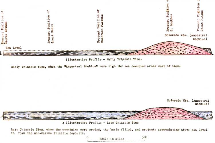
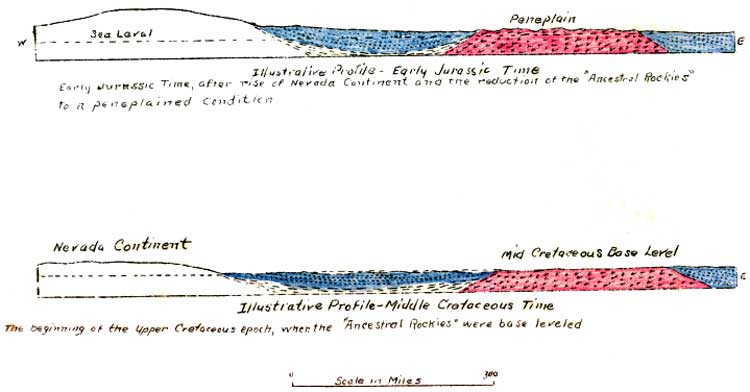
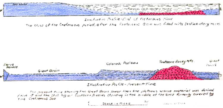
Probably the most important phase of the geologic history of the Rocky Mountain National Park is the growth and history of the mountains themselves. Although this region has had an extremely interesting history and has been the scene of many important events, few except those of the very earliest and the very latest geologic time, are represented within the actual boundaries of the park. The formations which portray the Paleozoic and Mesozoic history are represented in southern Colorado and in the foothill region immediately east of the park. Many of these formations at one time extended over the new mountainous region subsequently removed by the extensive erosion this region has suffered. Considering the fact that this region has been set aside because it typifies the grander features of the Rocky Mountain region as a whole, and that the mountains themselves are the primary object of wonder to the average person visiting the park, it seems most fitting that this phase of the geology be given the greatest consideration. A very brief statement has already been given presenting the more important series of events which have resulted in the formation of so grand a feature of the earth's crust. With the hope of more concretely presenting this series of events the following diagrams are included. It must be remembered that such a far flung and complicated system of structure as the Rocky Mountains can only be a most sketchy generalization of the structure at one locality. The locality here chosen for such representation is naturally the southern Rocky Mountains.
Paleogeographic maps illustrating the distribution of land and sea in this region during the various geological periods may be found in Heaton's report. (Heaton, R. L., 1933).
(click on images for an enlargement)

|

|

|
|
|
Last Modified: Sat, Feb 9 2002 10:00:00 am PDT |