Geological History of Crater Lake
National Park
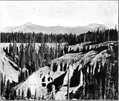
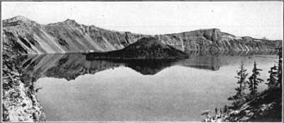
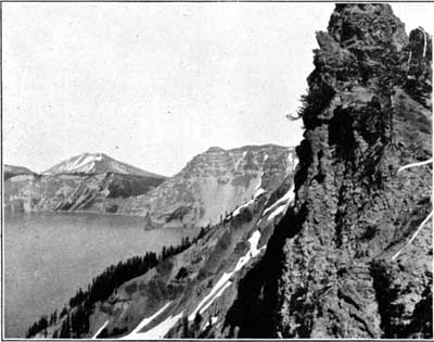
FIG. 5.—RIM OF CRATER LAKE AS SEEN FROM THE SOUTH ON ANNA CREEK.Within the park, approaching the lake from any side, the observer sees, as in the distant part of figure 5, a broad cluster of gentle peaks rising about a thousand feet above the general crest of the range on which they stand, but not until after he has left the main road, 3 miles from the lake, does he begin to feel the steepness of the ascent. The way winds over a large moraine littered with lava bowlders and well studded with firs. Arriving at the crest, the lake in all its majestic beauty, as it appears in figure 6, comes suddenly upon the scene, and is profoundly impressive. Descending the wooded slope a short distance within the rim to Victor Rock, an excellent general view of the lake is obtained. Upon the left is the western border of the lake, and upon the right its southern border (fig. 7). The eye beholds 20 miles of unbroken cliffs ranging from over 500 to nearly 2,000 feet in height, encircling a deep blue sheet of placid water, in which the mirrored walls vie with the originals in brilliancy and greatly enhance the depth of the prospect.
FIG. 6.—CRATER LAKE AS SEEN PROM NEAR VICTOR ROCK SHOWING THE WATCHMAN, GLACIER PEAK, WIZARD ISLAND, THE DEVILS BACKBONE, LLAO ROCK, PUMICE POINT, AND MOUNT THIELSEN IN THE DISTANCE.
Photograph copyrighted by Kiser Photo. Co., Portland, Oreg.
FIG. 7.—THE SOUTHERN BORDER OF CRATER LAKE AS SEEN FROM CASTLE CREST.
 |
 |