|
Kenai Fjords
A Stern and Rock-Bound Coast: Historic Resource Study |

|
Chapter 7:
THE LURE OF GOLD
Most of the Kenai Peninsula exhibits little evidence of mineralization, and mines on the peninsula, while numerous, have contributed only a minor portion of the state's mineral output. Few economically viable mines have been established on the eastern or western part of the peninsula. Extending in a generally north-south direction across the peninsula's central portion, however, is a belt of country rock consisting of alternating beds of slate and graywacke. Igneous dikes that are currently referred to as greenstones have locally intruded that rock mass. The dikes occupy fractures of irregular form and moderate extent; free gold is the primary mineral with economic importance, though sulfides are by no means uncommon. (The dikes also contain minor quantities of silver, copper, lead, and zinc.) Those dikes are found in an irregular belt that extended from the Hope and Sunrise areas south to Kenai Lake, while others are found along the North and West arms of Nuka Bay. Other mineralized areas on the peninsula are found on both the eastern and western slopes fronting on Resurrection Bay, along the Resurrection River, and additional sites scattered across the peninsula. [1]
Early Kenai Peninsula
Exploration

|
| Map 7-1. Historic Sites-Gold Mining. (click on image for an enlargement in a new window) |
As noted in Chapter 3, the first known mine on Kenai Peninsula was started at the behest of Peter Doroshin, a Russian mining engineer who visited the American colonies in search of potential mineral resources. In addition to the Port Graham coal deposits (which were mined during the 1850s and 1860s), Doroshin also found minor gold deposits along both the Kenai and Russian rivers. Little additional prospecting took place until the early 1880s, when Joseph M. Cooper sought gold near present-day Cooper Landing. In 1889, coal was extracted near present-day Homer, and the following year gold was obtained near Anchor Point. Both endeavors were commercially unsuccessful. [2]
More promising gold deposits were found along the peninsula's northern shore. A man named King discovered gold near present-day Hope about 1888, and shortly afterward, Charles Miller staked a gold claim on Resurrection Creek. The area remained fairly quiet, however, until 1893 when the creek witnessed new discoveries. Increasing numbers of miners arrived in 1894, and a remarkable find in July 1895 by John Renner and Robert Michaelson brought a major rush–perhaps 3,000 men and women–to the shores of Turnagain Arm the following year. Scores if not hundreds of claims were made in the Sixmile and Canyon creek drainages as well as within the Resurrection Creek drainage system. The towns of Hope and Sunrise boomed for the remainder of the decade, both diminishing in importance in later years. By 1911, Sunrise was practically deserted and by the 1930s most of the buildings had vanished. [3] Hope lost most of its population, too, but unlike Sunrise, Hope never "ghosted."
By the early twentieth century, prospectors had begun locating minerals in the southern peninsula as well. This may have been a result of the Hope-Sunrise excitement; the commencement of a large copper mine on nearby Latouche Island may have played a role; and the establishment of Seward in 1903 doubtless encouraged local mineral prospecting. Regardless of the reason, two claims had been staked in the Seward area by October 1904; both were located in Sunny Bay (present-day Humpy Cove) on the east side of Resurrection Bay. During the next several years, copper was found at a number of Resurrection Peninsula sites, and a minor (if well-publicized) copper rush ensued. Although the early reports on the copper claims appeared promising, no development occurred to compare with the copper mines of Latouche Island, and copper miners turned their interest elsewhere. Gold was also found in the area, most notably the Gateway Group along Tonsina Creek, but little if any production took place. By 1910, all development work for both copper and gold had ceased. [4]
Prospecting also took place during this period at the Kenai Peninsula's southwestern tip. A 1909 report noted that gold and other prospects had been located (probably since 1905) both at the west end of Windy Bay and near Port Dick. Ore quantities, however, were insufficient to justify production. [5]
Of particular interest to both prospectors and government geologists were the chromite (chromic iron) deposits west of Port Dick. Two deposits were known: one at Chrome Bay, near the mouth of Port Chatham, the other on the north side of Red Mountain, southeast of Seldovia. These deposits were known prior to 1910, but the Port Chatham deposit became of commercial interest only in 1917, when the price of ore rose because of wartime needs. [6] Whitney and Lass produced about a thousand tons of ore both that year and in 1918. By 1919, a "considerable plant investment" had been made, resulting in the production of "chrome of good quality." The company, however, mined no ore that year due to a return to prewar price levels. The plant soon closed and did not reopen. [7] At Red Mountain, commercial development did not take place until World War II. The mine operated from 1942 to 1944, and again from 1954 to 1957. [8]
Nuka Bay Gold Mining: A
Chronology
Government geologist U. S. Grant noted, after traveling through the area in 1909, that the outer coast was "entirely uninhabited." Prospectors, however, had previously visited the area. As noted in Chapter 5, George Stinson may have been one of the present-day park's first prospectors, in 1896. A group of miners were heading up the coast to the Hope-Sunrise diggings that year when a storm forced them to retreat to Nuka Bay. Stinson was intrigued by "rich-looking float" he found on the beach. The find, however, did not deter him from continuing on to Turnagain Arm, and the incident was soon forgotten. [9] Several years later, other prospectors (as noted above) located claims at Windy Bay and Port Dick and doubtless searched in many other locations.
Grant's report noted that prospecting parties had made gold claims in two general areas within the present park. One area was Two Arm Bay. It stated that on the mountain at the head of Taroka Arm, John Kusturin and Gus Johansen had staked nine claims on three quartz veins. [10] Development work had been limited to "some small stripping" of the veins. Grant also wrote that the east side of nearby Paguna Arm had "a few small quartz veins," an assay from which showed no gold. Near the head of Paguna Arm were seen "a few granite dikes." An assay from that deposit showed $1.80 per ton in gold, an amount that was insufficient to justify development work. This activity appears to have taken place between 1907 and 1909. The claims soon lapsed, and the area has remained idle ever since. [11]
The other area that had incited the interest of early prospectors was Nuka Bay. During the first decade of the twentieth century, the bay's East Arm (McCarty Fjord) was relatively short–McCarty Glacier extended some fifteen miles farther south than it does today–and the glacier's face reached from the southern end of James Lagoon to the mouth of McCarty Lagoon. A four-man prospecting party–Daniel Morris, James Sheridan, George W. Kuppler, and John H. Lee–located three deposits in 1909, two on East Arm and a third on North Arm. [12] One of the East Arm deposits was on the flat at the west side of the McCarty Glacier face; a "number of pieces" of float quartz were found, but no vein was located. The party also found a broken quartz vein "near the south point of the first ridge" west of McCarty Glacier. The vein, which was approximately 300 yards from the ice in July 1909, was opened for only two or three feet. On Nuka Bay's North Arm, they discovered a third deposit, located near the center of the arm's west side. The party did not engage in development work. Since that time, the East Arm sites have probably lain fallow, but the North Arm deposit was later relocated and became part of the Rosness and Larson prospect. [13]
U. S. Grant, the geologist who visited the area in 1909, took samples of several of the area's quartz-arsenopyrite veins. He later assayed the samples but found that "the results of these assays ... is not encouraging." His report, which was published in preliminary form in 1910 and in final form in 1915, may have put a damper on area prospecting, inasmuch as no known deposits were discovered along the park's coastline between 1909 and 1917. [14]
When gold was next discovered in the area is open to some dispute. A government report written in 1918 noted that "a quartz lode carrying free gold discovered on Nuka Bay in 1917 has attracted some attention, and it is reported that this lode was being developed in 1918." But another such report, written years later, said that Nuka Bay gold had been discovered in 1918 by Frank Case and Otis Harrington. The gold discovery, regardless of when it happened, took place at the Alaska Hills deposit, two miles up the Nuka River from Beauty Bay. [15]
Additional claim filing apparently followed these early discoveries, and by the spring of 1920, a bullish article in The Pathfinder stated that
Nuku Bay [sic], about eighty miles distant from Seward, is a quartz mining district. Although only discovered a few years ago, three large plants are operating continuously, and the average values are very high. This district is attracting considerable attention. [16]
The Alaska Hills deposit was probably one of the three "plants" in operation that spring. The identity of the remaining mines, however, is unknown, and it is doubtful if more than rudimentary excavations took place at those sites during this period.
Area mineral activity began to revive in 1922 when Charles Emsweiler, a Seward-based game guide and policeman, located a vein of free milling gold at the head of Beauty Bay. Emsweiler, working alone, mined one thousand pounds of ore from the outcrop of his find and packed it on his back to tide water. He took it to Seward and then transshipped it to the smelter at Tacoma. The shipment netted $80. The ore doubtless increased interest among some area miners, but the area received little additional publicity. [17]
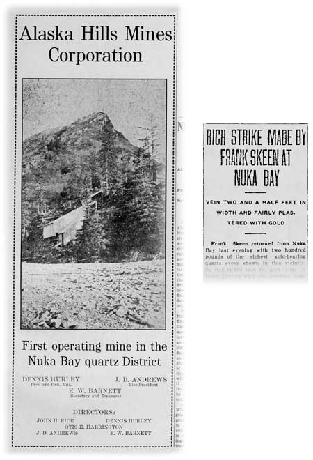
Frank P. Skeen, who had been prospecting in the area for more than 15 years, [18] then relocated the veins–350 feet southeast of the Emsweiler deposit–that Case and Harrington had discovered five years earlier. Skeen's "discovery," which took place in late June 1923, made front-page headlines in the July 2 issue of the Seward Gateway:
RICH STRIKE MADE BY FRANK SKEEN AT NUKA BAY
Vein Two and a Half Feet in Width
and Fairly Plastered with GoldFrank Skeen returned from Nuka Bay last evening with two hundred pounds of the richest gold-bearing quartz ever shown in this vicinity. So rich is the rock in gold that it fairly glitters with the precious mineral, and old timers who have seen the samples state they are better than have been shown in Alaska for many a day.
The vein, which is two and a half feet wide at the surface, was found by Mr. Skeen while burning off the grass around a property held by him at Nuka Bay. A piece about as large as one's fist was discovered sticking out of the ground, and upon examination the larger vein was found. Mr. Skeen stripped the vein for fifty feet and it showed the same high values at all points with no diminution in width. The vein is in block slate formation similar to the deep mines of California, and has every sign of permanency.
The new strike is about a mile and a half from salt water, on the Nuka River, and at about 500 feet in elevation. A wagon could be driven from the saltchuck to the mine. [19]
|
| Frank Skeen's June 1923 gold discovery led to the Alaska Hills Mine, which was the first commercially productive mine in the Nuka Bay district. The mill, shown in the photograph, was completed in November 1924; it operated until 1928. Seward Gateway, December 5, 1925, 9. |
Skeen soon returned to Nuka Bay to develop his property, and before long he brought back to Seward further proof of the claim's wealth. In late August, he exhibited a half ounce of gold that had been washed out from ten ounces of rock, and he also announced, based on recent assay results, that he had specimens showing values of more than $3000 per ton. These yields, according to newspaper reports, "caused considerable excitement among the old timers of this vicinity, and a number of prospectors and their outfits have taken gas boats for the scene of the strike." [20] A minor rush ensued, with Anchorage as well as Seward residents taking part; by early September, there were "some 65 miners and prospectors at the scene of the strike." One visitor to the claim announced that the strike "was all that it was reported to be, and more. Mr. Skeen has a wonderfully rich property there." [21]
The Pathfinder of Alaska gave an enthusiastic, detailed account of Skeen's discovery:
A sensationally rich gold quartz strike has been made in the Nuka Bay section, a short distance from Anchorage. Samples taken from the lead, which is exposed on the surface for a hundred or more feet, are said to go into the hundreds and even thousands of dollars. The silver content goes about $50 per ton, according to the assays.
The find was first made in June by Frank P. Skeen, an experienced hard-rock man of 25 years' residence in the north. The discovery was made as a result of finding a piece of quartz that was literally alive with gold, according to Skeen. Using his prospector's pick he began to dig around in the grass covered ground near the spot where the float was found and luckily encountered the vein. Skeen uncovered it for about 20 feet, enough to show that he had found a wonderful prospect. The vein at this point was about 20 inches in width and is what is termed a true fissure vein, crosscutting the formation. There is a sort of gouge in both walls, Skeen says, from which he picked out pieces that appeared to be plated with gold. Gold, he says, can be seen in much of the quartz, although there is a heavier concentration along the walls.
Subsequent development has revealed an ore body estimated to contain approximately $200,000 in what can be seen of it. The formation of the district is a black slate, occurring in blocks, and acidic and porphry [porphyry] dikes running through the country which are said to give encouraging prospects. [22]
The prospectors who invaded the area on the heels of Skeen's strike doubtless investigated the area surrounding his claims. Finding little, they fanned out across Nuka Bay and beyond, and scores registered claims. (Most claims were located near either the North Arm or West Arm of Nuka Bay, but some were made as far south as Tonsina Bay or as far north as Aialik Bay.) [23] By the summer of 1924, development work had taken place on at least six prospects, and work began on perhaps a dozen others as the decade wore on. [24]
Prospecting continued in the Nuka Bay area throughout the 1920s, but well before the end of the decade it became increasingly obvious that paying properties would be few and far between. As government geologist J. G. Shepard noted in a 1925 report, "it is not likely that the District will ever be an important producer, although small tonnages of commercial ore will probably be worked from time to time." [25] Factors such as remoteness, poor transportation, snowslides, and late-spring snow accumulations doubtlessly retarded progress. Another retarding factor, common to small-scale operations, was poor management. As geologist Robert Heath noted in 1932 after a visit to the area,
The greatest obstacle seems to be lack of men who understand the business and technique of mining. There have been many expensive mistakes made in the past by the pioneer operators that could be avoided by a new company just entering the field.... Practically all of the attempts at mining have been promoted and conducted by men who were trained in other kinds of work.
Primarily, however, the area's lack of development was due to a lack of economically extractable gold. [26]
During the 1920s, relatively few properties had sufficient ore to justify production. Two mines produced gold: the first, beginning in 1924, was the Alaska Hills Mine, which had been "rediscovered" by Frank Skeen just the year before. Four years later, the Sonny Fox Mine, at the head of Surprise Bay, was the second Nuka Bay mine to commence production. That so few properties were able to operate during the 1920s was, in large part, due to conditions that prevailed throughout the Territory; gold production in general, and lode gold production in particular, dipped to its lowest level in more than a decade. [27]
The Great Depression years of the 1930s were poor for the nation's business, but judging by production figures, they were relatively favorable for the Alaska gold mining industry. Gold production rose gradually during the early 1930s. Then, in January 1934, gold mining received a further boost when the U.S. government (which was the only legal gold buyer) raised the price of gold from $20.67 to $35 per troy ounce. In the Nuka Bay area, production rose and new properties began milling gold. The Rosness and Larson mine, on the west side of North Arm, began operating in 1931; the Goyne Prospect, on Surprise Bay, sent out its first ore the same year; and in 1934, the year gold prices rose, the Nukalaska Mine commenced production. [28]
A government report published in 1931 was bullish about the district. It noted that the Sonny Fox mine, in operation since 1926, was the area's top producer. In addition,
there are more than a dozen other properties in the district on which development work was in progress, and of these at least three shipped some ore or concentrates to smelters in the States for treatment. The properties at which work was in progress are widely distributed through the district, indicating that the mineralization is not localized at a few points. The success that already attended the operations of the Sonny Fox mine and the samples that have been assayed from many of the other properties give assurance that the mineralization in many places has produced ores that, if skillfully mined and milled, are of commercial grade. [29]
By 1933, however, optimism about the district had begun to dim. A U.S. Geological Survey report noted that "on the whole, small-scale prospecting does not appear to have been so active during 1933 as in the preceding year," and prospecting continued to decrease in 1934. Even the local chamber of commerce, which had been publicizing its potential just two years earlier, chose not to recommend the area as a potential mining area in a December 1934 letter. [30]
During the late 1930s, interest in the Nuka Bay mines continued to subside. The Geological Survey's 1937 report on Alaska mining noted that "mining was carried on at a somewhat slower rate than formerly." There were three producing properties–Nukalaska, Sonny Fox, and Alaska Hills–but "at none of the other mines were any notable new developments in progress, and no new prospecting enterprises are reported to have been started during the year." The following year's report stated that
perhaps half a dozen properties on which some work was done during the year, but the wave of interest that brought this camp to notice a few years ago seems to have subsided, so that many of the early comers have drifted away and mining has dropped to a low stage.
The 1939 report noted that work continued on six properties, "but at only three of them [the same three noted above] was the work much more than casual prospecting." [31] By the end of 1941, production had ceased throughout the district; the area remained idle until after World War II.
Between 1924 and 1941, a total of five mines produced and shipped gold ore. Two of the five (the Sonny Fox Mining Company and the Alaska Hills Mine) operated for ten or more years; one mine (the Nukalaska Mine) operated for five to nine years, and the final two (the Rosness and Larson Mine and the Goyne Prospect) produced gold for fewer than five years. Most of the mines were small in scale, with a crew numbering six or fewer, and in almost all cases the operations were seasonal, usually lasting from late April or early May until September or October. [32]
Little if any gold production data was ever published from these mines. [33] In the 1960s, however, geologist Donald Richter estimated production quantities based on mill capacities, gold values, yields per ton and scattered unofficial reports. On that basis, he estimated that the district produced perhaps $166,000 in gold between 1924 and 1940. The largest producer, the Sonny Fox Mine, yielded some $70,000 in gold. Production from the Alaska Hills Mine was $45,000; from the Nukalaska Mine, $35,000; and from the Rosness and Larson Mine, $15,000. (All figures are approximate.) The Goyne Prospect yielded an insignificant amount of gold–less than $1,000, according to Richter's estimate. [34]
By any measure, the yields from the Nuka Bay district were minor. The district yielded an average annual total of $10,000 in gold during the 1924-1940 period. [35] During those 17 years, however, the annual total of lode gold production in Alaska ranged from $2.7 million to $8.3 million, and the annual total of Alaska gold production (from both lode and placer mines) ranged from $5.9 million to $26.2 million. Using the most conservative measurement, therefore, the Nuka Bay mines do not appear to have ever contributed more than one percent of Alaska's lode production, and they consistently produced less than 0.3% of Alaska's total gold production. [36] Based on those yields, it is not surprising that the Nuka Bay mines (and other Kenai Peninsula gold mines) were consistently described in the "other districts" section of the U.S. Geological Survey's annual reports.
Mining on the Kenai Peninsula, as elsewhere in Alaska, revived slowly during the postwar years. Economic prosperity brought more jobs and rising wages, luring miners to the cities. The prices of mining equipment, moreover, increased along with other products. The price of gold, however, held steady at $35 per ounce. [37]
Because of those obstacles, and because the most promising veins had already been tapped, the level of Nuka Bay mining activity was far less than it had been before World War II. Sometime during the postwar period, the Golden Horn group unsuccessfully attempted to reopen the Goyne prospect on Surprise Bay. In July 1951, Wyman Anderson and B. C. Rick expressed an interest in the old Sonny Fox mine; they transferred the property to the Alaska Exploration and Development Corporation, which held the property for the next several years. Sometime in the 1950s a group from Hawaii, locally known as the Honolulu Group, unsuccessfully attempted to reopen the Nukalaska Mine but the venture was apparently short-lived. In 1959 and 1960, several Seward residents conducted development work at the Little Creek (Glass and Heifner) prospect, near the head of Beauty Bay. None of these attempts resulted in commercial production, however, and after a 1967 visit, geologist Donald Richter noted "today the area has been virtually forgotten." [38]
|
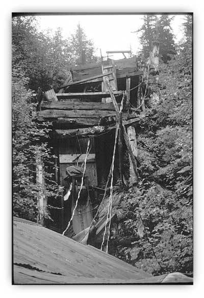
| Remains of tunnels, mining equipment, camp buildings and roads are scattered throughout the West Arm and North Arm of Nuka Bay. This 1970s-era photo may have been taken at the Goyne/Golden Horn prospect. Don Follows photo, NPS/Alaska Area Office print file, NARA Anchorage. |
The dramatic rise in the price of gold, beginning in 1968, favorably affected gold mining operations throughout the United States. Perhaps as a result, at least one recently active Nuka Bay mine has produced commercial quantities of gold, and small-scale activity has taken place elsewhere. In 1965, a group from Jamestown, Ohio, acquired the former Little Creek prospect; soon afterward, they constructed a small mill and mined "a limited amount" of ore. The pair operated on an intermittent, small-scale basis until the early 1980s; since then, others have extracted ore from time to time. At the Sonny Fox mine site, the ground was re-staked in 1968 and it remained an active claim site for more than twenty years thereafter. Other active development work in recent years has taken place at the old Goyne-Golden Horn prospect. During the early 1970s, there was also a purported barium deposit on the east side of Harris Bay. The four claims that encompassed that deposit, however, lapsed before the end of the decade. [39]
Nuka Bay Mining Sites: Beauty
Bay
Alaska Hills Mines Corporation
The first gold known to be discovered in the area surrounding Beauty Bay took place at the Alaska Hills deposit, two miles up the Nuka River from Beauty Bay. When the discovery took place is open to debate. As noted in the section above, a government report written in 1918 stated that "a quartz lode carrying free gold discovered on Nuka Bay in 1917 has attracted some attention, and it is reported that this lode was being developed in 1918." But a similar report, written during the mid-1930s, said that the gold discovery, by Frank Case and Otis Harrington, took place in 1918. [40] Additional claim filing may have followed that discovery, but no development work immediately ensued, and by the early 1920s, Case and Harrington had either relinquished or sold their claim.
Mineral activity in the area remained quiet until the early 1920s. As noted above, one source notes that gold was discovered nearby, in 1922, by Charles Emsweiler, a Seward-based game guide and policeman. Emsweiler apparently extracted a half ton of ore and sent it to Tacoma for smelting. [41] Then, a year later, the Case-Harrington claim was rediscovered by Frank P. Skeen, a prospector who had been living and working on the peninsula since 1907 if not before. Skeen had apparently acquired Case and Harrington's claim and, as noted above, was "burning off the grass" around his property in late June 1923 when he located a quartz vein that was "two and a half feet in width and fairly plastered with gold." Skeen stripped the vein for fifty feet and found it to be consistently rich; he then extracted two hundred pounds of ore and took it back to Seward for assaying. [42]
Table 7-1. Elements Comprising the Nuka Bay Mining District
| Mine Area and Name | Years of Commerical Operation | Identified Historical Register (pre-1948) Elements | National Register Eligibility |
Beauty Bay: | |||
| Alaska Hills Mining Corp. | 1925-28, 1931, 1937-41 | mill, adits (4), improved trail, tramway, log bunkhouses (2) | not evaluated |
| Nuka Bay Mining Company (Harrington Prospect) |
[none] | adits (2), open cuts, small mill, trail, upper camp, lower camp [cabins?] | not evaluated |
| Nukalaska Mining Company | 1934-38 (+1939-41?) |
road, tramway (2), mill (old and new), machine shop; camp buildings (4) and tents (2); bunkhouse/ore bin/tram terminal at adit #1; compressor shed at adit #2, tents (2); cabin and storehouse at beach | yes, 1991; SHPO concurs |
| Glass and Heifner Mine (Earl Mount/Little Creek Prospects) |
1965-85? | Open cuts, adit, camp, shaft, raise (all probably obliterated by 1965-85 work) | not evaluated |
| Miscellaneous Sites | [none] | adit, cabins (2) | not evaluated |
North Arm: | |||
| Rosness and Larson Property | 1931-33 | surface trenching, bulkhead, hoist, adits (3), winze, mill, log cabin, tents (2) | not evaluated |
| Kasanek-Smith Prospect | [none] | adit, surface trenches; cabin at nearby cove | not evaluated |
| Robert Hatcher Prospects | [none] | open cut, adits (4), cabin | not evaluated |
| Charles Frank Prospect | [none] | adit, cabin | not evaluated |
Surprise and Quartz Bays: | |||
| Sonny Fox Mine (Babcock and Downey Mine) |
1928-40 | trail, mill (old and new, surface tram, aerial tram, dock, adits (6), open cuts, camp buildings (5) | yes, 1991; SHPO concurs |
| Skinner Prospect #1 | [none] | adit | not evaluated |
| Johnston and Deegan Property | [none] | surface trenches, cabins (2), trails | not evaluated |
| Goyne Prospect (Golden Horn Property] |
1931-34 | tunnels (2), shallow pits, cabin, trail; bunkhouse? | not evaluated |
West Arm and Yalik Bay: | |||
| Lang-Skinner Prospect | [none] | open cuts, tunnels (4), frame house, log cabin; another cabin at "Lang's Beach" | unable to locate |
| Blair-Sather Prospect | [none] | adits (2), frame house | not evaluated |
Skeen soon returned to Nuka Bay to develop his claim. In late August, he exhibited a half ounce of gold that had been washed out from ten ounces of rock, and he also announced that he had specimens showing values of more than $3000 per ton. These yields, as noted above, "caused considerable excitement among the old timers of this vicinity" and caused a minor rush to the area; "some 65 miners and prospectors" had flocked to the area by early September. One visitor to the claim announced that the strike "was all that it was reported to be, and more. Mr. Skeen has a wonderfully rich property there." [43] Skeen called his claim the Paystreak.
Whether Skeen was the sole claimant at the time of his discovery is unknown, but by late August he had acquired several partners, including Earl W. Barnett and J. D. Andrews. [44]
During the winter of 1923-24, Skeen and his partners organized the Alaska Hills Mines Corporation. By the following summer, people working for the company had begun to dig two tunnels: an upper tunnel, at 570 feet above sea level and located on the vein, and a lower tunnel, 495 feet above sea level with drifting on the vein. Also under construction that summer was a mill, located at 40 feet above sea level and adjacent to left bank of Nuka River. The mill building contained a small Blake jaw crusher; a Worthington overflow-type, 5' x 5' ball mill; a drag classifier; amalgam plates; and a concentrating table. Its capacity was 40 tons per 24 hours. A 1,605-foot jigback aerial tramway, completed that year, connected the lower tunnel entrance with the mill, and "substantial camp buildings" (which probably consisted of two log bunkhouses) were also constructed. A two-mile trail connected the mill and adjacent camp with Beauty Bay, but it was so narrow that all the supplies for the mine had to be brought up the Nuka River on a barge. The mill was finally completed in November; a test run of ore was then processed, apparently with favorable results. [45]
In 1925, both the Paystreak Mine and the mill were active from May until November. By year's end, a tunnel (probably the upper tunnel) had been dug 200 feet into the hill and was following a vein 2 feet wide. The mill that year produced, in the opinion of government geologists, "a substantial production of lode gold;" the local newspaper reported that "about $12,000 in bullion" was produced. [46]
Based on that activity, the Alaska Road Commission agreed to improve the trail to the mine. The trail was "cleared, grubbed and graded 1_ miles for an average width of 7 feet." The grading included the blasting away of 1,507 cubic yards of solid rock, much of it along a narrow ledge; in addition, 200 linear feet of corduroy was laid and five timber culverts were constructed. By summer's end, the trail, which cost some $4,300, was "suitable for pack horses or double enders." The local newspaper editor judged the new trail to be "splendid." [47]
The Corporation held a stockholders' meeting in Seward in October and declared its first dividend. The directors had high hopes; they envisioned a post office and "a port for ocean-going steamers." Skeen was no longer part of the company; the primary participants at this time were J. D. Andrews and E. W. Barnett (who had been Frank Skeen's partners in 1923), who now served as the corporation's vice-president and secretary-treasurer, respectively. Other members of the board of directors included Dennis Hurley (president and general manager), Otis E. Harrington and John H. Rice. Miners included Jack Coffey and Jim Foster. [48]
The operation, however, was not without its problems. One major difficulty was an improperly designed mill. Noted one observer, "a great deal of gold has been lost in the tailings [because of the] failure of the concentrating tables to recover all of the sulphides in the ore." A properly designed flotation plant was recommended. Another visitor, moreover, criticized the extraction operation. Geologist J. G. Shepard noted that "the mine was poorly worked, no attention [having] been given to either chutes or manways." [49] In a late 1925 newspaper article, the company admitted that the mill had "been giving the company more or less difficulty during the first year's operations." They confidently stated, however, that it was "now doing much better and little future trouble is anticipated," and went on to describe that a cyanide plant, which had been recently installed, had "started up immediately and from last reports the recovery has been extremely gratifying." [50] Milling efficiency, however, continued to lag for the next several years.
Underlying the operation's difficulties was a lack of experience in commercial mining by company managers. E. W. Barnett, for example, was an engineer with the Alaska Railroad, and Otis Harrington, John Rice, and J. D. Andrews were all known to be prospectors. Given that background, J. G. Shepard roundly criticized the operation, noting that
The management of this property has been very inefficient. Nothing was known as to the value to the ore milled. The value of the tailings was an unknown quantity. A total lack of knowledge of the principles of mill operation was displayed. Mining was poorly done. In short it has been an operation such as might be expected, of men who had no conception of current mining practice.... [A] haphazard operation, such as [has] been carried on in the past, is bound to be a failure. [51]
Robert Heath, who visited the site in 1932, made a similar assessment, which pertained both to the Nuka Bay area generally as well as to the specific operation at Alaska Hills. He noted the following:
The greatest obstacle seems to be lack of men who understand the business and technique of mining. There have been many expensive mistakes made in the past by the pioneer operators that could be avoided by a new company just entering the field.... Practically all of the attempts at mining have been promoted and conducted by men who were trained in other kinds of work. [52]
Despite those difficulties, the Alaska Hills Mines Corporation continued to produce commercial quantities of gold for the next several years. The U.S. Geological Survey's annual report for 1926 noted that
the only [Nuka Bay] mine from which any considerable production of gold was reported was on the Paystreak claim of the Alaska Hills Mines. This mine increased its output considerable over the preceding year and appears to have had an especially successful season, being enabled to run practically without interruption from early in May until November. [53]
The mine remained active in 1927 and 1928; the Seward Gateway during that period faithfully reported the travels of Barnett, Coffey, and others involved with the company. In the spring of 1927, Territorial Highway Engineer R. J. Sommers visited the mill. Shortly afterwards ARC personnel were undertaking "small improvements ... desired by the operators in that district" to the two-year-old trail that connected the mill with tidewater. [54]
By 1928, the Alaska Hills operation was no longer the chief Nuka Bay producer, having been surpassed by the Babcock and Downey (Sonny Fox) mine in Surprise Bay. Production at Alaska Hills that year closed early owing to a snowslide that destroyed "several of the buildings." Perhaps as a result of the slide, "only the usual assessment work was done" in 1929. The following year, the mine apparently continued to be unproductive. [55]
By the summer of 1931, however, the damaged buildings had been either restored or replaced, and the Alaska Hills mine was one of two area mines "producing in a small way," the other mine being the Babcock and Downey outfit. Engineer Earl Pilgrim that year made a thorough investigation of the property for the Territorial Bureau of Mines. He noted that the property consisted of five mining claims: Pay Streak No. 1, Pay Streak No. 2, Pay Streak Extension, Pay Streak Fraction, and Fairweather. Four tunnels were dug on those claims: an upper tunnel, now 125 feet long; a lower tunnel, now 550 feet long; a crosscut tunnel (280 feet northwest of the lower tunnel and at a 370-foot elevation) which was 165 feet long; and a fourth tunnel, at the Emsweiler vein, which was 75 feet long. Pilgrim noted that a crew of three was working at the site that summer; they milled 267-1/2 tons of gold ore and reported a profitable operation. John H. Rice and E. W. Barnett, both of whom had been with the company since the mid-1920s, were the principal company officers. [56]
Production lapsed again after the 1931 season. In 1933, the USGS's annual report noted that "the principal producing mines in the Nuka Bay District" included "the Alaska Hills mine, under the management of E. W. Barnett." But little, apparently, was produced that year, inasmuch as Stephen Capps's 1936 report stated that "only a small amount of mining" had been done since 1931; work in 1936, moreover, was limited to assessment work. [57] For the remainder of the decade, U.S. Geological Survey officials provided bullish (if vague) statements about the mine's activity; in 1937, Alaska Hills was listed as one of three "principal producing properties" in the Nuka Bay area, and in 1939, it was listed as one of the three Nuka Bay properties where "more than casual prospecting" had taken place that year. [58]
The summer of 1940 again witnessed a minimum of activity. That October, however, the property was leased to partners Dave Andrews and John Coffey who, with two others, conducted gold mining and milling operations until late July 1941. The lessees, during that period, milled 160 tons of ore. Inasmuch as the two upper tunnels had caved in, the partnership worked in the two lower tunnels and operated a 1200-foot, two-bucket tramway between one of the tunnel openings and the top of the mill building. The mill, at this time, had a Blake type crusher (as before) but a Union Iron Works ball mill; its capacity was one ton per hour, some 40 percent less than the 1924-era Worthington ball mill had offered. Three men operated at once, two in the mine, the other doing the tramming and crushing. [59]
When Andrews and Coffey ceased operations, mining at the site had been taking place, off and on, for almost 20 years. [60] The property boasted some 900 feet of underground workings, and an estimated $45,000 of gold ore had been extracted, milled, and shipped. After July 1941, however, no known mining operations took place at the site. (The claims were soon relinquished, and unlike many Nuka Bay properties, no new claimants attempted to develop the property during the postwar period.) The site slowly decayed, and by June 1967, the mill had been "dismantled and burned and all the camp buildings were collapsed." Donald Richter, the geologist who investigated the property that year, was able to find just one of the four tunnel entrances (the others were either caved in or covered with snow), and the mid-1920s ARC trail along the Nuka River had been abandoned. [61]
In July 1991, National Park Service personnel visited the property's mill area and main camp as part of the agency's Mining Inventory and Monitoring Program. They made a detailed reconnaissance, spending two days at the site. At that time, the mill consisted of "rusted machinery and artifacts that are partially covered by lumber and metal remains of the collapsed walls and roof of the mill building. Much of the mill machinery is apparently missing." The nearby camp consisted of a log cabin ruin, specifically "sill logs covered with collapsed corrugated metal roofing. Very few artifacts were observed around the camp structure." Agency personnel made no attempt, as a result of the site visit, to nominate the property to the National Register of Historic Places.
|
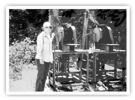
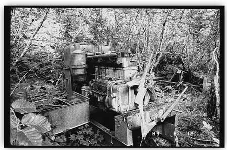
| Crews from NPS's Mining Inventory and Monitoring Program visited various Nuka Bay-area historic sites during the late 1980s and early 1990s. They encountered hundreds of artifacts--tramways (top), classifiers (bottom), and other items--that remain from the mines' heyday in the 1920s and 1930s. NPS photos. |
Nuka Bay Mining Company (Harrington Prospect)
Shortly after Frank Skeen found gold at what became known as the Alaska Hills Mines Corporation site, Otis Harrington located gold at a site two miles south of Skeen's find. (Harrington was no newcomer to the area; he, along with Frank Case, had claimed the Alaska Hills site in 1917 or 1918 but had subsequently abandoned it.) The new deposit was located 1,470 feet above the waters of Beauty Bay, near the crest of Storm Mountain's southern ridge. Harrington located the quartz vein, thereafter called the Harrington prospect, in either late 1923 or early 1924.
Inasmuch as Harrington apparently worked alone, development proceeded slowly. When geologist H. H. Townsend visited the site in 1924, the deposit sported several open cuts and one timbered shaft. During the year that followed, "very little development work" took place at the so-called "Nuka Claims;" the only improvement was a 20-foot tunnel. Harrington, by the summer of 1925, had taken a partner and was planning to install a small mill that winter. (News reports at the time noted that an Ellis ball mill was on its way to one of the area's mines; it may have been headed for Harrington's property.) The geologist that visited the property, however, told him that there was "not sufficient ore of a rich value in sight to warrant this expenditure." Perhaps on the basis of that advice, no mill was installed. [62] Harrington soon turned his interest in the property over to Denis Hurley. Hurley's interest in the site, however, was brief; that October, he relinquished all rights at the property to Calvin M. Brosius.
Brosius, a prominent Seward resident, was a lumber and building materials dealer. He had no direct interest in mining. Having supplied many area miners, however, it is not surprising that he became active in mining operations. In addition to the Nuka Bay property, he and partner Bill Knaak also had interests in mines at Crown Point (near Lawing, north of Seward) and on Stetson Creek (just south of Cooper Landing). Knaak was a miner by profession; he did most of the development work, while Brosius's support appears to have been primarily financial. [63]
The Nuka Bay property lay idle until 1928, when "some work" took place there. By the following year, Brosius and his associates had established the Nuka Bay Mining Company. Brosius let a contract to Alec Erickson to dig 100 feet of tunnel at the site. Another worker soon joined him. By year's end, "about 95 feet of tunnel was driven" and a mill (probably a "small gasoline-driven Gibson mill") had been delivered to a location "near the portal of the tunnel," but the mill was never operated. Access to the site was via the ARC trail for about three-quarters of a mile north from Beauty Bay; at that point stood a Nuka Bay Mining Company-owned log cabin, from which a 3,400-foot trail led eastward (and up a steep slope) to the mine. [64]
Development work appears to have continued at the mine for the next two years. By the summer of 1931, Earl Pilgrim noted that the "principal owners" of the "Nuka Bay Mines Company" were Brosius and Mrs. E. B. Weybrecht. The mine site consisted of three lode claims: Nooka, Nooka Extension, and Nooka No. 1. The complex consisted of the now-abandoned upper tunnel, at elevation 1,470 feet, where Harrington had carried on his early work; a lower tunnel, nearly 400 feet long, at elevation 1,140 feet; and an open cut at elevation 1,240 feet. An upper camp was located at elevation 1,200 feet. (A lower camp was not mentioned, but it probably consisted of the log cabin, and perhaps ancillary buildings as well, at the ARC trail junction.) The mill was situated at the mouth of the lower tunnel, where most of Brosius's activity appears to have taken place, but according to a 1936 report, the mill was probably never used. [65]
After 1931, the operation lapsed into idleness. In 1933, Charles Goyne may have spent time at the site (his Surprise Bay property was being worked by others that year), and plans were also announced to have miner John Soble drive a 30-foot tunnel there. The tunnel, however, was apparently never begun, and no further development work took place at the site. Brosius, who still controlled the property, continued to perform annual assessment work until 1941. The following year, Brosius was killed in an accident at his lumber store, and the claims were apparently relinquished soon afterward. [66] In 1968, two new mining claims (North Beauty No. 1 and No. 2) were made at the property, and the following year the Snowlevel claim was located, possibly at the same site as the North Beauty claims. The owners, all of whom held other area claims, were Donald Glass of Jamestown, Ohio; Martin L. Goreson of Seward; J. L. Young of Kenai; and Ray Wells, address unknown. No development work took place as a result of these claims. The two North Beauty claims were abandoned, and by the early 1980s the Snowlevel claim had been relinquished. [67]
The camp, last actively used in 1931, deteriorated quickly. In 1936, the mill was "exposed to the weather and in bad condition." By 1967, Donald Richter noted during a site visit that "no buildings remain standing in the prospect area, and the tailing pile at the portal of the [lower] exploration tunnel is largely grown over with alder." The portal of the tunnel, with its "410 feet of underground workings," was still open and accessible. The trail from the ARC trail to the camp, however, was "almost completely covered with growth" and the cabin where the trail commenced was in a collapsed state. [68]
In July 1991, the mine and camp were visited by National Park Service personnel as part of the agency's Mining Inventory and Monitoring Program. As part of their detailed reconnaissance, they noted that "the site consists of a large concentration of mining equipment and machinery, an adit with associated ore cart track, a large spoil pile, and two prospect pits." No buildings were found, and artifacts were "composed mainly of tool fragments and industrial debris." This group, like Richter 24 years earlier, was unable to locate the upper tunnel. A few days later, members of the group visited the collapsed log cabin, at the base of the trail, that may have served as the lower camp. They found that "some courses" remained on all four walls; no roof existed, however, and the logs were "punky and sodden." A few associated artifacts were found nearby. Agency personnel made no attempt to nominate either property to the National Register of Historic Places.
Nukalaska Mining Company
The Nukalaska Mine, located on a near-vertical, north-facing slope high above Beauty Bay, was the last significant prospect in the Nuka Bay area to be located, and also the last to be commercially developed. Al Blair, who had previously developed the Blair-Sather prospect in Yalik Bay, discovered the vein and made three mineral claims in 1926. He appears to have remained active at the site through the summer of 1927. [69] Soon afterward, however, he lost interest in the area. In September 1931, veteran prospector Robert Hatcher (who was also active elsewhere in Nuka Bay) and fellow Sewardite T. S. McDougal claimed the vein but did little if any site work. [70] Hatcher apparently hired Ray Russell, who developed the site sufficiently to interest mining developer M. B. Parker from Hollywood, California, along with Edward P. Heck of Fellows, California and F. G. Manley of San Francisco. The group bought the property in early 1933. By the end of that year, a government geologist was probably referring to this site when he noted that "rumors were afloat of a number of deals pending with a view to the undertaking of more intensive work." [71]
By early 1934, Parker had formed the Nukalaska Mining Company. Commercial development proceeded immediately. Geologist Stephen Capps noted that the improvements included:
the construction of 1-1/4 miles of road from the beach to the camp and thence to the lower terminal of the tramway, 2,000 feet upstream from the mill; a 3,500-foot 2-bucket 7/8-inch cable gravity tramway from the mine to the lower terminal...; and a mill, office, bunk houses, cook house, and blacksmith shop. The [flotation] mill is equipped with jaw crusher [and] ore bin, with a capacity of 1 ton an hour.... [72]
The original or western quartz vein, according to Capps, "crops out on the crest of a high, rugged ridge" at elevation 2,280 feet and "is so steep as to be difficultly [sic] accessible." To mine it, an adit (or tunnel) was driven into the cliff face 200 feet below the outcrop. Workers found the vein after digging into the mountain for 230 feet; once encountered, they began crosscut tunnels that, by August 1936, had been driven 175 feet to the west and 200 feet to the east. Active stoping was also carried on; in one section, stopes reached 80 feet above the adit level. At the mine portal stood a bunkhouse, ore bin and tram terminal, with an enclosed blacksmith shop. [73]
Development proved so promising that in 1935, the company staked 15 additional mining claims. The size of the crew also increased; in 1934, the crew was evidently fairly small, but by 1936 the company had 20 workers at the site, enough for one daily shift in the mine and three shifts in the mill. [74] Workers in 1935 included Don McGee and Amos Buffin; company managers included Parker, his assistant Z. N. Marcott, and Ray Russell. [75]
During 1936 and 1937, good news prevailed at the Nukalaska Mine. After an August 1936 visit, for example, geologist Stephen Capps noted that "the material milled was yielding about $100 to the ton in gold, notwithstanding the fact that about two-thirds of it was country rock that had to be mined along with the vein quartz." Based on such promising results, a crew numbering either 19 or 20 people (including one woman) worked a six-month season, from May to November. [76]
Despite the company's success, managers recognized that the existing system of ore removal needed to be changed. Snowslides each year destroyed the 2,000-foot road that connected the camp with the lower tramway terminal; nearly every year, moreover, snowslides swept the towers away from the tramway that connected the mine entrance to the road terminus. The destruction caused by those events limited the milling season to three months annually. [77] In order to circumvent those problems, managers by the end of 1937 unveiled plans to drive a new, eastern tunnel "on the opposite side of the creek from the old workings." [78] Work both that year and in 1938, however, was limited to the western workings.
In June 1938, a fire "destroyed part of the buildings comprising its surface plant;" the milling plant (perhaps the only building involved) was "completely destroyed." The company, as a result, gained new management; the new managers, who resided in Los Angeles, included W. V. (Vince) Conley, President; W. R. Foster, Treasurer; and J. S. Mathews, Secretary. Mining was suspended for the remainder of the year. [79]
That winter, another tragedy struck as "heavy snow slides ... damaged some of the surface equipment at the Nukalaska property." The twin disasters forced the company to lay off two-thirds of its workers. The remainder of the work force soldiered on, however, and "in spite of the delays required for these repairs, the operators [in 1939] were able to extend the long crosscut they had been driving about 350 feet." By year's end, the length of the crosscut tunnels that branched off the main, 230-foot tunnel reached 200 feet (to the west) and 490 feet (to the east). The western tunnel was abandoned thereafter. [80]
On June 1, 1940, the company began to develop the long-planned eastern or lower tunnel, the portal of which was at elevation 1,300 feet. Work on the new tunnel continued all summer and by early September, 1,250 feet had been dug. [81]
By the following July, 90 feet had been added to it. At its portal stood a compressor shed; between there and the mine camp stretched a 2200-foot aerial tramway with a single 5/8" cable and a 3/8" carrier cable. A 1941 visitor to the camp noted that "safety conditions are none too good: the men ride to and from work on the power tram on a two-wheel carrier, which almost touches the ground in two places, and the carrier cable drags on bedrock in several places forming grooves." The tram to the mine's western tunnel workings, described as a 3,700-foot aerial tram with a double 7/8" cable, was no longer used but had not been removed. [82] The camp and the surrounding area had changed little since the mid-1930s. The main camp consisted of three wooden buildings–the office, a bunk house, and cook house–plus two tents. A machine shop was located 300 feet above the camp; at the beach, 1-1/4 miles northeast of the main camp, stood a cabin and a small storehouse. Miners lived in the bunkhouse, the tents, and the beach cabin; the crew in 1940 numbered 12 to 15 people, which included a tram operator, a blacksmith, and site manager Vince Conley. Two men lived with their wives, and one of the couples had their two young children in residence. [83]
During the summer of 1941, mining was concentrated on a western extension of the eastern workings. According to a mine resident, however, production had to be curtailed because of falling rocks and because so much water was encountered that fuses could not stay lit. After that season, production shut down for a decade or more. During the 1950s some Hawaiians, locally called the Honolulu group, tried to rework the mine but the venture was apparently short-lived. [84] The site appears to have lain idle until 1969, when J. L. Young, V. J. Wright, and Ray Wells claimed the property as the Lucky Devil Mine. No known production took place there, however; they last performed assessment work on the property in 1971, and there have been no mining claims on the property since then. In 1976, the property was assessed at a rock-bottom valuation of $250. [85]
The Nukalaska Mine, in retrospect, was one of the largest mines in the Nuka Bay area. Although activity took place at the site off and on between 1926 and the 1950s, it appears to have operated commercially only from 1934 until 1938. (No commercial production took place after 1938 because no mill was in place.) During that time, two widely varying estimates have emerged of its gold yield. J. C. Roehm, in 1941, reported that "the total production ... was reported at 2,320 tons of ore milled" and a "total production figure of $116,000." But Donald H. Richter, who based production figures solely on years of activity and an assumed volume of 200 tons of gold ore per year, estimated the mine's yield to be approximately $35,000. Based on the size of the crew, the length of the workings, and (admittedly anecdotal) descriptions of the ore's value, Roehm's yield appears to be the more accurate of the two. [86]
This property, along with most sites in the Nuka Bay area, has significantly deteriorated over the years. When Richter visited the site in June 1967, he wrote that the
road from Shelter Cove to the mill & camp ... was obscured by vegetation, and the mill equipment and camp buildings had been destroyed by man and weather. An aerial tram, however, was still standing; it has a vertical drop of about 1,900 feet and extends from the mine adit to a terminus three-eighths of a mile west of the mill. Southwest of the mill the remains of another aerial tram, or possibly one that was under construction in 1940, extends up the east face of the mountain.... The mine workings were inaccessible owing to caved timbers at the portal. Four hundred feet west of the mine ... a small bunkhouse still stands cabled onto a narrow ledge. [87]
Despite its relatively advanced state of decay, the remaining site evidence has intrigued visitors. By the early 1980s, a National Park Service report noted that "the access road to the complex is extremely overgrown, and the effects of past mining activities are not readily visible." Even so, archeologist Harvey Shields called the site a "Jewel in the Jungle." At the old camp, he noted that
Because of the underbrush and overgrowth it was difficult to get a truly accurate idea of what was there. However, several collapsed buildings were seen along with many pieces of large equipment such as generators, a possible flotation cell, a Model A Ford, and an assay office. This was in addition to many smaller tools and household items.... Cables could still be discerned high overhead that relate to the system bringing ore down from the mine. The actual shaft was not located but local knowledge suggests that it was intentionally sealed off with a great deal of equipment stored inside. [The complex] has a great deal to offer the National Park Service and the nation. Most obviously it is a time capsule for understanding early to mid-twentieth century mining in Kenai Fjords.
The property's value was reflected in Kenai Fjord National Park's General Management Plan, issued in July 1984. The plan noted that "the abandoned mine facility at Shelter Cove is an excellent representative of the type of mining operation which occurred in the Nuka Bay area." [88]
In 1989, a team from the NPS's Mining Inventory and Monitoring Program visited the mill and camp area. The description of the area is more accurate, if perhaps less dramatic, than that provided in 1983:
The Nukalaska mill and camp location consists of several collapsed structures with a large inventory of associated, in-place artifacts dating from the 1920s and 1930s. Buildings, for the most part, are in a state of total ruins. Several structures appear as diffuse lumber scatters with foundation remnants. Distinct but collapsed structures include three plank-framed cabins, a plank-framed cookhouse, a powerhouse/blacksmith shop, and a mill building. Associated with these last two features is a huge inventory of in-place artifacts and equipment associated with the processing of gold-bearing ore materials. Other associated features include a collapsed shed, an equipment scatter, a stationary engine, and a barrel scatter. Although the structures are in poor condition, site integrity is exceptional [89]
Personnel spent several days making a detailed description of the property. In the evaluation that followed that visit, agency personnel noted that the site was "probably eligible" to the National Register of Historic Places. A year later, historian Logan Hovis wrote a "Determination of Eligibility" report in which he concluded that the mine and camp was eligible for listing on the National Register under criteria A, C, and D. That report was forwarded to Alaska's State Historic Preservation Officer, Judith Bittner. On April 24, 1991, Bittner agreed, noting that "we concur that [the site is] eligible for inclusion in the National Register of Historic Places under the stated criteria."
During the summer of 1991, NPS personnel returned to the area and visited the Lucky Devil Mine (i.e., the west workings of the Nukalaska Mine). The site included a collapsed cabin with associated artifacts, a pit of unknown function, an unrecorded adit, and a nearby cable tram. It has not yet been evaluated for National Register eligibility. [90]
Glass and Heifner Mine (Earl Mount and Little Creek prospects)
In September 1923, shortly after Frank Steen's "discovery" attracted scores of miners to the area, Eric Burman and H. Carlson found four promising quartz veins near the head of Beauty Bay and dubbed it the Little Creek property. The site of their find was along Ferrum (Iron) Creek, just 0.9 miles from tidewater and less than three miles away from Frank Steen's Alaska Hills claim. The pair began developing their property that summer; they excavated a large number of open cuts, dug a 20-foot tunnel, and roughed out a trail between the claim and the bay. [91]
Carlson soon lost his interest in the property, and in June 1928 Burman sold his rights at the site to Earl Mount, a longtime Seward resident and proprietor of the Seward Leather Works. [92] In the summer of 1929, Mount hired a miner to help develop his property. The claimant periodically visited the prospect but probably spent little time there. [93]
By 1931, Mount had staked two claims–Little Creek No. 1 and Little Creek No. 2–and either he or his employees had performed development work on four of the property's quartz veins. On the vein that had been developed in 1924, a tunnel had now been extended another 30 feet. The other three veins, located to the south of the tunnel, featured open cuts and trenches. A small camp (of unspecified composition) had been established not far northeast of the tunnel. [94]
By the following year, Mount had staked an additional claim. Geologist Stephen Capps, who investigated the property in 1936, noted that Mount began leasing the property to others in 1932; either he or the lessee sank a 15-foot shaft that year. [95] For the next two years, Jack Morgan, Guy Kerns and other lessees extended the existing tunnel another 400 feet and completed a raise that extended to the surface. The lessees, however, failed to find enough gold to justify the purchase of a mill, and in 1934 they abandoned their lease. For years afterward, Mount continued to hold the property but limited his involvement to annual assessment work. [96] The claim was eventually abandoned.
In 1958, Seward residents William Knaak and Frank Cramer relocated the property, calling it the Beauty Bay Mine. They erected a cabin, built an arrastra, and treated 500 to 600 pounds of ore to determine its value. Cramer, a barber, and Knaak, a World War I veteran, carpenter, and longtime miner, attempted to develop it for the next few years. Knaak reportedly found several more ore bodies and remained active with development work until 1962, but the partners did not commercially develop the property. [97]
In 1965, two men from Jamestown, Ohio, geologist Don Glass and pharmacist Max Heifner, agreed to purchase the property for $52,500. They began making payments that year, and in 1968 they completed the purchase and secured a warranty deed from the former claim owners. Glass visited the property every year for more than a decade. Beginning in 1965, Glass worked the Beauty Bay claim. Then, in 1968, he staked the Glass-Heifner No. 1 and No. 2 claims. [98]
The new partnership reinvigorated activity at the mine. Heifner noted that soon after the partnership began purchasing the property, Glass "cleared out an ad hoc [aircraft] runway along the beach and made it sufficiently long by clearing out a lot of alders that grew above the high tide line." [99] He also widened the mile-long trail between the beach and mine with a bulldozer. In 1965, Glass purchased a used four-foot ball mill from the state and installed it on the property. By 1967 he had also lengthened the existing cabin by 15 to 18 feet and had added a machine shop. In addition to the ball mill, the milling equipment consisted of two jaw crushers and a concentrating table. By 1973, the partners had reportedly invested $230,000 in the operation. [100]
Records are not available regarding the amount of ore milled from the site, but it appears to have been a small-scale commercial operation. Donald Richter noted in 1967, for example, that "a limited amount of ore" had been mined, and the Seward City Council, in 1974, stated that $27,000 in gold had been extracted from the site during the previous year. George Moerlein, asked to assess the operation in July 1976, stated that the partners had produced "less than 100 tons" of ore over the last 12 years (although he also stated that "to date, the property has no recorded production"). He assessed the property, exclusive of improvements, at $30,000; this was more than twice that of any other Nuka Bay mining property. Heifner, in a recent interview, noted that the partners were "fairly successful" but that they didn't get rich. [101]
Glass returned to the site each year until 1979. By 1981, the partners had leased their property. They later sold the mine on contract to Harry Waterfield, who mined and performed assessment work. After Waterfield's death, Glass and Heifner again claimed the property and continued to hold it until 1994, when they sold it to Seward resident Tom DeMachele, the current claimant. Because mining has remained active in recent years, there are still two valid unpatented mining claims at the site: Glass-Heifner No. 1 and Glass-Heifner No. 2. [102]
Although development activities took place in the mid-1920s, early 1930s, and late 1950s, commercial mining took place only after 1965. Recent activity, moreover, has diminished whatever historic value the site may have acquired from pre-World War II developments. Shields, in 1983, noted that recent mining activities had "pretty much obliterated the traces of the early mining activity." [103]
In August 1989, a National Park Service team visited the site as part of the Mining Inventory and Monitoring Program. A report generated after that visit noted that the camp still contained all the buildings that had been constructed in the 1960s save the bunkhouse, which had burned. It also stated that "scattered pre-1940 artifacts were observed and recorded, although they have been displaced from their original contexts and integrated into the modern venture." Based on that evidence, investigator Logan Hovis stated that "it seems likely that this site is not eligible for nomination to the National Register of Historic Places," and no attempt was made to prepare such a nomination.
Miscellaneous Sites, Beauty Bay
Little is known about other mining sites adjacent to Beauty Bay. Somewhere along the bay's west side, perhaps midway between the head of the bay and Shelter Cove, was a prospect worked by Robert Evans. Evans, as noted in Chapter 6, was a homesteader who lived in a cabin near present-day McCarty Fjord. Nuka Island resident Josephine Sather recalled that when Evans "first came to this part of the country he did assessment work for others. Later he hunted seals, and finally he took to prospecting." Records related to Evans are few, but a May 1935 article from the Seward Gateway suggests that he remained at one site for an extended period:
Bob Evans came to town this morning riding his Speedboat "Nuka Bay Comet." It was his first visit from the gold camp in two and one-half years. He is doing development work on gold claims owned jointly by Mrs. P. C. McMullen and himself, driving a long tunnel into a rich lead. Mr. Evans, veteran prospector and amateur photographer of exceptional ability, is in town for a brief vacation and for supplies. [104]
Evans probably began working the claim in late 1931 or 1932; how long he worked the site is not known, although other comments by Mrs. Sather suggest that he may have intermittently returned to the site until just before his death in 1941. [105] Unfortunately, however, no area visitors ever noted the specific site of his claim, and the site may now be indistinguishable from the surrounding terrain. Evans probably never built a cabin at the site, preferring instead to travel there from his East Arm cabin, and inasmuch as no records establish specific development work, he probably never installed milling equipment.
Scattered sources refer to other ephemeral prospecting ventures. The Homestead and Anchor Group, purportedly located between the Alaska Hills Mine and Nuka Bay, was located shortly after Skeen's find in 1923, and it was visited by geological investigators in both 1924 and 1925. A 15-foot tunnel was driven on the property in 1924, but the prospects were so poor that it was probably abandoned after 1925. So far as is known, no recent investigators have rediscovered this site.
Two historic cabins were constructed on the shore of Beauty Bay which are not known to be related to a mining venture. Earl Pilgrim noted both during his 1931 investigation; both were located at the head of the bay. One, at the base of the trail to the mining development along Ferrum Creek, was probably built by Earl Mount (or someone in his employ) after Mount acquired the mining property in 1927. A field examination notes that the other cabin, at the northeast end of the bay, is located at the southern end of the old wagon road; in all probability, therefore, it was built in conjunction with either the Alaska Hills or Nuka Bay properties. Geologist Don Glass may have obliterated Mount's cabin as part of his airstrip development during the 1960s. If not, it may still exist, though in deteriorated condition. The other cabin is now just above the tidal zone, the land having subsided during the March 1964 earthquake; only a few base logs remain to identify it. [106]
Nuka Bay Mining Sites: North
Arm
Rosness and Larson Property
This property is located on the west side of North Arm, more specifically two miles northeast of Moss Point and surrounding a small cove. The mountain slope, in the area of the workings, juts up fairly steeply from the water's edge. All human activity at this site took place within several hundred yards of tidewater.
This site is one of the first places where minerals were recorded in the present park boundaries. When Ulysses S. Grant made the area's first geological investigation in 1909, he noted that a four-man prospecting party–Daniel Morris, James Sheridan, George W. Kuppler, and John H. Lee–had located several pyritized dikes at the site and staked a mineral claim. Grant recorded five mining sites that year along the park's southern seacoast; this site, however, was the only one that was later developed. [107]
The claim made by Morris and his fellow prospectors was quickly abandoned, and the property lay idle until Skeen's find brought renewed interest to the area. Soon afterward, "old John Gillespie" (as he was known locally) rediscovered the site. By the summer of 1924, he had teamed up with Albert Rosness. [108] An investigator that year noted that the partners were pursuing a quartz vein that was exposed at tide level, but "little exploratory work" had been done at that time. By the following summer, "a small amount of work" consisting "mostly of surface trenching" had taken place at the site. But the site investigator that year was pessimistic to an extreme; he stated that "nothing of any importance was discovered," and furthermore predicted that "it is not likely that the prospect will ever prove of commercial value." [109]
Nothing more was heard about the property for the next several years. By 1931, however, Gillespie had abandoned his interest in the site; Rosness's new partners were Josie Emsweiler and Frank Larson. [110] Investigator Earl Pilgrim, who visited the area that July, noted two men working there. At the quartz vein located in the southwest corner of the cove, they had erected a bulkhead to prevent waves from entering the workings. They had mined the decomposed surface material and hoisted it up to an ore bin by means of a trolley and windlass. Thirty feet to the south, a 28-foot tunnel had been dug; near the end of it, a winze had been sunk to a depth of 27 feet. Two hundred and fifty feet northwest of the beach workings, at an elevation of 110 feet, was a 20-foot tunnel. Seventy feet to the north was an open cut; below the cut was a 105-foot tunnel. In order to process the ore from the three tunnels and the various surface croppings, the partners had erected a gasoline-driven Ellis mill; the mill, located just below the 20-foot tunnel, was small, having a capacity of four tons per day. In addition, the site featured a small frame residence and two tents. [111]
By 1932, Emsweiler's interest in the property had been replaced by that of Nuka Island resident Peter Sather, and the mine continued to operate on a commercially-productive basis for another year. Donald Richter, who chronicled the site's history, was skeptical about the level of commercial activity, noting that the property "apparently produced some gold" during the 1931-33 period. Using rough calculations, however, he estimated a total production of about $15,000 in gold during that biennium. [112]
The property was probably not active after 1933, and by 1967, when Richter visited the site, he described the mill and camp buildings as "ruined." [113] In May 1969, the property was restaked as the North Nuka No. 1 and No. 2 claims by J. L. Young, V. J. Wright, and Ray Wells. The trio, however, apparently made no improvements to the site, and they abandoned their yearly assessment work after 1971. The site has lain idle since that time. [114]
In July 1991, National Park Service personnel visited the property as part of the Mining Inventory and Monitoring Program. The site that year featured "a power plant with a mill, two adits at tide level, an adit on a hillside, a penstock, a dam, and scattered artifacts." Power generating equipment was located on the floor of the ruined power plant, mining equipment was found outside of one of the adit portals, and scattered mining artifacts were found in the intertidal zone. The crew was not, however, able to locate either the cabin or the tent frames that comprised the former camp. Perhaps based on the poor condition and relative paucity of artifacts, the agency made no attempt to nominate the property to the National Register of Historic Places.
Kasanek-Smith Prospect
Southeast of the Rosness and Larson property, and directly across North Arm, is a small, unnamed cove. On a point of land, about one-half mile north of the cove, Alec Kasanek [115] and Jack Smith found a promising quartz vein in 1924 or early 1925. They called their claims the Butter Clam group. "Alex Kasenek" registered four claims in July 1925, and by September a tunnel 20 feet long had been dug near the high tide line. But ore values were apparently low; visiting geologist J. G. Shepard remarked that "the prospect does not seem to warrant further investigation." [116]
The partners, however, decided to press on. A Seward Gateway article in December 1925 stated that the pair were "remaining in the district over the winter." They remained active as late as 1927; that June, Kasanek was listed as one of several mining men who "will carry on development work on their various properties," and Smith was also at "the quartz camp" that year. The ever-bullish local newspaper stated that the partners were "developing one of the best looking properties in the Nuka Bay field." [117] Expectations, however, evidently exceeded reality, and by 1931 the property had been abandoned. The tunnel, at that time, was described as being 26 feet in length, which suggested that the partners undertook little development work after September 1925. (Based on evidence gained during a 1976 visit, the partners may also have dug out a surface trench above the adit; see discussion below.) Pilgrim noted a cabin, evidently associated with the tunnel; located in a small cove a few hundred feet south of the tunnel, it was probably built about 1925. So far as is known, no mill was ever brought to the property. [118]
Donald Richter, during his 1967 investigation, did not visit the property. But in July 1969, three prospectors–J. L. Young, V. J. Wright, and Ray Wells–established the Rainy Day claim there. They maintained yearly assessments until 1971, then abandoned the claim. George Moerlein, who visited the property in 1976, found "a 20 foot adit along the shore" and, at an elevation of 60 feet, "a shallow trench on a 3 foot wide quartz vein." [119] NPS personnel have since located the adit but no one, so far as is known, has visited the cabin site. The area has not been evaluated for National Register of Historic Places eligibility.
Robert Hatcher Prospects
Robert L. Hatcher was, according to one source, "one of the best known prospectors and miners of Alaska." Born in 1867, Hatcher first located Kenai Peninsula claims in 1910, near Moose Pass. Later, he staked the properties that became the well-known Independence Mine, north of Palmer. (Hatcher Pass, two miles southwest of the mine, is named in his honor.) During the mid-to-late 1930s, he returned to the Kenai and developed prospects on Palmer Creek (south of Hope) and Slate Creek (northeast of Cooper Landing). He remained active well into his dotage; at age 76, he located a new property between Lawing and Moose Pass. More successful than most, Hatcher was one of thousands who spent his life in search of gold and other "colors." [120]
From the mid-1920s through the early 1930s, some of Hatcher's energy was directed toward a series of prospects along Nuka Bay's North Arm. He located five or more properties, none of which proved commercially successful. His first prospect was apparently located in 1923 or 1924; a geologist visited the site, on the east side of the arm, in the summer of 1924 and noted that Hatcher's work consisted of a single open cut and a nearby adit.
By the following summer, Hatcher had not improved either site, and the geological investigator was pessimistic that future adit work would prove fruitful. Perhaps as a result, Hatcher pursued new properties. During the summer of 1925, he and a partner known only as Mr. T. McDonald staked some "quartz ground" in a valley on North Arm's western side. The site, opposite Pilot Harbor and three-quarters of a mile upstream from tidewater, contained two huge waterfalls, ten feet wide and more than a thousand feet high. So far as is known, Hatcher and McDonald never developed this claim. [121]
Despite his lack of success, Hatcher did not give up. In the summer of 1927, he was still active in Nuka Bay mining. [122] By 1931, when engineer Earl Pilgrim visited the area, Hatcher had driven four tunnels along North Arm's eastern shoreline. Along the southern shore of Pilot Harbor, at the harbor mouth and just 10 feet above sea level, he had driven a tunnel for "a few feet;" just above that tunnel, at elevation 85, a 60-foot tunnel had been driven. These two tunnels were located on the Sea Level No. 1 claim. A quarter mile to the south, he had driven a 30-foot tunnel just above the high tide line. Finally, he had driven a 20-foot tunnel, at an elevation of 64 feet, three-quarters of a mile south of the 30-foot tunnel. The southernmost tunnel was part of the Utopia vein, which included the Utopia No. 1 and 2 and North Gold claims. Hatcher's cabin was located just south of the 30-foot tunnel, at the head of a small cove. A map that accompanies Pilgrim's report specifies locations for all four tunnels as well as the cabin. [123]
Little is known about the details of Hatcher's activities. It is not known, for example, whether Hatcher was actively working any of his prospects in 1931. No name has surfaced for one of Hatcher's claims. Details about the construction date or appearance of Hatcher's cabin are unknown. Similarly unknown is when Hatcher began drilling his various tunnels, and which of them (if any) were his "single open cut" noted in 1924 or the tunnel face noted in 1925.
Hatcher appears to have lost interest in his North Arm prospects after 1931. A year later, his name briefly surfaced in relation to a prospect on the western side of Nuka Bay's West Arm. (This location was not far north of the Lang-Skinner Prospect; its exact location, however, is uncertain.) Those prospects, however, did not pan out, and after 1932, Hatcher apparently abandoned Nuka Bay altogether. [124] His North Arm prospects remained forgotten until 1967, when Donald Richter visited the area. Richter relocated the tunnel, at the mouth of Pilot Harbor, that was "a few feet long," as well as the 30-foot tunnel located one-quarter mile to the south. He was not, however, able to enter either tunnel (rough waters prevented his leaving the boat), nor was he able to find either the cabin site or the other two tunnels. [125]
These prospects appear to have been entirely ignored in recent years. None were claimed during the 1970s, and none are active claims today. Members of NPS's Mining Inventory and Monitoring Program did not visit these properties during the late 1980s or early 1990s, and no attempts have been made to evaluate any of these sites for the National Register of Historic Places.
Charles Frank Prospect
Just one-quarter mile south of the Rosness and Larson property is the Charles Frank prospect. Located on a steep slope, the prospect is about fifty feet above the high tide line on the west side of North Arm.
The property was probably worked for only a short time. Between 1925 and 1931, Charles Frank dug a 60-foot adit, at the end of which was dug an additional 60 feet of drifting. Three hundred feet southwest of the tunnel, on a bluff 100 feet above sea level, a cabin was built to support the mine. No mill, however, was ever brought to the site. [126]
The property remained active until 1932 but no future developments took place, and it was all but ignored by later investigators. By 1967 the adit was covered with slide debris and vegetation, and no remains of the former cabin were noted. In 1969, a trio of prospectors–J. L. Young, V. J. Wright, and Ray Wells–established the Cheri claim at the site. So far as is known, however, they made no improvements to the property, and they ceased doing assessment work in 1971. The property has probably lain idle since the early 1930s. [127] Personnel from the NPS's Mining Inventory and Monitoring Program did not visit the site, and the property has not been considered for nomination to the National Register of Historic Places.
Nuka Bay Mining Sites: Surprise and Quartz
Bays
Sonny Fox Mine (Babcock and Downey Property)
The Sonny Fox Mine is located one mile upstream from the mouth of Babcock Creek. This creek flows into Palisade Lagoon, which is at the head of Surprise Bay, an eastern extension of Nuka Bay's West Arm. The mine was, by all accounts, one of the major mining properties along the Kenai Peninsula's southern coast. It produced gold on a commercial basis for more than ten years, longer than any other Nuka Bay property during the pre-World War II period.
Gold was apparently discovered at the site soon after Frank Steen awakened mining interest in the area with his June 1923 find. That September, the Seward Gateway reported on Tom Babcock's good fortune:
Tom Babcock, an old time Dawson and Willow Creek miner ... arrived today from Nuka Bay. Mr. Babcock prospected the country while at Nuka Bay, and found three claims on an opposite mountain, tracing the ore vein for 1200 feet.... [128]
Babcock did not immediately develop his prospect. By 1925, however, he had acquired two partners; one was David W. Downey, the other was his brother A. C. Downey, a Seward longshoreman. J. G. Shepard, who visited the Sonny Fox mining claim at the "Babcock and Downey Prospect" that September, noted that the partners had already roughed out a mile-long trail from the beach to their mining property. He also noted that they had "ordered an Ellis chili ball mill and a small aerial tramway for installation this fall." Shepard, however, was patently skeptical of the site's commercial viability; he noted that "it is extremely doubtful if ore of a sufficiently rich gold tenor will be found to make an installation of this sort profitable. Certainly at this time, the expenditure is not warranted." The partners, however, remained optimistic, and they hauled the mill to their claim that fall. By December 1925, they were "preparing everything so that in the spring, actual operations can commence." [129]
Despite the presence of milling equipment, the property produced no gold either in 1926 or 1927. But in 1928 production began, and a U.S. Geological Survey bulletin for that year declared that "in the Nuka Bay region, the greatest amount of gold was recovered from the Babcock & Downey property." (Until this time, the Alaska Hills Mine had been the only other commercial producer.) [130] During 1929 and 1930, Babcock and Downey's operation became even more important in the local area; it was Nuka Bay's only producing camp, owing to the snowslide that destroyed several buildings at the Alaska Hills site.
In May 1929, the local newspaper editorialized on the success of the Babcock and Downey "gold quartz mine;"
After three years of hard effort [the mine] made its first production last summer.... Further development has only gone to confirm the early judgment that it is the biggest gold strike in years.... Notwithstanding the fact that big balls of amalgam [of] almost solid gold weighing many pounds recovered from a little wornout mill testified to the phenomenal richness of the vein, the scoffers refused to believe, evidently on the theory that Babcock and Downey were modern alchemists and had made their gold out of some base metals they found out there.... This gives the direct lie to the wise-crackers who sneeringly declaim that Alaska is no longer the land of opportunity for the poor man.... In fact there is no portion of Alaska that holds forth greater promise right now to the prospector than Nuka Bay and its extensions. [131]
News from the site, now known as the Sonny Fox Mining Company, remained good during the first several months of the 1929 season. Except for a bad casting, which slowed mill production for a short time, good news poured forth. A June 14 article was particularly bullish; "It is estimated that the partners will take out at least $100,000 this season." A mid-July article noted that Tom Babcock had just brought between 20 and 30 pounds of gold bricks into Seward, and that "a few months ago a similar shipment was brought up from the camp." By this time, Babcock's sole partner was Dave Downey. (A. C. Downey had given up his interest in the operation back in October 1928.) The two owners hired an employee (Charles Skinner) to work at the mine site that summer. [132]
Based on the mine's optimistic prospects, Babcock and Downey petitioned the Alaska Road Commission for improved access to the mine. At the time, only a rough, one-mile trail connected the mine with Palisade Lagoon; over that trail, the partners had carried supplies to the mine, first on foot and later on horseback. Because the mine was now producing commercially, Tom Babcock hoped to obtain an improved trail and a 30- or 40-foot bridge, the cost of which would be approximately $1,500. Babcock also convinced the local chamber of commerce to intercede on his behalf. Philip Garges of the ARC, however, turned him down, noting that "I very much doubt if status of our funds will permit considering the project this season." The ARC, so far as is known, never helped improve this trail. [133]
For the next several years, the mine continued to be the area's top producer. At the close of the 1929 season, the U.S. Geological Survey noted that "the showings on this property continued to be very encouraging, and the plant was in operation from the later part of May to early in October." Up to that point, the ore had been tested in the Ellis ball mill, the tailings were concentrated, and the concentrates were shipped to a smelter in the States. But the amount of stoping ground that had been opened up was overtaxing the small capacity of the mill, and by mid-July the owners decided to purchase a 15-ton No. 1 Denver stamp mill. [134] In 1930, many improvements were added. Work that year consisted of the mill installation
and the construction of the necessary mill and compressor buildings, together with tram, dock, and other facilities required to aid production. At the mine about 1,000 feet of drifts and tunnels and 100 feet of raises have been driven. The ore is principally quartz, with sulphides, and the larger part of the gold is recovered by amalgamation. In addition to concentrates some crude ore is produced that is shipped directly to smelters in the States.
The installation of the new mill and the other construction work necessarily restricted production in 1930. The report noted, however, "from all accounts the conditions are favorable for a considerably greater production in 1931 if not subjected to interruptions." [135]
Mine operations in 1931, as predicted, were rosy. Although several Nuka Bay operations were active that year, it remained the region's biggest producer. The property that year consisted of six mining claims: Sonny Fox (the discovery claim) and Sonny Fox Numbers 1 through 5, inclusive. Earl Pilgrim, who visited the site that year, noted that on the Sonny Fox claim, a 60-foot tunnel and, 40 feet higher, a second 40-foot tunnel had been drilled. A raise had been excavated between the two tunnels, and a tramway (as noted above) delivered ore from these workings to an Ellis ball mill. The Sonny Fox vein had produced "a small production of gold." On the Sonny Fox No. 3 claim, 1,200 feet to the south, the owners had dug out a short tunnel, at an elevation of 206 feet, and several open cuts. Twenty feet to the south was a fourth tunnel, 60 feet long (and also at a 206-foot elevation); and south of that, on the Sonny Fox No. 4 claim, was the Lady Luck vein, which was "the most productive vein on the property" at that time. Initial operations on this claim had consisted of "an open-cut, 65 feet in length, from which several hundred tons of high-grade ore was extracted." Subsequently, a 100-foot tunnel was driven on the vein below the outcrop exposure at an elevation of 190 feet. The tunnel being worked in 1931 was driven at an elevation of 150 feet, just below the 100-foot tunnel; by July 1931, it was 230 feet long. An "800-foot surface tram, partly graded and partly on trestle work" connected the portal of the 230-foot tunnel to an ore bin at the head of a short two-bucket aerial tram. The aerial tram, after a 75-foot drop, carried the gold ore to the new (Denver) stamp mill, which was at an elevation of 35 feet. Other mill machinery included a Blake jaw crusher and a Wilfley concentrating table. The camp buildings, located adjacent to the stamp mill, included "a log mess-house, a log bunk-house, two tent-frame residences, and a log compressor-house and blacksmith-shop." The company that year had three owners: Thomas Babcock, D. W. Downey and Charles A. Tecklenberg, all of whom listed a Seward address. On August 1, 1931, the property had produced about 1,000 tons of ore; the value of that ore had averaged approximately $25 per ton. [136]
In spite of their operation's success, the owners recognized that the mill installed in 1930 made "no adequate provision ... to improve the milling technique to a point where the gold losses would be negligible." Furthermore, they knew that "the recovery of no more than 60 per cent [of the gold ore] is possible with this equipment." In 1931, therefore, Babcock left to purchase "complete cyaniding equipment." Such equipment, however, was never used at the mine site. [137]
The mine continued commercial production each year during the early and mid-1930s, and annual government reports consistently described the site as one of the "principal producing mines in the Nuka Bay district." Local sources buttressed those statements; an April 1935 newspaper article, for example, stated that development work had been going on all winter, that mill operations were set to begin, and that a "big season" was in the offing. [138]
In 1936, geologist Stephen Capps visited the property and found that both the camp and the tramway system had changed little since Pilgrim had been there five years earlier. He noted that the present workings, which were at the same site as in 1931, "are on a vein which crops out near the camp and on which more than 800 feet of drifts have been driven on two levels, in addition to raises and stopes." Capps, clearly impressed by what he saw, said that
free gold is ... present, often in coarse particles abundantly visible to the naked eye. This mine has yielded remarkable rich specimens, assays having shown a gold content of many thousand dollars to the ton and one shipment of 5 tons to the smelter having yielded a net return to the owners of $530 a ton. [139]
The mine, with its relatively long production history, is one of the few in the district in which details of the area's social history are known. Nuka Island residents Pete and Josephine Sather, for example, liked to stop by. As Josephine recalled several years later,
Pete would often take me with him to visit Mrs. Downey, who for years was the only woman besides myself in Nuka Bay, and whose husband and his partner, Tom Babcock, owned several claims.... Tom Babcock would take me up to the tunnel and pan gold for me, while Pete sat visiting with the Downeys and drinking coffee. Every pan Tom brought out of that tunnel had gold in it. [140]
Bad news came out of the mine, too. In April 1932, Dave Downey was seriously injured when his left hand was caught in a compressor. Ray Russell, who was working with him, turned off the machine in time to save his life. [141]
During the mid-to-late 1930s, the Sonny Fox Mining Company and the Nukalaska Mining Company were the only two consistent producers in Nuka Bay. To judge by crew size, the Nukalaska was a far larger operation; while Nukalaska's crew during the 1934-1938 period ranged from 12 to as many as 20, Sonny Fox's crew during the same period ranged from 2 to 4. [142]
In 1939, the mine remained active; a report that year noted that the Sonny Fox was one of three Nuka Bay mines where "more than casual prospecting" took place. In 1940, a site visitor noted that "Babcock and Downey have been developing and milling a small amount of ore with no men hired." A year later, Babcock reported that the property "had been inactive all season." Rumors flew that "further development [was] to be continued this fall and winter," but other events–perhaps the beginning of World War II–intervened, and before long Babcock and Downey abandoned their claims. [143] By the time it ceased operation, the property had been commercially active for 13 years, from 1928 to 1940 inclusive. During that time, it produced an estimated $70,000 in gold. Both the length of operation and the level of commercial output were greater than for any other Nuka Bay property.
The property remained idle until July 1951, when Wyman Anderson and B. C. Rick relocated the site, calling it the Surprise Mine. Soon afterward, they transferred their interest in the mine to the Alaska Exploration and Development Corporation. The company held the ground, apparently without developing it, until August 1953, when a territorial mining engineer evaluated the property's mineralization potential. The engineer noted that minerals were limited to pyrite and arsenopyrite; at no point was either free gold or gold ore encountered. Perhaps on the basis of that report, the company abandoned the property. [144]
When geologist Donald Richter visited the property in 1967, the condition of the mine, mill and camp had significantly deteriorated. He noted that only the northernmost quarter-mile of the route connecting the camp to Palisade Lagoon was "a well graded trail;" the remainder was "no longer discernible." The rock and wood trestle connecting the mine entrance with the mill was still in evidence, but the mill was "almost completely ruined." Most of the camp buildings were "still standing and serviceable," but the "lower adit, or main working tunnel" was caved and thus inaccessible. Richter, as part of his survey, sampled the sediments of nearby Babcock Creek and noted that the results "suggest the presence of additional gold-bearing veins in the drainage area." [145]
Perhaps in response to Richter's visit, Leroy Hollman of Seward and William Bern of Wooster, Ohio, recorded the Surprise Bay No. 1 through No. 5 claims on August 23, 1968. The partners [146] do not appear to have carried on active development work. They retained their interest in the property at least until 1976; an assessment that year stated that past production had amounted to "1,500 tons averaged 1 to 2 ounces of gold per ton." The existing physical plant, however, was limited to a "one room cabin in poor to fair shape." (This appears to have been the only standing building. The "old mill building" was collapsed, and both of the tunnel portals were partially caved.) The value of the physical plant was assessed at $1,000; the value of onsite minerals, judged to be primarily from mill tailings, was assessed at $5,250. [147]
In 1979, claim holder Julie Bern Hightower leased the five claims to John Kinney and Jock Coglan. The following year, the pair cleared brush from the tailings piles, re-opened the portals, and tested the tailings and loose materials found underground. Kinney apparently found prospects encouraging; in 1981, he acquired a full interest in the property from Hightower, Don Coisman, and Leroy Hollman. [148]
Kinney held the unpatented claim for more than 15 years. In 1983, archeologist Harvey Shields visited the site and noted that the "Surprise Bay Mine" was an active concern where "present activity is focused on the reworking of the tailings from previous operations...." Shields found that there were "several buildings making up the [camp] complex, including a standing bunkhouse and cookhouse as well as a collapsed shed or garage." He also found a sizable collection of mining tools and equipment. Kinney, however, had "gone through" many of the artifacts, and because of his "well intentioned collecting," Shields observed that "archeologically, this site's worth has been severely diminished." Bill Brown, who accompanied Shields to the site, came away with a more positive impression; he noted that "the area is rich in mining machinery and artifacts dating mainly from the 1930s and 1940s." He too recognized that "most of the artifacts have been moved, reused, etc., to the point where they have no scientific value." He did, however, note that the artifacts had "atmospheric value" and that Kinney's "opportunism in using old items in the modern mining site is one of the strongest historic values at the site." [149] Kinney held the claim until the mid-1990s, when the NPS acquired it.
In 1989, a team of NPS personnel working for the Mining Inventory and Monitoring Program visited the site. The writeup that followed that visit stated that the site was potentially eligible to the National Register of Historic Places. A year later, staff prepared a Determination of Eligibility report for the site and again recommended the site's National Register eligibility. The NPS forwarded the report to Alaska's State Historic Preservation Office. On April 24, 1991, the head of that office, Judy Bittner, wrote the NPS and stated, "We concur that [this site is] eligible for inclusion in the National Register of Historic Places under the stated criteria." [150]
Skinner Prospect #1
This property is located in a small cove on the east side of Surprise Bay, approximately one mile south of the narrows at the entrance to Palisade Lagoon. Little is known about the prospect, and some of the available information is contradictory.
In 1931, when engineer Earl Pilgrim visited the various Nuka Bay properties, he noted the Frank Skinner Property. Here, at an elevation of "a few feet above high-tide level, a tunnel has been driven on the [graywacke and quartz] vein for a distance of 42 feet." Pilgrim made no mention of how old the tunnel was or if it was currently active. He visited the site but did not sample the ore; he was informed, however, "that assays of two samples of the vein taken by others showed values in gold of $38.90 and $18 per ton, respectively." Those values, at that time, appeared to justify further development work. [151]
The following year, the Chamber of Commerce listed and mapped the site as an active prospect; the claimant, however, was labeled as Gaylord (not Frank) Skinner. Nothing more surfaces in the literature about Frank Skinner; the following year, however, the local newspaper described "Gaylorde Skinner" as a "Nuka Bay quartz operator." (As if to lend authenticity to this claim, a 1928 article in the Seward newspaper noted that "G. R. Skinner" had been prospecting in the area for the past three years and had recently found a purported platinum deposit.) By the mid-1930s, Skinner had lost interest in the site and was instead developing a new property (probably the old Lang Prospect) on the western side of West Arm (see below). [152]
The property lay idle until 1966 when three men from Seward, with the surnames of Madison, Quackenbush, and Suddath, relocated the property and called it the Tidewater claim. A year later, Richter visited the site and found that the trio had left the site untouched. The site, however, had severely deteriorated; slumping of the cliff at the adit's portal had shortened the tunnel by 17 feet, and the Good Friday earthquake of 1964 had lowered the local topography to the point where the adit was almost completely flooded during high tides. [153]
The three Sewardites soon abandoned the property, and in May 1969 three others–J. L. Young, V. J. Wright, and Ray Wells–established the Sheri No. 1 through No. 3 claims. They, however, made no improvements to the property, and abandoned it after 1971. A 1976 assessment of the site showed that neither a mill nor camp was located anywhere in the vicinity; furthermore, there was "nothing of economic interest evident on these claims." The site was not claimed again. The NPS did not visit the site as part of its Mining Inventory and Monitoring Program work, and no attempt has been made to nominate the site to the National Register of Historic Places.
Johnston and Deegan Property
As historian Mary Barry has noted, Fred Johnston was a Seward pioneer, having arrived in town with his family in 1904. In 1916, he began working as a fireman for the Alaska Engineering Commission, which at that time was building the railroad from Anchorage to Fairbanks. By 1925 he was an engineer, and he continued to work on the Alaska Railroad until his death in 1932. [154]
In addition to his railroad duties, Johnston worked with a partner, Mike Deegan, in developing a Nuka Bay mining property. The pair may have begun their partnership as early as 1925; a newspaper article that fall referred to Johnston as a "Nuka Bay mining man." Though no corroborating evidence has surfaced, it appears likely that by the fall of 1925, the pair had begun to develop a claim on the ridge between Quartz and Surprise bays. In June 1927, a local newspaper article noted that the two men, along with several others, were getting ready to go to Nuka Bay to "carry on development work on their various properties." [155]
The first known description of the partners' claims appeared after engineer Earl Pilgrim's 1931 visit. Pilgrim noted that the pair had five claims that were situated on either side of the ridge top. The Grubstake No. 1 and No. 2 and Lost Bay claims were on the Quartz Bay side of the ridge, while the Grubstake Extension No. 1 and No. 2 claims were "on the ridge directly above the narrows that connect the head of Surprise Bay with Palisade Lagoon." Development work, by that time, included a number of shallow surface trenches, which were probably located on the Grubstake Extension claims. The pair also built a cabin at the northeastern end of Quartz Bay and roughed out several trails that connected the cabin to the various quartz veins on their property. Pilgrim's report suggests, however, that the site was idle at the time of his visit. [156]
That October, Johnston had a fall, and in January 1932 he died from his wounds. Deegan, however, retained an interest in the property until 1936, when the property was incorporated into the Sonny Fox holdings, two miles to the northeast. A geologist who visited the area that year noted that "no recent work of note" had taken place at the Johnston and Deegan claims. [157] These claims, along with the Sonny Fox holdings, were probably abandoned in the early 1940s.
Little is known about the property's current status. It does not appear to have been reclaimed by latter-day prospectors. Donald Richter, who visited the area in 1967, was unable to find the decades-old trenches (he suggested that they were covered with either slide debris or snow) and did not describe the condition of the Quartz Bay cabin. [158] The NPS's Mining Inventory and Monitoring team did not visit the site of either the trenches or cabin, and it therefore made no attempt to nominate the property to the National Register of Historic Places.
A U.S. Geological Survey quadrangle, published in 1953, identified a cabin at the northwestern end of Surprise Bay; more specifically, it was located just southwest of the narrows and at the base of a likely access route to the Johnston and Deegan claims. (This cabin is just one-quarter mile southeast of the claims, while the Quartz Bay cabin is a mile or more west of them.) The source for the cabin's existence appears to have been a 1951 aerial photograph. Although the cabin is not known to have been related to the Johnston and Deegan operation, it was probably constructed after the Sonny Fox interests claimed the property in 1936, and the cabin was probably used in that context. The cabin no longer exists; either the 1964 earthquake or an avalanche destroyed it. [159]
Goyne Prospect (Golden Horn Prospect)
The Charles Goyne prospect is located on the west side of Surprise Bay, one-half mile south of the narrows that separate the bay from Palisade Lagoon. Over the years, several people have attempted to develop the site. Charles H. Goyne, the initial site claimant, moved to Alaska in 1906, apparently from Pennsylvania. Shortly after World War I, he and his brother Frank moved to Seward. Before long he became interested in Nuka Bay's mining possibilities, and in 1929 he located and staked his first claim at the site. [160] By 1931, Goyne apparently had two claims, the Surprise and the Bear, which extended "from the shore of Surprise Bay up the mountain-side to an elevation of approximately 1,000 feet." A year later, however, Robert Heath stated that Goyne had a "group of three contiguous unpatented lode claims" which started "at the beach line and continue[d] up the hill in a westerly direction for three thousand feet," where it joined with the Johnston-Deegan claims. [161]
Regardless of the actual number or configuration of Goyne's claims, development activity was focused on the Surprise claim, near tidewater, where the principal vein exposures were located. By the summer of 1931, Goyne had dug out a 51-foot tunnel at an elevation of 150 feet; earlier that year, he had taken 6,710 pounds of the extracted ore to a Tacoma smelter. (The ore yielded 4.1 ounces of gold and 1.7 ounces of silver, and Goyne received about $80 for his efforts.) By early 1932, Goyne had dug a few shallow pits just 20 feet south of the tunnel, and by the end of the 1932 season, he had apparently extended his tunnel another 100 feet. He had a cabin at the site, which may have been built as early as 1929. In the spring of 1932, he was living alone at the cabin. [162]
Later in 1932, Peter M. Ogle, a Seward garage owner, and William Patterson obtained an option on Goyne's property, and the partners spent the next two years working there. Various news articles during the period detailed their comings and goings; at one point, Ogle's wife and her niece visited the property for several days. [163] The partner's efforts were centered on digging out a second, lower tunnel, just 30 feet above sea level, and by 1934 the tunnel was 300 feet long. During the winter of 1934, the pair shipped 35 tons of ore to the Tacoma smelter. The results of that shipment, however, were disappointing, and the partners allowed their option to lapse. Stephen Capps, who visited the property in 1936, philosophically noted that
There can be no doubt that ore having a high gold content occurs on this property, but the developments so far made have not yet demonstrated the presence of an ore body of sufficient size to justify the installation of milling equipment with the assurance that a continuous supply of profitable ore can be obtained. [164]
Despite that glum assessment, Goyne apparently returned to the property sometime after 1936. He now had four claims: Surprise, Bear, Surprise Extension, and Bear Extension. By 1940 he was again "working alone developing on his property at Surprise Bay." A year later, perhaps as a result of a financial infusion from outside investors, he was calling his claims the Golden Horn prospect. He spent the year "engaged in driving the lower tunnel by hand mining," and by late July of 1941 the tunnel was 514 feet long. [165] But the coming of World War II forced Goyne to stop his prospecting. He returned to Seward and worked as a longshoreman until his retirement in 1953. He then returned to Pennsylvania. [166]
After the war, the Golden Horn group of investors may have made another attempt to work the deposit. They were, however, unsuccessful. [167] No further work has been performed at the site. Altogether, the prospect had more than 650 feet of underground workings from two tunnels, and there were also "numerous small open-cuts extend[ing] up the slope above the upper tunnel to an elevation of 570 feet." Despite all that activity, however, no mill was ever built, and less than $300 in gold ore appears to have extracted from the property [168].
The site, predictably, has significantly deteriorated in recent years. When Donald Richter visited in 1967, he noted the presence of two adits: the vein in the lower adit was just 100 feet long, and in the upper one it was just 70 feet long. All that remained of the campsite area was "a wave-demolished cabin on a small slate-pebble beach, about 300 feet north of a still-conspicuous tailings dump," the latter located at the lower tunnel entrance. [169]
In August 1968, Henry Waterfield of Anchorage renewed interest in the property when he established the Surprise Bay No. 1 claim at the site. Soon afterward, he installed an air compressor on the beach, and using a 1_ inch compressed air line he did some shallow trenching on a quartz vein located 500 feet above sea level. George Moerlein, who assessed the property in July 1976, estimated that 100 to 200 tons of ore, containing 2 to 4 ounces of gold per ton, might exist between the upper and lower tunnel levels. Based on that estimate, he estimated that the property, exclusive of physical improvements, was worth $7,000. [170]
In late June 1983, NPS historian Bill Brown visited the property. He noted that "some artifacts and old narrow-gauge ore-car rails make the mine reasonably interesting, but it is not a significant site." (Waterfield probably obtained the ore-car rails from the nearby Sonny Fox Mine.) Brown recommended that the agency make no effort to preserve onsite artifacts. [171]
In 1986, a team from the NPS's Mining and Minerals Branch in Anchorage visited and mapped the site. They noted two adits with adjacent tailings piles, a gravel road connecting the upper adit with the beach, an ore bin and adjacent crusher, a covered equipment/storage building, a recently constructed cookhouse/bunkhouse and adjacent fuel storage location, an old bunkhouse and cabin remnants.
Six years later, members of NPS's Mining Inventory and Monitoring Program visited the site and made a detailed description of the mine and camp. The inventory form that resulted from the visit showed several new site features, at least some of which appear to have been borrowed from other Nuka Bay mine sites. The form stated that the site
consists of an amalgamation of features and structures dating from the 1930s through to the present. Features dating from the 1930s operations include: cabin remnants; upper adit; equipment scatter and aerial tramway. All that remains of the wave demolished cabin are sill logs adjacent to the slate pebble beach. Recent structures and features dating from the 1950s to the present include: screening and concentrating machinery; collapsed rib frame structure; explosives box; plywood bunkhouse; smaller plywood shed and compressor. The site is in fair to poor condition and deteriorating rapidly.
Throughout this period, Henry Waterfield claimed the property, but after his death in the mid-1990s, his claim was relinquished to Tom DeMachele. [172]
Nuka Bay Mining Sites: West Arm and Yalik
Bay
Lang-Skinner Prospect
The Lang-Skinner Prospect is located on the west side of Nuka Bay's West Arm. The property is 1-1/2 miles due west of the southern end of Beautiful Island and just north of the mouth of a small stream that flows northeasterly into Nuka Bay. The site is relatively inaccessible; in the immediate vicinity, according to a 1931 report, "the shores are rocky and there is no beach suitable for landing a boat." [173]
Frank Lang located the site before Territorial Engineer Harry H. Townsend visited the area in the summer of 1924, but the only development to that point had been one or more open cuts on a single quartz vein that outcropped onto the beach. During the following year, Lang located a second vein, 14 feet above the beach, and drove 10-foot tunnels into both the upper and lower veins. Engineer J. G. Shepard sampled ore from both veins and declared that the showings were "worth further investigation." Lang was apparently so buoyed by the results of the ore samples that he remained at his property for most or all of the following winter. In 1927, he was still actively working his claim; that June, he noted that "his average assay runs around $90," a return so hopeful that he contemplated the purchase of a stamp mill. [174]
When Earl Pilgrim visited the area in 1931, the upper tunnel, 10 feet above the high tide line, was 88 feet long. Two buildings now existed on the property: a log cabin, situated on the hillside above the tunnel, and a frame house, on the leveled dump at the tunnel's portal. [175] Robert C. Heath, a 1932 visitor, noted that the tunnel was now caved near the entrance. The site was also practically abandoned, inasmuch as "very little work has been done on the property for the last two years." Neither Pilgrim nor Heath noted the existence of the lower tunnel, perhaps because the tailings pile outside the upper tunnel had covered it up. [176]
After 1932, Lang apparently abandoned his interest in the area. Then, in 1936, geologist Stephen Capps described the Gaylord Skinner prospect in or near the same area. No sources have provided a definite link between the two sites, but Capps's description of the prospect's location ("on the west shore of West Arm, 1_ miles south of the entrance to Beauty Bay") closely matches the one which Pilgrim and others assigned to the Lang prospect. Donald Richter, moreover, concluded that the two prospects "are probably the same, although discrepancies exist in regard to length of tunnels and orientation of the veins." Inasmuch as the Lang Prospect tunnel appears to also describe one of the Skinner Prospect tunnels (as noted below), logic suggests that the two properties are in the same location. [177]
In 1936, when Stephen Capps visited the property, the so-called Skinner Prospect contained three tunnels. One was a "50-foot tunnel at the cabin, just above high-tide level." This tunnel, which was probably the same as the tunnel on the old Lang prospect, had not been worked "for some years." Two newer tunnels were also on the property. One, 50 feet long, was located at an elevation of about 75 feet; a second, at an altitude of about 400 feet, was 300 feet long. Both of the new tunnels were driven to tap into the Golden Goose quartz vein, which "is said to have been traced on the surface for a distance of 2,600 feet." Interest in the vein was fostered because, as Capps noted, "it is said that assays showing as much as four ounces of gold to the ton have been obtained...." The 300-foot tunnel was begun in 1934 and was under current development when Capps visited the site; the 50-foot tunnel at elevation 75 feet was apparently dug earlier. The "cabin" which Capps refers to is apparently the same as the "frame house" which Pilgrim describes. Capps failed to mention either Pilgrim's "log cabin" or the cabin at Lang's Beach. [178]
Capps, in his site description, noted that the Golden Goose vein "ranges in thickness from 3 to 8 feet of quartz and carries abundant sulphides." He also noted, however, that "so far no high-grade shoots of free-milling ore have been found on it." Apparently little of economic value was found in later years, and by 1941, an engineer with the Territorial Bureau of Mines was unable to locate the tunnel associated with the "Lang gold prospect," perhaps because it was "located in a very thick alder slide along a steep slope." Donald Richter, who investigated Nuka Bay's mines in the summer of 1967, was also frustrated in his search, noting that "Diligent search along the coastline in this area during our visit ... failed to reveal any workings, buildings, or even significant mineralization." [179]
Blair-Sather Prospect
The Blair-Sather Prospect is located on the south shore of Yalik Bay, about two miles from its bay's mouth and near the mouth of a small stream. A quartz vein here runs parallel to the shoreline for some 1,500 feet; according to one report, the site was particularly favorable because "nowhere along the [vein] is it more than 300 feet distant from the beach."
It is not known who first established a mining claim in the area; most probably the discoverer was Al Blair, who later located the vein that would be developed into the Nukalaska Mine near Shelter Cove. He apparently began working the claim in 1924 or early 1925. By the summer of 1925, the so-called Blair Prospect–owned jointly by Blair, Pete Sather, and John Smith–had been "stripped at intervals for a distance of some 1,500 feet." Engineer J. G. Shepard sampled the vein. He found that the samples did not carry "bonanza values;" they were, however, "sufficiently encouraging ... to warrant a further examination." The ore samples revealed quantities of free gold, galena, zinc and pyrite, an analysis that was "quite pleasing to the partners." The three men located seven mining claims that August; the following April, Blair relinquished to Sather his interest in the property. [180]
Nothing more is known about development work at the site until 1931, when engineer Earl Pilgrim visited the area. By that time the property was known as the Sather Prospect; both Blair and Smith had relinquished their interest in it. The property that summer consisted of seven claims: Rolph No. 1 to Rolph No. 7. (Sather, as noted in Chapter 9, had owned several boats over the years, most of which he dubbed the Rolfh.) The claims paralleled the beach from east (No. 1) to west (No. 7). A 51-foot tunnel, just above the beach line, had been drilled on Rolph No. 1; 700 feet to the west, there was a 60-foot tunnel, at an elevation of 20 feet, on Rolph No. 3. A frame house was located just east of the mouth of a small, unnamed stream; the cabin was "at a point in the heavy timber" about 450 feet west of the 60-foot tunnel. Samples from both tunnels were not encouraging, assaying "a trace of gold and silver." [181]
After Pilgrim's visit, Sather abandoned the site, although he performed annual assessment work for another few years. Government engineers who periodically visited Nuka Bay (Capps in 1936, Roehm in 1941, and Richter in 1967) bypassed the site. [182] No known activity was associated with the property until May 1969, when J. L. Young, V. J. Wright and Ray Wells located the Determination No. 1 through No. 3 claims there. They retained the claims for another two years and then abandoned them. George Moerlein, who visited the site in July 1976, noted that site improvements consisted of a "one room cabin in fair to poor shape. The mining property, however, was described as "not reasonable to develop" and was assessed at a minimal value of $750. [183] The site has not been claimed since then.
In 1989, a team of NPS investigators from the Mining Inventory and Monitoring Program visited the site. In the inventory form that followed their visit, they noted a "milled lumber cabin in an active state of collapse," trenches dug on a nearby, quartz-veined dike, and two adits (in the locations noted above). The team made no attempt to nominate the property to the National Register of Historic Places.
Resurrection River Mining Sites
As noted in Chapter 3, Russians had occasionally traveled up and down the Kenai River drainage during the early and mid-nineteenth century, and in 1850-51 mining engineer Peter Doroshin headed a 14-man party that ascended the drainage and scouted for minerals in the area just west of Kenai Lake. The Russian party found gold seemingly everywhere it looked, but the quantities were insufficient to warrant further exploration. [184] Some Americans, however, believed that the area held an untapped gold reserve. A 1921 issue of the Seward Gateway described the long-rumored gold:
Shortly before the acquisition of the Territory by the United States government, the Russians had discovered placer gold in interesting quantities on the high ridges of Resurrection River on the right [west] limit, but owing to the change in ownership and resulting circumstances, the prospecting in this locality was discontinued. Following down to our day, there has even been a whispering amongst the out-of-door men like unto a legend that placer gold was found by the Russians on the high reaches of Resurrection River. [185]
No one, however, responded to the siren song until after the turn of the century. Two brothers–William L. and B. F. Redman–were the first known prospectors in the Resurrection River drainage. William L. Redman, an experienced quartz miner, moved from Bellingham, Washington, to Seward in 1907. He and several partners spent the next two years prospecting along the east side of Resurrection Bay or in the vicinity of Kenai Lake. [186]
In 1909, B. F. Redman joined his brother, and the two headed toward the upper reaches of the Resurrection River in order to investigate possible mining sites and establish claims. They first traveled to present-day Redman Creek, and on September 3 they established three quartz claims at the head of the creek. They may have remained at the site that winter; the following spring, however, the brothers vowed their intention to prospect "the upper reaches of Resurrection River," and before long they ventured north to Placer Creek. In August 1910 they "made an important strike" there and staked Log Cabin Placer Claim Nos. 1 through 8. By October of that year, the property (in the words of the local press) "bids fair to become one of the big mines of this peninsula," with assays "of better than $12 per ton in gold." "Creditable reports" at the time noted that the mine "will soon be opened" as a commercial venture. The two "Redman prospects" were still viable during the summer of 1911, when U.S. Geological Survey topographer R. H. Sargent visited the area; they were the only mineral deposits located in the Resurrection River valley at that time. [187]
Despite that optimism, the Redmans worked their claims for only a short time. In January 1912, B. F. Redman relinquished all of his remaining mining properties (including the eight Placer Creek claims) to his brother, and just two days later, W. L. Redman agreed to sell all of his Kenai Peninsula claims to J. D. Meenach of Seattle. Meenach, however, was unable to complete the transaction and the properties remained with Redman. Before long, however, William Redman died, and in March 1913 his widow, May Redman, sold three of the claims–Log Cabin Placer Claim Nos. 1 through 3–for $100. The purchasers were Seward residents John Dubreuil and Frank Winchester. Winchester apparently lost interest in the claim shortly after purchasing it. [188]
John Dubreuil, the new claim owner, had been born in Canada in 1863. He was a relative pioneer to the area; he and his wife, who was five years his senior, had moved to Seward just two years after the town's founding. In 1905, he prospected along the eastern side of Resurrection Bay. The following year, he and his wife built and opened a small Seward hotel. They continued to do so until September 1908, when his wife died of a stroke. The following year, both Dubreuil and William Redman were serving as volunteer firemen; furthermore, Dubreuil made no secret of his desire to abandon the hotel business in favor of mining. So it is not surprising that Dubreuil, in March 1913, purchased several of his late friend's mining claims. [189]
During the next several years, Dubreuil apparently spent little time on his claims. He did, however, retain an interest in them, and during the fall of 1919, when local residents petitioned the Alaska Road Commission to build a short spur road up the Resurrection River valley from Seward (see Chapter 5), Dubreuil was an active supporter (although not an instigator) of that effort. At the time, others were also developing mining properties in the Resurrection River valley. They included Charles A. Tecklenberg, who also had claims near Hope and a fleeting interest in the Sonny Fox Mine at Nuka Bay; the Adams Company, represented by John and Charles Adams; and the Stotko Company, represented by J. P. Stotko. Anton Eide, a Road Commission official based in Seward, noted that the local mining district consisted of "some claims up there in various stages of development." [190]
Perhaps intrigued by the road proposal, Dubreuil returned to his claims, and during the winter of 1920-21 an 18-foot tunnel and 66-foot raise was driven on his property, which was located "at the falls of the Placer River." Dubreuil constructed the tunnel so as to divert the stream at the top of the falls; this diversion caused the stream to pour out of an adjacent rock wall. The following spring, Dubreuil began to sluice the former creek bed and soon recovered "a substantial quantity of placer gold." When he returned to Seward, he exhibited "large samples" of the coarse, dark gold and noted that although the site "discloses an ideal hydraulic proposition," it would probably continue to be operated as a "most feasible hand mining proposition." [191]
Encouraged by his find, Dubreuil continued his work at the site, and by 1924 he had added two new claims–Log Cabin Placer Claim Nos. 4 and 5–to his original three. (As noted above, the Redman brothers had originally established claims with this name in 1909 or 1910. It is not known if the two new claims were located in the same place as the former ones.) Dubreuil's claim was apparently quite successful; John Brody, a former district ranger with Chugach National Forest, recalled that "some ambitious men ... took out about 25 to 40 thousand in gold" from the site. [192] The site was sufficiently significant that the U.S. Geological Survey, in 1924, noted that Resurrection River was one of several "small producers in the Kenai District." The optimistic Seward Gateway noted that the river valley, in 1925, was "rich in placer and quartz workings." (Dubreuil's property was undoubtedly productive; so far as is known, however, other area prospectors were unable to commercially develop their operations.) Dubreuil himself most likely abandoned the site during the mid- to late 1920s; he died during the 1930s.
Before long, William "Bill" Bryan became interested in the area. Bryan, who was in charge of the Resurrection Bay Lumber Company sawmill at the mouth of Fourth of July Creek, purchased various properties and claims in the Seward area. On December 5, 1932, he and two partners–Oliver Bryan (his brother) and longshoreman Lindsay "Happy" Ratchford–discovered and located three mining claims. These claims, known as Falls Claim Nos. 1 through 3, were on Placer Creek and situated "14 miles from the Rail Road up the Resurrection River." They were probably located at or near the site of the Redman-Dubreuil claims. [193] How long the claims may have been retained is unknown; they may have been abandoned just a few years later, or they may have been retained until October 1944 when Bill Bryan, the last of the trio still living, disappeared under mysterious circumstances. The three apparently conducted development work, but commercial production never took place. [194]
No sooner had Bryan disappeared than new interest arose in the area. Herbert Smith, who was probably nicknamed "Whitey" Smith, had been using trapping cabins, on the Resurrection River's east side, since the 1930s. (In 1939 he had requested a U.S. Forest Service permit to use a trapping cabin just south of the Boulder Creek mouth. Although he eventually abandoned that site, he returned to the area in 1945 and requested a second permit for a trapping cabin two miles to the south, at the mouth of Martin Creek.) Smith and Bryan knew each other; when Bryan disappeared, in fact, the local newspaper noted that Bryan, at first, was "thought to be up the Resurrection River with Whitey Smith, who has a cabin about 18 miles up the river from Seward." [195]
Smith apparently moved to claim the Placer Creek property soon after Bryan's disappearance. No record has surfaced regarding his locating the property, but he, together with George Lesko and possibly Foss Wright Sargent, appear to have constructed a cabin on the property in 1945 or 1946. (George Lesko and his wife Myra Lesko, and Foss Sargent and his wife Mary "Irene" Sargent, were all recent migrants to Seward. If the values placed on quit-claims are any indication, George Lesko may have helped Smith construct the cabin but Sargent may have joined the partnership at a later date.)
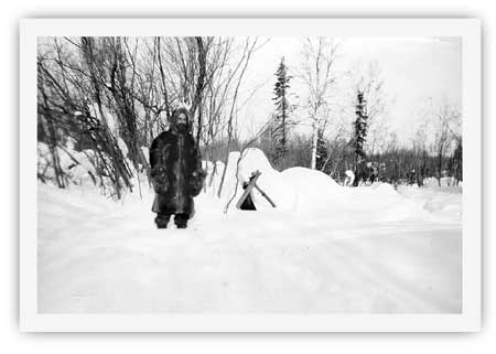
|
| Foss Wright Sargent, a recent migrant to Seward, may havfe helped built the Placer Creek cabin. He was one of a trio of men who owned the cabin from the late 1940s until 1953. NPS photo. |
The three retained an interest in the cabin until 1950. Seward resident George Black bought out Bert Smith's interest in the property that January. During the spring of 1953, Black purchased the interests of Sargent and Lesko. Black paid a total of $210 for the cabin. Neither Black nor the trio that preceded him, it should be noted, were interested in the area's mining claims; instead, they were interested in the "cabin and the surrounding grounds" for their trapping or homesteading possibilities. [196] Black, the cabin's owner after 1953, remained in Seward for years afterward. Nothing is known, however, about whether he spent much time at his cabin. Before long he abandoned it. During subsequent years, as graffiti on the cabin's walls attest, other Seward residents used the cabin from time to time. The Bureau of Land Management recognized the cabin's cultural importance following a June 1978 visit by archeologist John Beck, but the site was still unclaimed public land when President Jimmy Carter proclaimed Kenai Fjords National Monument in December 1978. [197]
During the summer of 1983, archeologist Georgeanne Reynolds led a reconnaissance of the Resurrection Valley's west side. Central to her survey was an investigation of the lower Redman and Placer Creek drainages. The survey uncovered evidence of four area cabins. On the south bank of Redman Creek, on the western edge of the valley, the team uncovered the ruins of a 16' x 17' cabin. Hidden in the underbrush, the extant walls were two to three logs high. Reynolds noted that a 1915 report on the area, which was based on 1909 fieldwork, described a placer mine in the vicinity but did not describe a cabin. Reynolds therefore concluded that the cabin "most likely dates to the 1920's mining era due to its state of preservation and all the similarities with the other mining aged cabins located this summer." She further suggested, on the basis of site evidence, that the cabin may have been a short-term or intermittent occupation site. [198]
On Placer Creek, Reynolds and her crew found the remains of three cabins. The most intact cabin, the so-called Placer Creek cabin, was just south of the creek and one-half mile west of the creek's confluence with the Resurrection River. It was the only standing historic structure in the valley. The dimension of the one-room cabin, with an adjacent portico, was 25' x 15'. Reynolds estimated that the cabin was built in 1945 or 1946. She noted several remarkable architectural features:
The building was carefully constructed as a major residence and multi-purpose (i.e., mining and trapping) base of operations. The logs are well laid and tightly fitted, utilizing a modified saddle notch technique. The hand split shingle roof is also carefully crafted and is a rarity in this part of Alaska because of the difficulty in finding clear and straight grained wood suitable for bolts. Another unusual feature is the portico on the east end of the structure which functioned as a shed. [199]
The cabin, Reynolds noted, was being converted during the summer of 1983 into a backcountry public use cabin. That summer the roof was reshingled, tin was laid around the stovepipe, and new floor joists were laid. Five years later, a new stovepipe was installed. [200>] In 1997, the entire cabin was restored. The cabin has not yet been evaluated for eligibility to the National Register of Historic Places.
Just 470 feet upstream from the Placer Creek Cabin, the team found a cabin ruin. Reynolds noted that the logs were stacked three or four high in the corners of the 12' x 13' structure; the center of the walls, however, were lower. Based on a site survey, Reynolds estimated that the site "evidently predates Placer Creek Cabin due to its advanced state of deterioration." (She noted elsewhere that the cabin was "likely much older" than the Placer Creek Cabin, but she did not speculate as to the cabin's age.) The lack of a dump, the lack of artifacts under the collapsed roof, and the small size of the foundation led her to conclude that the cabin had witnessed only short-term use. [201]
The team located the remains of a third cabin in the Placer Creek drainage on the creek's north side, almost directly across from the Placer Creek Cabin. Reynolds noted that the cabin, although in a ruined state, was relatively intact in comparison to both the Redman Creek ruin and the 12' x 13' cabin ruin on the south side of Placer Creek. This cabin, which had dimensions of 13' x 14', featured walls that were between four and five logs high, and the surrounding clearing had not regrown as much as the other two ruins. Based on the large amount of mining-related debris around the site, Reynolds estimated that the cabin "probably dates to the mining days of the 1920's and early 1930's." She further noted that the cabin was occupied for a longer period of time than the 12' x 13' ruin on the south side of Placer Creek. [202]
Inasmuch as Reynolds did little historical research in conjunction with her archeological survey, she was able to provide only rough estimates on the age of the various Resurrection River valley cabins. In 1997, however, NPS intern Mary Tidlow prepared a draft Historic Structures Report for the Placer Creek cabin; as part of her research, she extracted sufficient historical documentation to provide a historical context to each of the cabins that Reynolds had identified. Her history noted, for example, that the Redman brothers' prospecting in 1909 and 1910 was the only known historical activity along Redman Creek. That knowledge, combined with the deteriorated condition of the Redman Creek cabin ruin, caused Tidlow to conclude that the Redmans built the Redman Creek cabin; this date is consistent with verbiage in the 1915 USGS report, which described mining activity along the creek in 1909.
Tidlow, on the basis of her research, also helped pinpoint the history of the various Placer Creek cabins. She noted, for example, that the Redman brothers also built the 12' x 13' cabin on the creek's south side in either 1909 or 1910. The brothers abandoned the cabin shortly after it was constructed, but it apparently later served as the occasional residence of John Dubreuil, who owned several area mineral claims from 1913 to the mid-1920s. The cabin on the north side of Placer Creek, which was in better shape than the 12' x 13' cabin, probably dates from the 1930s; based on her research, Tidlow noted that the cabin was probably built by William "Bill" Bryan, Oliver Bryan, and Lindsay "Happy" Ratchford. Herbert "Whitey" Smith and George Lesko, possibly assisted by Foss Wright Sargent, probably built the so-called Placer Creek Cabin in either 1945 or 1946. This cabin is still standing; it is, in fact, the only standing historical structure in Kenai Fjords National Park. [203]
Little is known about the various historic cabins east of the Resurrection River, all of which are administered by the U.S. Forest Service. As noted above, "Whitey" Smith had permits for two "trapping cabins" during the 1939-1945 period. One was near the mouth of Boulder Creek (specifically, within 132 feet of the east bank of the Resurrection River and "approximately 400 yards from Boulder Creek"), while the other was at the "junction of Martin Creek and Resurrection River." [204] Inasmuch as historical mining claims were established along Martin Creek (and perhaps Boulder Creek as well), it is probable that both of these cabins were built prior to the late 1930s. Both were built to support either mining or trapping activities. The condition of the two cabins is unknown.
Two other historic cabins also appear to have been built east of the Resurrection River. One is located near the river, midway between Martin and Boulder creeks; the other is just three-quarters of a mile north of the Resurrection River vehicle bridge. Archeologist John Beck noted both cabins during a June 1978 overflight. He was not able to visit either cabin on the ground. On the basis of his aerial observation, however, he noted that the two cabins were still standing; moreover, they "have hand split shingle roofs and could conceivably have been constructed by the same individual(s)" that constructed the Placer Creek cabin. That assumption, however, was challenged in 1984, when U.S. Forest Service archeologist Jonathan Lothrop surveyed the area around the proposed Boulder Creek Recreation Cabin. During that survey, he located the cabin midway between Martin and Boulder creeks. He found it "in a state of advanced decay, with the original corrugated sheet metal roof collapsed and the four walls still standing, but missing one or two of the upper log courses." He concluded that the structure did not qualify for the National Register of Historic Places. The other cabin has not yet been subject to a detailed survey; a Forest Service official, however, noted that the cabin had "pretty well melted down" by the mid-1990s. [205] Historical details about both cabins are entirely lacking.
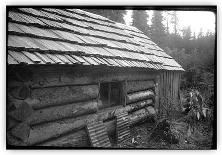
|
| The Placer Creek Cabin, built in 1945 or 1946, is located in the Resurrection River valley north of Exit Glacier. The only standing historic building in the park, it was photographed in November 1992. NPS photo. |
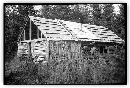
|
| The Placer Creek Cabin, as seen in November 1992. NPS photo. |
kefj/hrs/chap7.htm
Last Updated: 26-Oct-2002