|
Kenai Fjords
A Stern and Rock-Bound Coast: Historic Resource Study |

|
Chapter 1:
THE STERN AND ROCK-BOUND COAST
The whole coast between Cape Saint Elizabeth in the west and the mouth of Copper River in the east is deeply indented with coves and fiords, and towering peaks rise abruptly from the sea. Nearly every valley and ravine has its glacier, some of the latter being among the most extensive in the world. [1] — Ivan Petroff, 1880
Geographic Overview
|
| Map 1-1. Kenai Fjords National Park. (click on imasge for an enlargement in a new window) |
Kenai Fjords National Park is a sequestered glacial landscape of ice, tidewater glaciers, deeply chiseled fjords, and jagged peninsulas formed by the forces of the Harding and Grewingk-Yalik icefields as they plunge into the sea. Located on the southeastern or seaward coast of the one hundred and seventy-mile-long Kenai Peninsula, the park abuts the Kenai Mountains to the north and west. These lofty mountains, part of the Chugach and St. Elias ranges, bisect the peninsula close to the southeastern coast and extend to Kodiak and Afognak islands. Only the mountain peaks (nunataks) are visible above the permanent mantle of ice and snow of the icefield. Along the coast, the summits of the same mountain range surface as offshore island stacks. As the glaciers recede the fjords deepen, enlarging and exposing peninsulas that indent the coast and disappear into the sea.
The setting is dynamic. The park is located on an active tectonic shelf of the Pacific Ocean Plate that follows the coast from Port Dick (west of Nuka Bay) to Day Harbor (east of Seward) in one of the most seismically erratic regions of the United States. During the 1964 earthquake lands within the Kenai Fjords National Park subsided. The tremor dropped the coastline from three to six vertical feet in most areas and attempted to counterbal-ance the force by raising it in others. As the shifting plate moves and grates against the continental landmass, the coast submits to the sea. This process is believed to have begun after the last major period of glaciation, 20,000 years ago.
|
| Sea stacks are a common feature along the Kenai Fjords coastline. M. Woodbridge Williams/NPS photo in Alaska Regional Profiles, Southcentral Region, July 1974, 36. |
Glaciers and deep fjords in the southwestern portion of the Kenai Fjords radiate from the colossal snow pack of Harding Icefield. In 1950, the USGS officially named the icefield for President Warren G. Harding who died in 1923, soon after the first presidential visit to Alaska (see chapter 10). Ten of the thirty-four tidewater and hanging glaciers that emanate from Harding Icefield are included within the park. [2]
The mile-high Harding Icefield is a glacial vestige of the 10,000-year-old Pleistocene period when an expansive ice sheet blanketed southcentral Alaska. The icefield may also be a remnant of the massive Truuli Icefield, recorded by the naturalist Ilia G. Wosnesenski in 1842 that comprised both the Sargent and Harding icefields. Heavy winter snow loads feed the glaciers at higher altitudes as moist air settles above the mountains. Snowfall occurs primarily in the winter months though summer storms are not uncommon; the icefield accumulates as much as 400 inches of snow annually. Warming winds off the Gulf of Alaska temper winter weather creating a maritime climate. Glacial runoff feeds the streams and lakes that drain into the comparatively milder terrain and lowland component of the peninsula. Glacial till and moraines covered in vegetation constitute most of the low-lying lands. Landing beaches are few. Deep snow on the mountainsides increases the likelihood of avalanches in these lower areas. [3]
The park includes Bear and Exit glaciers in the vicinity of Seward. The parklands then proceed south and west on the Kenai Peninsula to Petrof Glacier west of Nuka Island. The park's northern boundary bisects the Harding Icefield. All coastal areas between Bear and Petrof glaciers are part of Kenai Fjords National Park.
Park boundaries exclude almost all offshore features: open sea, channel water in the fjords, pinnacle rocks, and islands. The signing of ANILCA in 1980, transferred most of the offshore islands to the Alaska Maritime National Wildlife Refuge. Significant island groups fall under this category; they include the Pye and Chiswell islands, which are major bird conservation habitats.
|
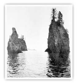
| George Davidson's illustration of glaciers on outer coast in 1902. Bancroft Library. |
In 1867, English-born George Davidson, a geodesist with the U.S. Coast and Geodetic Survey (USC&GS), supervised what many consider the first American coastal assessment of Alaska under a directive from Congress. Relying heavily on the cartography of Teben'kov and his navigators, other Russian ship captains, and Vancouver, Davidson compiled a descriptive account of coastal positions and natural resources from Sitka to the Pribilof Islands which he submitted to Congress in the 1869 USC&GS annual report. In it, Davidson offered the following introductory description of the vicinity:
From Cape Puget to Cape Elizabeth the shores have been very well explored by the Russian navigators, searching for good harbors and shelter for the Russian whalers. Their reports show that the line of coast is broken by bays and coves, but none offering good anchorage; there being very close to shore not more than thirty to fifty fathoms of water. The coast is very rocky, steep and mountainous, yet covered with wood, while the ravines and gorges between the mountains contain in many places, glaciers which stretch back from the heads of the bays even to the gorges descending towards Cooks inlet. [4]
Many descriptions of the coast in later years followed Davidson's version; most of them presented an equally rugged portrait of the land and its glaciers.
|
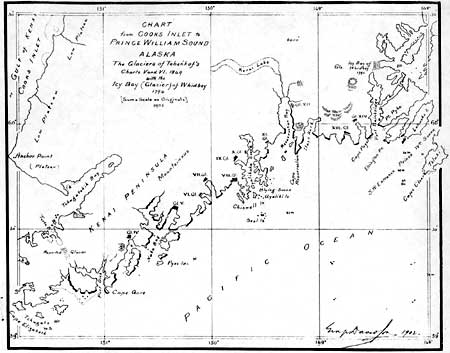
| George Davidson portrait. Bancroft Library. |
Historical Geography of the
Coast
The outer coast of the Kenai Peninsula contains an extensive cultural landscape that incorporates both those who lived along its icy shores and those drawn to explore and exploit its resources. The coastline provided an intermediary ground for resource use, trade, and travel on the peninsula. Portage Pass, which cuts across the northern edge of the peninsula, offered an easy nine-mile link between Prince William Sound and Cook Inlet.
During the period of Russian occupation, the coast was consistently considered as an extension of surrounding regions, implying that it had nothing of interest to engender a name of its own. Teben'kov referred to the region merely as the "coast from Kenai Bay eastward to Chugach Bay." [5] (Both names were of Russian origin; Kenai Bay referred to the waters of Cook Inlet, and Chugach Bay to Prince William Sound). Given no geographic distinction or name of its own, the coast became a generic no man's land. Hence the margin for error when referring to the area could be enormous, especially when trying to determine population and village location and density, maritime activity, or trade and shipping routes along such a wide stretch of coast.
Russian cartographers and explorers tended to use the terms Kenai Bay and Chugach Bay interchangeably, especially in the area of the park. This practice gave the impression that the outer coast belonged to neither region. The rare descriptions of the Kenai coastline fell within the geographic parameters of Chugach Bay and the glaciers were regarded merely as a preamble to the warmer regions west of Montague Island. These practices further reiterated the post-contact notion that the coast was predominantly a transitional stretch of land. To add to the general confusion of Russian geography, William H. Dall factored in Kachemak Bay, located at the southern end of the Kenai Peninsula, as being part of Chugach Bay.
The Native name of the bay is Kachekmak, in allusion to the high bluffs of the northern shore; the Natives of Chugach Bay [Prince William Sound] in coming to the inlet made a portage from the Pacific to the head of this bay, and so reached the Russian trading post at Port Graham, so the traders called it the bay of the Chugachi, or Chugachik. The Native name was misspelled on an obscure map without the central "k," and although the Coast Survey in the first and only chart of the bay gave the correct spelling, the Board of Geographic names adopted the incorrect form, which thus becomes obligatory in all Government publications. [6]
|
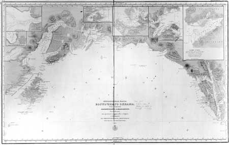
| Russian Hydrographic Dept. Chart 1378, 1847. Library of Congress. |
Although Teben'kov's atlas included several earlier Russian surveys of the coast, in 1868 Davidson found the information incomplete at best. As he wrote in his first drafts of a description of the coast, "There is not even a small scale map of any part of the coast, or of any harbor which can be counted on more than a reconnaissance or preliminary survey." [7]
In particular, Davidson noted that he had no detailed description of Resurrection Bay, despite the fact the Russians had built and maintained a shipyard at the head of the bay. Davidson relied heavily on the writing of Vancouver, Meares, Portlock, Dixon, and Lisiansky to write his observations. [8]
In a letter to USC&GS Superintendent Benjamin Pierce, Davidson made note that he obtained sixty-eight ship's logs from the Russian-American Company "embracing a large number of years." He recognized the generosity of captains Illarion Arkhimandritov (who later became an agent for the Hutchinson Company) and Paul Lemashafski. [9] Davidson obviously kept close contact with these captains, and recommended that the USC&GS do so as well. He mentioned to Pierce that the captains should be put on the USC&GS mailing list to receive future maps.
Maps from the early twentieth century prepared under the charge of federal scientific expeditions, notably those conducted by the USC&GS, suggested that the outer coast was geographically dynamic. Studies of glacial advancement on the peninsula indicated that after 1900 all glaciers had begun to recede. [10] In 1905, 1908, and 1909, U. S. Grant and D. F. Higgins of the USGS conducted a series of explorations of the glaciers of Prince William Sound and the Kenai Peninsula. Grant began his reconnaissance of the Prince William Sound and southern Kenai Peninsula regions in 1905. Returning three years later with Higgins, Grant spent a week surveying the eastern coast of the peninsula from Port Bainbridge on Prince William Sound to Culross Passage near Whittier. During their 1908 trip, the team examined copper and gold deposits in Resurrection Bay near Seward.
In 1909, Grant and Higgins returned to the Kenai Peninsula to survey the outer coast from Cape Puget on the western edge of Prince William Sound to Nubble Point near Seldovia. They planned to spend most of the field season along the fjords and bays of the outer coast. The team completed the work in three phases: July 3 to 6; July 11 and 12; and the major portion between July 20 and September 8. [11] Following this itinerary, Grant and Higgins set out from Resurrection Bay determined to cross the outer coast in a small boat. Severe rain plagued the survey, forcing the crew to stop and wait out the storms. Despite these setbacks, Grant and Higgins accomplished the four components of their fieldwork for the coast. These included an examination of the geology, a survey of known mineral prospects, a cursory inspection of the tidewater glaciers, and the rough mapping of the coast. [12]
Limiting most of their reconnaissance to the coast with only brief hiking trips inland, Grant and Higgins investigated Northwestern and Holgate glaciers, Harris Bay, and the Pye Islands. Higgins mapped most of the coast with only "a rough graphic triangulation with the traverse plane table and sketching of topography." [13]
In June 1911, Rufus H. Sargent began a topographic expedition for the USGS from Kachemak Bay to Turnagain Arm on the northern portion of the Kenai Peninsula. Leading a party of four, Sargent later crossed the peninsula to investigate the Resurrection River drainage close to Seward. [14] Sargent concluded his survey in October having covered over 3,000 miles. The surveys resulted in the production of 1:250,000 maps with 200-foot contours. [15]
|
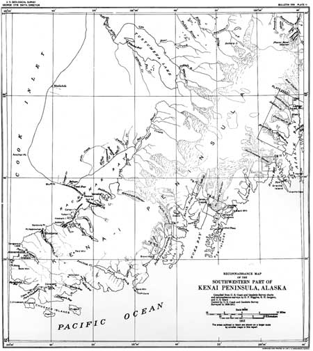
| USGS Reconnaissance Map of Grant, Higgins, and Sargent, surveyed 1901-1911. |
Place names within the park provide many references to history of the region's geography. Access to the region has usually been by sea, the bays and fjords being the best vantagepoints from which to explore the coast and the glacial walls of ice. Portages through the Kenai Mountains have also served as an entry to the coast. As the same photographer who could not find Kenai Fjords on the map poetically observed, the geographic place names of the protected fjord harbors and coves brought to mind sublime retreats with names like Delight Lake, Moonlight Bay, and Desire Lake. These place names are in sharp contrast to others located on the more exposed portions of the Pacific coast. In a stretch of coastline between Harris Bay and McCarty Fjord the names of Thunder Bay, Cloudy Mountain, Wildcat Pass, and Roaring Cove portray a more challenging terrain. Many names have association with local residents including Skeen's Arm in Nuka Bay or Pete's Passage near Matushka Island. Other places have retained Native names including Paguna Arm, meaning black bear, and Taroka Arm, referring to the brown bear. As with many place names in the park, there is an overlay of Native, Russian, Spanish, English, and American experience and assimilation that varies according to the time period and the perspective of research.
Glaciers
The glaciers of Kenai Fjords National Park are an inescapable presence. These rivers of ice formed the focal point for establishment of the park. The glaciers that emanate from the Harding Icefield influence the land and climate.
As recent as the beginning of the twentieth century, some of the fjords were completely filled with tidal glaciers, producing a dramatically different natural landscape. Throughout the course of prehistory, human activity in the area responded to many periods of glacial advancement and retreat. With each glacial stage, the amount of navigable water and land available for exploration and inhabitation dramatically fluctuated, thus creating an ever-changing landscape. In 1905, Grant reported that many of the glaciers had reached terminus positions and had begun to recede. Although other glaciers in the region continued to advance, some researchers speculate that the size of the glaciers in the late 1800s and early 1900s had little resemblance to what they may have looked like one hundred years earlier.
Rice observed that the Dena'ina vocabulary included many words to describe the glacial surroundings. Some of the more pertinent terms are: "ti" for glaciers, "titeh" directly translating to "among the glaciers" or icefield, "tizaq" for crevasses, "tivena" for terminal glacial lake, and "ti tnu" for glacial river. Some of the Dena'ina terms persist in altered form on present day topographic maps. "Dghili" or "Dghelay" means mountain and is printed as Truuli on USGS quadrangles to label the highest peak in the southwest portion of the Kenai Mountains. "Dusdebena ti" translated into English as "peninsula-lake glacier." Currently written as Tustumena Glacier, the name describes the largest land-based glacier that flows northwest from the Harding Icefield. [16]
Two of the park's most spectacular and active glaciers had dramatic retreats in the late 1800s. USGS maps based on 1909 fieldwork documented the McCarty and Northwestern glaciers flowing out the length of the fjord and actively and visibly calving into the Gulf of Alaska.
In the early 1930s the USC&GS reported that McCarty Glacier had retreated about one quarter of a mile in the fifty years prior to 1909. During that period the glacier had reached its terminal position "since the growth of the present trees." [17] By 1927 McCarty Glacier had receded one and one-half miles from its terminus; the most intense calving began after 1925; surveyor Paul Whitney noted that "From 1925 to 1927 the retreat was rapid, the front falling back a full mile in that time." [18] The 1964 Alaska Coast Pilot indicated that the glacier had retreated another ten and one-half miles during the ensuing thirty-seven years.
Regarding Northwestern Glacier, Davidson deduced from Teben'kov's 1852 measurements that the glacier was two miles in width and "coming directly into the water." [19] In the mid-1800s Teben'kov's maps depicted the glacier extending far out in the fjord "reaching almost to the sea." [20] Grant and Higgins estimated the end point of the glacier to be one-quarter of a mile past its position in 1909. This maximum advance would have been reached approximately ten to fifteen years before their expedition. [21]
Impressed by the size of Northwestern Glacier, the geologists described it in detail. They wrote, "This glacier is one of the largest ice streams of the Kenai Peninsula and is in full view from the open ocean, forming, with its surrounding lofty peaks, the most striking scenic feature of the southern shore." [22] In 1976 a joint U.S. Fish and Wildlife Service and NPS survey team observed that Northwestern Glacier had receded a mile or more in the last twenty years. [23] As the ice has receded, Sitka spruce and western hemlock forests have slowly reclaimed the newly exposed land. The glacial retreat has created habitat for many of the park's land mammal species.
Grant and Higgins recorded the majority of local names for glaciers and other features within the park. Between 1909 and 1911 the team concentrated on glacial formation in the region. Among the names they applied was Bear Glacier, at the park's eastern boundary. Located at the mouth of Resurrection Bay near Bulldog Cove, the glacier is oriented to the southeast. It is the only coastal glacier that has yet to form a fjord. Exit Glacier, northwest of Seward and north of Bear Glacier, flows east off the Harding Icefield. In 1968, the first group of climbers to cross the Harding Icefield descended by way of this glacial spur. [24]
The Fjords
Resurrection Bay
Although outside the boundaries of the park, Resurrection Bay served as the principal location for expeditions and settlement in the region. Considered the largest fjord along the coast, it was likely formed by the collective massing of the Harding and Sargent icefields. [25] The Russian geologist Petr Doroshin visited the bay on several gold and coal mining expeditions to the peninsula in the early 1850s. Doroshin described a landscape in which glaciers known by Russian names cascaded down the mountainous entrance to the deep bay.
At the west side of the entrance to Resurrection Bay a great glacier [Bear Glacier] comes down the mountainside. Its moraines, coming from two sides, connect into one dark stripe down the middle of the glacier. As we advanced into Resurrection Bay we could see more and more of the branch of Nunikofski Glacier on the eastern shore. Streams run from under it as they do from Resurrection Glacier. [26]
George Davidson wrote of the bay in his 1904 article, yet given his tendency to reiterate earlier works and rely heavily on other sources, it is unclear if his description actually corresponded with how the bay appeared in the early 1900s. He wrote, "The head of Resurrection Bay is nearly three miles wide, and on the eastern shore, two miles from the head, is a glacier [Godwin Glacier] one mile wide facing the west and a little back from the shore." [27] Harding Gateway at the entrance to Resurrection Bay was named during the presidential visit to Seward on July 17, 1923. [28]
|
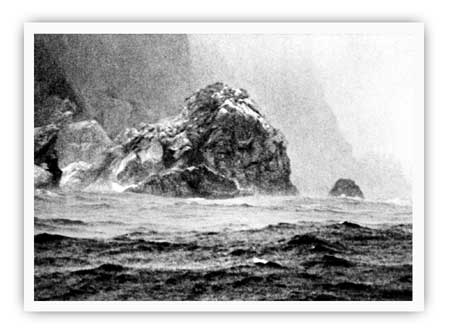
| Aialik Cape, and the remainder of the southern Kenai Peninsula coast, are notable for being windswept and stormy. M. Woodbridge Williams/NPS photo in Alaska Regional Profiles, Southcentral Region, July 1974, 20. |
Aialik Bay
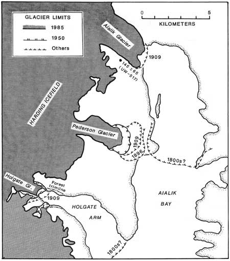
Aialik Bay, a deeply forged inlet formed by the retreat of the Aialik, Pederson, and Holgate glaciers, extends approximately twenty-two miles from the face of Aialik Glacier to the Gulf of Alaska. In the late 1920s and early 1930s, USC&GS surveyor Paul Whitney observed that the Aialik Glacier was unique among Alaska glaciers because it likely left a "bar across the bay centuries ago." [29] In 1908 and 1909 geologists Grant and Higgins named Aialik Glacier and Aialik Cape after Aialik Bay, a name that originated from an "eskimo name obtained by the Russians and recorded as Bukh[ta] Ayalikskaya." [30] The glacier extends four miles from Harding Icefield to Aialik Bay.
Between 1908 and 1911, Grant also named several other features in the bay: Pederson Glacier, Coleman Bay, Holgate Arm, and Holgate Glacier. The derivation of the name Coleman is unknown. Grant named Holgate glacier for Dr. Thomas F. Holgate, Dean of the College of Liberal Arts of Northwestern University. [31] A field geologist during the summer, Grant was also a professor and the chair of the Northwestern University geology department. Grant accepted the position in 1899 and remained with the university until his death in 1932. [32] Addison Glacier is located between Pederson and Aialik glaciers. Grant named this glacier for his eldest son, Addison Winchell. [33]
|
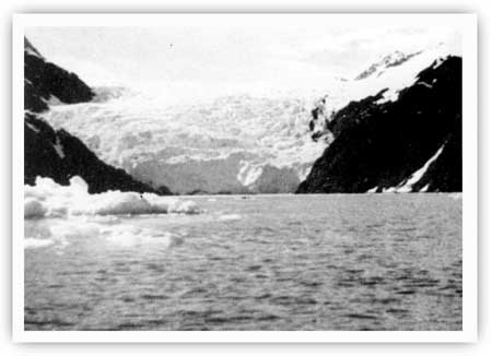
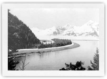
| Holgate Glacier, as it appeared in the spring of 1955. Alaska Sportsman, August 1956, 19. |
The group of jagged rocky islands at the mouth of Aialik Bay acquired the name Ostrova Ayaliki during the Russian period. Then, in 1786, Captain Nathaniel Portlock visited the site and named them the Chiswell Islands, after a wealthy man named Trench Chiswell. [34] Portlock's name still holds.
|
| Glacier limits in the Aialik Bay area. Steven W. Nelson and Thomas D. Hamilton, Guide to the Geology of the Resurrection Bay-Eastern Kenai Fjords Area, Anchorage, Alaska Geological Society, 1989, 25. |
Harris Bay
Northwestern Lagoon is surrounded by high ice-capped peaks with glaciers flowing down the mountains from the top of Harris Peninsula. Upper Northwestern Lagoon has only recently been deglaciated, the glaciers having receded a mile or more in the last 20 years. Arctic terns and mew gulls were the first to colonize islands recently exposed by these receding glaciers. [35] — Nina Faust, 1977
Harris Bay forms at the mouth of Northwestern Glacier and Northwestern Lagoon. In 1908-09 Grant and Higgins named both the bay and the glacier for Abram W. Harris, president of Northwestern University between 1906 and 1916 and a friend of Grant. [36] In 1938 calving ice from the Northwestern Glacier crowded Harris Bay, the lagoon was "shoal and foul," and the entrance was "blocked by rocks, bars, and usually by large cakes of ice." [37]
|
| Northwestern Glacier, as it appeared in the mid-1940s. Alaska Sportsman, October 1946, 20. |
McCarty Fjord or East Arm of Nuka Bay
McCarty Glacier is believed to have been named after William McCarty of Seward. The USGS reported and recorded the local name in 1911. William McCarty was an entrepreneur and boat builder who owned the McNeily Cafe or Moose Cabin Cafe in Seward during the years 1904-05.
In 1913 Alfred H. Brooks of the USGS named the Dinglestadt Glacier, on the fjord's west side, for Konstantin Dingelshtedt, an employee of the Russian-American Company. In 1834 Dingelshtedt and fellow employee Ivan Chernof circumnavigated the west coast of the Kenai Peninsula. [38] Chernof Glacier is located ten miles to the north; both glaciers are part of the Kenai National Wildlife Refuge.
McArthur Pass derived its name from the USC&GS steamer that was commissioned to survey the outer Kenai coast in 1906-07. In 1911, Grant named James Lagoon in honor of Captain James Bettels, a longtime Valdez resident. In 1927 and 1928, the USC&GS named Moonlight Bay and Roaring Cove, respectively, for descriptive reasons. [39]
|
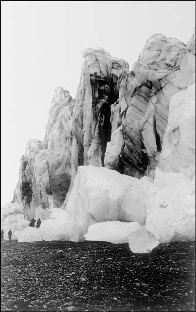
| Adventurers explore McCarty Glacier during 1919 USC&GS expedition. National Archives, photo 23-G-IAD-9795. |
Nuka Bay (West Arm)
The estuary of Nuka Bay is ten miles wide and divides into two distinct bodies of water or arms. The name of what was originally called East Arm became McCarty Fjord. In 1826 Lieutenant Gavriil Sarychev published an Alutiiq or Eskimo name for the bay. The name Guba Nuka, or Nuka Bay, is derived from "nukaq" which refers to a "young bull caribou." [40] Sarychev had visited the area in 1790 and provided one of the earliest descriptions. His accounts attested to the impressive range of the glacier. He noted that
Nuka Bay is seven miles and a half broad at its entrance. It extends nine miles in length, having mountainous and woody shores. In the interior shore of the bay, we found in the cleft of a mountain, snow or ice, so high as almost to reach above the tops of the trees. [41]
Nuka Glacier, northwest of the bay, is an outflow glacier from the Iceworm Peak Glacier Complex. It flows into Bradley Lake but is located near the headwaters of the Nuka River. [42] The river is in the park, but the glacier is primarily outside. In 1908 the USC&GS bestowed the name Nuka on the large island to the west of the bay's mouth. Grant and Higgins named Yalik Glacier for the small settlement of the same name in Yalik Bay, which is part of Nuka Bay. [43]
Split Glacier–so named because a huge boulder has forced the river of ice to follow two paths–is located at the head of North Arm of Nuka Bay. Grant and Higgins noted that the glacier looked like an obvious route for travel and exploration between Nuka and Kachemak bays. [44] Few, however, have followed that route during the decades that have followed their observation.
Portages
Historical accounts of the coast, with the exception of Ivan Petroff's enumeration of the territory for the Tenth Census and Frank Lowell's somewhat confusing account of the relocation of local residents, drew attention to the absence of villages. Evidence of historic land use, and the presence of people and activity along the coast, existed in the description of trails that crossed the peninsula. These trails linked people of the southern Kenai coast with resources and trading partners in Cook Inlet and Prince William Sound.
Henry Elliott, an illustrator and assistant agent to the Treasury Department, also commented on the lack of villages but alluded to the presence of seasonal inhabitants in an 1877 article on Alaska for Harper's New Monthly Magazine.
The vast reach of the coast and country between Sitka and Kodiak, including Cook Inlet and Prince William Sound, is not marked by a single civilized settlement–not a single one–only two or three small trading-posts on the eastern shore of the inlet, and all the rest is as wild as the bear or the grouse found in its dreary solitudes. The Indians sojourning there at wide intervals in small bands are but slightly modified from their condition and habit when first seen by white men a century and a half ago; through the instrumentality of the traders, they have fire-arms and blankets, lead, powder, beads, iron, and tobacco; otherwise the descriptions of Cook, Vancouver, Portlock, and Dixon are as true and vivid of them as our own notes are taken today. [45]
Teben'kov had made similar observations about the range and extent of trails on the peninsula:
This isthmus [Portage Pass] consists of a pass between the mountains, covered by ice, under which streams flow, melting during the summer into sheer ice fields. The boldest of the Natives set out across the isthmus in winter, when the icy passes and the channels of the streams are strewn with snowdrifts. [46]
In the late 1890s the U.S. government and military began to investigate trails on the peninsula. In 1898, Lieutenant H. G. Learnard of the 14th Infantry received instructions to inventory and explore sections of the Kenai Peninsula that interested the military. The army needed first hand information, especially on Native trails and portages, to learn of routes to existing forts and to identify other routes that could be used by miners and prospectors entering the region. Learnard's party consisted of Corporal Young, seven enlisted men, Captain Howe and his son, and Walter C. Mendenhall, a geologist with the USGS. The party first crossed the peninsula from Portage Glacier in Prince William Sound to Turnagain Arm. Their second crossing of the peninsula started at Resurrection Bay. On May 30, 1898, Learnard's orders instructed him to leave Resurrection Bay and scout out a trail north to Sunrise City, on Cook Inlet. Taking only a party of three–himself, Mendenhall, and a civilian named Bagg–Learnard set out on the morning of May 31. Each man carried sixty pounds of gear which included ten days' worth of rations, but no tents. [47] The crew followed a makeshift mining trail that started at head of the bay. After about one-half mile the trail widened into a rough mining road that followed Salmon Creek. A California mining company had cut the road to haul in their gear. Reaching Kenai Lake, Learnard's crew stopped for dinner at a log cabin that miners had recently built. At many points along the route, the party encountered groups of miners. The number of miners attested to the ever-growing interest in the region.
As a member of Learnard's party, Mendenhall became the first geologist to cross the peninsula. [48] His findings resulted in the production of a topographic map of the area and an initial inventory of geological information.
In 1906 geologist Alfred Brooks reported on the use of glaciers and glacial moraines as trails across the peninsula.
Many large glaciers discharge into the fiords of Prince William Sound of the eastern shore of Kenai Peninsula. Portage Bay, the western arm of Prince William Sound, is connected by a low glacier-filled pass with Turnagain Arm. This gap has long been used by the Natives. A broad valley stretches inland from Resurrection Bay, and its upper end is separated from streams flowing into Turnagain Arm by a pass only 1,000 feet high. Through this natural highway in to the interior a railway is now being built. [49]
In 1914 geologists Ralph Tarr and Lawrence Martin researched the Portage Glacier, and determined that it was free of ice in 1794. [50] These observations are based on Vancouver's writings in which he recounted information learned from Russians. Vancouver described a cross-peninsula trade route near Portage Valley "across which isthmus is the route, by which they [the Russians] state that all their intercourse between the Russian settlements, in this and that extensive inlet [Cook Inlet and Prince William Sound], was now carried on." [51] Only during this century has the glacier advanced and grown.
Knowing that routes existed over the Portage Pass glacier diminishes the idea that glaciers were barriers to communication and trade or that glaciers were walls that isolated both terrain and inhabitants. It also distinguished the people who mastered the trails as bearing hardships that by today's standards seem insurmountable. The geography of Kenai Fjords National Park presupposes any introduction to the region's cultural resources; so bound together are the park's historic resources with its setting.
|
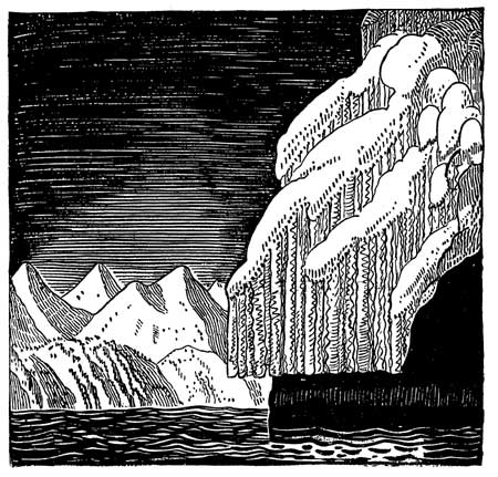
| Illustration by Rockwell Kent from Wilderness, A Journal of Quiet Adventure in Alaska, 1920. The Rockwell Kent Legacies. |
kefj/hrs/chap1.htm
Last Updated: 26-Oct-2002